
The last week of weather has been wild in Pennsylvania, with some very nice days mixed in with heavy rain and strong winds. We have another stretch of warmth coming, but not before the most widespread severe thunderstorm opportunity of the season to date – coming Sunday. A low pressure moving east near the New York border will be the source of a front that will push directly south. Thunderstorms will develop and rapidly strengthen in Northern PA late Sunday afternoon as they move south-southeast.
To simplify the details, there will be enough convective (thunderstorm) energy and spin (wind shear) to accommodate a few tornadoes late Sunday afternoon and evening. The focal point for that activity will be in the western half of the state. Late in the afternoon Sunday and even into dinnertime is when we expect a few individual supercells in that area, before a broken line of thunderstorms will form around 6-7 PM Sunday. After that point, the tornado threat is reduced but not zero, but we will shift to more of a wind threat.
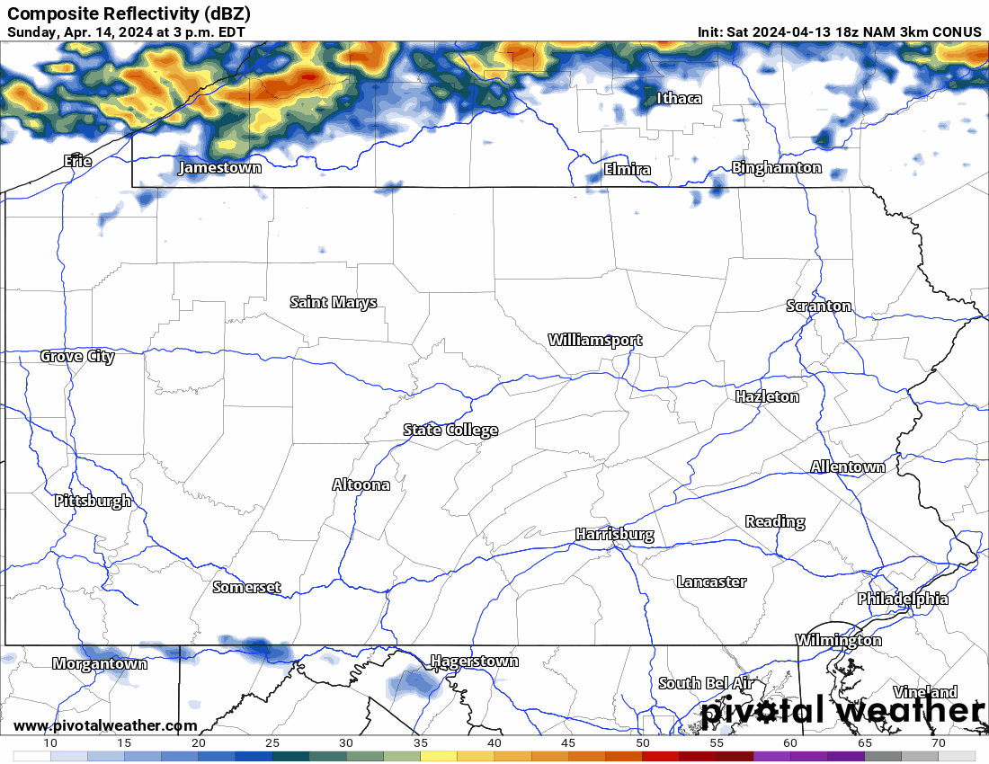
Below is timing on Hi-Res NAM Model for Sunday’s storms. Timing is in the top left!
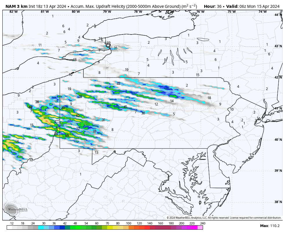
When we look at where the Hi-Res NAM has most storm rotation, we see an obvious area in much of Western PA into North Central PA. This is where the tornado concern exists.
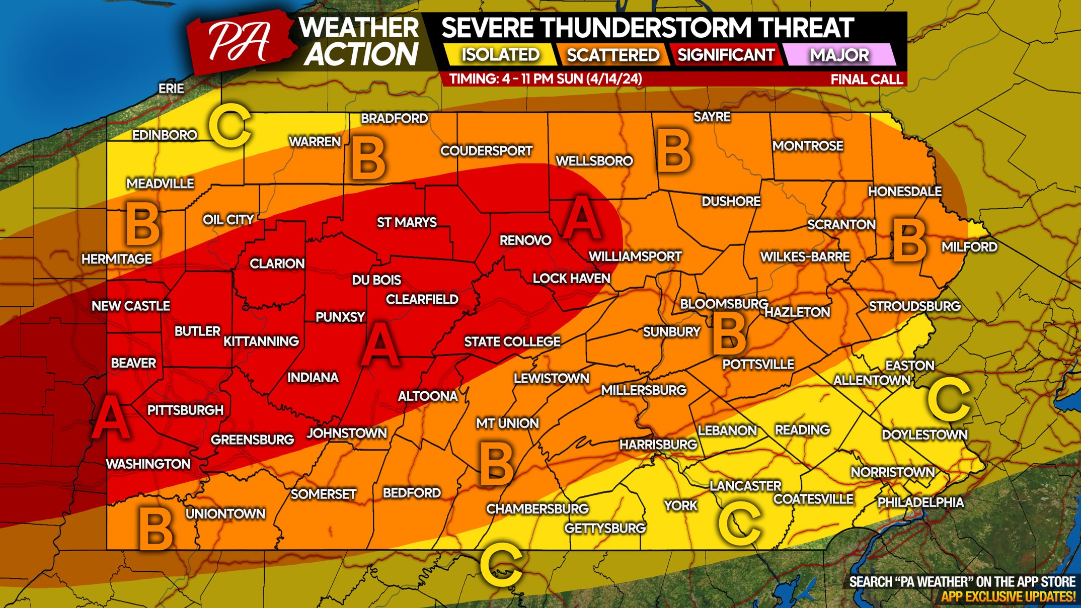
SUNDAY SEVERE THUNDERSTORM THREAT MAP
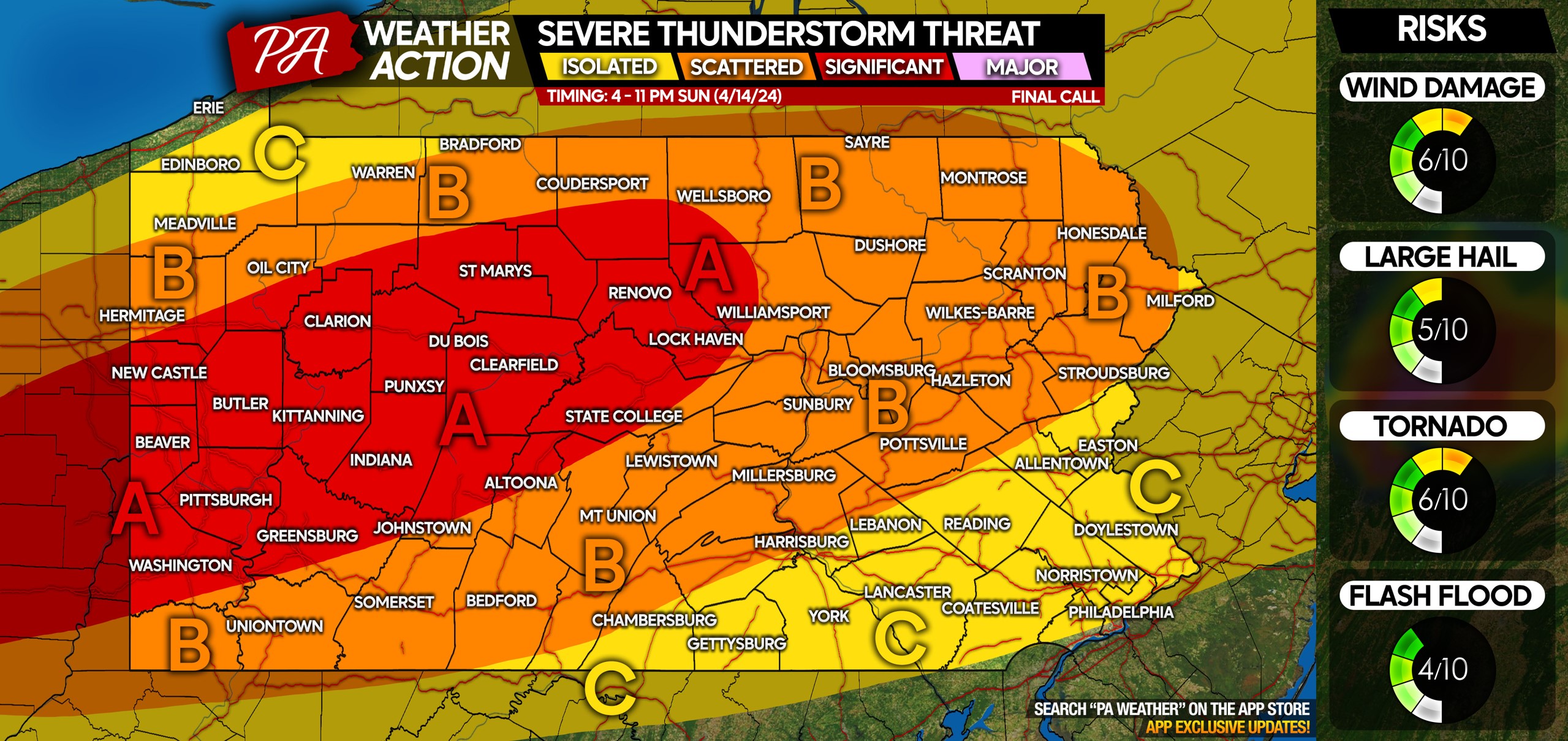
Area A: Significant threat for severe thunderstorms, with one or two tornadoes probable somewhere within this area. The damaging wind risk will be more widespread, with gusts of 55-70mph possible. Scattered large hail is also possible especially around I-80.
Area B: Scattered severe thunderstorms possible, with damaging winds being the primary concern. An isolated tornado cannot be ruled out, but it would probably be close to Area A. Isolated large hail possible west of I-81.
Area C: Isolated severe thunderstorms possible, with damaging winds as the only concern. Most wind gusts should be below severe criteria, somewhere between 35-55mph.
Don’t forget to share this forecast with family and friends! Sunday will be warm, so people will want to be outside, but there is this thunderstorm risk.

You must be logged in to post a comment.