
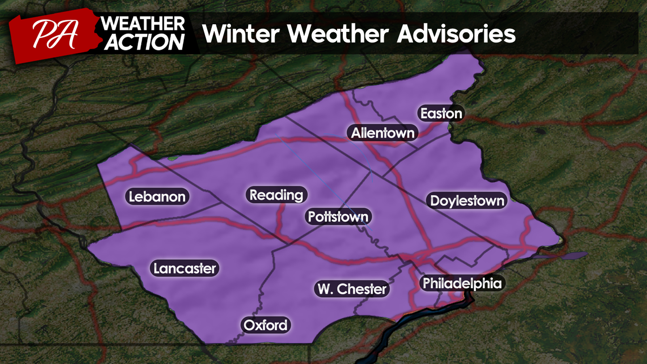
Good Morning Everyone! I hope you all are staying warm as more snow and Arctic air is set to impact the region tomorrow through the weekend. With the Arctic air that followed Tuesday’s storm locked in place, our next snowstorm will fall in the form of all snow for the entire region, with no mixing issues expected. The National Weather Service has once again issued Winter Weather Advisories for the entire region. Continue reading for details, including snow totals!
Thursday
Today, the weather will be quiet, albeit still cold. Expect overcast skies to fill in this morning and linger throughout the remainder of the day. An isolated snow shower is possible this afternoon. However, no substantial snowfall is expected until tomorrow. Highs will be slightly warmer than they were yesterday, topping out in the upper 20s – low 30s.
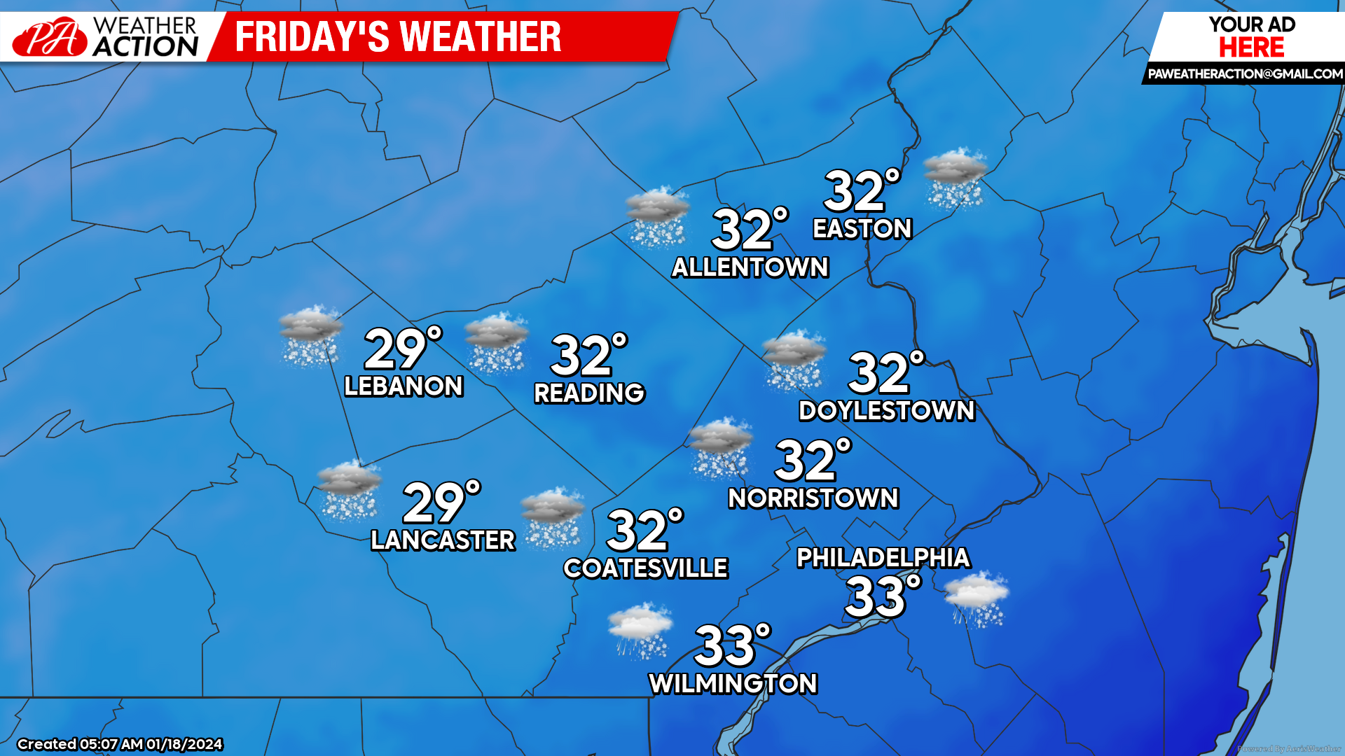
Friday
Overcast skies overnight will give way to light snowfall early Friday morning. I expect snowfall to begin between 4 am and 6 am from West to East across the region. Temperatures tomorrow morning will be in the mid-20s, meaning snowfall will accumulate on all surfaces from the onset.
Snowfall rates will pick up as we head throughout the morning. By 11 am, moderate snowfall will be falling region-wide as our low-pressure system organizes. Temperatures will warm until the low-30s by the afternoon. However, temperatures aloft will remain well below freezing, ensuring precipitation will continue to fall as snow.
(This is an automated map: although it showed maybe a mix around Philly, I do not expect this to happen. However, it shows a good estimate at high temps during the afternoon).
 A Bit of Meteorology: In Tuesday’s storm, a more amplified (Northerly) storm track allowed for more substantial warm air transport well above the surface. This caused snow to change over to sleet and freezing rain even though surface temperatures remained well below freezing. In tomorrow’s storm, although surface temperatures will be a bit warmer than on Tuesday, an inverted trough will initiate a more progressive (Eastward) storm track means that warm air transport will not put up much of a fight against cold temperatures in the mid-levels of the atmosphere, ensuring all snowfall this time around. In these scenarios, the heaviest precipitation tends to fall to the north of the vorticity (spin) maxima associated with the trough. SEPA happens to be right in this zone. What does that mean for us? We will likely be the big winners when it comes to snowfall from this system!
Moderate snowfall will continue to fall through the afternoon. By the evening, our low pressure will begin to make its exit. I expect snowfall to gradually taper down between 7 pm – 11 pm tomorrow from NW to SE. Leaving it is wake another bitter Arctic blast!
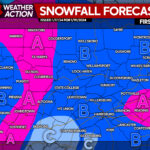
Snow Totals
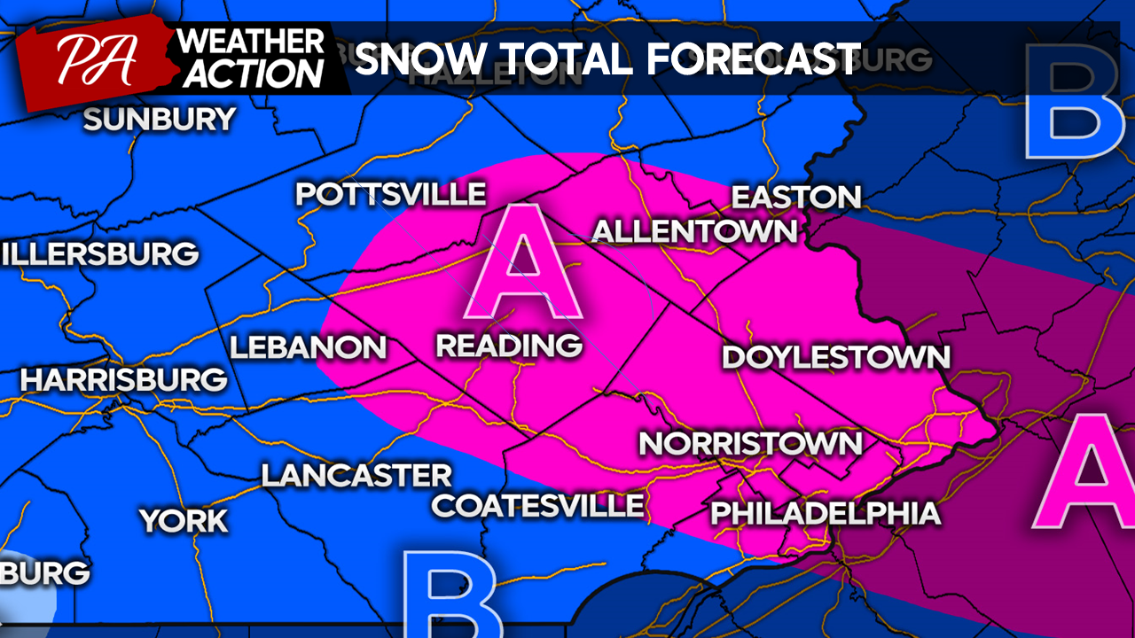
Zone A: 4″ – 6″ Moderate Snow – Expect snow-covered roads affecting both the morning and evening commutes, causing slick conditions. School cancellations are likely.
Zone B: 2″- 4″ Light – Moderate Snow – Expect snow-covered roads affecting both the morning and evening commutes, causing slick conditions at times. School cancellations are very possible.
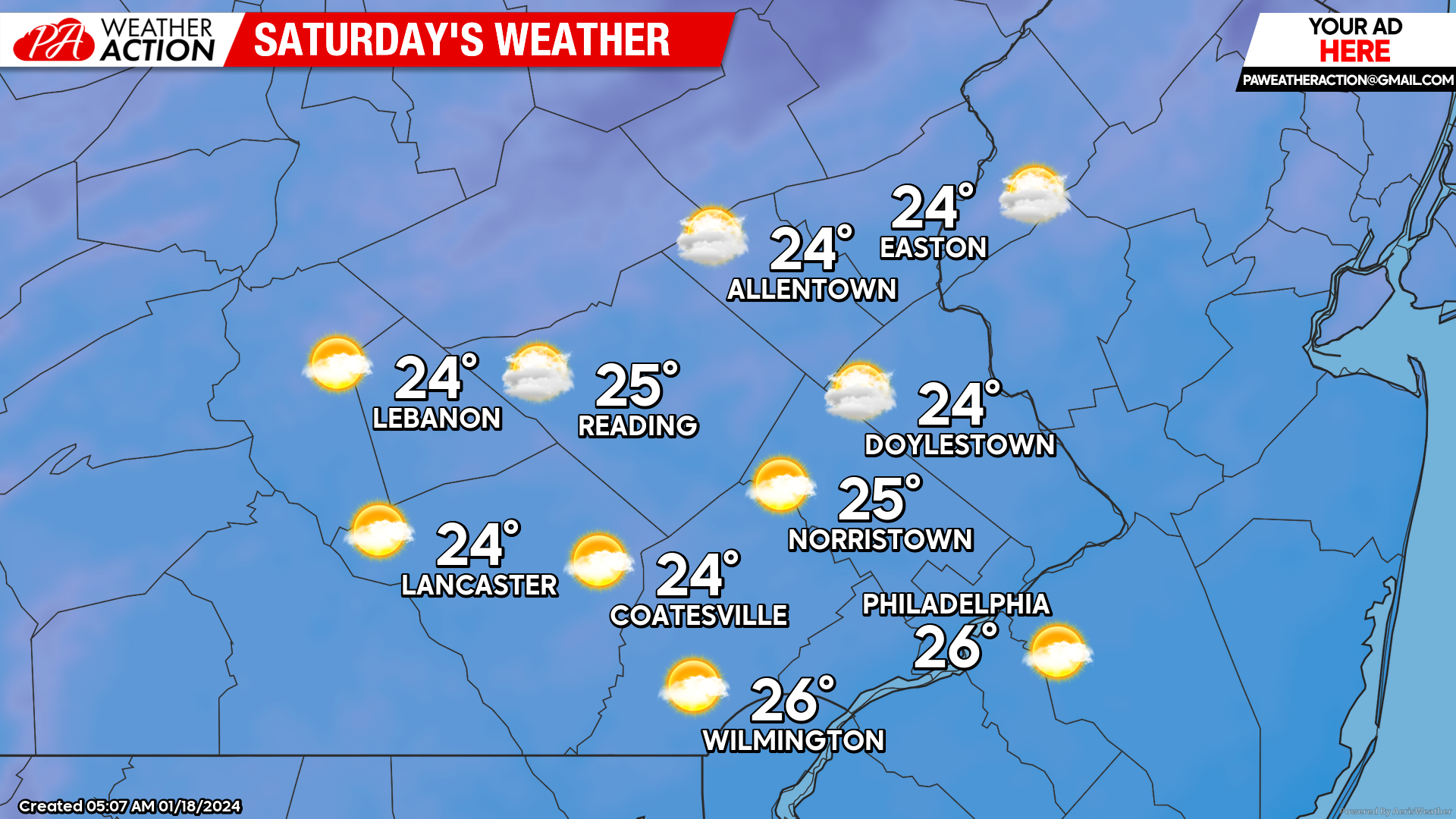
Saturday
Overcast skies and lingering snow showers overnight will give way to partly cloudy skies by the morning. Temperatures will be frigid once again, with lows Saturday morning in the mid-upper 10s. Winds will be out of the NW at 10-15 mph, making temperatures feel near zero. A mix of sun and clouds will linger into the afternoon, with highs only making it into the mid-20s. Steady winds throughout the day will keep temperatures feeling like the single digits throughout the day.
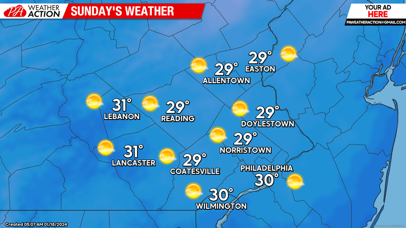
Sunday
Sunday morning will feel very similar to Saturday, with temperatures in mid-upper 10s feeling near zero. However, mostly sunny skies will allow afternoon temps to get a bit warmer, topping out in the upper 20s and low 30s. However steady winds out of the NW at 10-15mph will keep temperatures feeling like the single digits all day.
Looking Ahead:
As we head into next week, we are expecting a late-January thaw, with temperatures gradually warming back above average by mid-next week. There are a few more light precipitation chances next week. However, these look likely to come mostly in the form of rain for our region.
Thank you all for the continued support on facebook and these blogs! I will post the final call for snow totals this evening if there are any changes! Have a great day, and stay warm!
-Michael Woytowiez
You must be logged in to post a comment.