
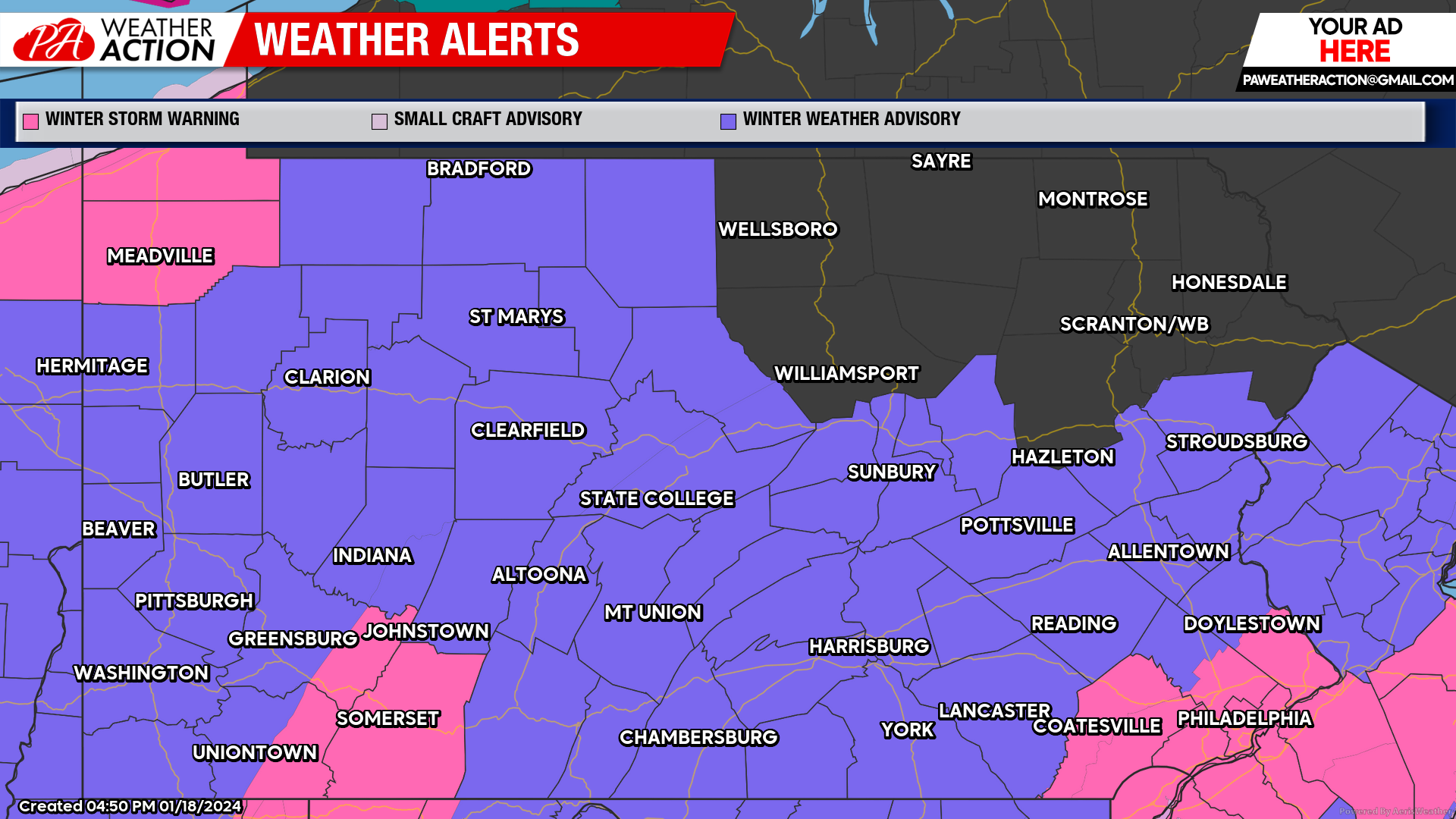
A Winter Storm Warning will be in effect for the higher elevations of Westmoreland and Fayette counties, and all of Somerset County from 1 am Friday through 10 am Saturday. Heavy snowfall and hazardous road conditions can be expected. All remaining counties within the region will be under a Winter Weather Advisory during the same timeframe.
Friday
Snow is expected to impact the entire region throughout the day. Higher elevations can expect to have heavier snowfall rates. Highs will be in the high to mid 20s. Winds will be north-northwest at 5-13 mph, higher winds can be expected in the higher elevations. Lows will be high single digits, with wind chills approaching 10 below.
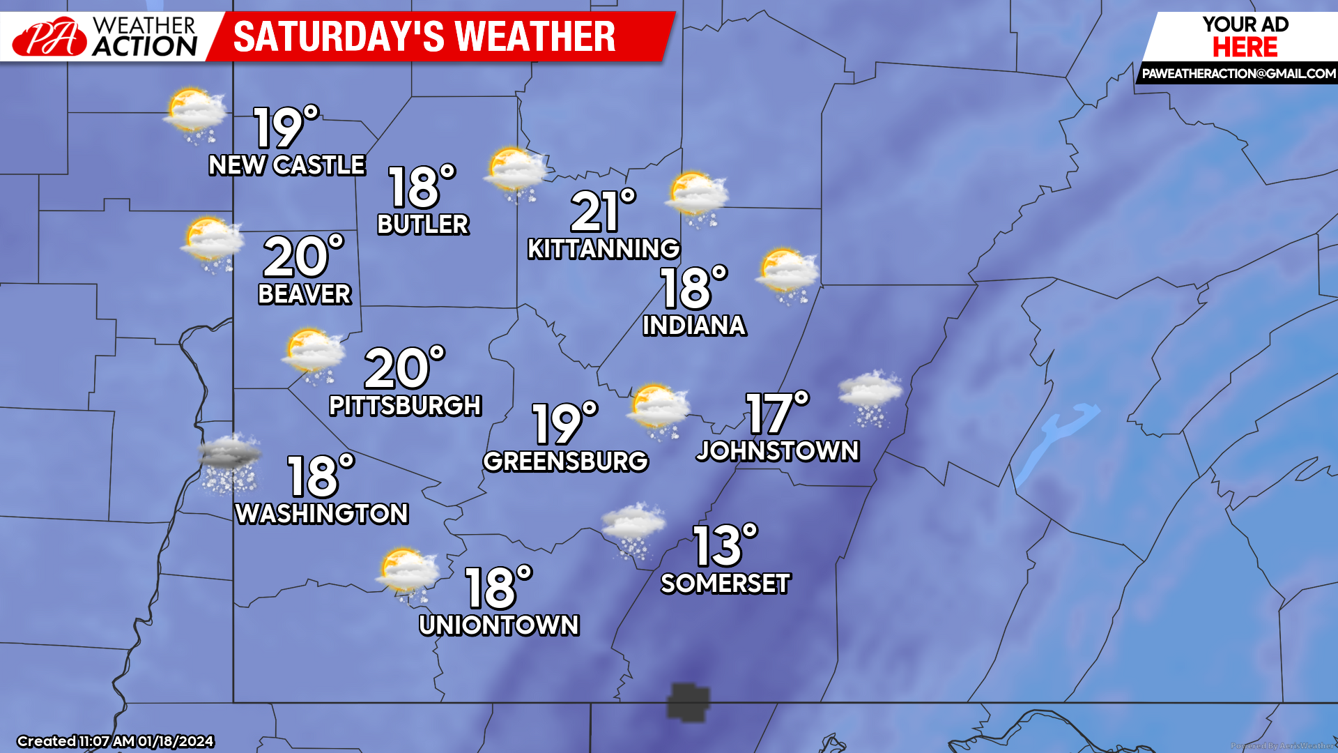
Saturday
Lingering snow showers can be expected in the in the morning and afternoon hours, followed by mostly cloudy conditions. Highs will be in the low 20s to mid-teens. Winds will be out of the west at 13 to 18 mph, higher elevations could experience wind speeds in the mid 20s. Lows will be in the low teens to higher single digits.
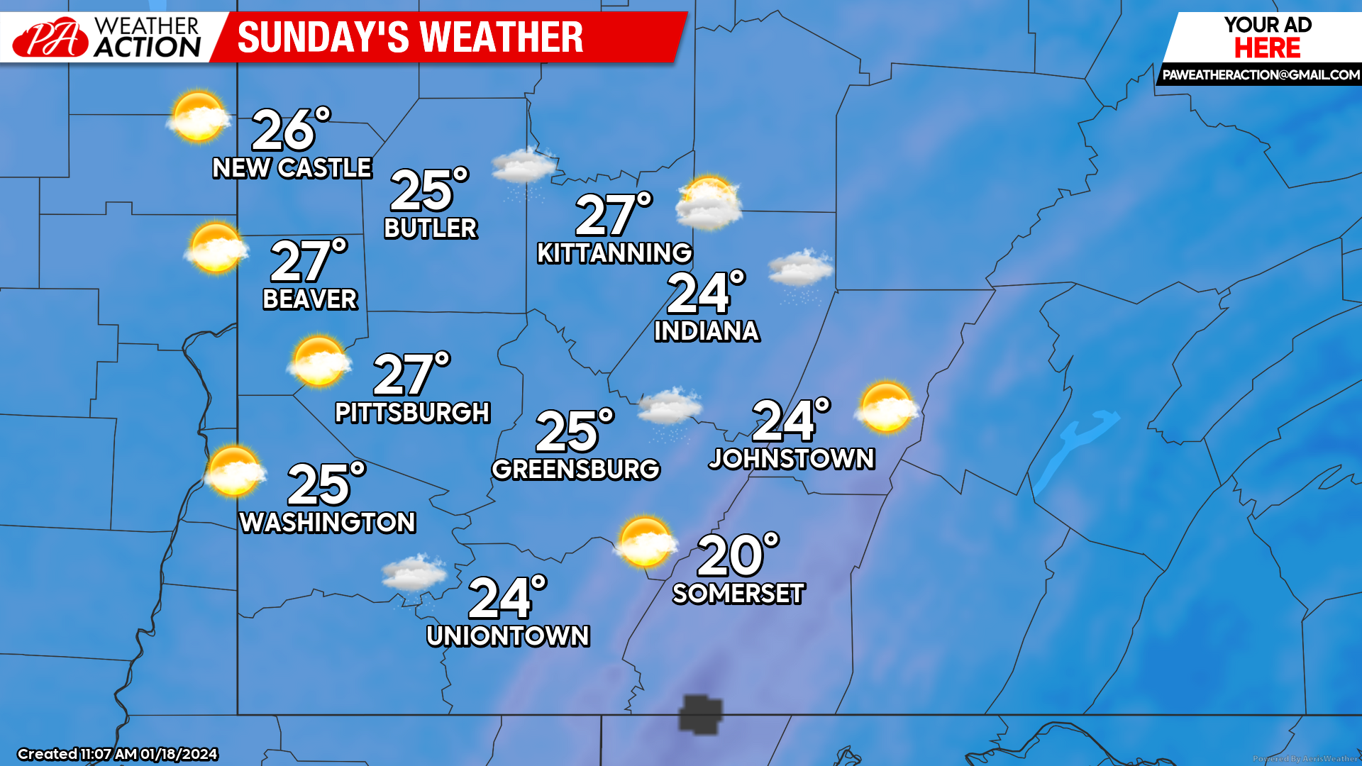
Sunday
Partly sunny to mostly cloudy conditions are expected throughout the region. Highs will be in the mid to low 20s. Winds will be out of the west at 8 to 10 mph. Lows will be high to mid-single digits.
Be sure to follow PA Weather Action for details on snowfall amounts and timings throughout the region in our periodic Snowfall Forecast.

You must be logged in to post a comment.