
Yes, more snow is possible! Storms have been numerous, with one in Eastern PA this past weekend, one tonight, and now a clipper looking more possible Wednesday Night. This will likely be a very powdery snow, as temperatures will be in the low 20s as the snow falls. As a result, even light to moderate snow will accumulate quickly due to high liquid to snow ratios of 20:1.
Heaviest accumulations look to be in Southwest PA and the Laurel Highlands. Often times with these storms, more snow falls on the western side of the Appalachian Mountains unless a secondary coastal low forms, which won’t be the case Wednesday Night. Here is the latest GFS run for 5 AM Thursday Morning.
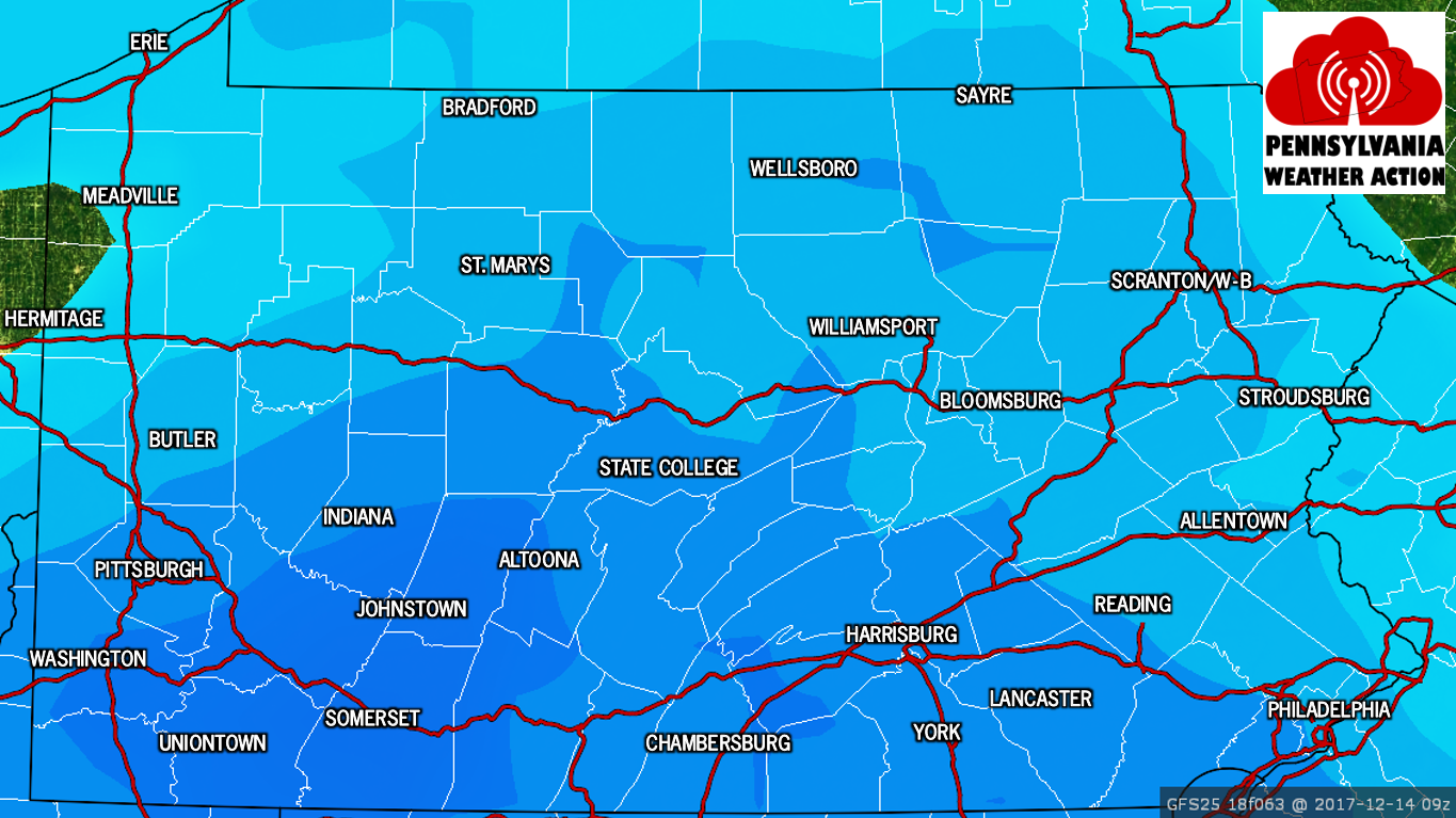
The timing of this storm will also be key. The majority of the snow will fall overnight. As a result, the Thursday Morning Commute is looking hazardous across Southwestern and Southcentral PA. Any roads that are not treated will become snow-covered with temperatures in the low 20s as the snow falls. Now let’s look at possible snow amounts.
SNOWFALL POTENTIAL MAP FOR THURSDAY’S CLIPPER
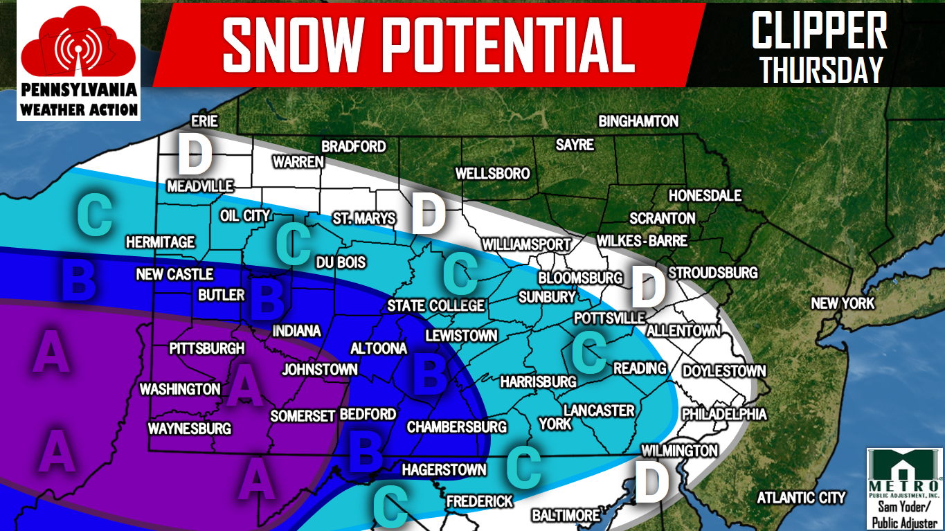
Area A: This region has the best chance to see 3″ or more.
Area B: This region has the best chance to see 2″ or more.
Area C: This region has the best chance to see 1″ or more.
Area D: This region has the best chance to see a coating or more.
Make sure you have us liked on Facebook for the latest regarding this clipper and much more, click here>>>Pennsylvania Weather Action’s Facebook Page. Also, download our app for the latest alerts and interactive radar. Click here to download our app!
Share this snowy news with your family and friends using the button below, stay tuned for our First Call Forecast Tuesday Evening!
You must be logged in to post a comment.