
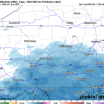
Multiple winter systems will pass through the region bringing chances for snow early in the first half of the week before transitioning to a wintery mix with freezing rain possible. Winter Weather Advisories have been issued for the southeastern counties of the region.
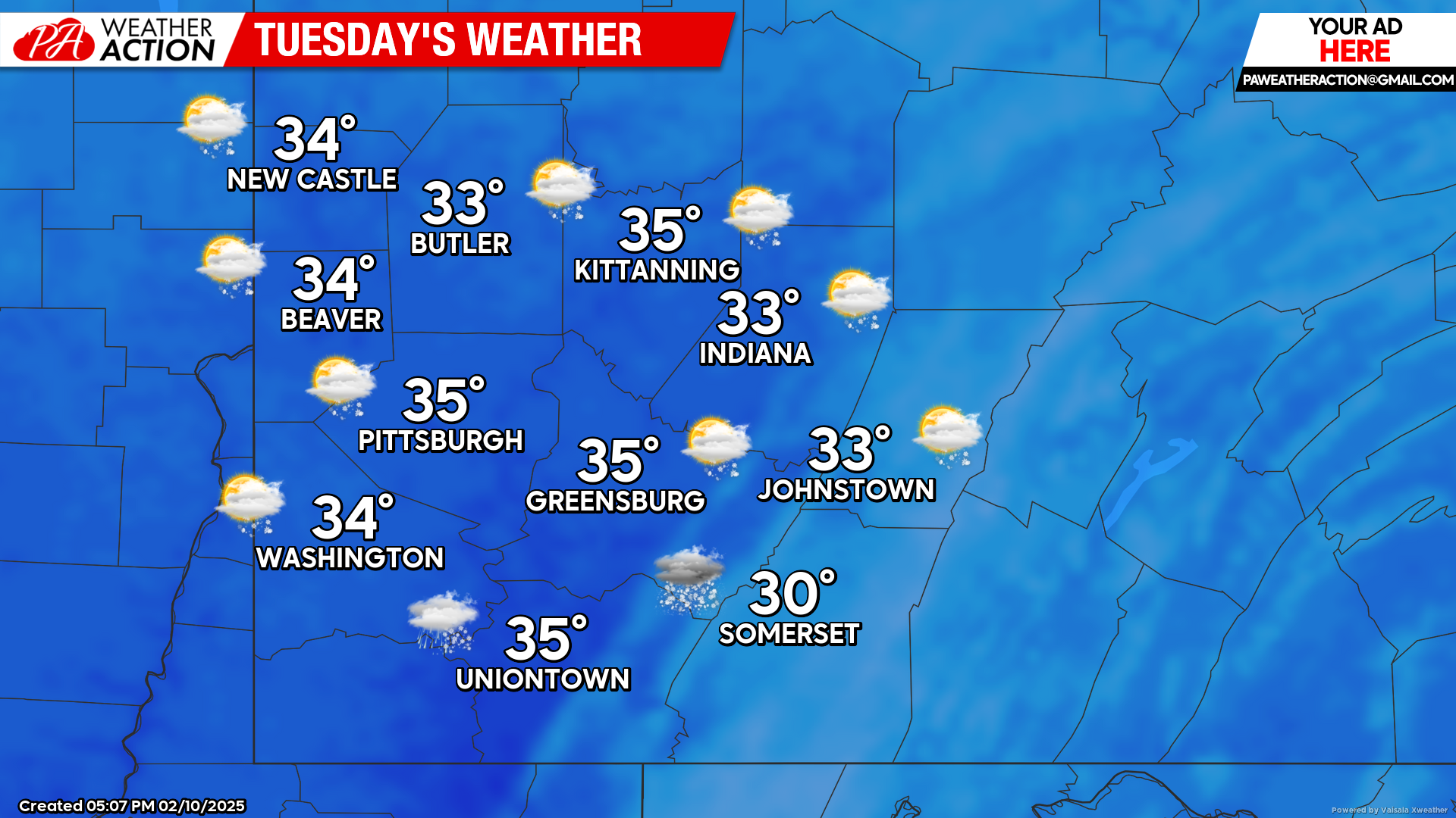
Tuesday
Chances for periods of snow are possible, primarily in the afternoon hours and continuing overnight. Greatest chance for accumulation will be in the higher altitudes. Highs will be in the mid to low 30s, lows will be in the upper to mid 20s.
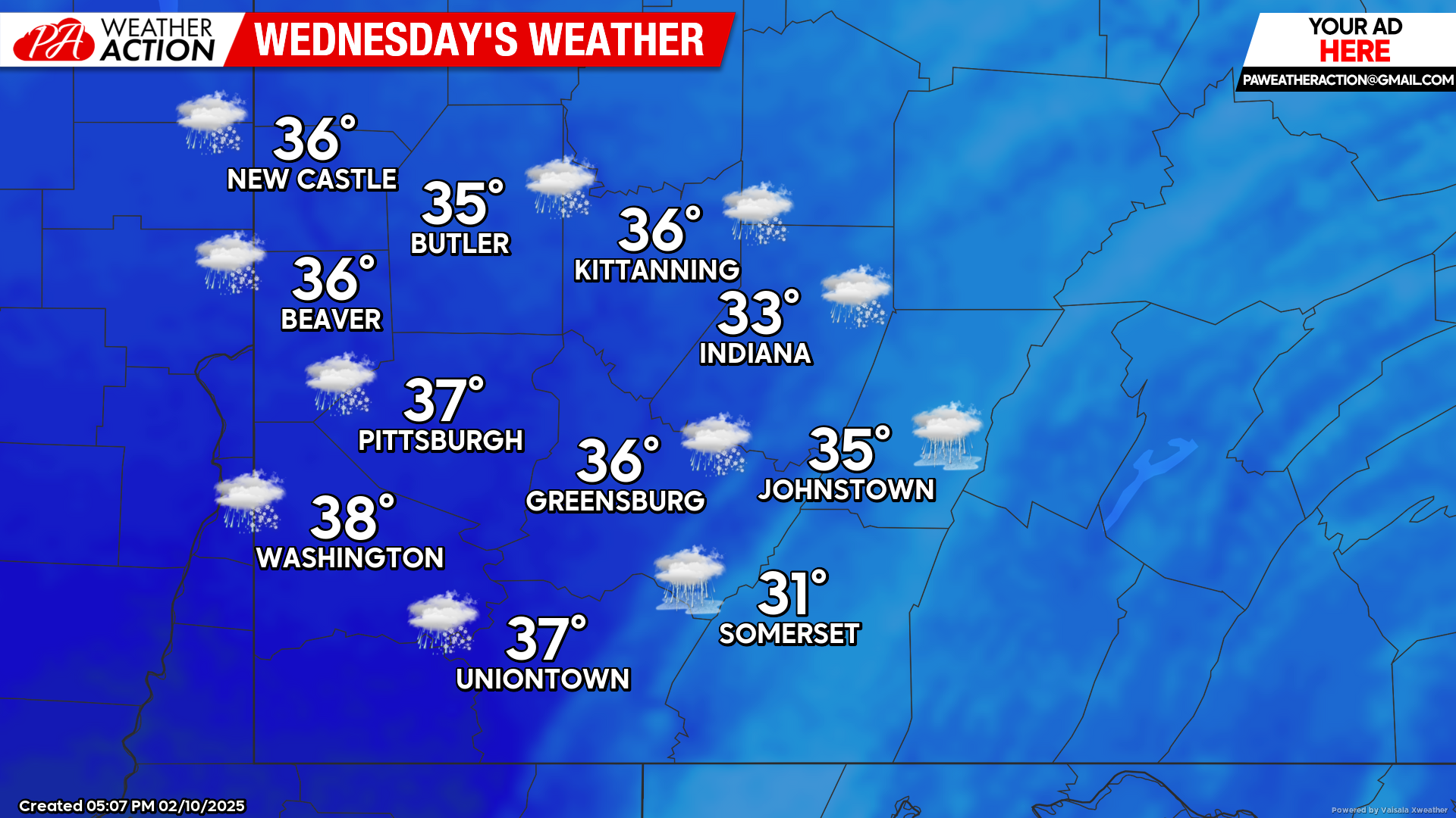
Wednesday
Chances for snow in the morning hours will begin to transition to rain, a wintery mix and freezing rain, especially in the higher elevations, in the afternoon hours. Highs will range in the 30s, lows will be in the low 30s to upper 20s. Winds will be out of the east-southeast at 10-17 mph, wind gusts could approach 30 mph in some areas.
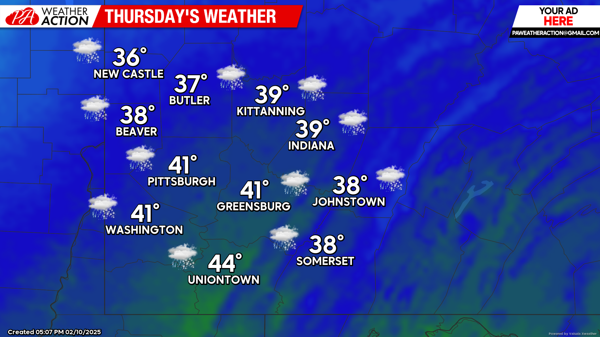
Thursday
Mostly cloudy with chances for rain and snow possible. Highs will be in the low 40s to mid 30s, lows will be in the low 20s to mid-teens.
Another chance for a weekend with mixed wintery precipitation is possible. Be sure to follow PA Weather Action for more forecasts and statewide forecasts with specific winter storm details.
You must be logged in to post a comment.