

After a few beautiful days of weather, severe weather is likely in parts of Pennsylvania Tuesday. Our forecast yesterday received many different reactions, and we’re going to clarify a few things.
Scattered to widespread severe thunderstorms are expected to come in the form of some discrete supercells and clusters of storms. Within a severe thunderstorm itself, straight line winds are the biggest concern, posing the risk of wind gusts of 60-80mph.
However, these winds occur in stretches that are about 0.5 – 1 mile wide, and often 2-5 miles in length. These gusts are typically what result in power outages even in areas that see lower winds. Statistically, your backyard is far less than 50% likely to see thunderstorm damage in severe thunderstorms forecasts since these impacts are highly localized. However, downed trees and power lines in hardest hit areas can have far-reaching consequences.
So when you read wind gusts up to 90mph, know that it refers to maximum localized wind gusts in the strongest storms of the day. We understand giving a range of maximum winds is the better move.
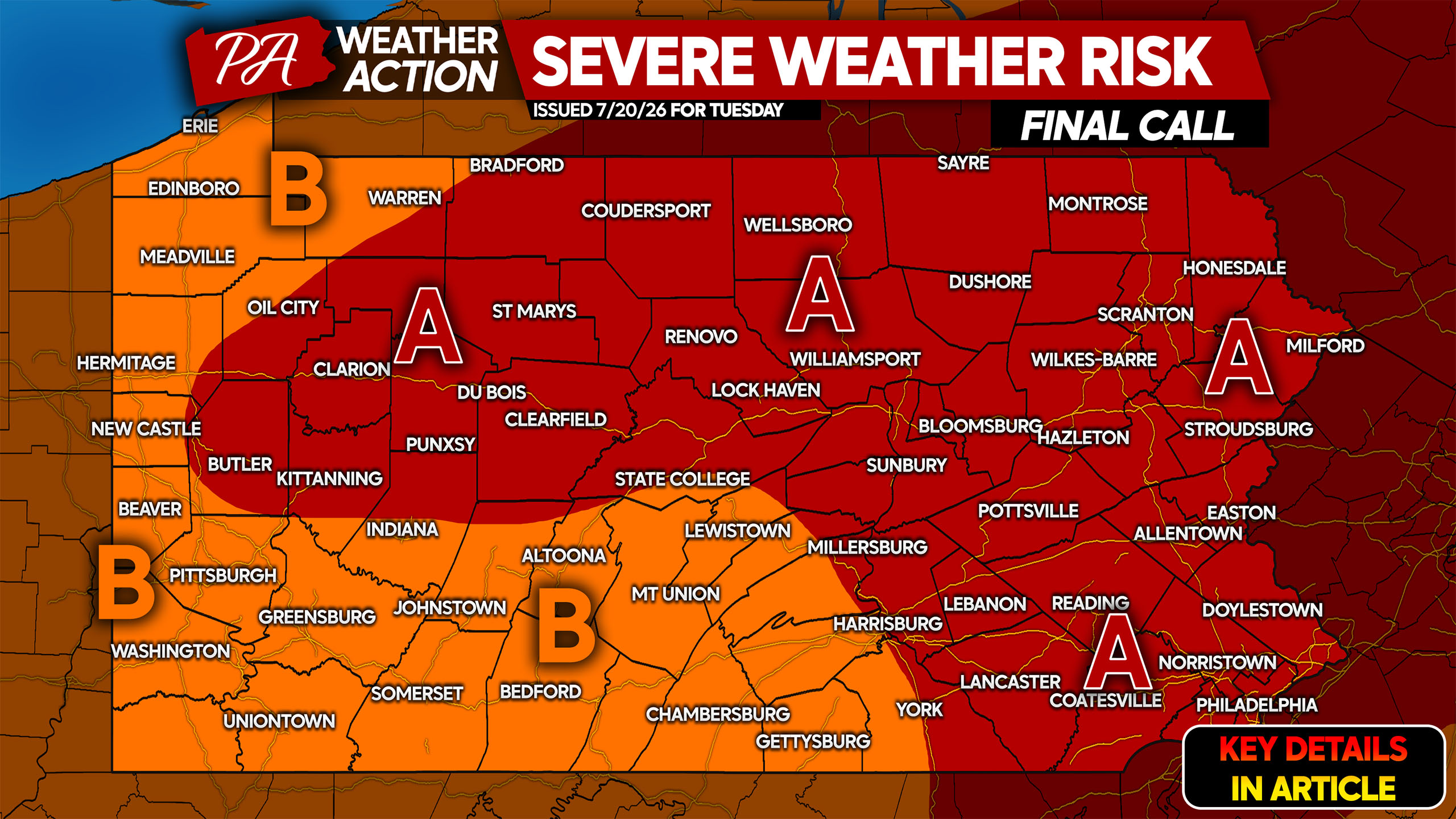
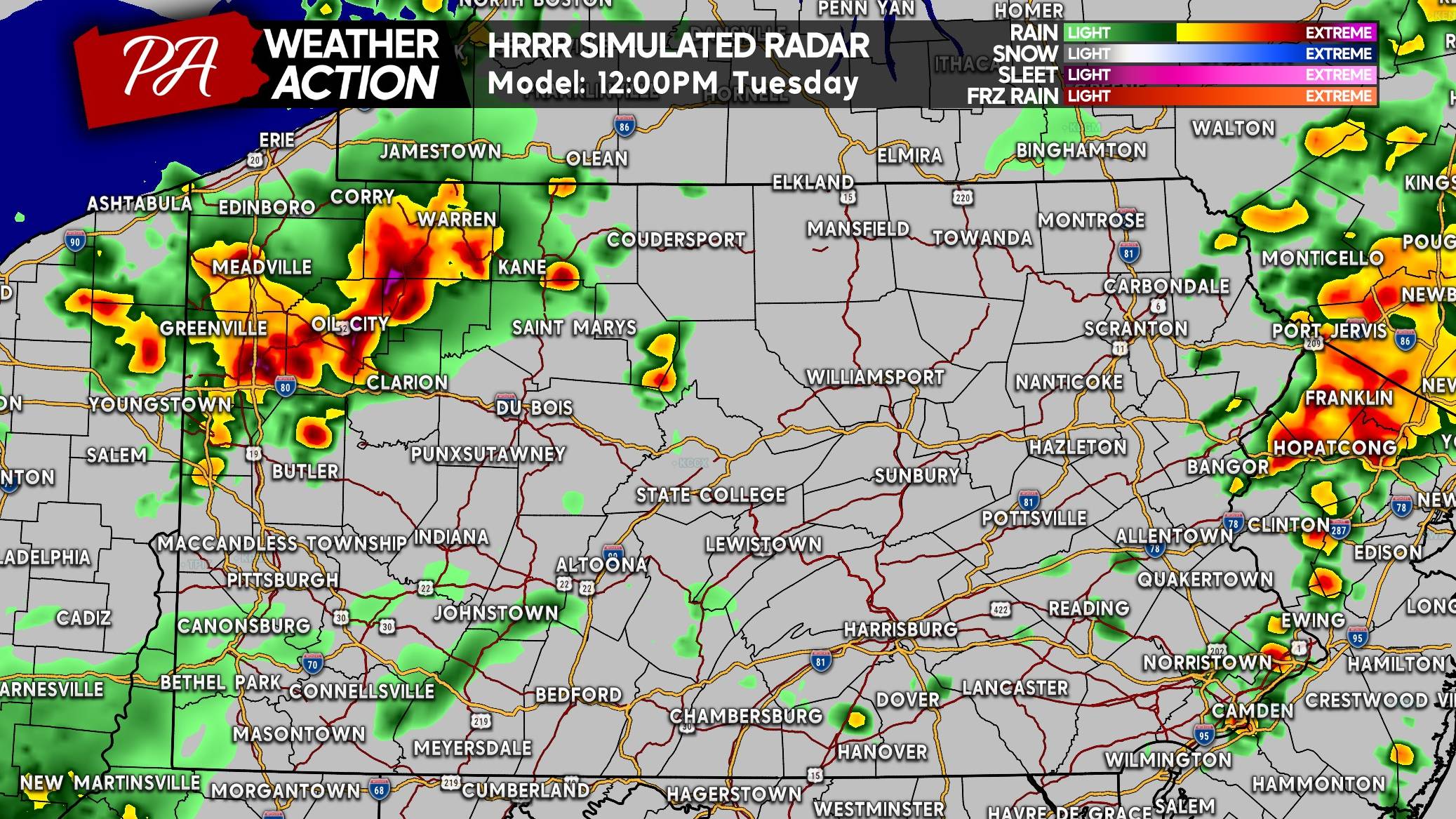
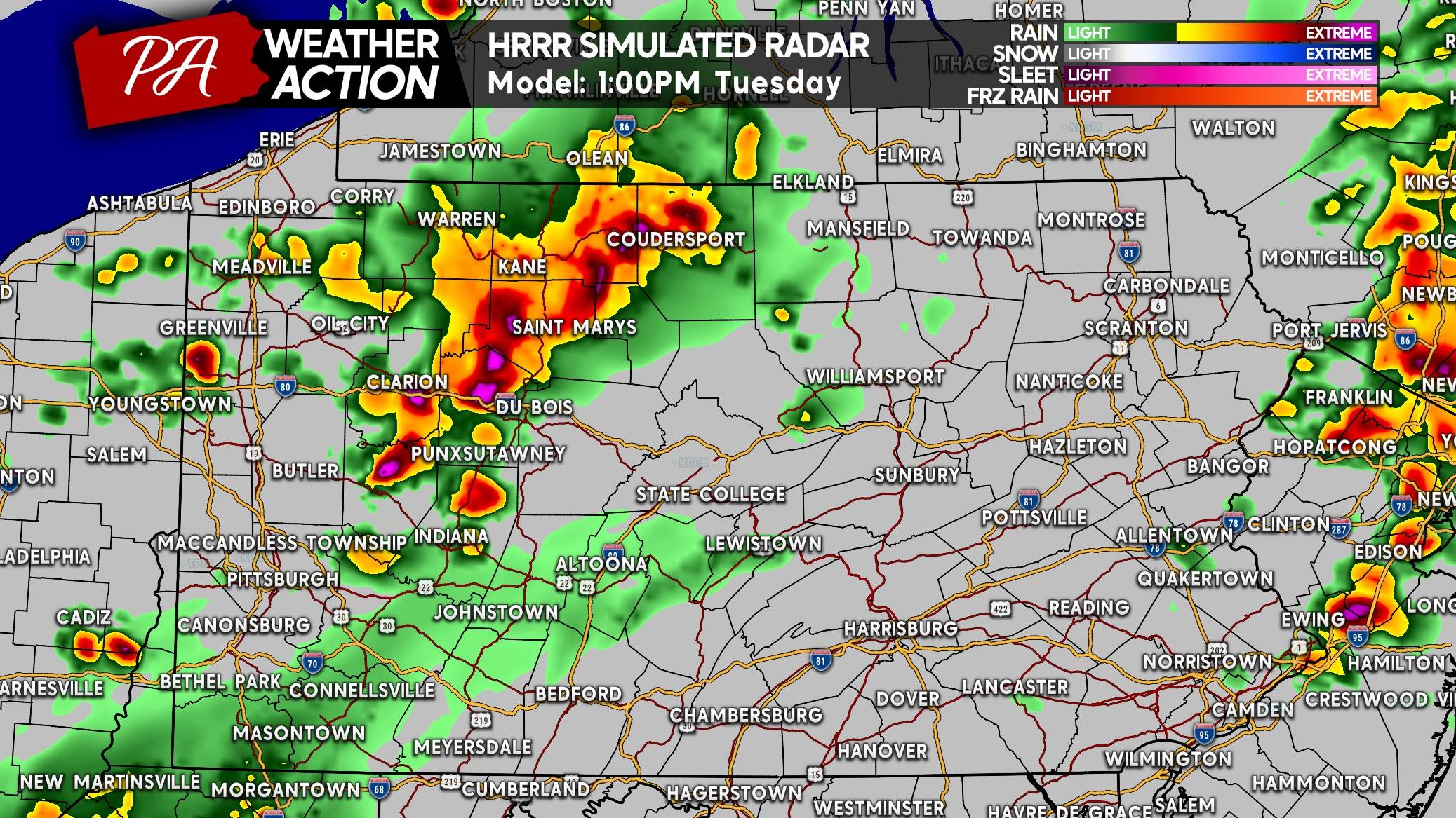
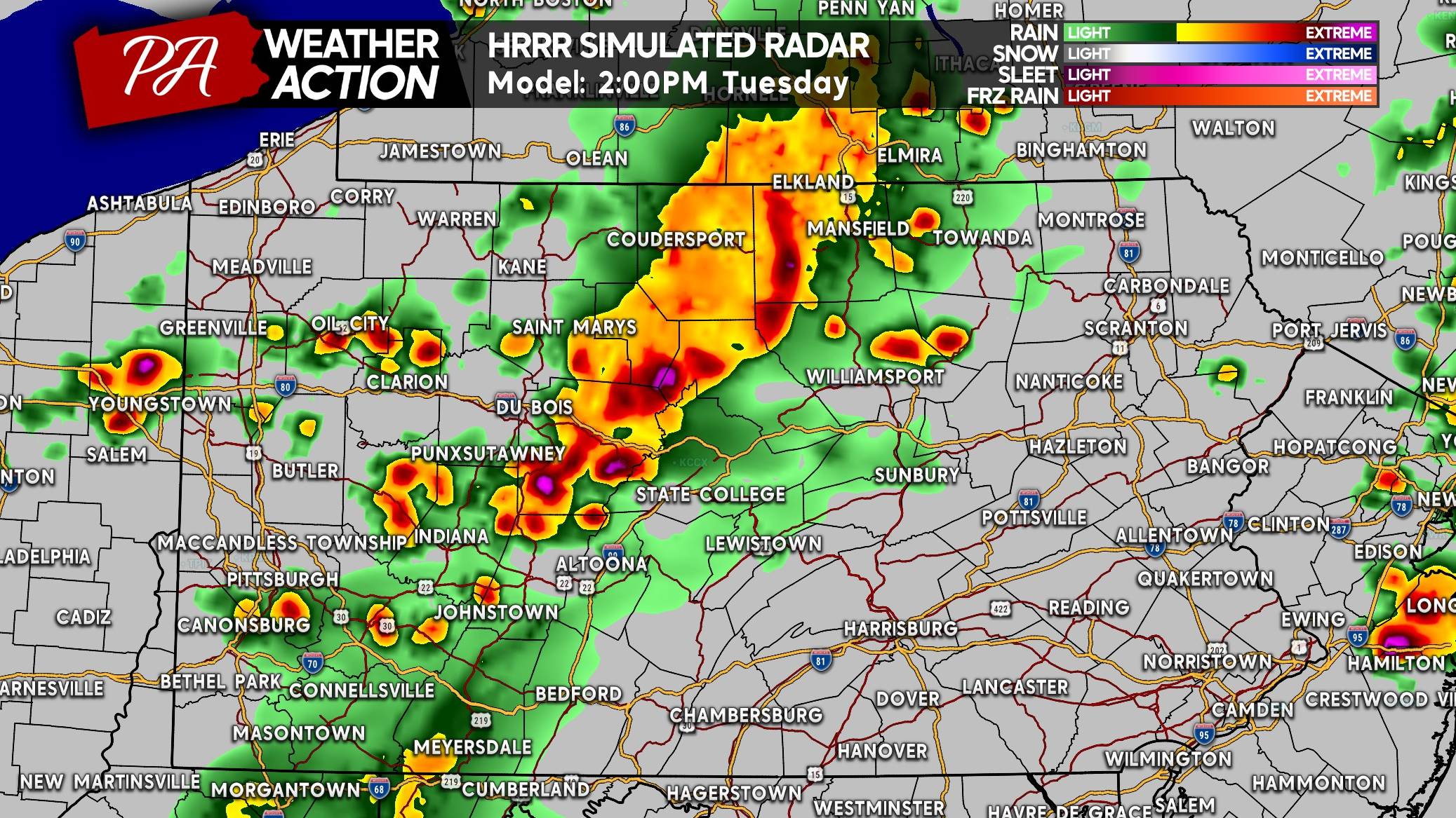
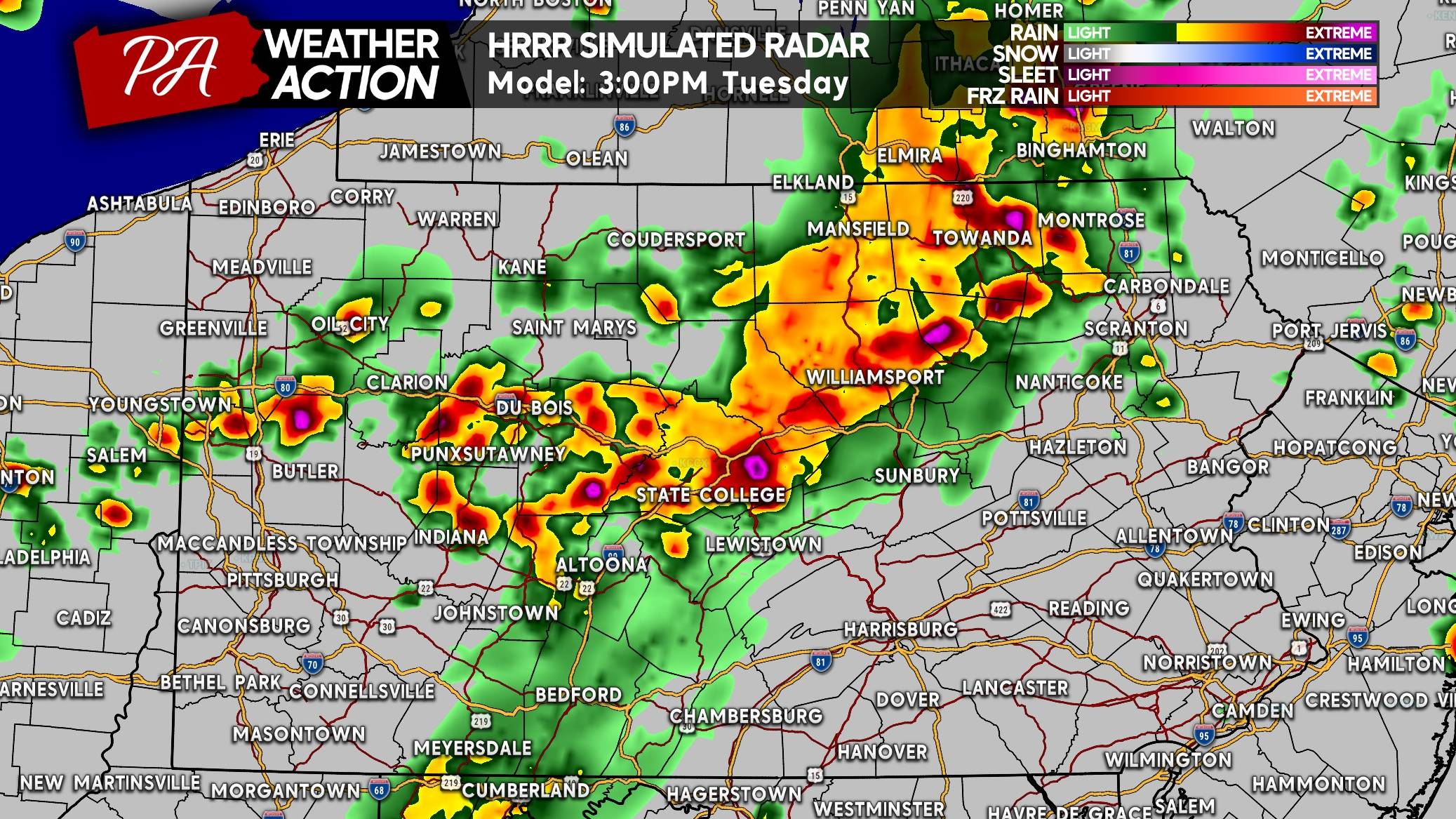
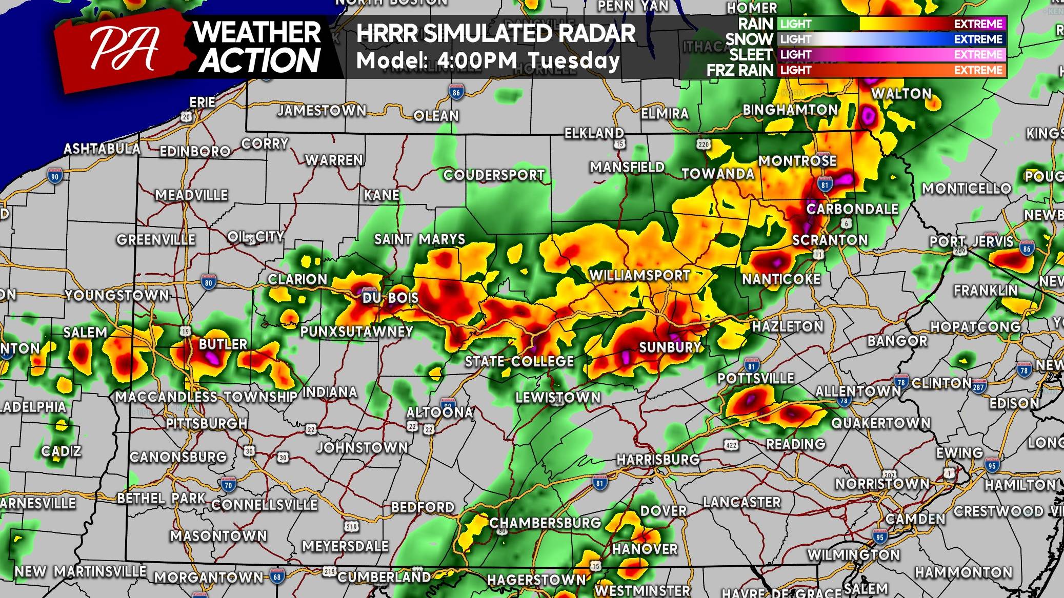
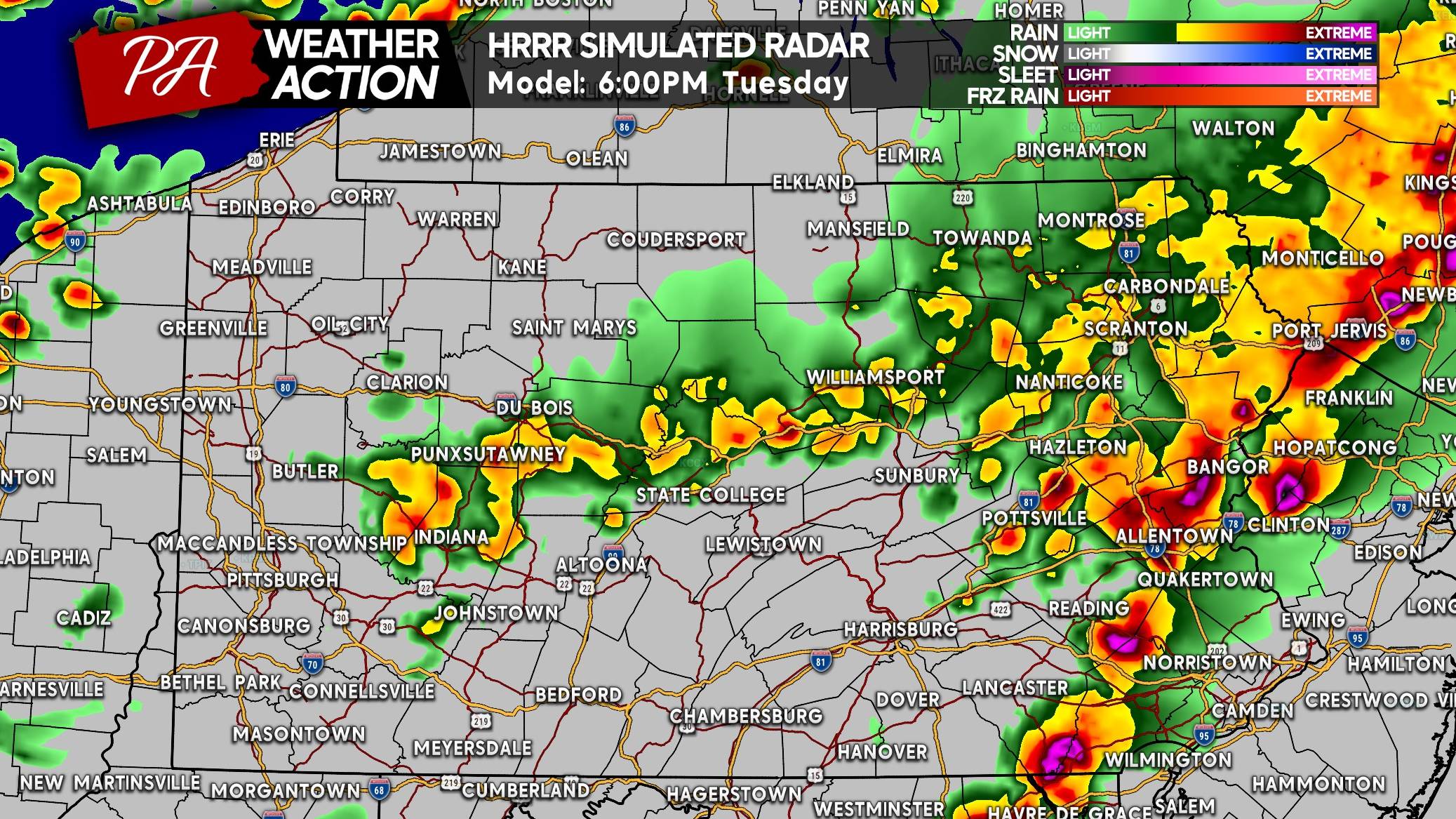
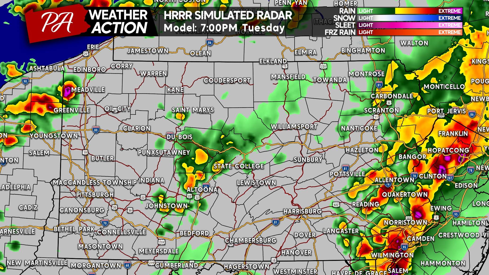
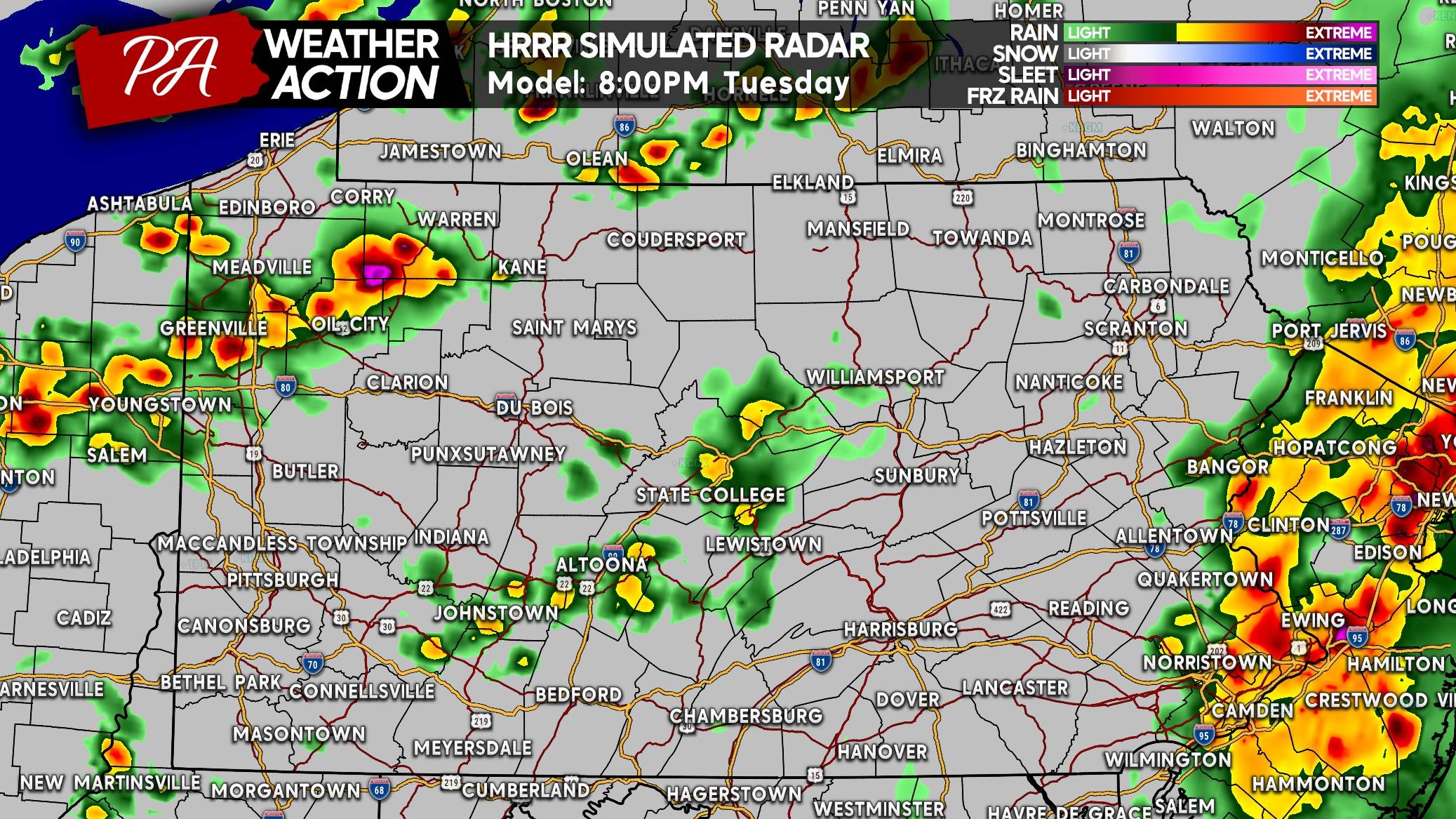
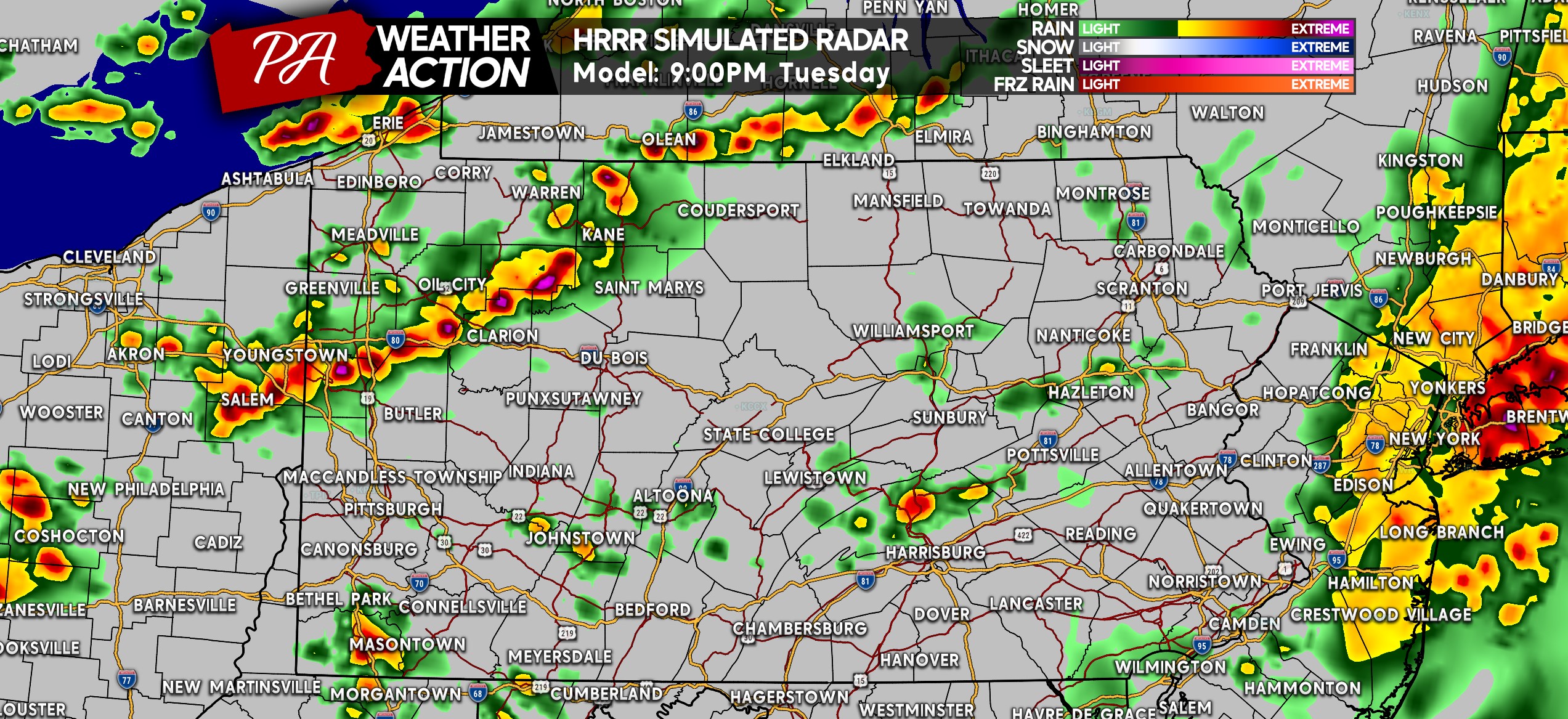
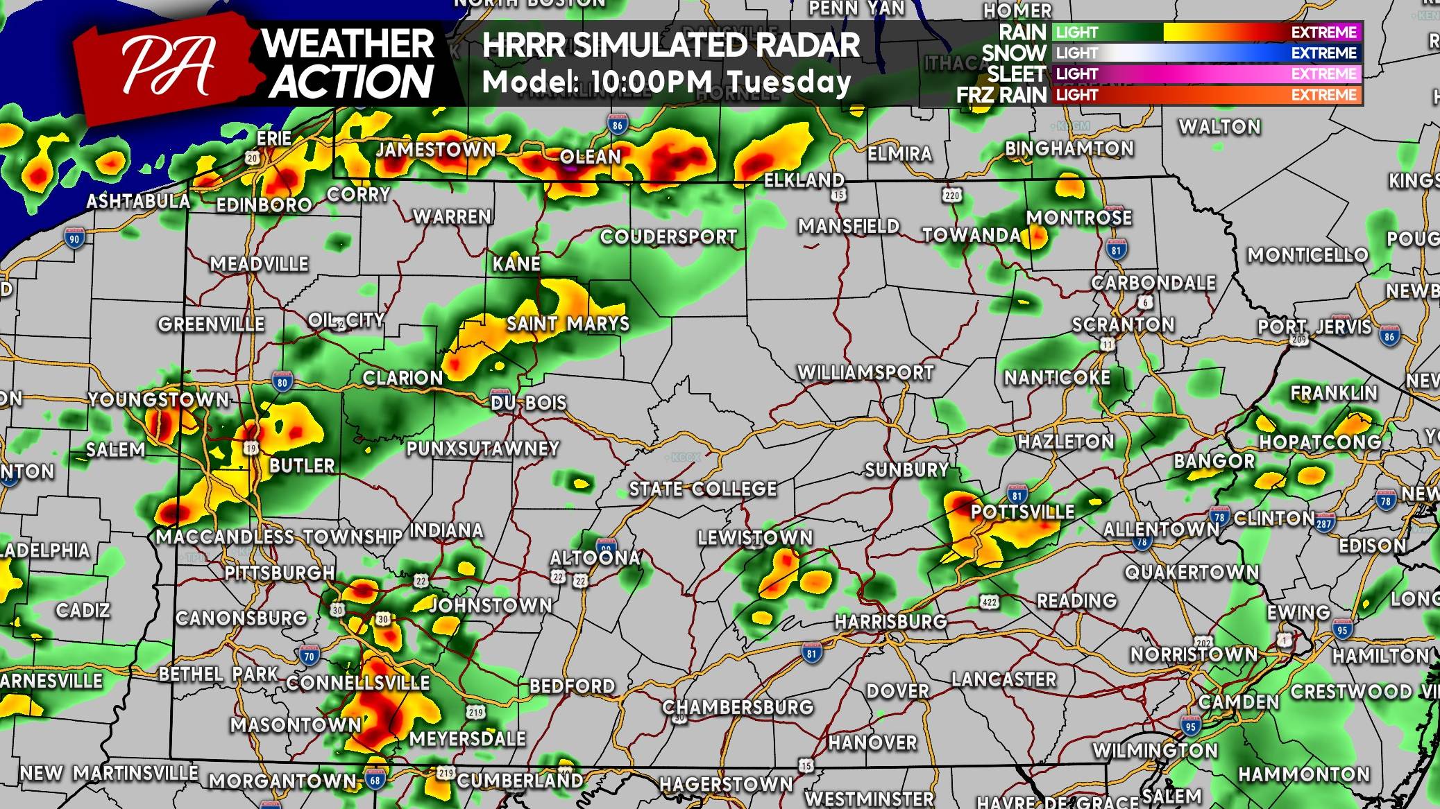
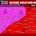
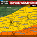
Now for the forecast itself. The highest risk has shifted northeast, with Northern and Eastern PA having a higher certainty of seeing scattered to widespread severe storms. A question mark still remains especially in the Pittsburgh Metro and over into South Central PA as to whether storms will develop. Below is the latest HRRR model forecast for this event.
FUTURE RADAR TIMING (HRRR MODEL)

SEVERE THUNDERSTORM THREAT FORECAST FOR TUESDAY
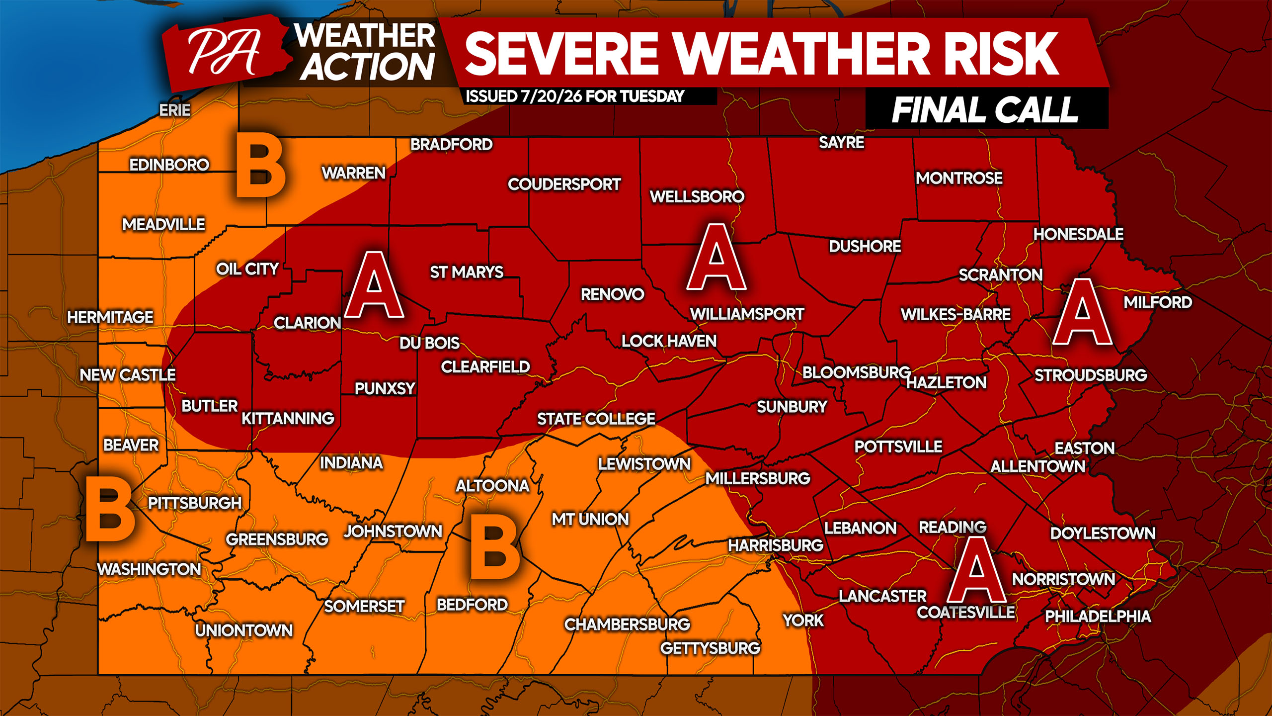
Area A: Scattered to widespread severe thunderstorms are expected Tuesday PM. A few supercells are likely along with clusters of potent storms. Localized wind gusts of 60 – 80 MPH are possible along with a few tornadoes and very isolated hail. Isolated power outages are probable.
Area B: Isolated to scattered severe thunderstorms are anticipated Tuesday PM. A couple supercells are expected, along with clusters of strong to severe storms capable of producing localized gusts of 60 – 80 MPH. A very isolated tornado is possible as well. Isolated power outages are possible.
Get the latest weather alerts and forecast for your location with our app! Download the PA Weather Action app here.
Be sure to share this forecast with family and friends who may be affected!

You must be logged in to post a comment.