
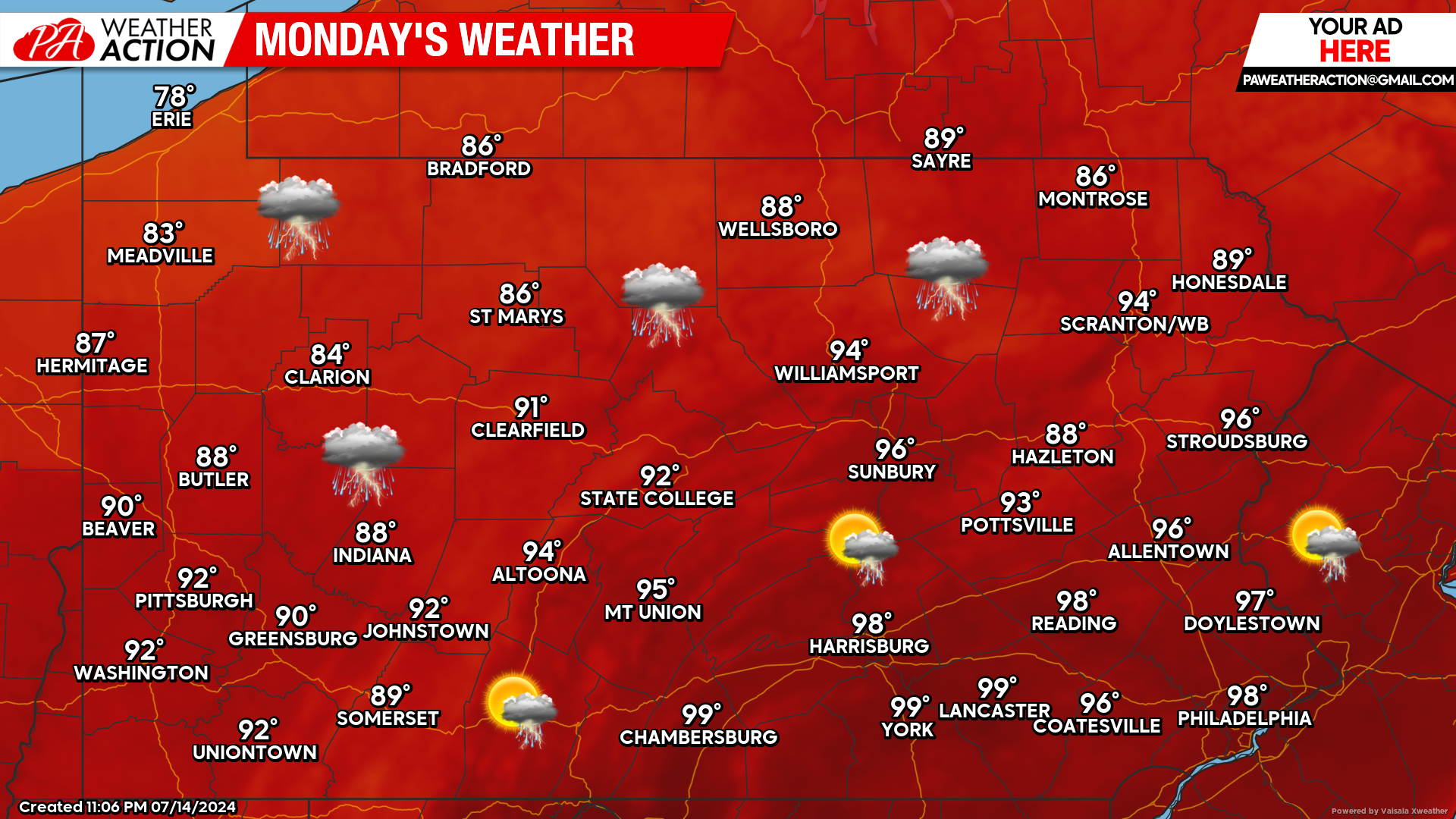
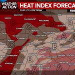
Widespread Heat Advisories and Warnings have been issued all across the state for both today and tomorrow. All-time record high temperatures will likely be broken for many locations. We cannot express enough to make sure you are staying hydrated during this heat wave.
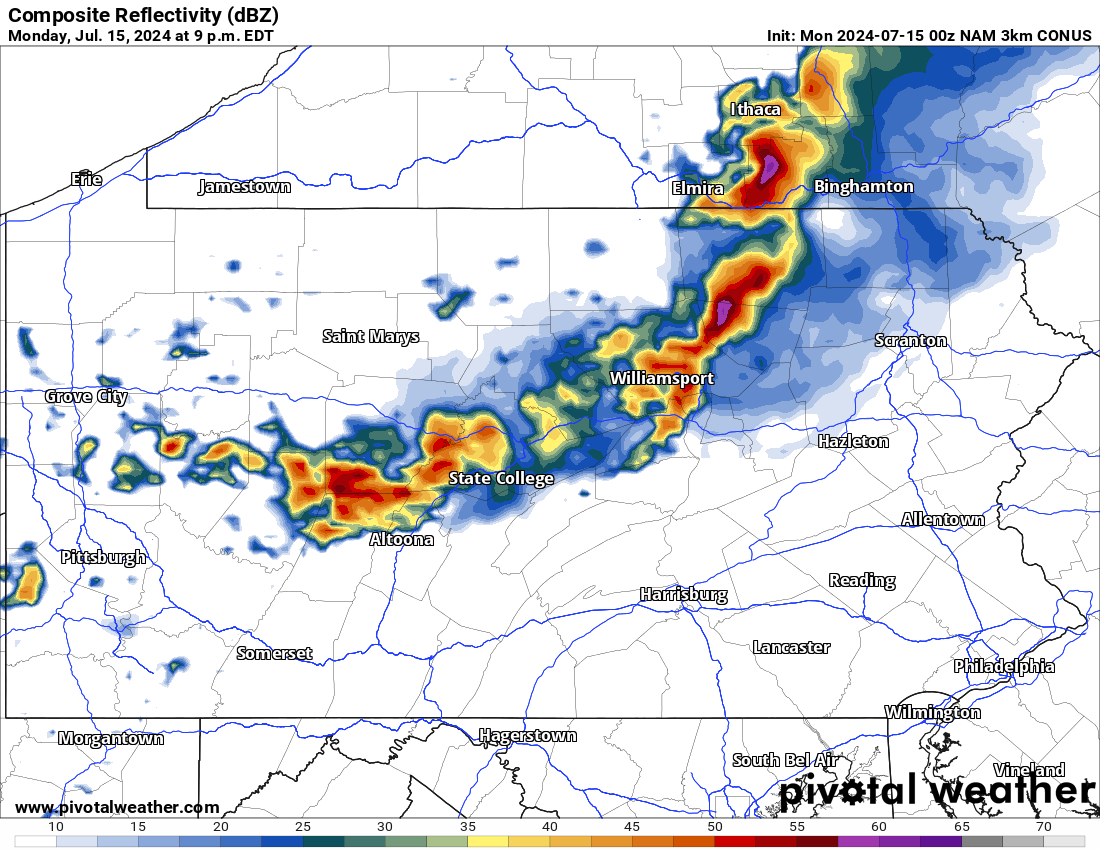
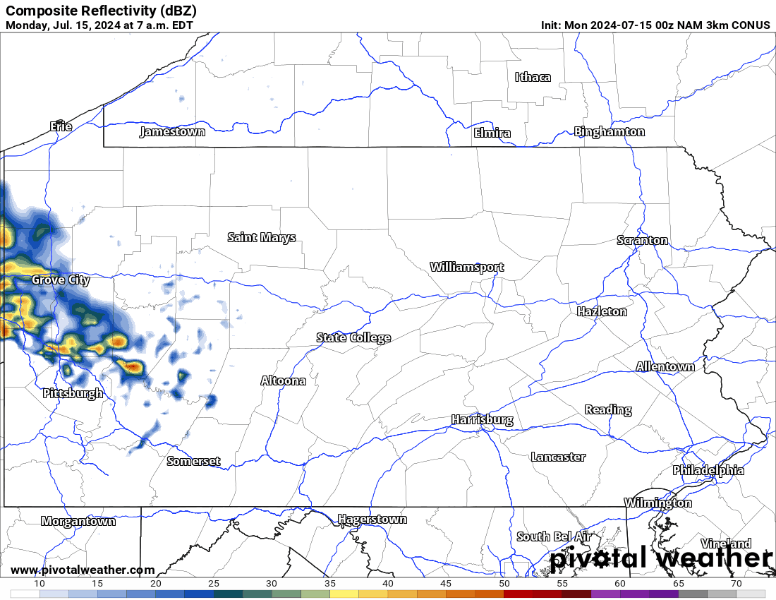
With the heat, the chance for strong to severe thunderstorms will increase in the afternoon hours today. Below is a look at the latest radar imagery:
Today’s Weather Forecast: 5/10
The National Weather Service has issued both Heat Advisories and Warnings for many locations today with temperatures soaring well into the 90s and even near the triple digits.
All-time high temperatures have the chance to be broken. During the afternoon and evening hours, strong to severe thunderstorms are possible.
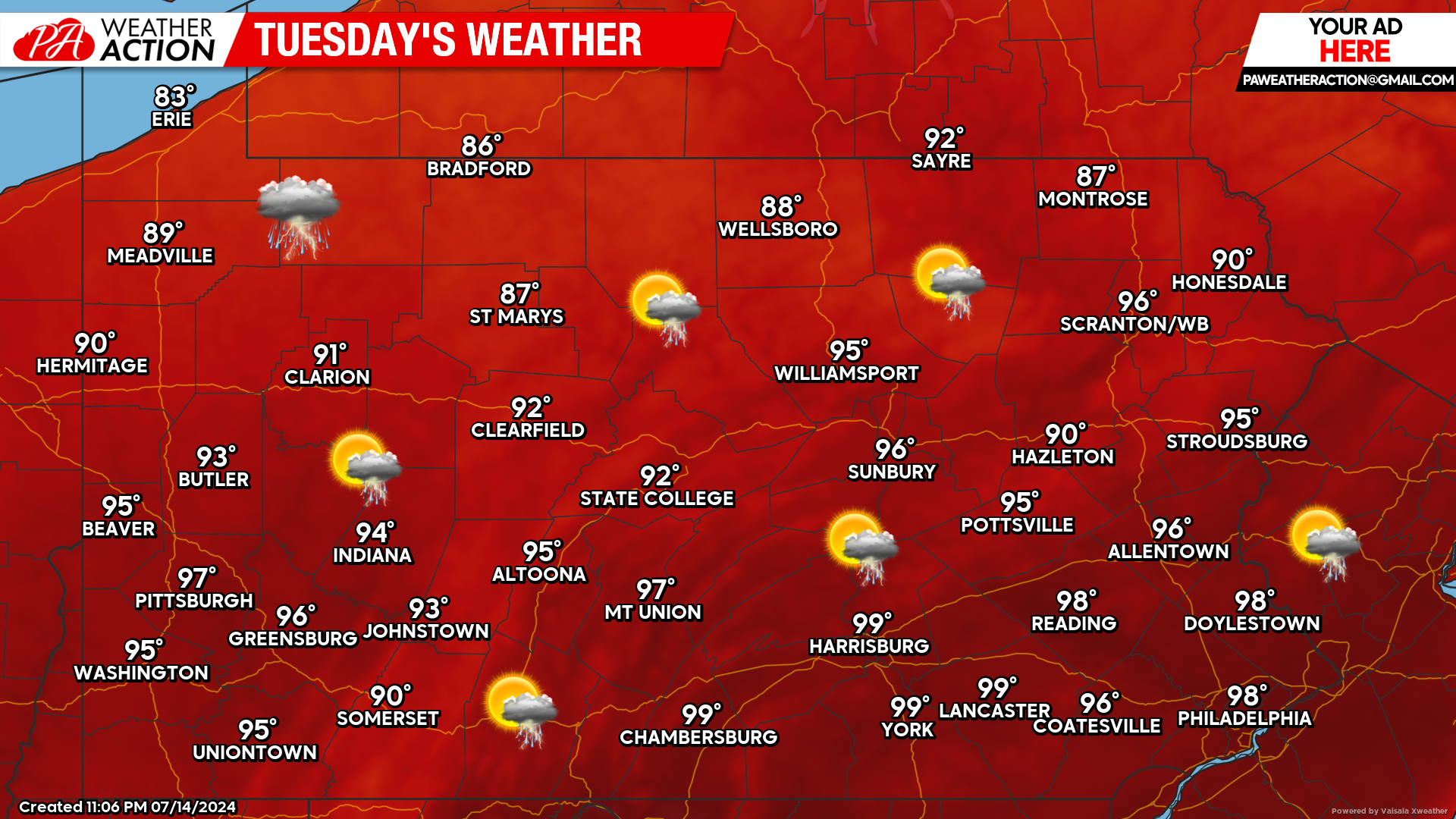
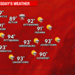
Tuesday’s Weather Forecast: 5/10
Overall, Tuesday will be even hotter than today. A slight chance of a shower or thunderstorm is possible. Almost every single town will have temperatures in the 90s with much of southern Pennsylvania approaching 100 degrees.
Keep in mind, heat indexes or “real feel” temperatures will be 5 to 10 degrees hotter than the actual temperature.
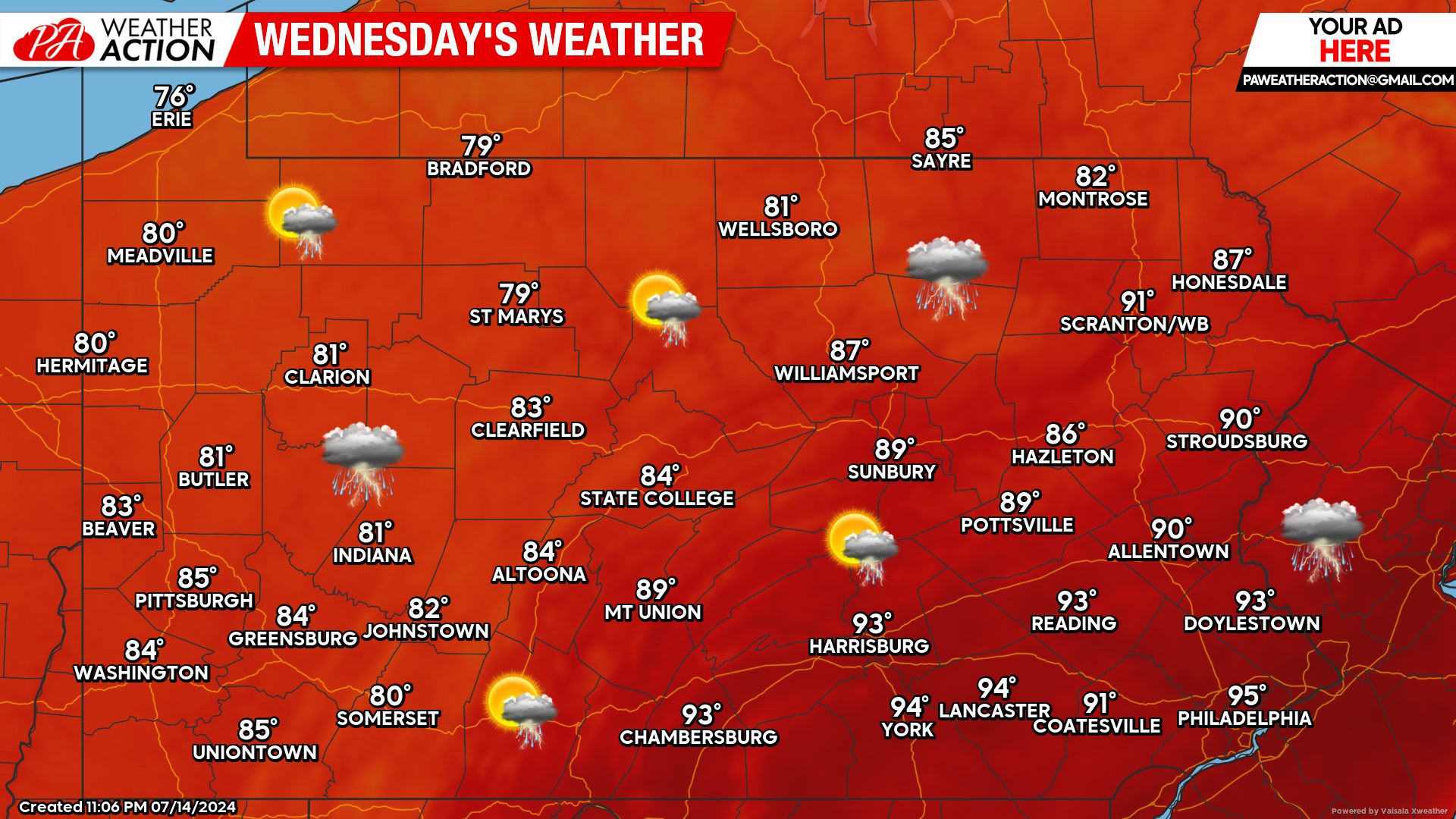
Wednesday’s Weather Forecast: 7/10
Southeastern counties will remain hot Wednesday. Everyone else we will begin to finally see a relief from the heat.
The good news is, we do not anticipate anymore heat waves in the near future. There is the threat for showers and thunderstorms.
Hi-Res NAM Future Radar Valid Through Wednesday AM:
Our main concern the next two days will be the excessive heat across the state. However, we cannot underestimate the potential for strong to even severe thunderstorms today.
Looking at the future Hi-Res NAM radar, the best chance for areas to see severe weather today will be across northern Pennsylvania. For time reference, view the top left of the graphic below:
You must be logged in to post a comment.