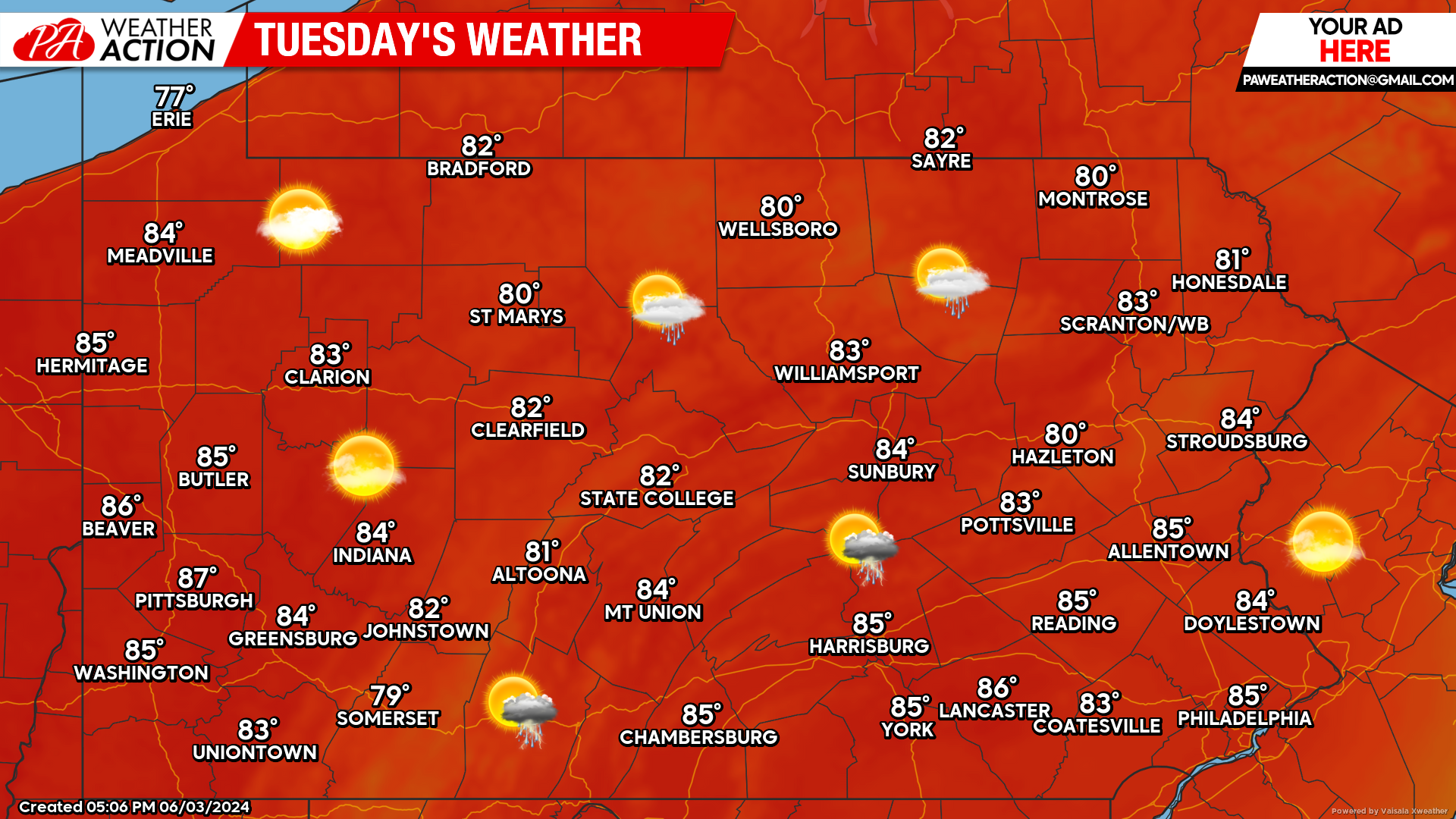
Today will be almost an exact replica of what we saw yesterday. Looking at our satellite this morning, clouds and sunshine will once again be in the forecast:

Today’s Weather Forecast: 8/10
As mentioned, today will be very similar to yesterday. A chance for an isolated shower or thunderstorm is possible, but not likely.
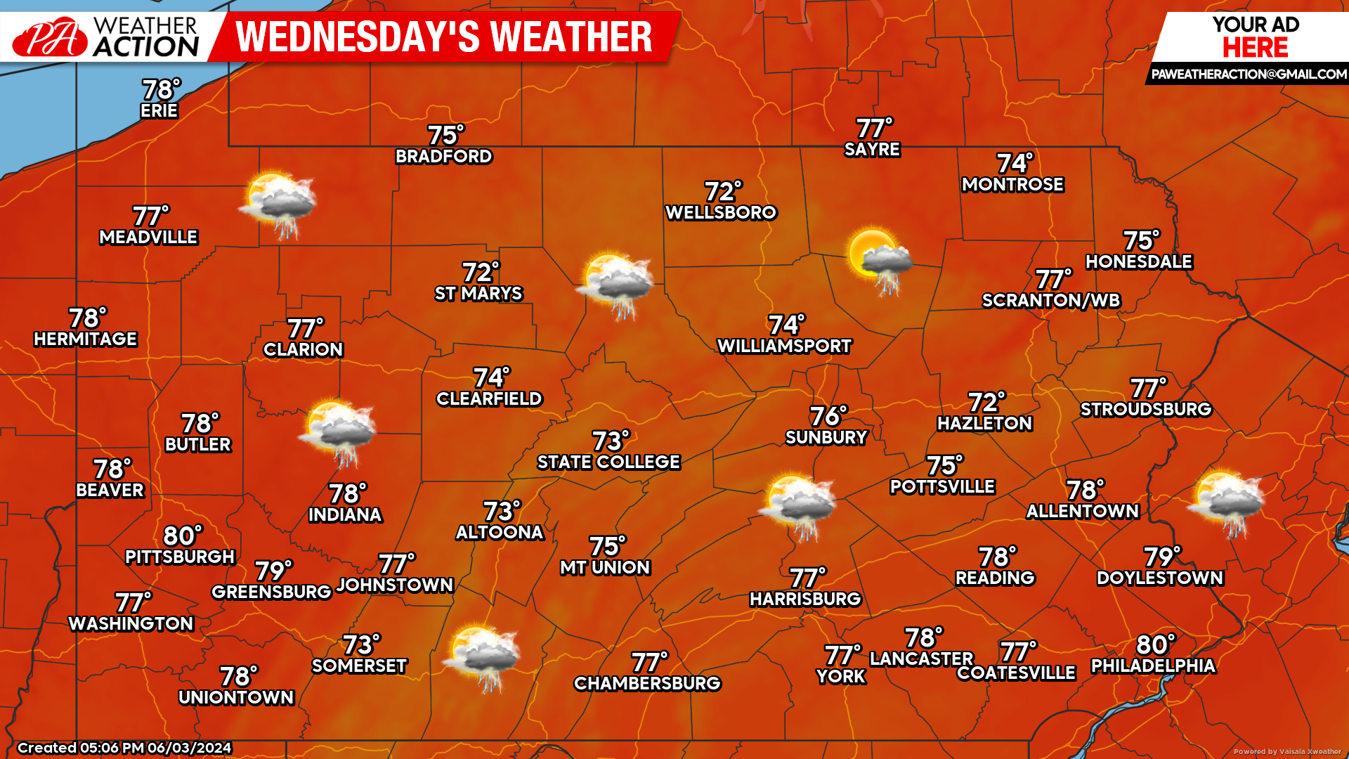
Wednesday’s Weather Forecast: 5/10
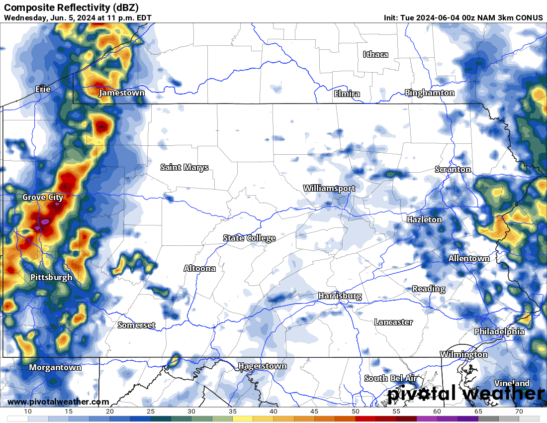
Widespread showers and thunderstorms are likely as we move forward into the day Wednesday. Outside of the chance for torrential downpours, we do not anticipate much in the way of severe weather with Wednesday’s storms.
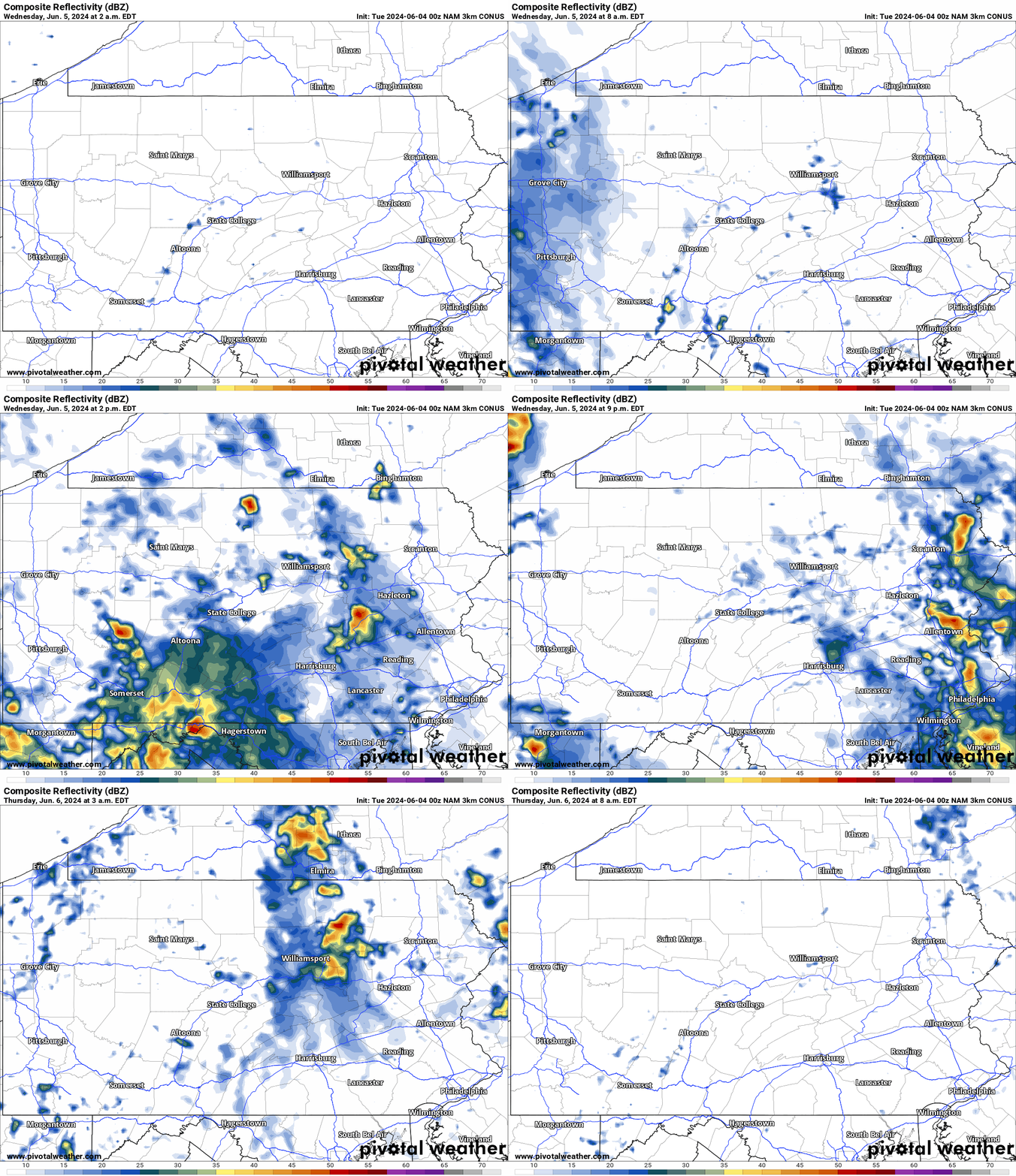
Hi-Res NAM Future Radar Wednesday AM through Thursday AM:
Taking a look below at the Hi-Res NAM future radar, we can expect the majority of the showers and storms to arrive by Wednesday afternoon and continue through the evening and into the very early morning hours on Thursday. For reference, the time stamp is on the top left of the graphic below:
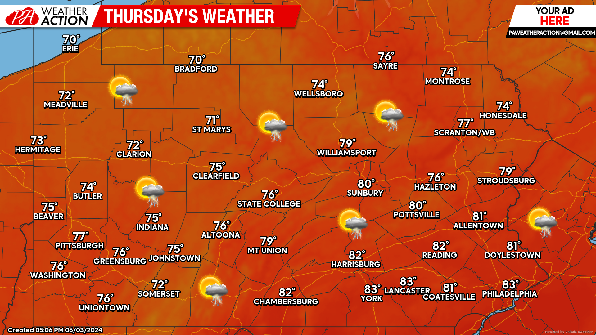
Thursday’s Weather Forecast: 8/10
Other than early morning showers, Thursday should remain mostly dry with the potential for an afternoon thunderstorm.
Weekend Update:
Looking at the weekend, model guidance is in agreement that Saturday should be free of any shower activity. However, guidance disagrees with each other for Sunday. The European model suggests we will be dry, while the American model suggests we will see widespread showers. Keep it here as we iron out the details.


You must be logged in to post a comment.