
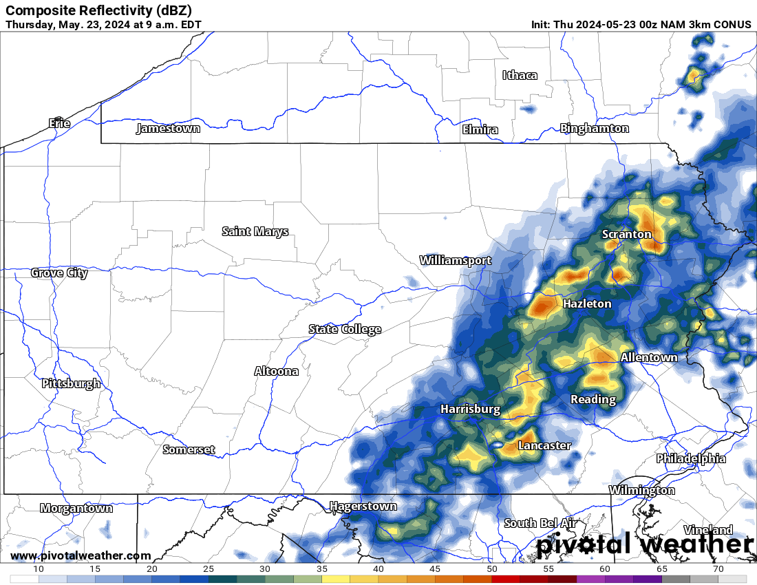
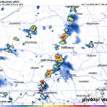
Today will feature another chance for scattered showers and thunderstorms across the state, especially in the morning hours. Below is a current look at the radar this morning:
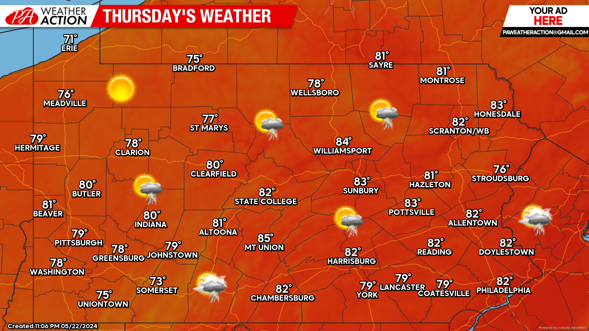
Today’s Weather Forecast: 8/10
Overall, today will be very similar to yesterday. While there is a threat for showers and thunderstorms, most areas will escape the day dry. High temperatures will range anywhere from the mid 70s to lower 80s.
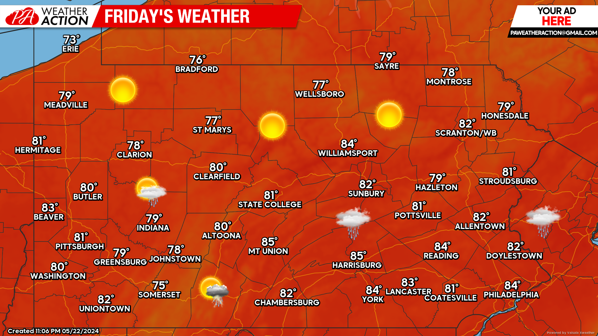
Friday’s Weather Forecast: 8/10
Other than the chance for a passing shower or thunderstorm, Friday will remain mainly dry.
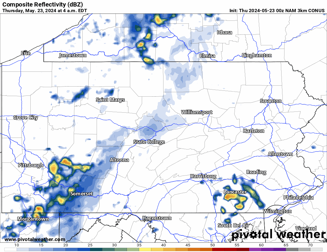
Hi-Res NAM Future Radar Valid Through Early Saturday AM:
Looking below at the Hi-Res NAM future radar, we can expect a line of showers and storms to roll through state this morning and by the afternoon hours we begin to clear out. The future radar begins to show our next real threat of rain and thunderstorms arriving early Saturday morning:
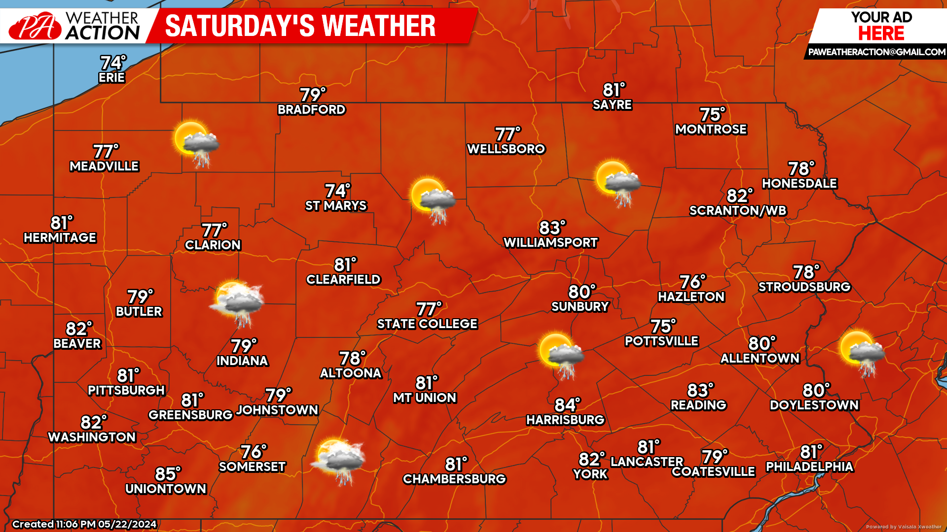
Saturday’s Weather Forecast: 7/10
Saturday does stand the best chance for widespread thunderstorms throughout the state. The good news is, these thunderstorms will not cause the entire day to be wet. Any outdoor activities should go on as planned, just keep an extra eye to the sky.
Memorial Day Weekend Update:
As mentioned, Saturday does not appear to be a washout. Model guidance continues to trend drier for both Saturday and Sunday. In fact, Sunday looks mainly dry. Memorial Day itself still appears to be damp across the state. For now, we recommend to plan any outdoor plans this weekend for either Saturday or Sunday.

You must be logged in to post a comment.