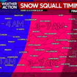
Many areas are waking up to a fresh snow pack on the ground. Strong early morning snow squalls will continue, before the attention turns to lake effect snow by the early afternoon hours. Below is a look at the latest radar:
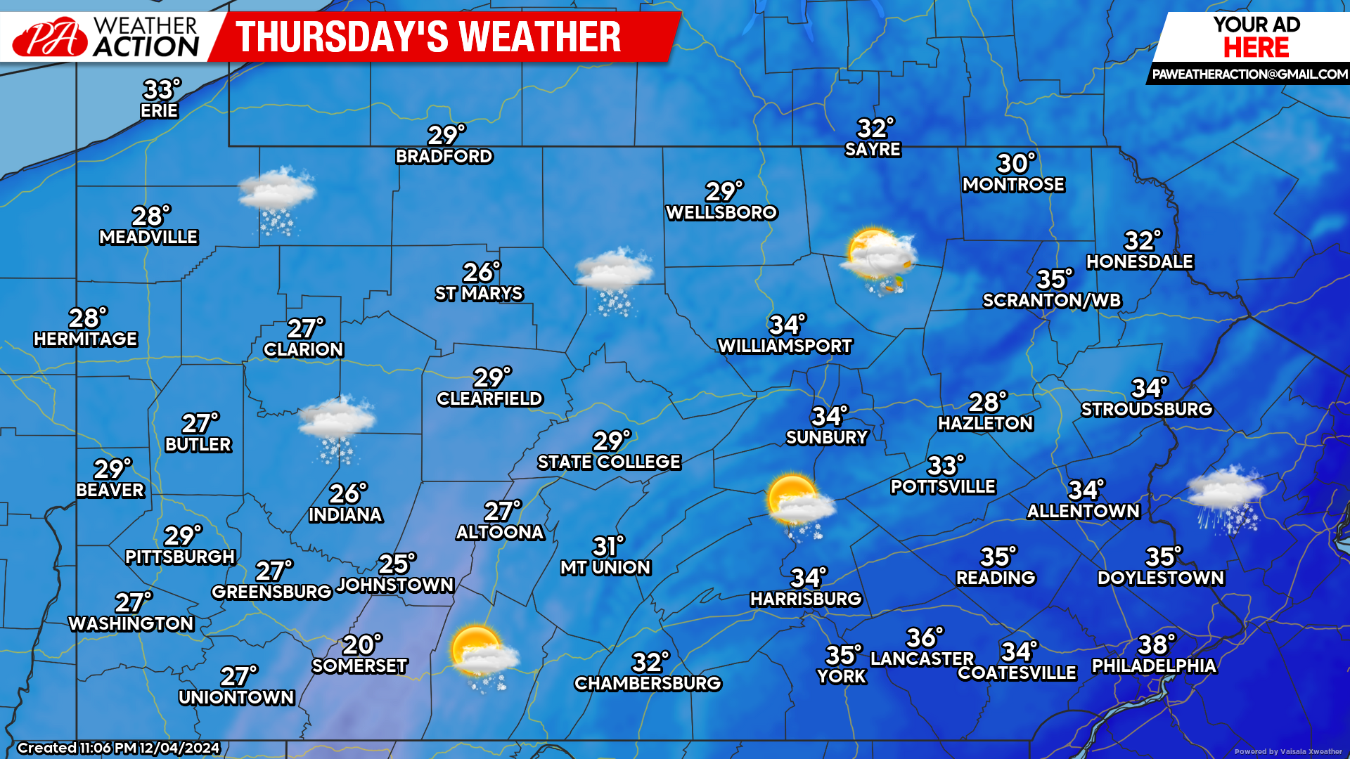
Today’s Weather Forecast: 4/10
Strong early morning snow squalls will continue through the morning hours. By the afternoon hours, lake effect snow will be back in full force across northwest Pennsylvania.
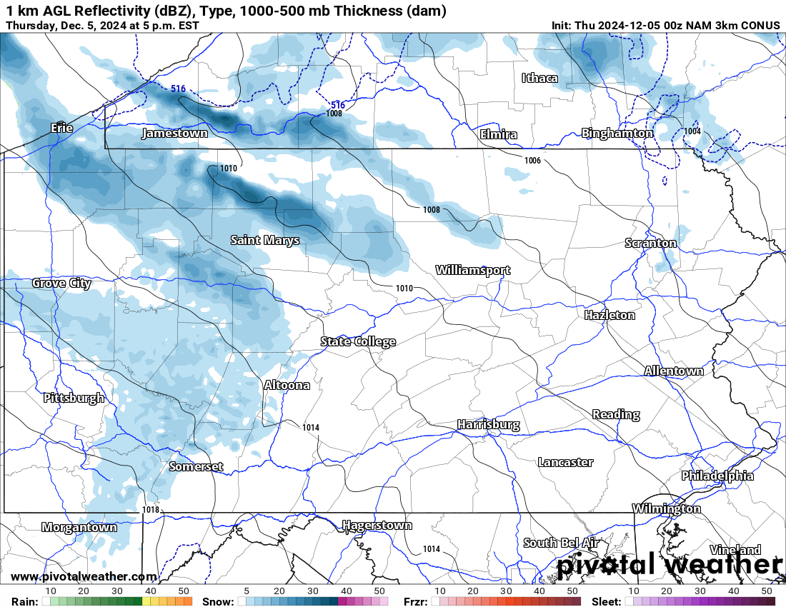
Future Radar Valid for 5:00 PM Today:
Winds will be on the increase today coming out of the northwest. This will allow for lake effect snow to once again ramp up across northwest Pennsylvania. Whiteout conditions will be possible in these lake effect bands. Play close attention to the radar today!
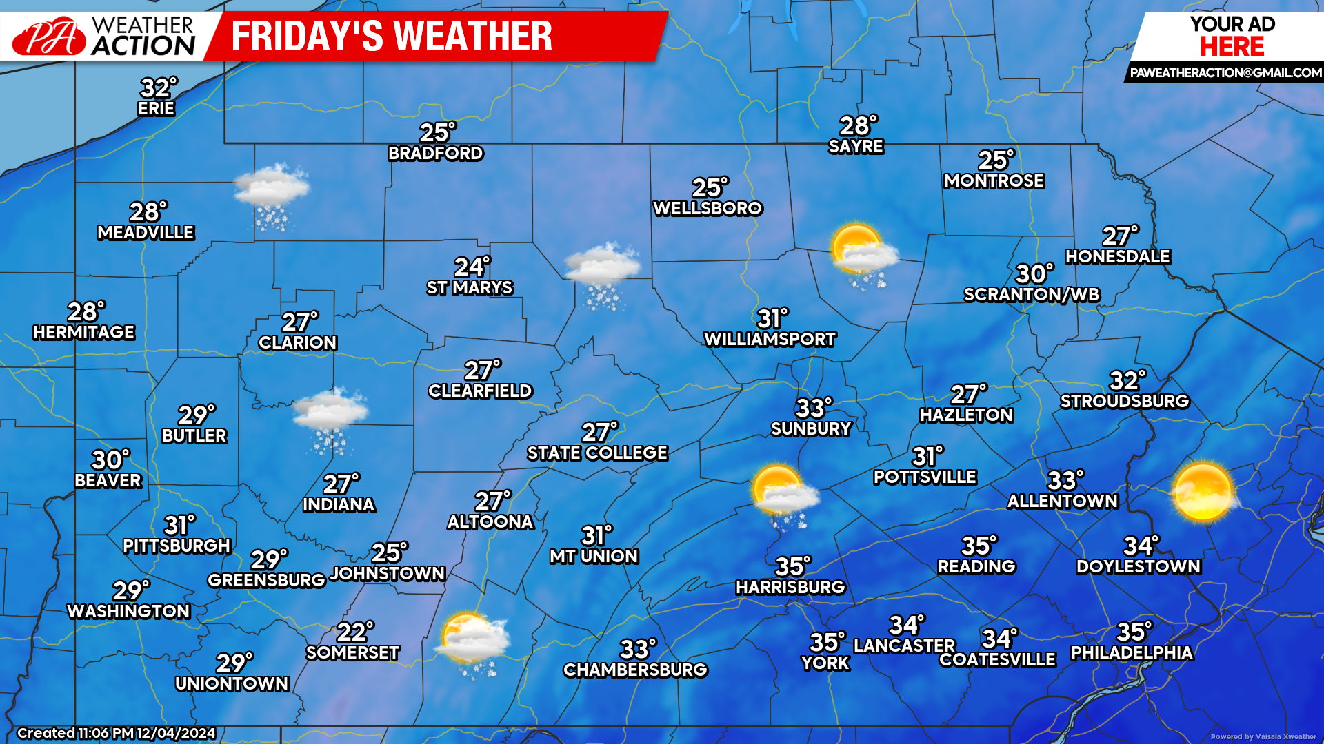
Friday’s Weather Forecast: 5/10
More lake effect snow will continue across northwest Pennsylvania. Elsewhere scattered flurries are possible with temperatures in the 20s and 30s across the state.
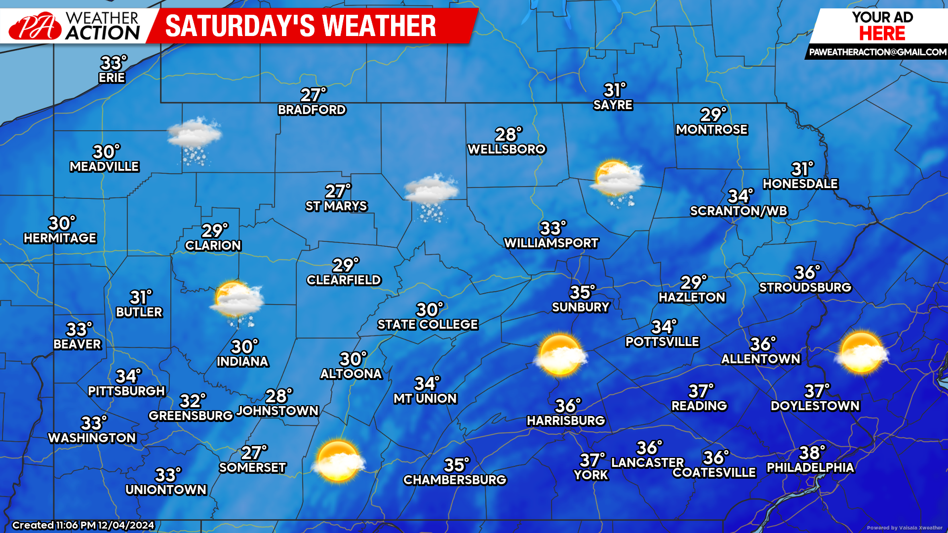
Saturday’s Weather Forecast: 6/10
The lake effect snow will continue to linger into the day Saturday. Elsewhere a mix of clouds and sunshine can be expected with temperatures in the 20s and 30s across the state.


You must be logged in to post a comment.