
This week’s showers delivered around a half inch of much-needed rainfall to our area so far. A cut-off upper-level low is currently located over the Tennessee/Arkansas/Missouri border. This will play a pivotal role in the fate of Helene.
Helene has undergone explosive intensification today. As of 5pm, Helene is located about 130 miles west of Tampa FL, and now has 125 winds! This makes her a high-end Cat 3 hurricane! Tropical storm force gusts are already occurring over much of the Florida Peninsula. The aforementioned upper-level low will draw Helene northward into the Big Bend area of the Florida Panhandle this evening as a major hurricane. This will be a huge news story as the shape of the coastline and the size / intensity of the storm will result in a catastrophic storm surge of 15-20 feet, along with devastating wind gusts. Tornadoes will be likely east of her track, including parts of the Florida Peninsula.
UPDATE: As of 6:20PM, Helene continues to intensify rapidly, and now has 130 mph winds, making her a Cat 4 storm! Further intensification is likely!

The upper-level low will rapidly pull Helene northward through Georgia overnight and then westward into Kentucky by Friday evening, where she will be absorbed and merge with the upper-level low. This rapid movement will result in powerful gusts well inland, with high tornado potential east of her path. Her large size also means it will take longer for her to spin down, so strong gusts will be experienced as far inland as Kentucky and Ohio / Indiana / Illinois, etc. This will result in widespread power outages and flooding from the Southeast into the Mississippi / Ohio River area.
After she merges with the upper-level, a large spiraling area of rain and gusty wind will be nearly-stationary over Kentucky / Tennessee / Indiana / Ohio through this weekend. An upper-level trough over eastern Canada will draw some of her upper-level moisture eastward over Virginia and southern Pennsylvania which will result in the chance for showers, possibly as far north as our area this weekend.
Anticipated rainfall from Thursday afternoon through Sunday evening:
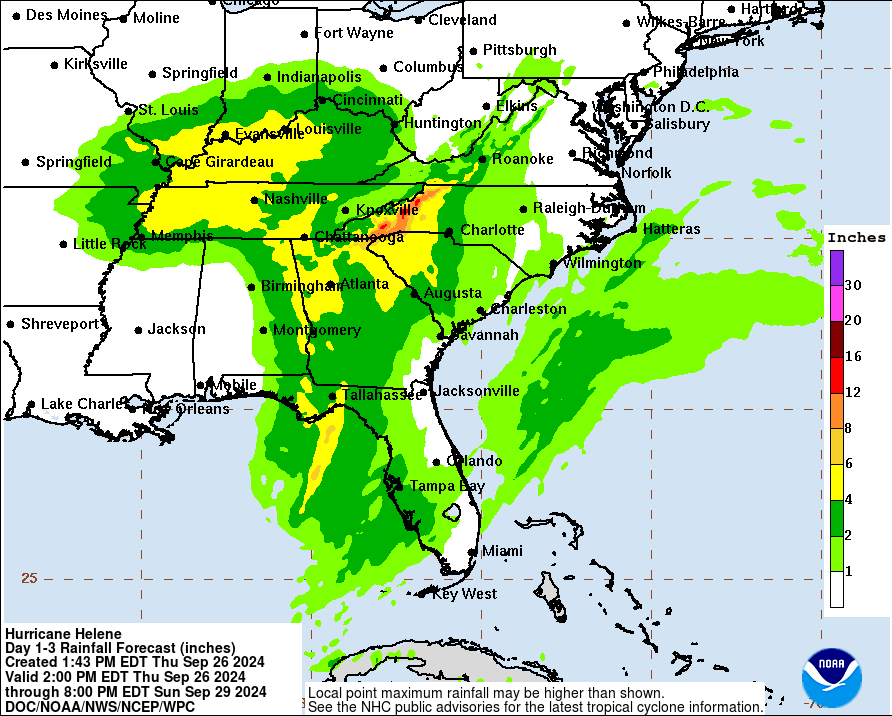
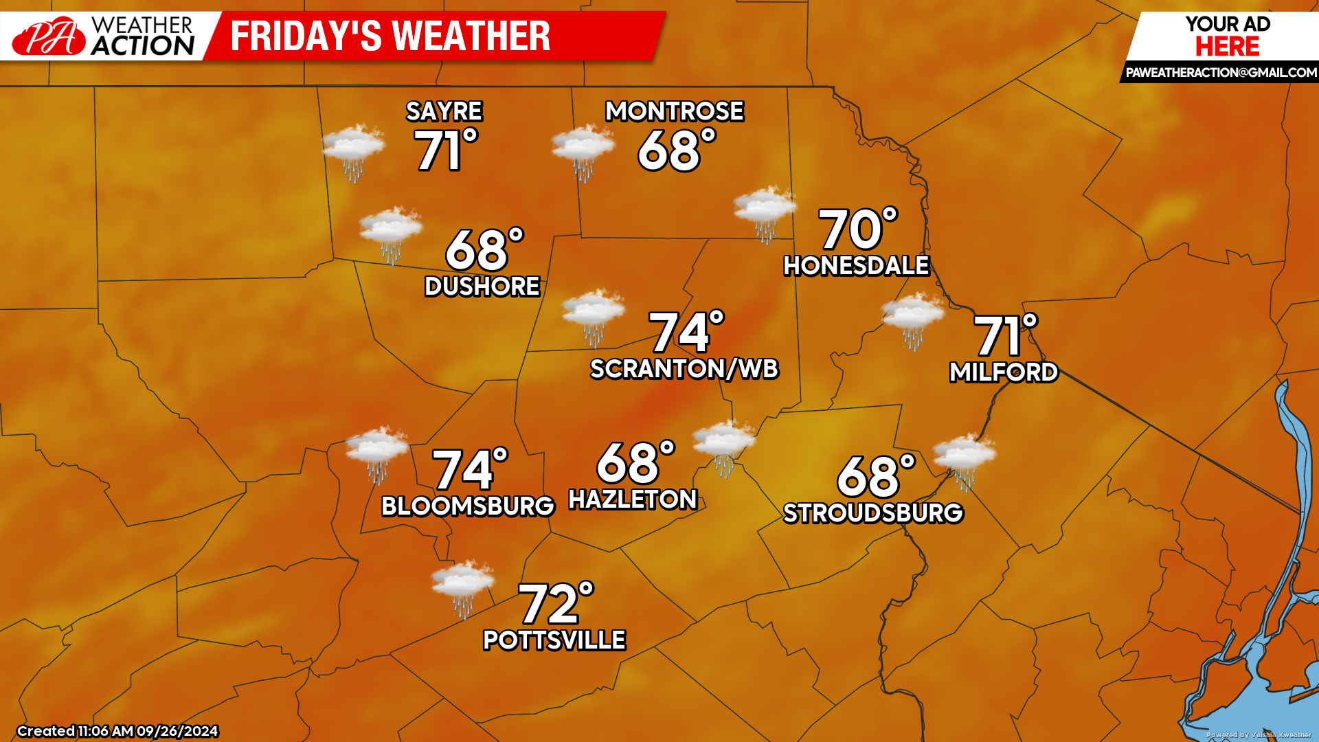
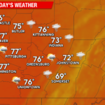
FRIDAY
As Helene spirals northward and then westward into Kentucky Friday, our area will experience cloudy conditions. A band of light rain will stretch across the southern part of Pennsylvania, with some light showers possibly working northward into our area during the afternoon.
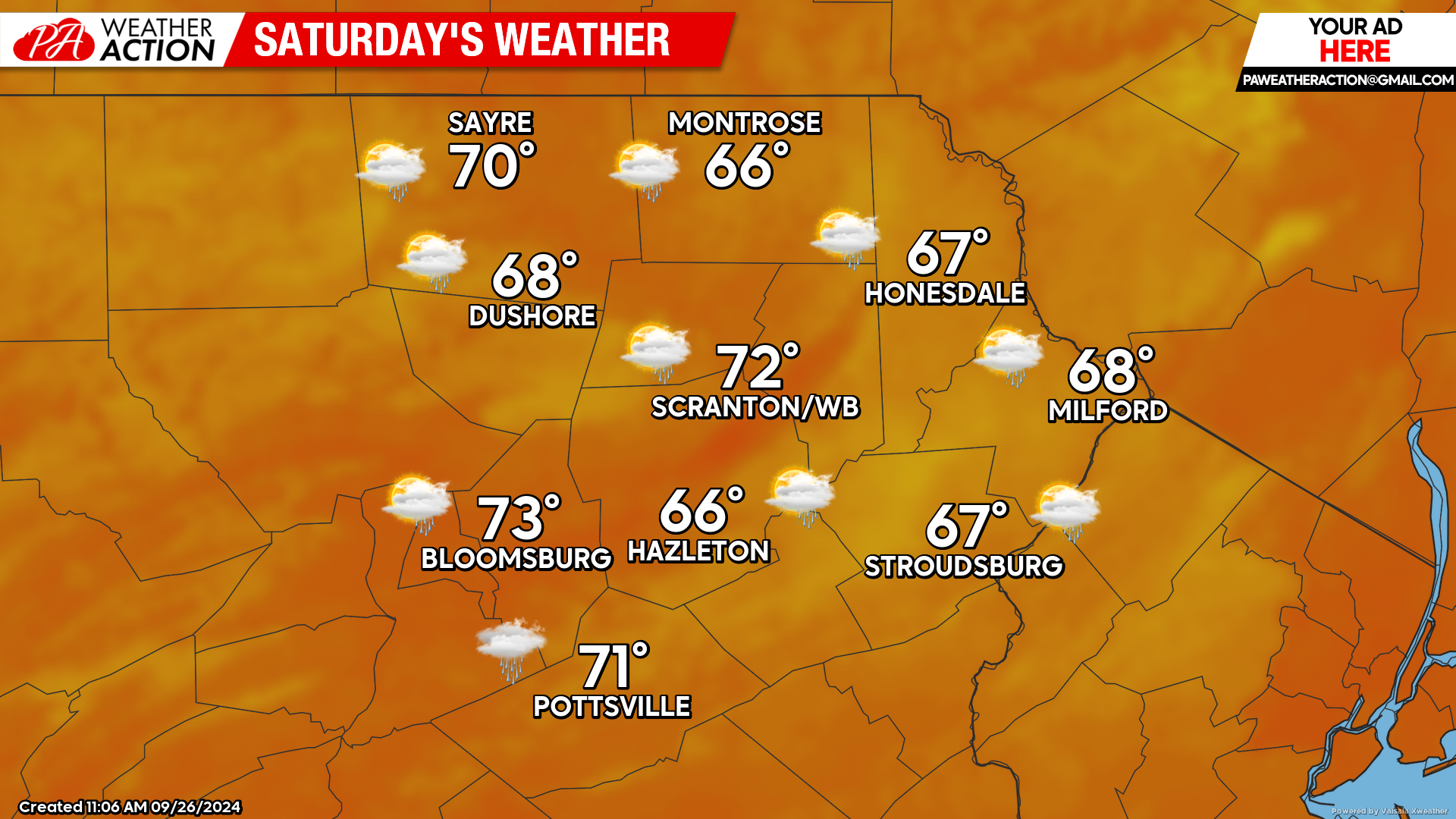
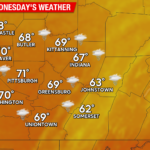
SATURDAY
Helene will be fully absorbed into the upper-level low by Saturday, resulting in a large area of rain spiraling over Ohio / Indiana /Illinois / Kentucky. Some moisture will be pulled eastward across Pennsylvania and could deliver some light showers to our area. It will also be a breezy day as a surface high to our north induces an east wind off the Atlantic gusty 10-20 mph.
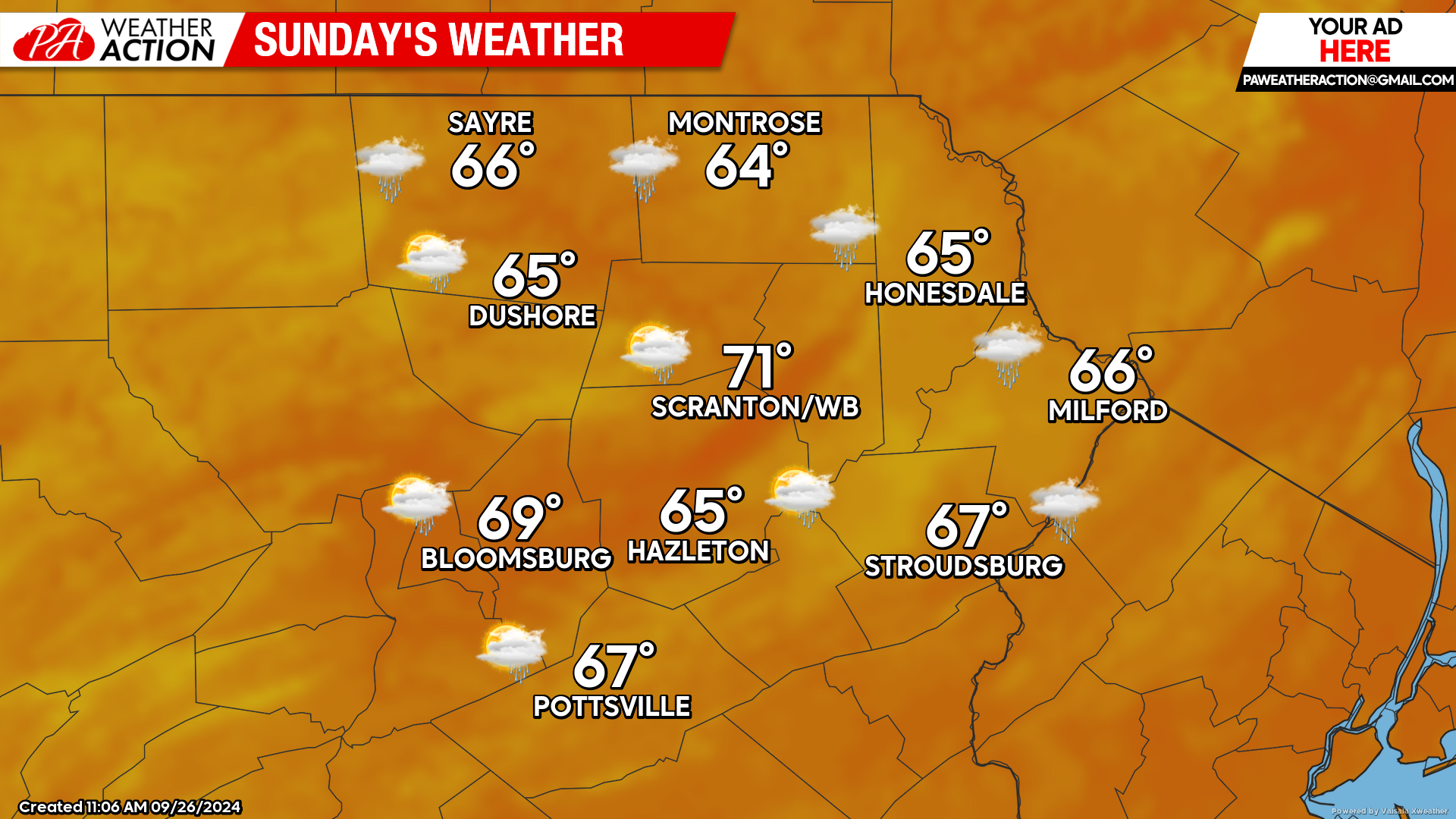
SUNDAY
The large cut-off low to our west will continue to remain nearly stationary, centered over Kentucky. We will continue to experience a breeze from the east, along with the chance for some light showers.
You must be logged in to post a comment.