Millions of people will be traveling early this week ahead of the holidays, and a quick round of winter weather may create travel hazards Tuesday morning. A weak clipper will push through with a 2-4 hour period of snow for most, and even ice in parts of Southern PA.
While the snow and ice amounts will be insignificant, the concern is more with the timing of this event. Any amount of freezing rain can create slippery roadways, and even an inch of snow can be troublesome for some vehicles. Let’s dive into the timing, followed by amounts!
Winter Weather Timing
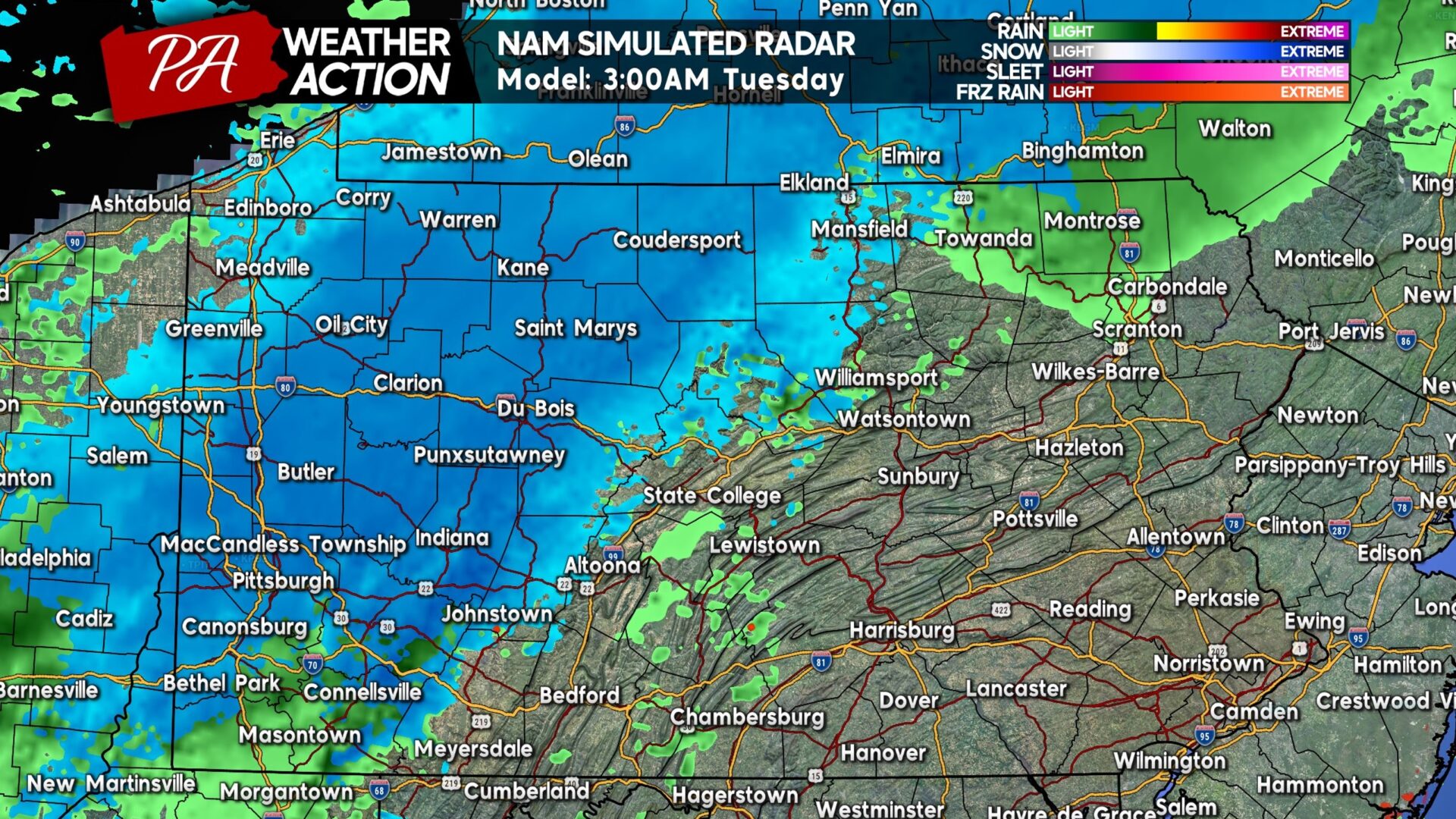
Snow will push into Western and Northern PA from the northwest very early Tuesday morning. The green you see below is precipitation not hitting the ground, rather than rain. While a brief period of rain is possible south of Pittsburgh, moderate snow will be falling everywhere else in Western PA.
Note that Western PA should see the snow before sunrise, meaning crews will have the chance to treat roadways before the morning rush. Below is Hi-Res NAM Future Radar for 3:00 AM Tuesday morning.
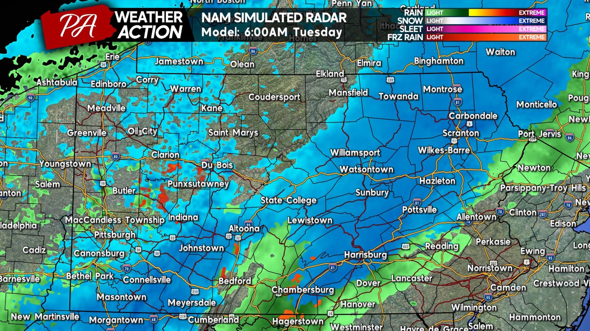
As we near sunrise, snow will move into the Route 15 and I-81 corridor, along with the Laurel Highlands. Snowfall rates will be a third to a half-inch per hour. Roads in Northeast PA may become coated in snow for the Tuesday morning rush, making for slick travel. Here is future radar for 6:00 AM Tuesday.
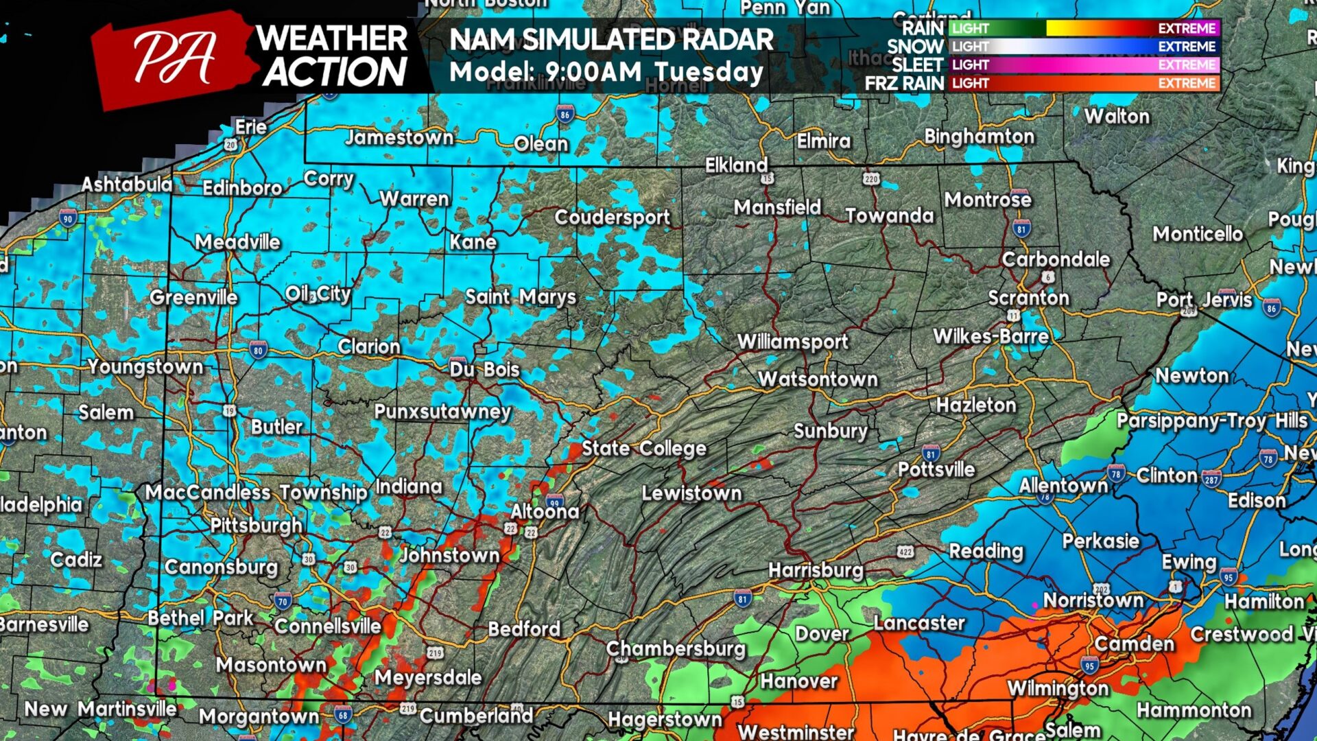
And by 9 AM Tuesday, light snow is expected in Southeast PA. Also seen below is an area of freezing rain in the southern tier counties in Southeast PA, which is concerning as this is a very populated areas. The NWS has already issued Winter Weather Advisories in that area for this timeframe due to the threat of icy conditions.
Below is Hi-Res NAM Future Radar for 9:00 AM Tuesday. This will be fast-moving, with most of the state clear by mid-Tuesday morning. There may be some patchy freezing drizzle on the Allegheny Front around this time, along with lake effect flurries to the west.
White Christmas Forecast
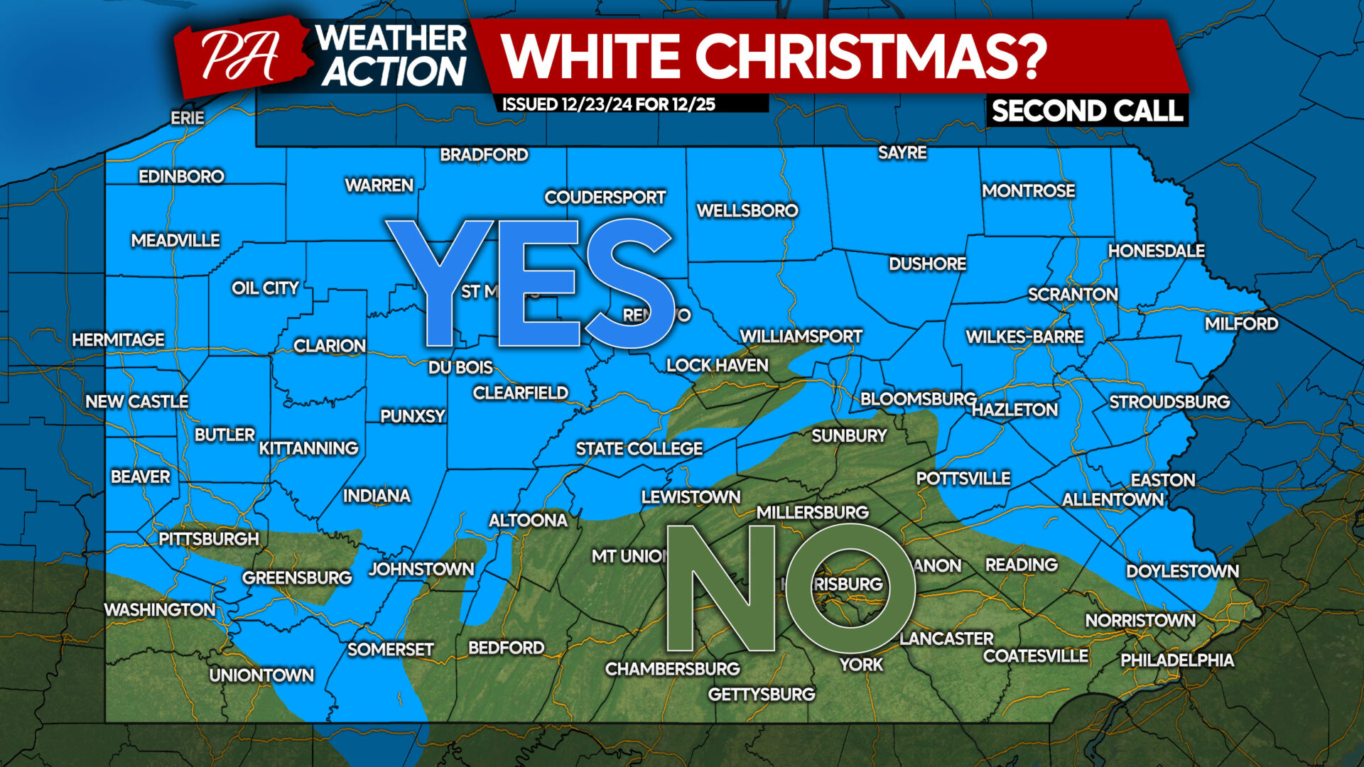
A White Christmas is defined by having an inch of snow on the ground at 7:00 AM Christmas morning, and this map below is our prediction for which areas will see a White Christmas! A lot will depend on how much snow melts Christmas Eve in these fringe areas like Pittsburgh, the Susquehanna & Lehigh Valley.
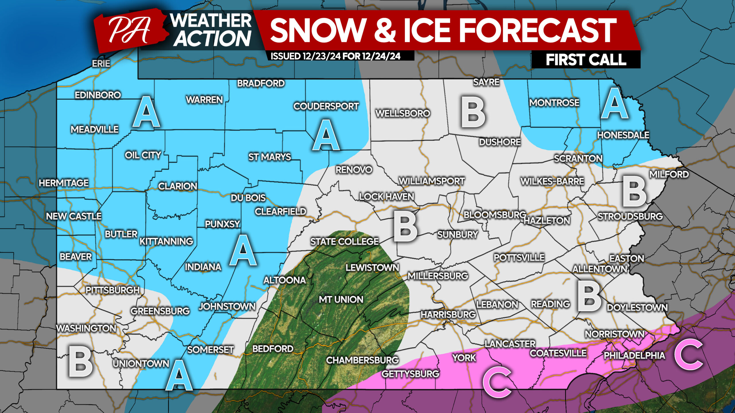
FIRST CALL SNOW & ICE FORECAST FOR CHRISTMAS EVE MORNING
Area A: Snowfall accumulation of 1 – 3″ expected. Roadways will be covered in the pre-dawn hours of Tuesday, making for some slippery travel Tuesday morning.
Area B: Snowfall accumulation of less than 1″ anticipated. Roadways will be coated in snow as the snow moves through, temporarily making for slippery travel.
Area C: A thin glaze of ice is possible due to freezing rain, making for hazardous walking and driving conditions.
While this will be quick with minor accumulations, the timing is not great! We advise waiting until late Tuesday morning and beyond to travel if possible, especially if your vehicle is 2WD.
Don’t forget to share this forecast with friends and family, Merry Christmas & Happy Holidays!


You must be logged in to post a comment.