
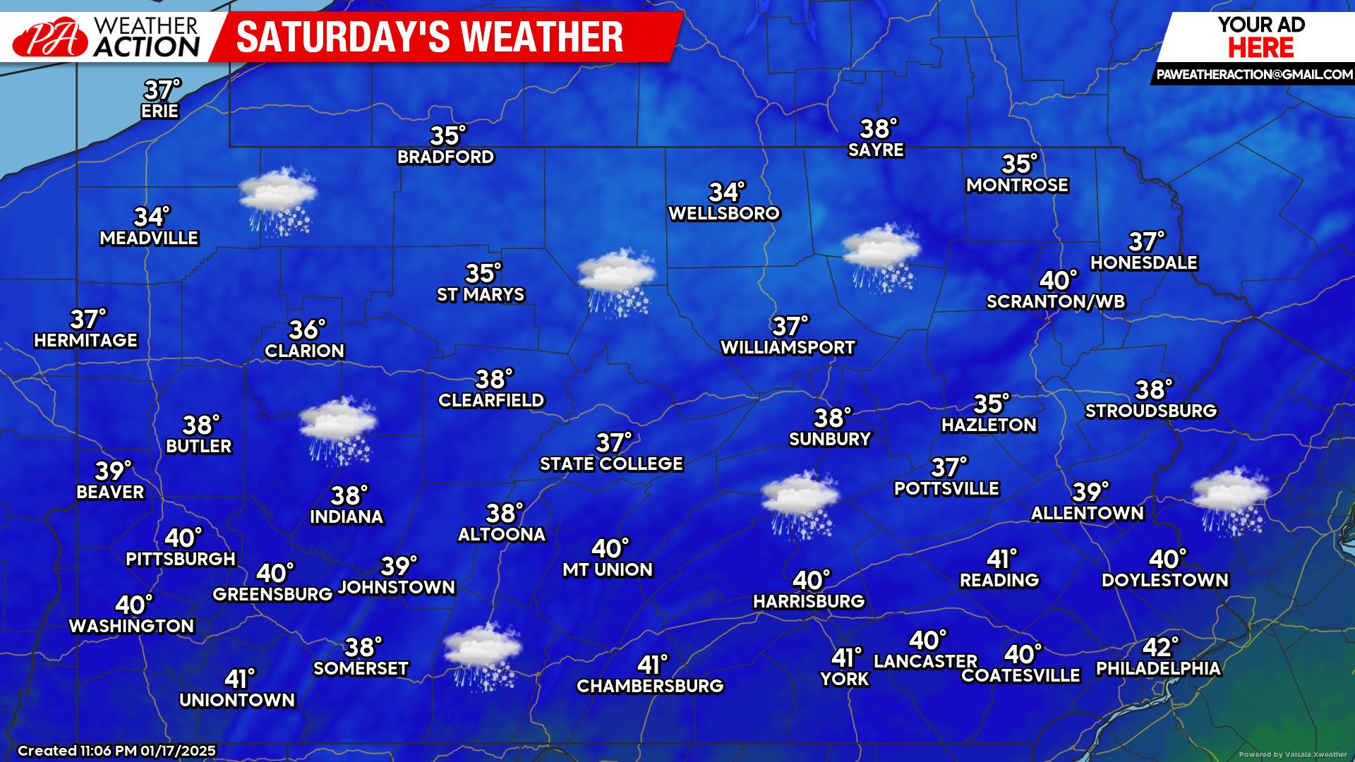
Mother Nature is making her presence felt this weekend! Today, rain and snow showers are in the forecast! Below is a look at the latest radar:
Today’s Weather Forecast: 3/10
Today, rain and snow showers can be expected. Any snow accumulations will be limited to western Pennsylvania in the higher elevations, however the accumulations will be minor. High temperatures will range in the 30s to near 40 degrees.
Sunday’s Weather Forecast: 1/10
Widespread heavy snow, especially over eastern Pennsylvania is expected Sunday. Significant accumulations are likely with temperatures in the 20s and low 30s.

Hi-Res NAM Future Radar Valid for 1:00 PM Sunday:
Below is the Hi-Res NAM model illustrating the potential for widespread moderate to heavy snow during the day Sunday across parts of central and much of eastern Pennsylvania.
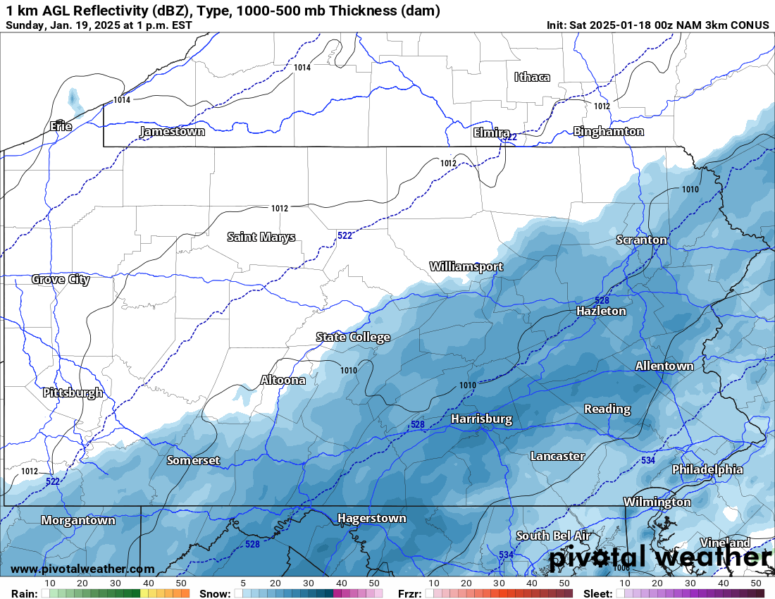
If you do have travel plans Sunday, please plan accordingly. Many areas will see a significant amount of snow Sunday, expect delays and treacherous travel. See the bottom of this article for our latest forecast.
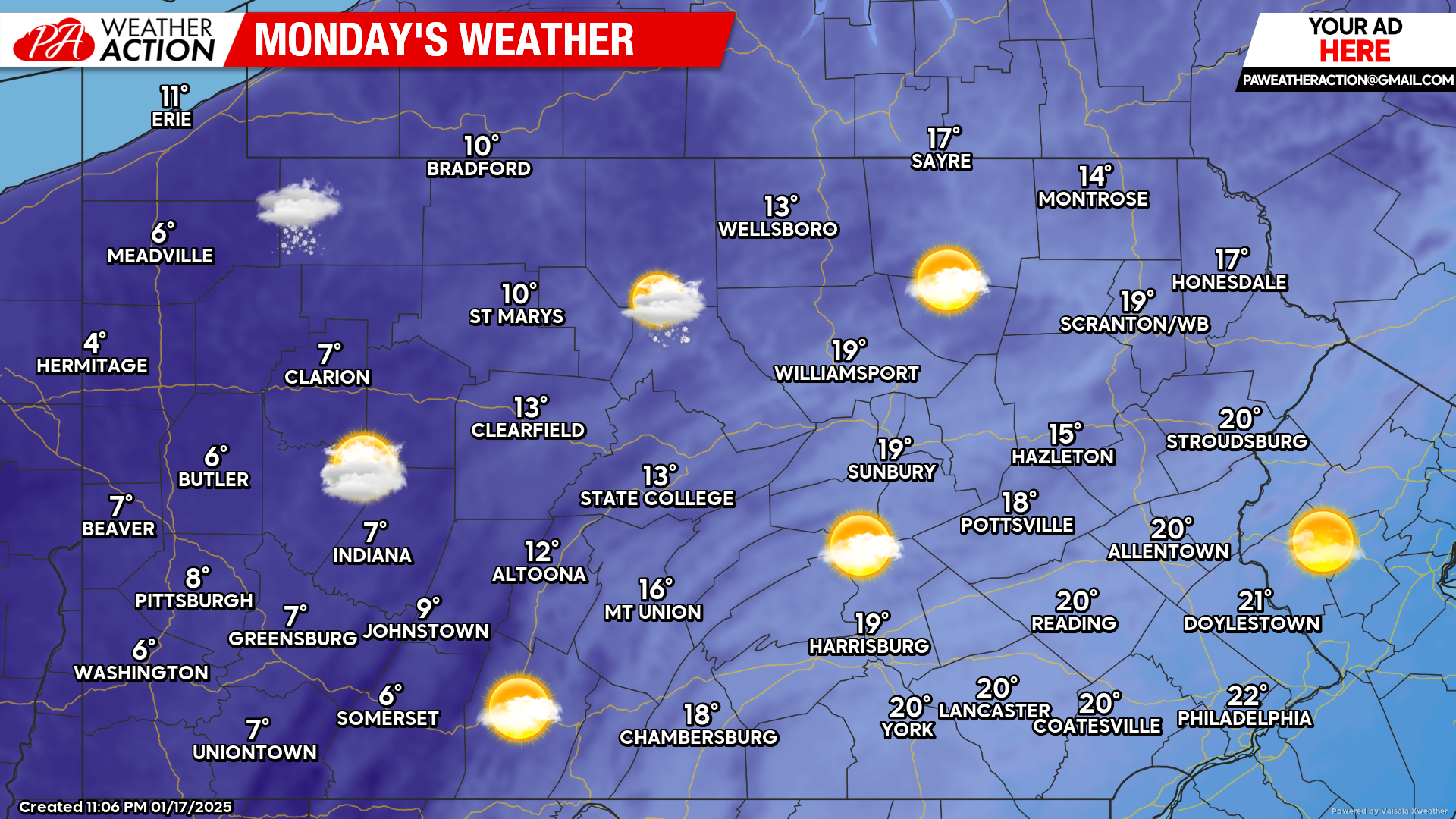
Monday’s Weather Forecast: 3/10
While many areas will be cleaning up from Sunday’s snowstorm, temperatures will be frigid Monday. High temperatures will generally range from the single digits to the teens with wind chills below zero at times!
Our second call snowfall forecast will be posted later today. If you missed our first call snowfall forecast for Sunday’s snowstorm, please click here:
First Call Snowfall Forecast for Sunday’s Significant Snowstorm in Pennsylvania


You must be logged in to post a comment.