

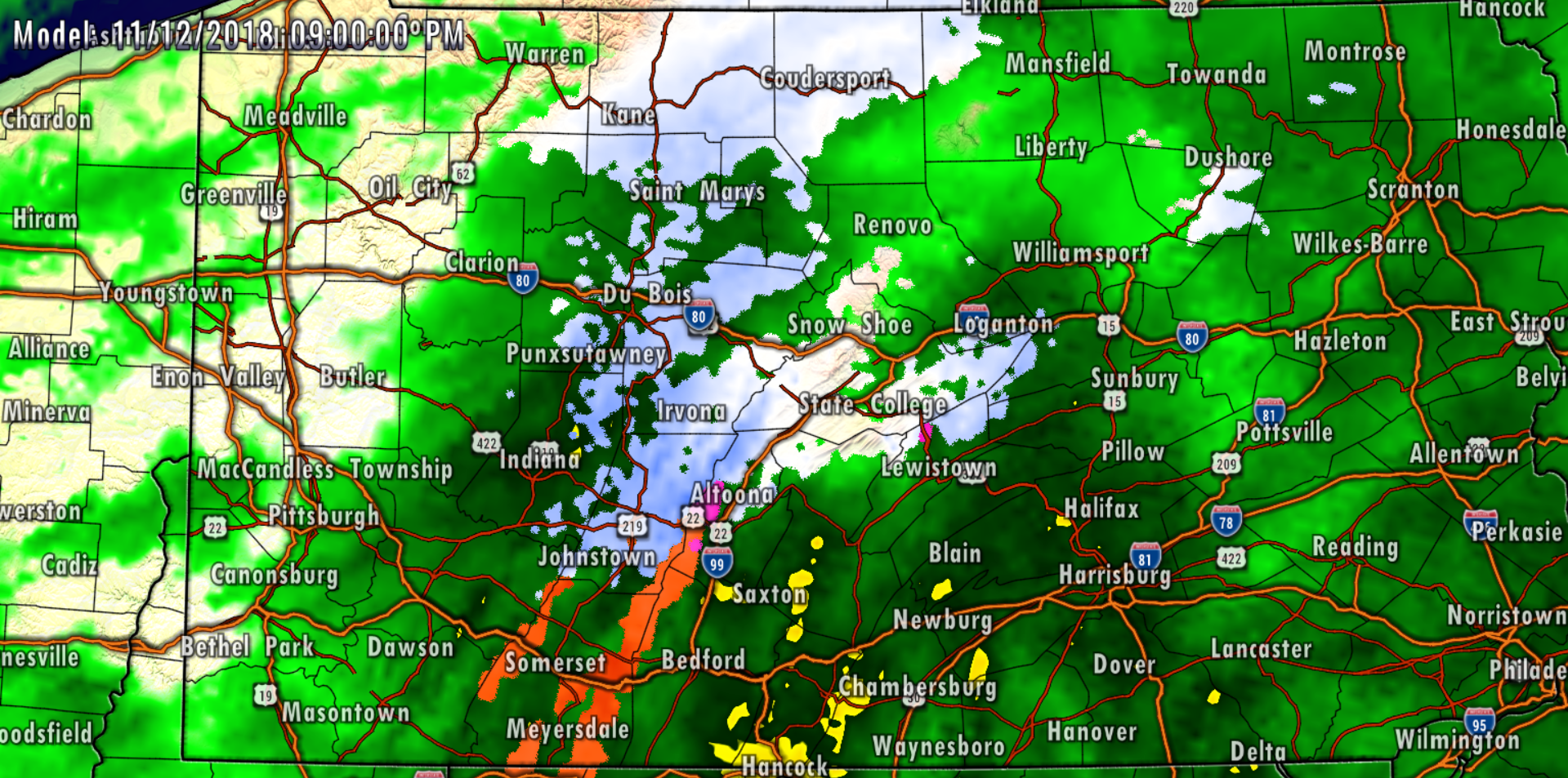
We are tracking a low pressure system that will impact our weather overnight tonight into Tuesday morning with a period of rain and for some areas, snow. A low pressure system that has developed over the south today will push northeastward in our direction tonight. Precipitation will develop from south to north after 7:00 PM this evening. We expect areas south of Interstate 80 to receive all rain from this system with the only exception being the Laurel Highlands. Below is a look at 9:00 PM this evening:
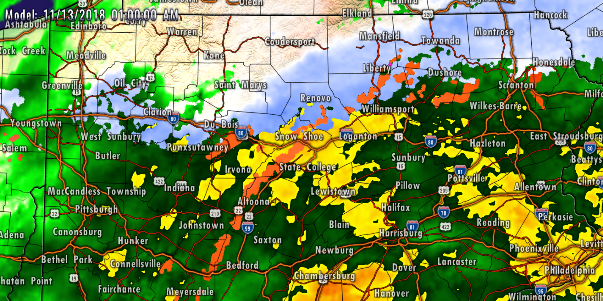
 As we continue to look at the latest observations and short range model data, we anticipate a several hour period of wet snow for areas north of Interstate 80 late tonight into the early parts of Tuesday morning. Because of the timing, we expect accumulations on grassy and roadway surfaces. Below is a look at 1:00 AM Tuesday morning:
 For most locations, whatever snow does fall, will change to rain by 4:00 AM Tuesday morning. Potter and McKean counties will likely jackpot from this storm in the snowfall category as these counties will likely stay all snow throughout the duration of the event.
 It is expected that most of the precipitation will be done and over with by 9:00 AM Tuesday morning. However, as the storm begins to pull away, a northwest breeze will develop off Lake Erie Tuesday into Wednesday morning which will lead to Lake Effect snow bands.
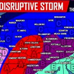
TUESDAY’S STORM SUMMARY
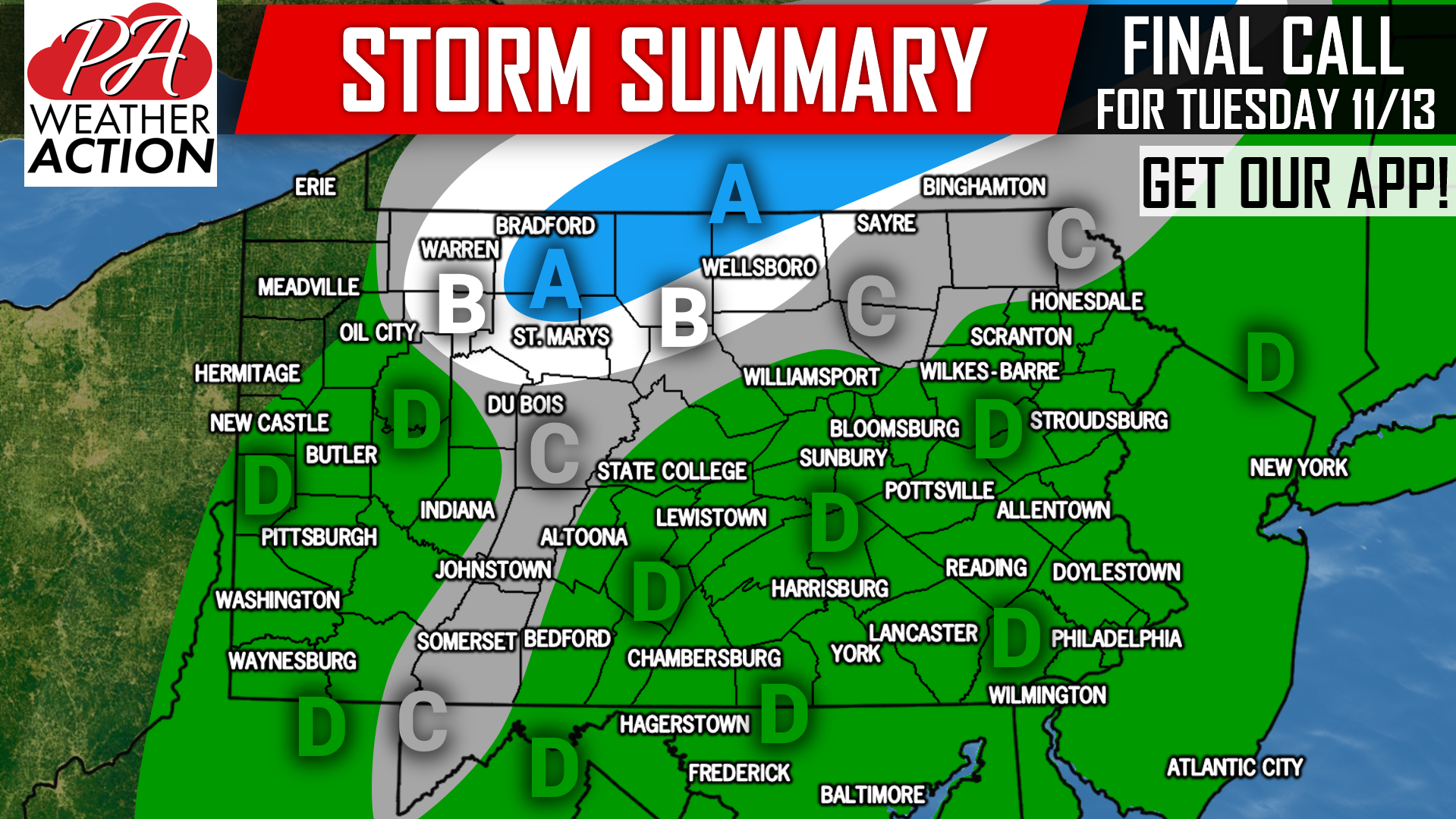
Area A: Snowfall accumulation of 2-4″. This area should stay mainly snow but may mix with rain between 4-6 AM Tuesday before changing back to rain.
Area B: Snowfall accumulation of 1-2″. Southern sections of this area will change to plain rain by 2-3 AM.
Area C: A brief period of snow, sleet, or freezing rain is possible late Monday Night. Plain rain is likely afterwards.
Area D: Plain rain is likely with this event, but a drastically different story is possible Thursday, especially near i-81.
As mentioned, we are watching a potentially disruptive winter storm for Thursday into Friday. Snow, sleet, freezing rain, and rain are all on the table in many areas that have not seen much of any wintry precip. yet this year. Stay tuned for an article on Thursday’s storm later this evening.
Download our app to receive the latest winter weather updates, along with your local hourly and daily forecast, radar, and more >>> PA Weather App Link
You must be logged in to post a comment.