
Now that the first round has moved on, our full attention turns to round two. Round two will pack a much larger punch. A strong low pressure will develop over the Mid-Atlantic region this evening and will take a track directly over eastern Pennsylvania. Currently guidance suggests that this low pressure will drop to below 975 millibars, which is an impressive reading. We still anticipate that the bulk of the snow will fall over western and central Pennsylvania, but latest guidance suggests parts of eastern Pennsylvania, especially northeast PA, could see a changeover to snow before the precipitation wraps up.
Most locations will start off as a period of rain tomorrow morning. The rain will then begin to changeover to snow in southwest Pennsylvania after 4:00 AM tomorrow morning. Below is a look at 5:00 AM Friday Morning:
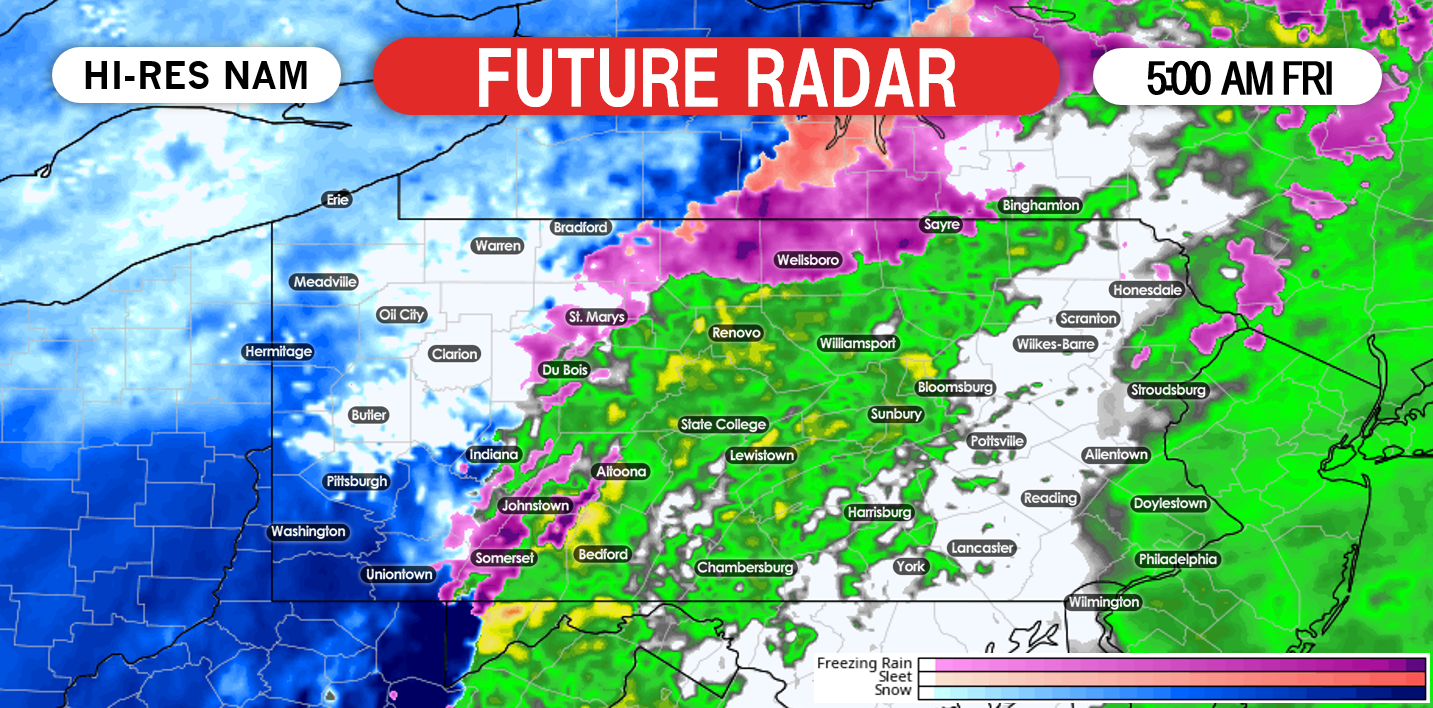
Friday morning’s commute to school and work will be significantly impacted across western and central Pennsylvania. Once the the rain transitions to a heavy, wet snow, snowfall rates will likely be 1″/+ per hour Friday morning. This means snow will accumulate at a rapid rate. Road crews will have a difficult time keeping up with the accumulations. As we take the future radar out to 8:00 AM, the precipitation has pushed northeast, allowing for many areas to changeover to snow:
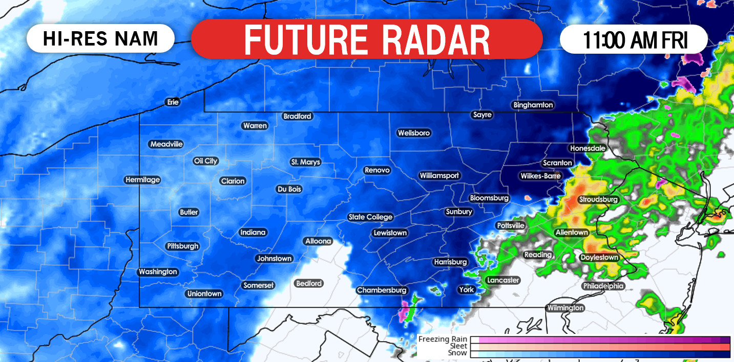
 The worst of the snow will fall between 7:00 AM and 11:00 AM tomorrow morning. Any travel plans you do have, we suggest to hold off until the later afternoon hours. The rain/snow line will be absolutely critical when it comes down to how much snowfall certain areas see. A track more west, will allow for less snowfall, while a track more east, will allow more areas to get into the accumulating snow. The Hi-Res NAM model does have the changeover to snow occur pretty far east tomorrow. Below is a look at 11:00 AM Friday morning:
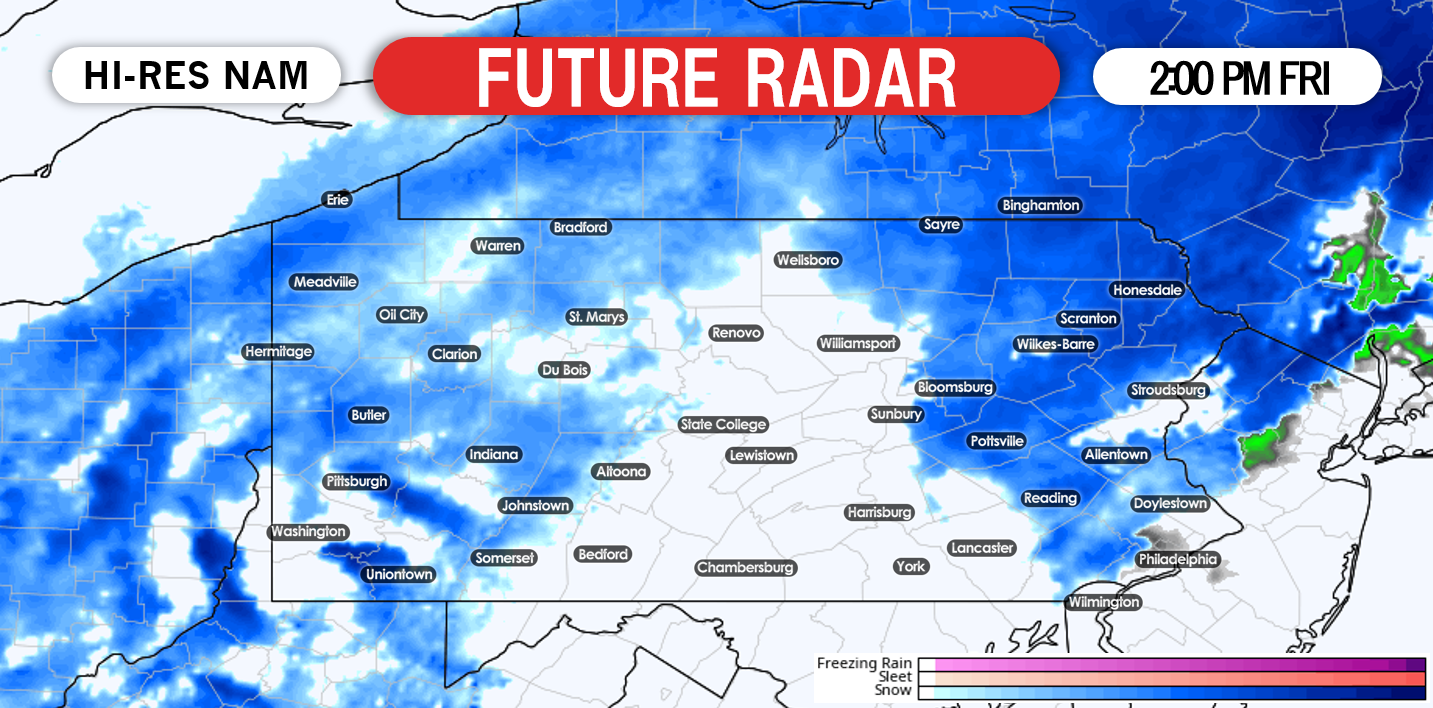
The Hi-Res NAM is definitely a bit colder than our thoughts, however it is certainly possible with a storm track farther east to allow more areas to changeover to accumulating snow. We expect any snow that does fall, will begin to taper off by lunchtime. Below is a look at 2:00 PM Friday afternoon:
 Again, the future radar does suggest some snow makes its way all the way to far eastern Pennsylvania, even near the Philadelphia area. This is possible, but not what we are forecasting.To summarize, when the rain changes to snow in western and central Pennsylvania, it will fall heavily. However, this is also a quick moving storm system. This will help keep snow totals from completely getting out of hand. Eastern Pennsylvania will see mainly rain, with the potential for a brief changeover to snow before the system wraps up.
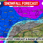
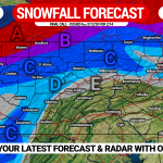
FINAL CALL SNOWFALL FORECAST FOR FRIDAY
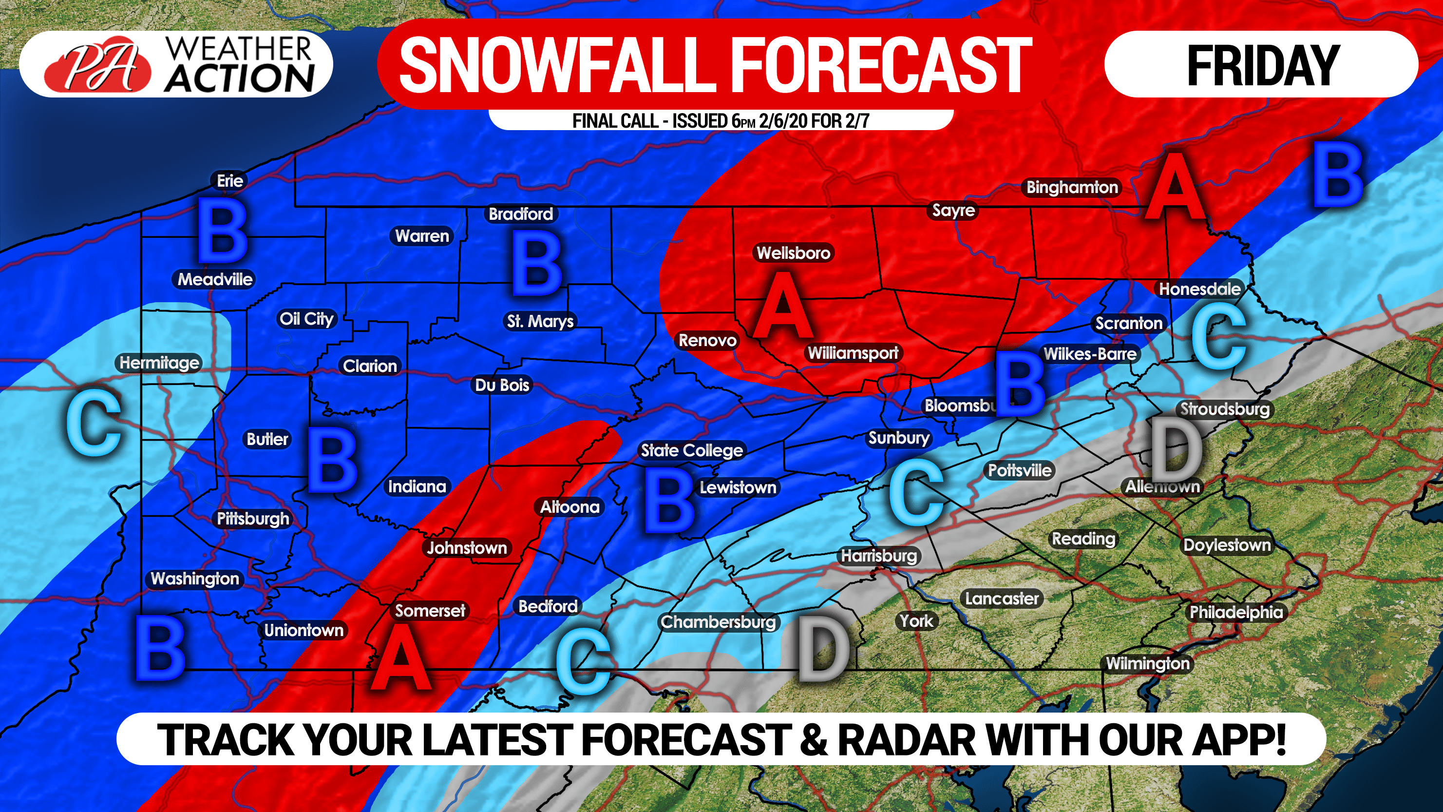 Area A: Snow accumulation of 4 – 7″ expected. School delays and closings likely as snow will be very heavy, quickly accumulating on roads.
Area B: Snow accumulation of 2 – 4″ anticipated. School delays possible especially in rural locations.
Area C: Snow accumulation of 1 – 2″ expected. An earlier changeover may result in more snow than this in the eastern Appalachians, while a later changeover would mean less.
Area D: Snow accumulation of less than 1″ anticipated. Once again, an earlier changeover may result in more snow than this in the eastern Appalachians, while a later changeover would mean less.
Be sure to share this forecast with friends or family in impacted areas!
A great way to track the changeover on radar and temperatures is with our free app. Get it by tapping on the banner below >>>
![]()
You must be logged in to post a comment.