
After snow this morning took many people by surprise (despite being well forecasted by PWA), we now turn our attention to a more complex storm for Sunday into Monday.
Models have had a very rough time with this one, originally projecting a very amplified storm with blizzard conditions in the Upper Midwest and a significant severe thunderstorm risk in the Tennessee Valley. Over the last few days, models have trended towards a weaker storm that moves up I-95 Sunday into Monday. However, since there’s a lack of a good high pressure to our north, many populated areas in the valleys across Pennsylvania will be wet, rather than white.
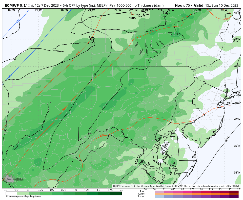
Let’s take a look at the latest European model’s progression of the storm in Pennsylvania. Of course, as we’re still four days out, there’s room for change and chances are, models may trend to an even weaker solution with a later changeover and very little snowfall. Nonetheless, here is the 12z Thursday ECMWF model:
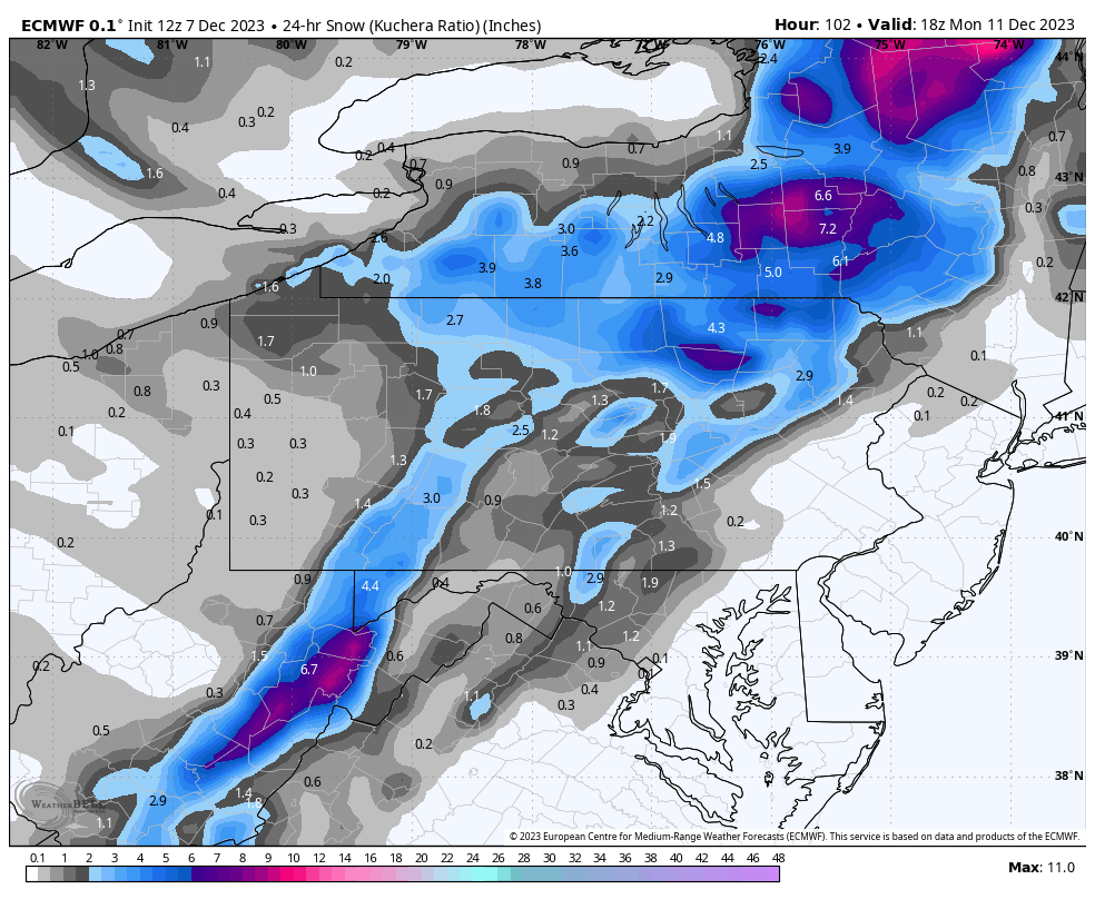
Here is the European model’s snowfall output. As expected, accumulations over 2″ are across elevations above 1000′. On mesoscale modeling, valleys will likely receive even less.
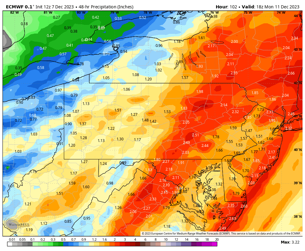
Finally, the wet side of the system, which will be the main story especially in Eastern PA. Rainfall amounts statewide between 1 – 2″ Sunday into Monday, with lower end amounts in Western PA, higher amounts Eastern PA.
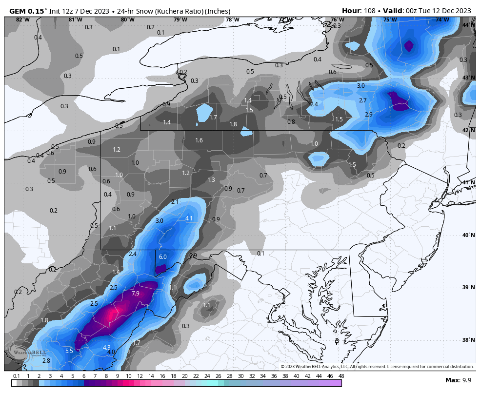
The Canadian model has improved steadily over the years and is now more accurate than the American model, the GFS. It’s unfortunately true, and the Canadian model is typically more aligned with the Euro model, which maintains its #1 ranking in terms of accuracy. Below is the Canadian model’s snowfall output. It’s relatively similar, but the Laurel Highlands and the highest elevations of Northeast PA do best, with a little less elsewhere.
CHANGEOVER TIMING
Rain is currently expected to change to snow after sunset Sunday, between 7-10 PM, in the Laurel Highlands and elevations in North Central PA above 1800′ elevation. By midnight to 1 AM Monday, all areas of the state above 1200′ elevation, except the Poconos, are expected to change to snow.
By 2-3 AM Monday, the Poconos (above 1200′ elevation) are expected to change to snow. However, precipitation will be quickly moving out from southwest to northeast, and will be wrapped up in Central and Western PA by 4 AM Monday besides light lake effect snow showers.
Temperatures at 7 AM Monday morning will be at or below freezing in all areas of the state above 1000′ elevation. Winds will be gusting to 25mph, so a flash freeze isn’t expected. However, roadways in areas of elevation that receive snow will likely be slippery for the Monday morning commute.
EARLY LOOK SNOWFALL FORECAST FOR SUN PM – MON AM
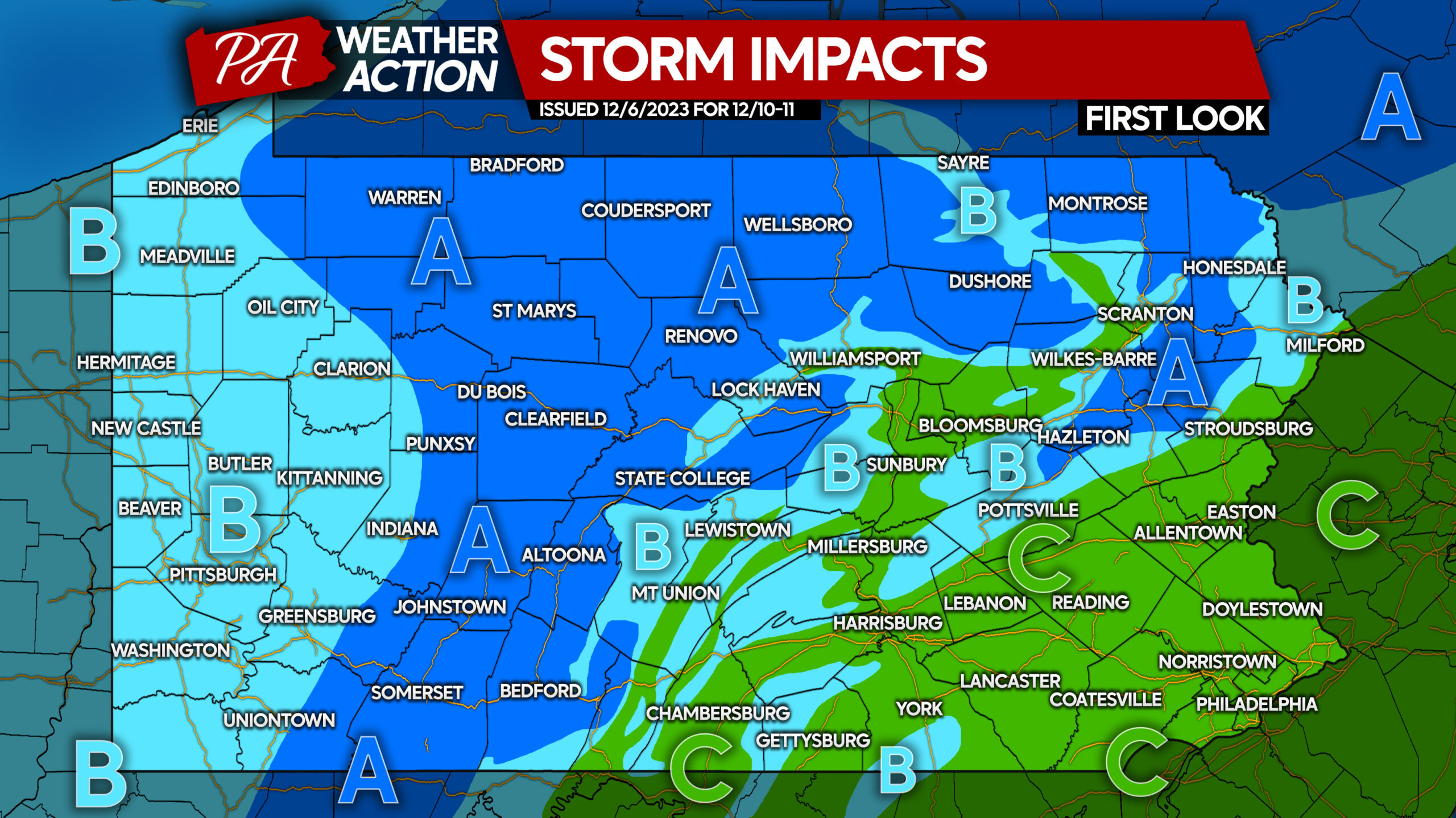
Area A: Snowfall accumulation above 1″ possible late Sunday evening, ending before sunrise Monday.
Area B: Snowfall accumulation under 1″ possible late Sunday evening, ending before sunrise Monday.
Area C: All rain is expected with this storm.

You must be logged in to post a comment.