
Warmer temperatures are back in the forecast to start the weekend. A rain filled end brings a chance for snow late and into early next week.
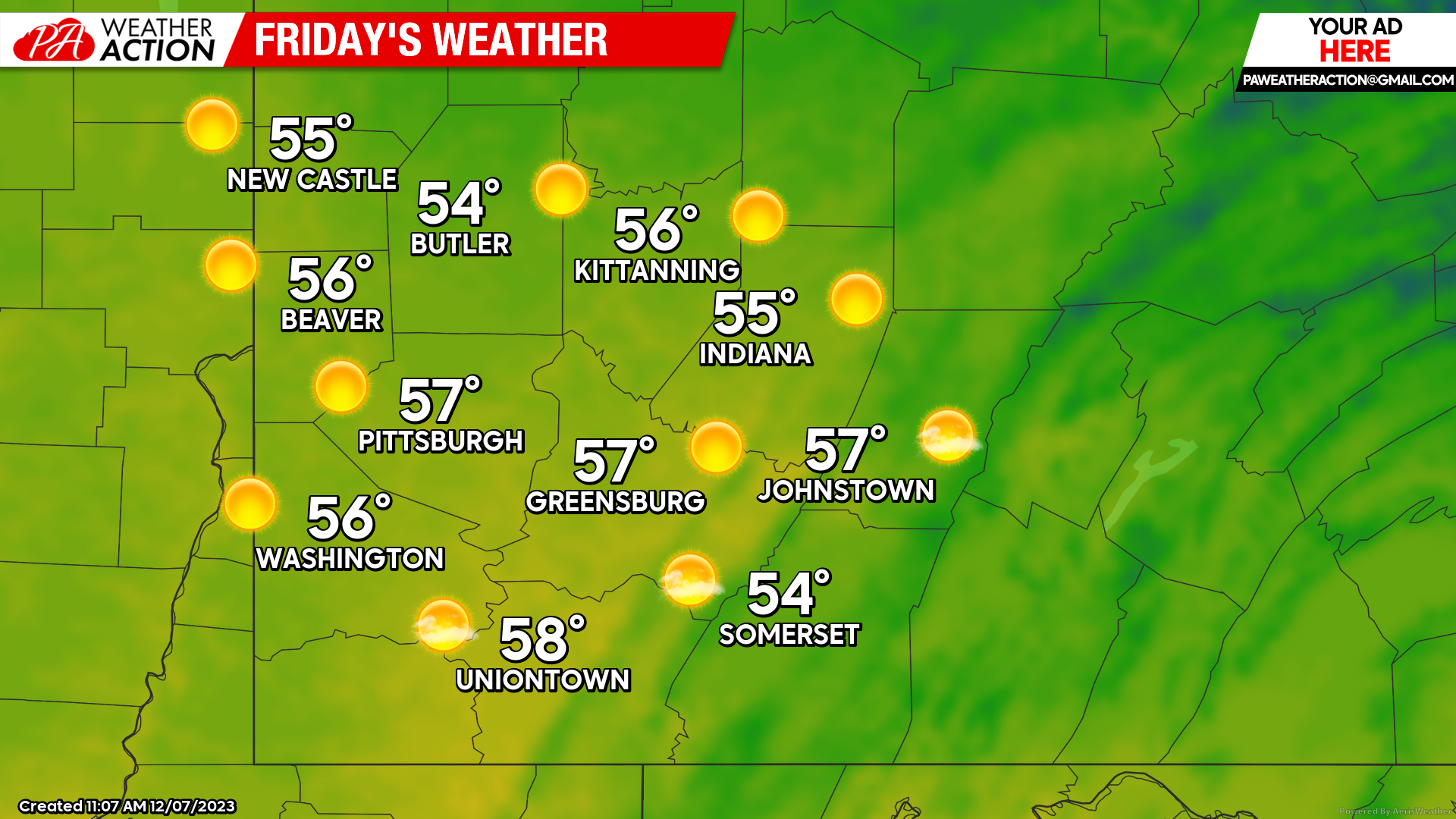
Friday
A pleasant, mostly sunny and un-seasonably warm day. Highs being in the high to mid 50s. Winds will be out of the South-Southwest at 6-14 mph. Wind gusts could be as high as 23 mph in the higher elevations. Lows will be in the low 40s to mid 30s.
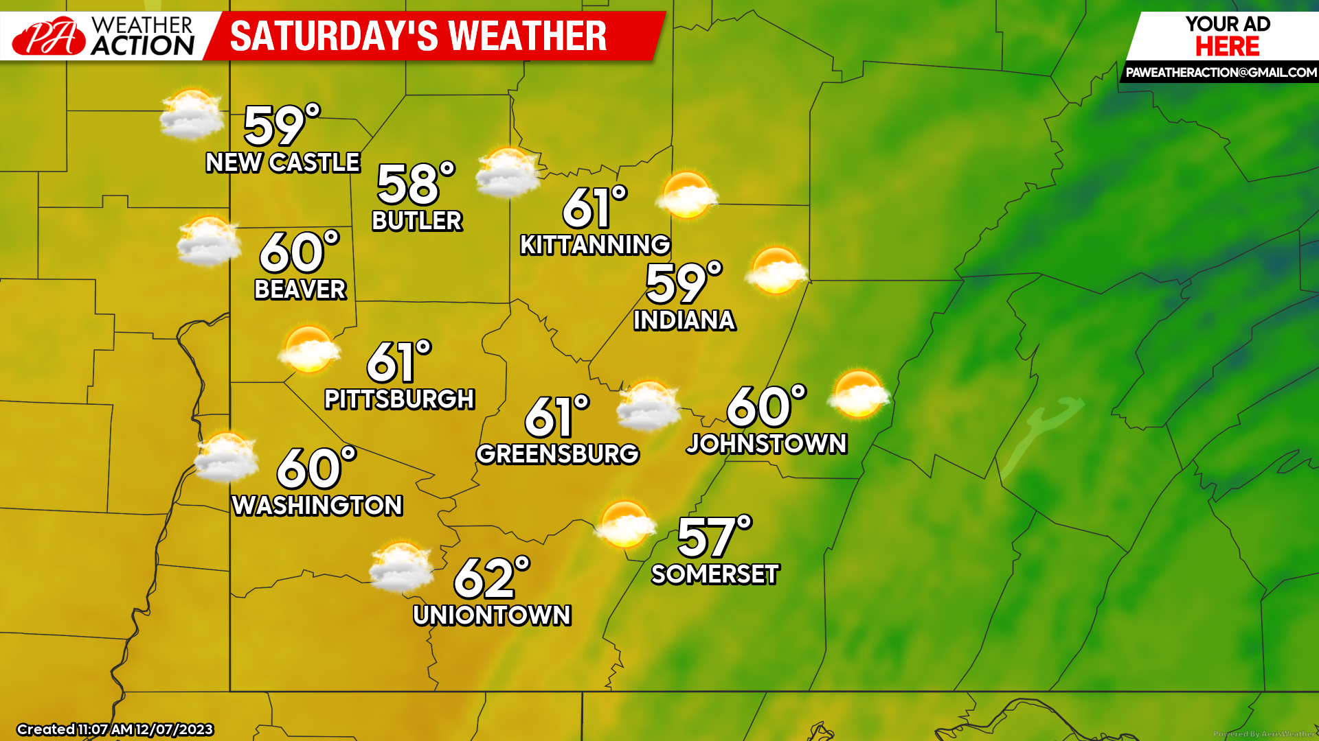
Saturday
Partly Sunny for the majority of the day, ending with a chance for rain in the overnight hours. Highs will be in high to mid 50s, some places could see temperatures as high as 60 degrees. Winds will out of the south at 9 to 16 mph, gustier conditions could be experienced in the higher elevations. Lows will be in the mid to low 40s.
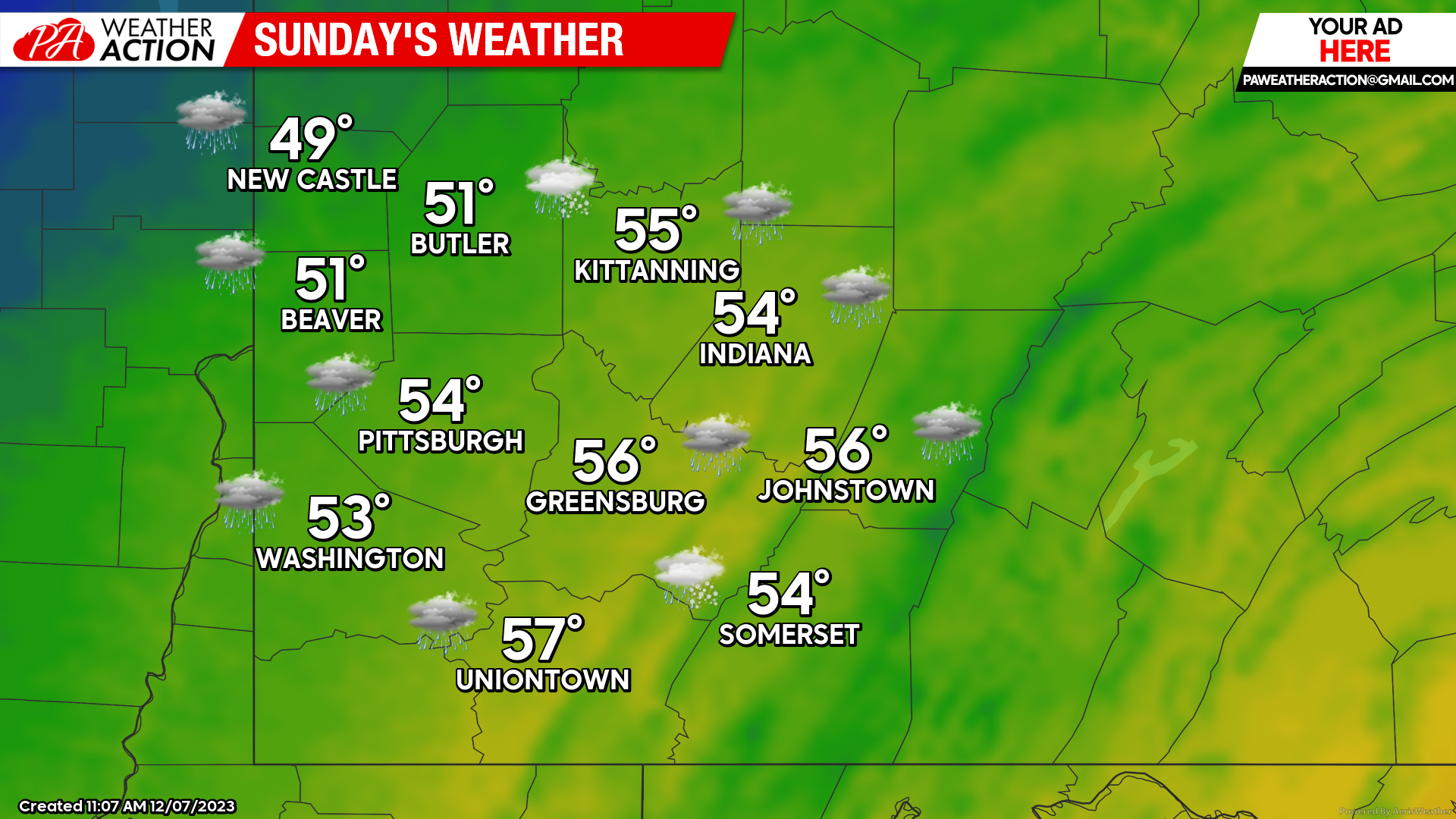
Sunday
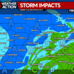
Widespread rain showers throughout the region, eventually transitioning to snow showers in the evening and overnight hours. Highs will be in the Mid to low 40s. Winds will fluctuate throughout the day ranging between 5 to 12 mph. Wind gusts may approach 25 mph throughout the region. Lows will be low 30s to mid 20s. Rain will begin to transition to snow just after sunset and continue into Monday.
Models continue to be sporadic on the overall possible snowfall total amounts. Some places could see little to no accumulation and areas in the higher elevations could see snow accumulations up to 3 inches.
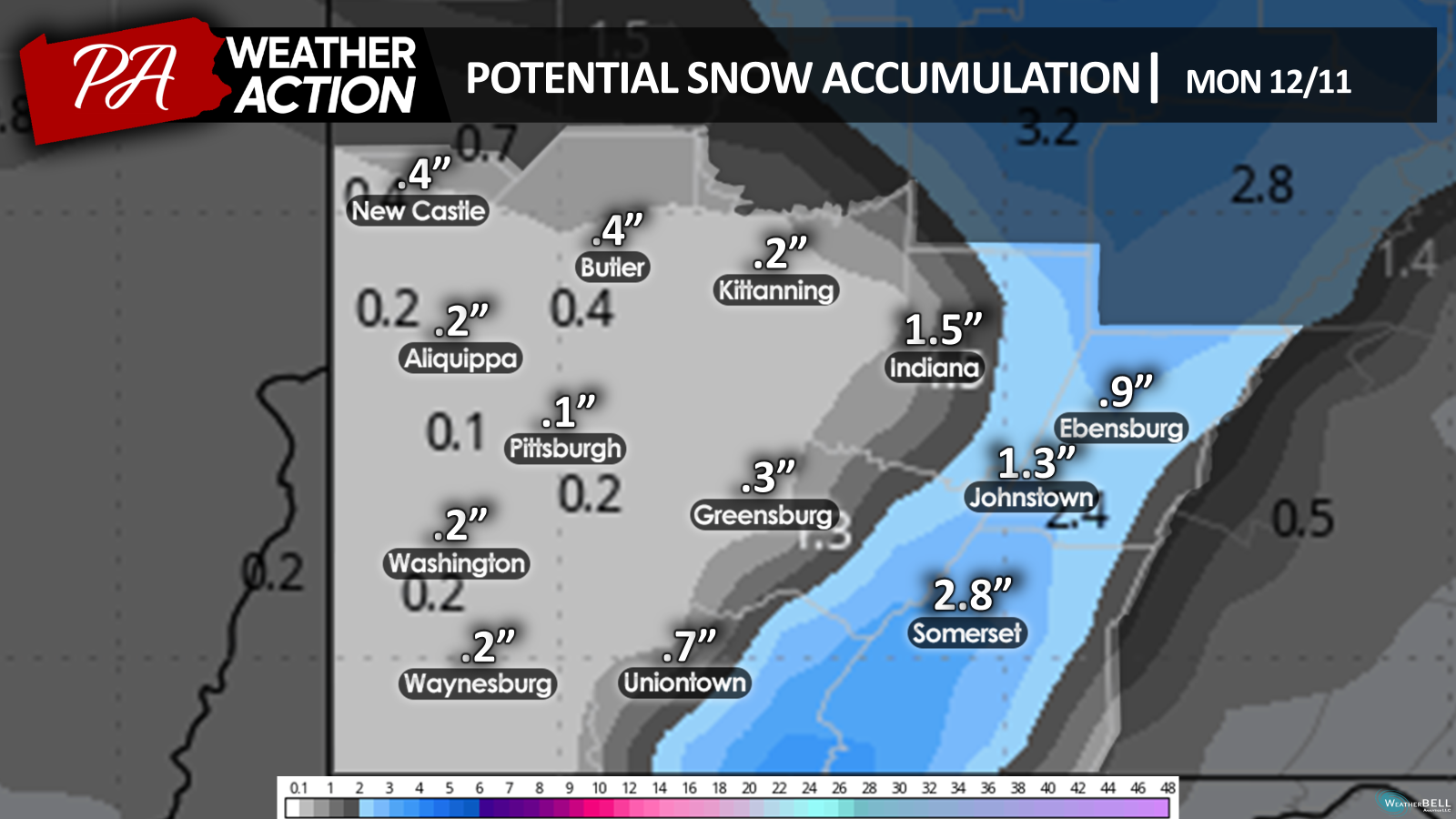
Be sure to stay connected to PA Weather Action to track changing weather conditions early next week.

You must be logged in to post a comment.