
Periods of off-and-on heavy rain are likely Thursday across eastern and central Pennsylvania. Highest rainfall totals are expected to be in southeast PA. Below is timing followed by our rainfall forecast map.
RAIN TIMING
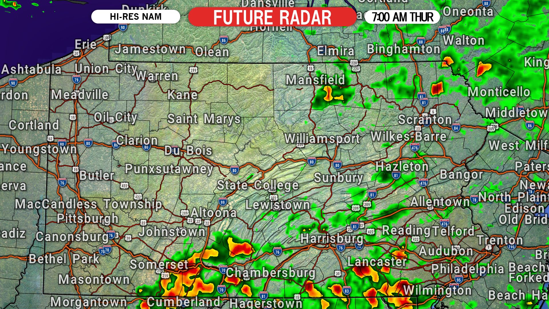
Patches of moderate to heavy rain will move into southeast PA early Thursday morning from the south. By sunrise Thursday, patches of heavy rain are expected to be scattered throughout much of the eastern half of the state. Below is future radar for 7:00 AM Thursday.
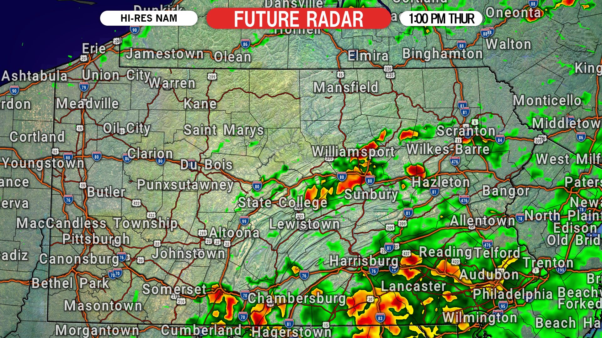
Widespread rain will fill in across southeast PA by lunchtime Thursday. Here is future radar for 1:00 PM Thursday.
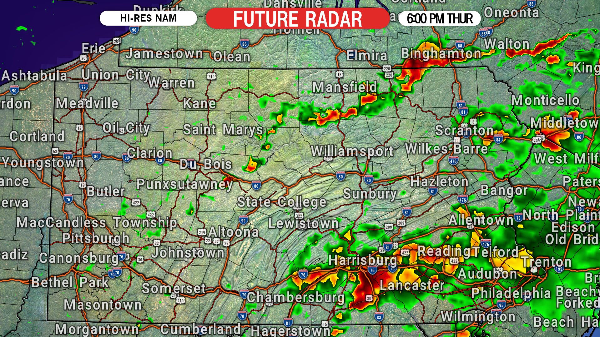
Batches of heavy rain will continue to roam eastern PA Thursday afternoon and into the dinner hour, before likely winding down late Thursday evening. Below is future radar for 6:00 PM Thursday.
THURSDAY RAINFALL FORECAST MAP
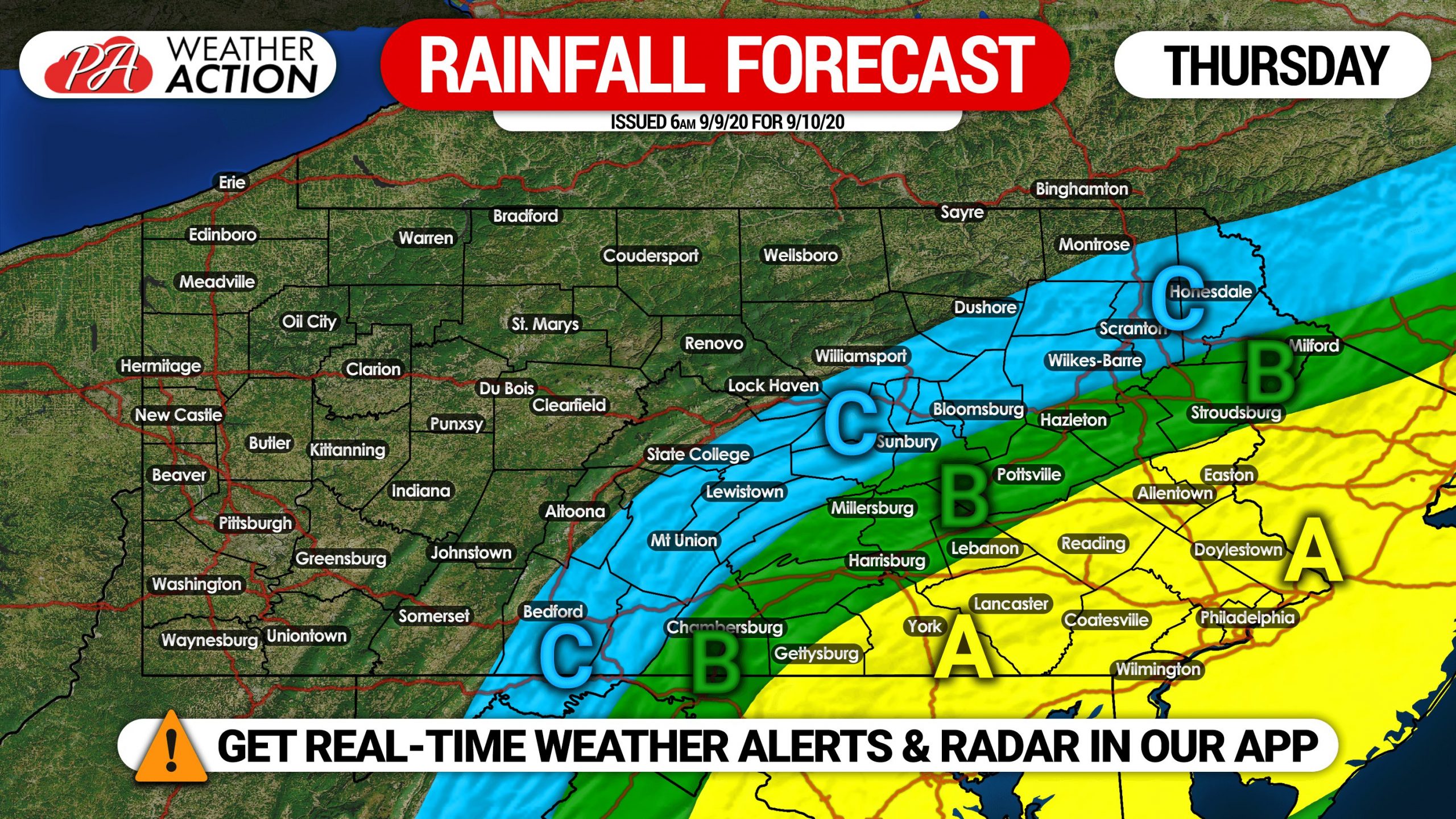
Area A: Rainfall amounts of 1.00 – 1.50″ expected, with large variations possible.
Area B: Rainfall amounts of .50 – 1.00″ anticipated, with large variations possible.
Area C: Rainfall amounts of .25 – .50″ expected, with large variations possible.
Don’t forget you can track the forecast with our app, we are constantly improving it! Download it here on iOS & Android >>> Weather Action App
Stay safe!

You must be logged in to post a comment.