
We have adjusted our rainfall forecast map based on the prevalent western trend with today’s coastal low pressure. Higher amounts of 4-6″ of rain are now likely back into Central PA, and remain likely in Eastern PA. Keep in mind not all of this will fall today, but a solid 2-3″ and locally 4″ will.
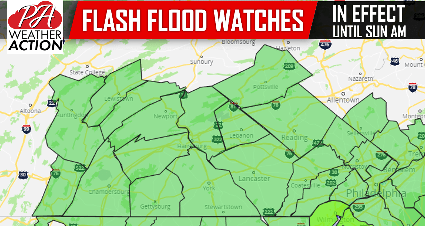
Flash Flood Watches have been posted for the Delaware Valley and the Lower Susquehanna Valley, in effect until late tonight:
Sunday Morning will be mainly dry before showers start to work their way into Southern PA. Monday to Thursday will be rain-filled, however there will be breaks in the rain. We are still holding out hope that next weekend will be mainly dry.
UPDATED RAINFALL FORECAST MAP
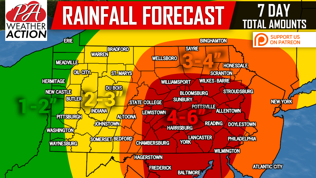
Area Red: Total rainfall amounts of 4-6″ are expected. Prepare for basement flooding and avoid flooded roadways.
Area Orange: Total rainfall amounts of 3-4″ are expected. Prepare for basement flooding and avoid flooded roadways.
Area Yellow: Total rainfall amounts of 2-3″ are expected. Isolated flash flooding possible.
Area Green: Total rainfall amounts of 1-2″ are expected.
If you appreciate our work, please consider supporting us on Patreon >>> Our Patreon Page!
Download our app to view your latest hourly and daily forecast as well as interactive radar, and much more! >>> App Link
Be sure to share this important update with your family and friends using the blue button below, stay safe!
You must be logged in to post a comment.