
We’ve had some pretty peaceful weather lately, but we’re entering an active period of weather beginning tomorrow. A strong cold front will push through the area, producing a line of heavy rain and gusty winds upwards of 40mph Thursday. Temperatures will drop about 15 degrees in an hour as the front comes through, and that will set the stage for a cooler stretch of weather upcoming.
Western PA will see heaviest rain in the morning, Central PA in the early to mid afternoon, and Eastern PA towards the late afternoon. Below is future radar.
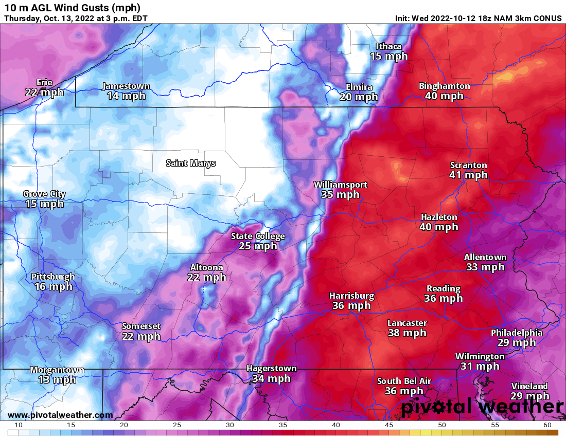
Wind gusts on the order of 25-35mph will be blowing in the hours before the front goes through, and scattered gusts up to 50mph as the line passes. Below is an example of those gusts ahead and behind the line of storms. After the line is past, gusts will quickly diminish.
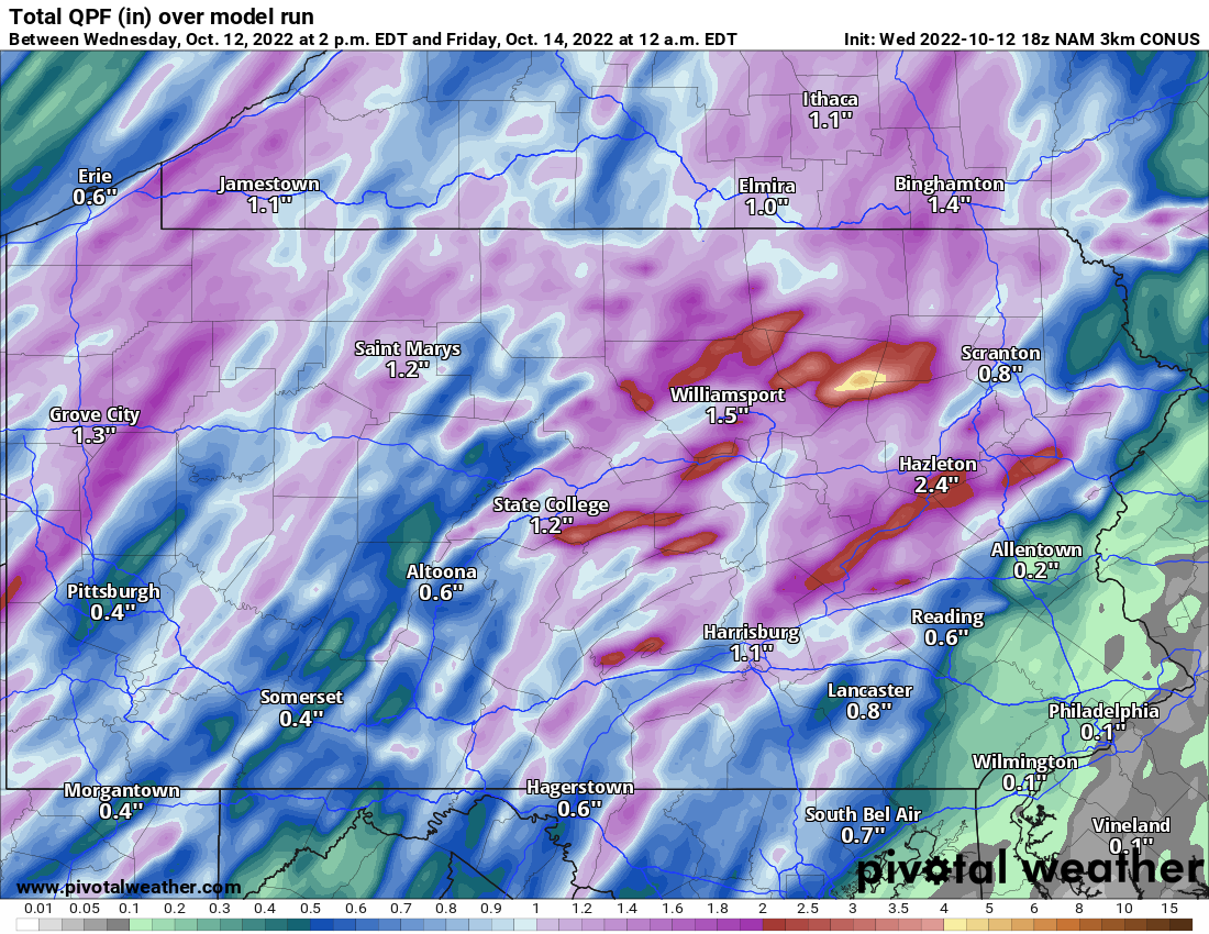
Below is a look at rainfall totals for this event. Some areas like SEPA may not receive much, but inland areas in the mountains are likely to see an inch or more.

You must be logged in to post a comment.