
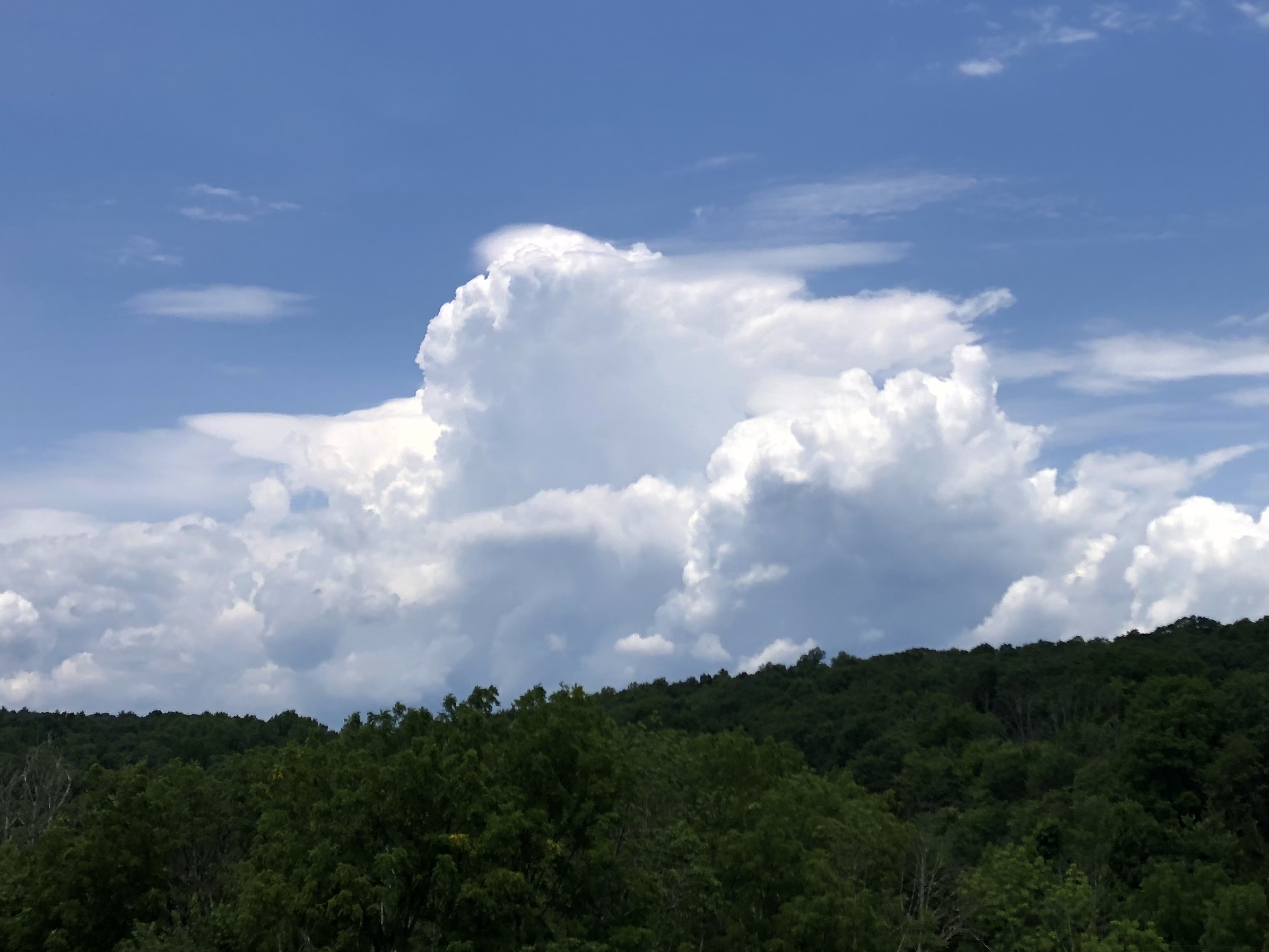
Yesterdays cold front sparked numerous strong thunderstorms and rainfall amounts over 2″ in some locations. That front delivered a refreshing break from the incessant humidity. The Canadian surface high responsible for this refreshing air will provide dry weather through at least the first part of Saturday.
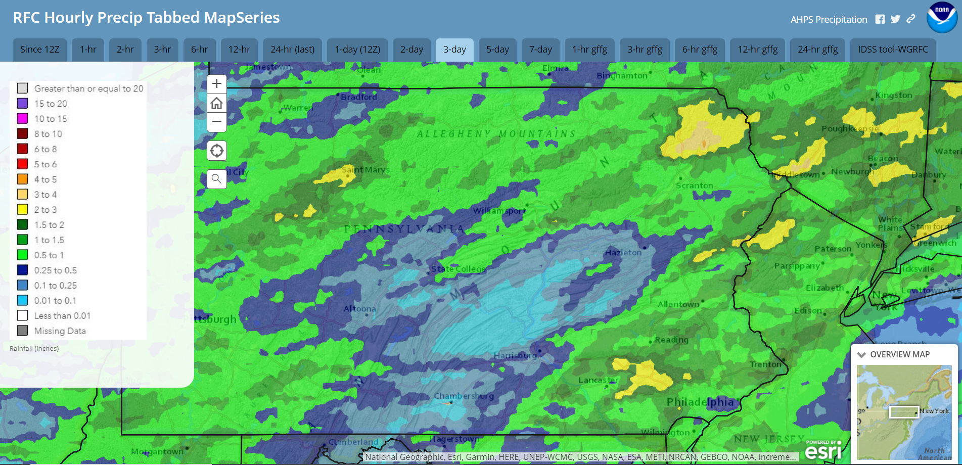
Radar-estimated rainfall Monday July 15 – Wednesday July 17:
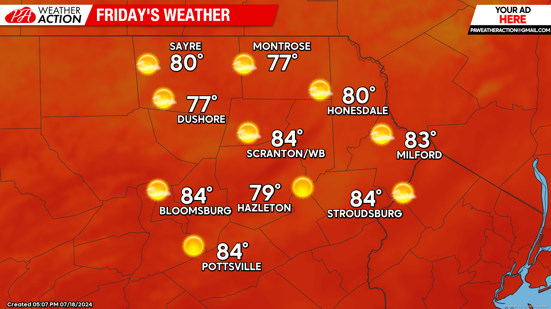
FRIDAY
Friday will feature ample sunshine, seasonal temperatures, and low humidity. Enjoy!
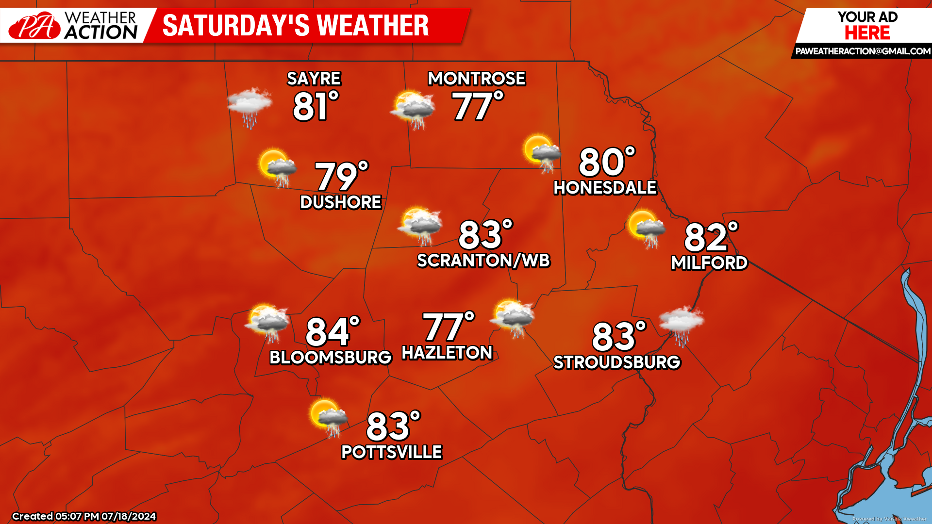
SATURDAY
The Canadian surface high will provide a cool start to the day. Clouds will move northward into our area during the day. Humidity will increase throughout the day as well. An approaching disturbance will attempt to inspire isolate showers during the evening and nighttime, but most locations should remain dry.
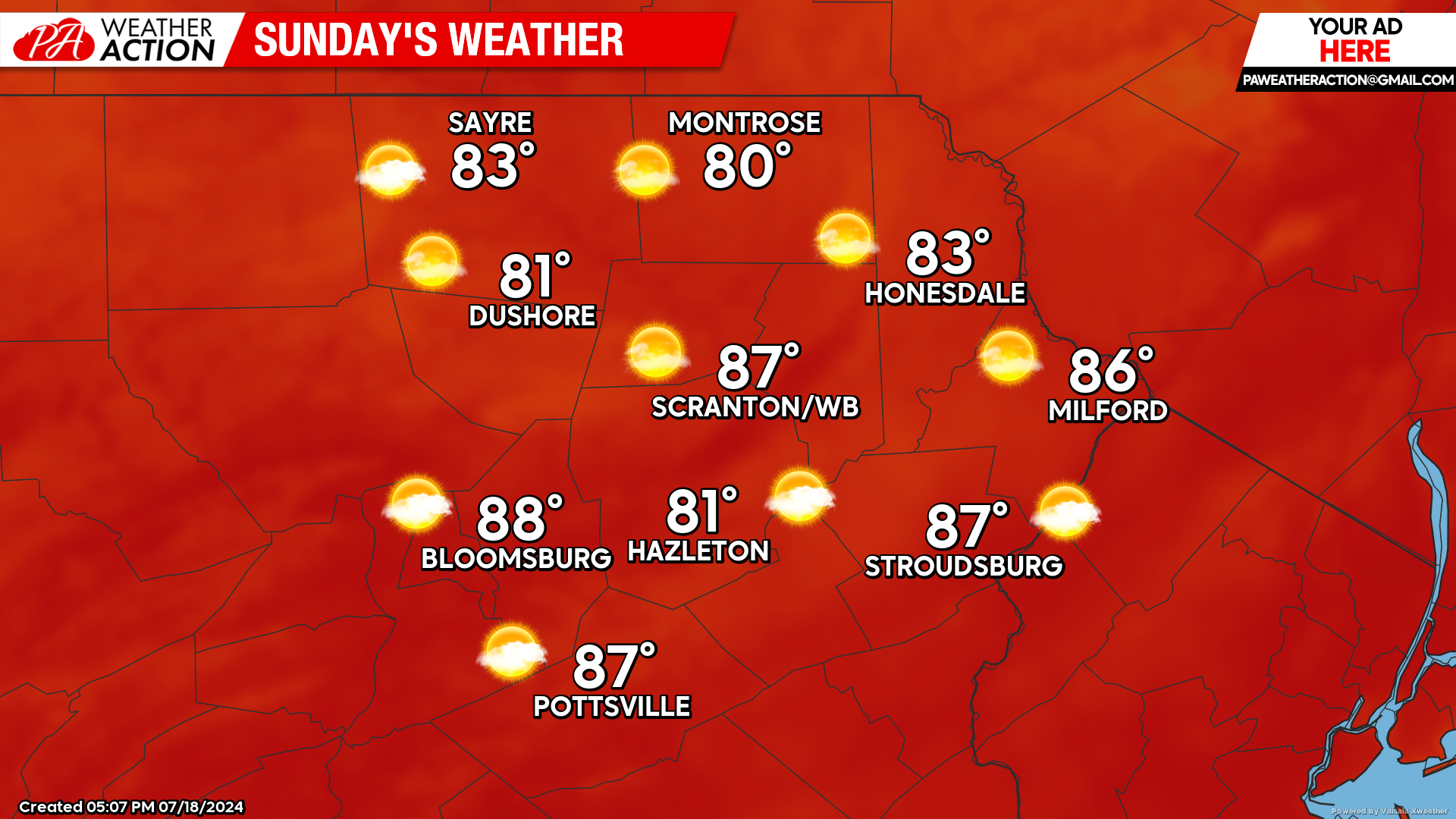
SUNDAY
Sunday will be a dry and sunny day. Saturday evening’s humidity should decrease by Sunday morning, so despite the higher temperatures on Sunday, most people will remember it as a relatively refreshing day.
BEYOND SUNDAY (Mon-Fri July 22-26)
Next week will feature temperatures around 5 degrees above normal, with widespread highs in the 80s. Humidity will increase over the course of the week. Along with the increasing humidity, there will also be an increasing opportunity for daily afternoon thunderstorms as the week progresses.

You must be logged in to post a comment.