
A cold front pushed through our area Sunday evening, heralding a refreshing Canadian surface high. That high delivered lower humidity today, and temperatures will fall down into the lower 50s tonight.
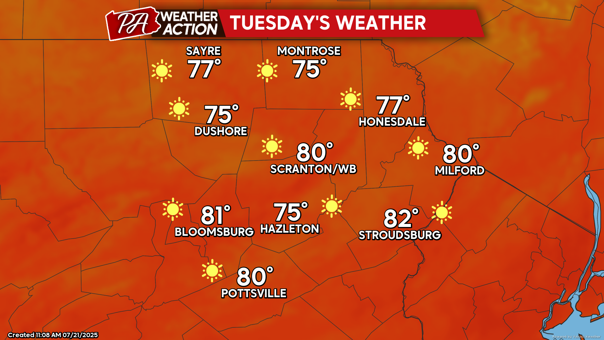
TUESDAY
Tuesday will dawn with temperatures in the low 50s. Sunshine will boost temperatures into the mid 70s to near 80, with low humidity and light wind. The low humidity will also make for another comfortable night to open the windows. Enjoy!
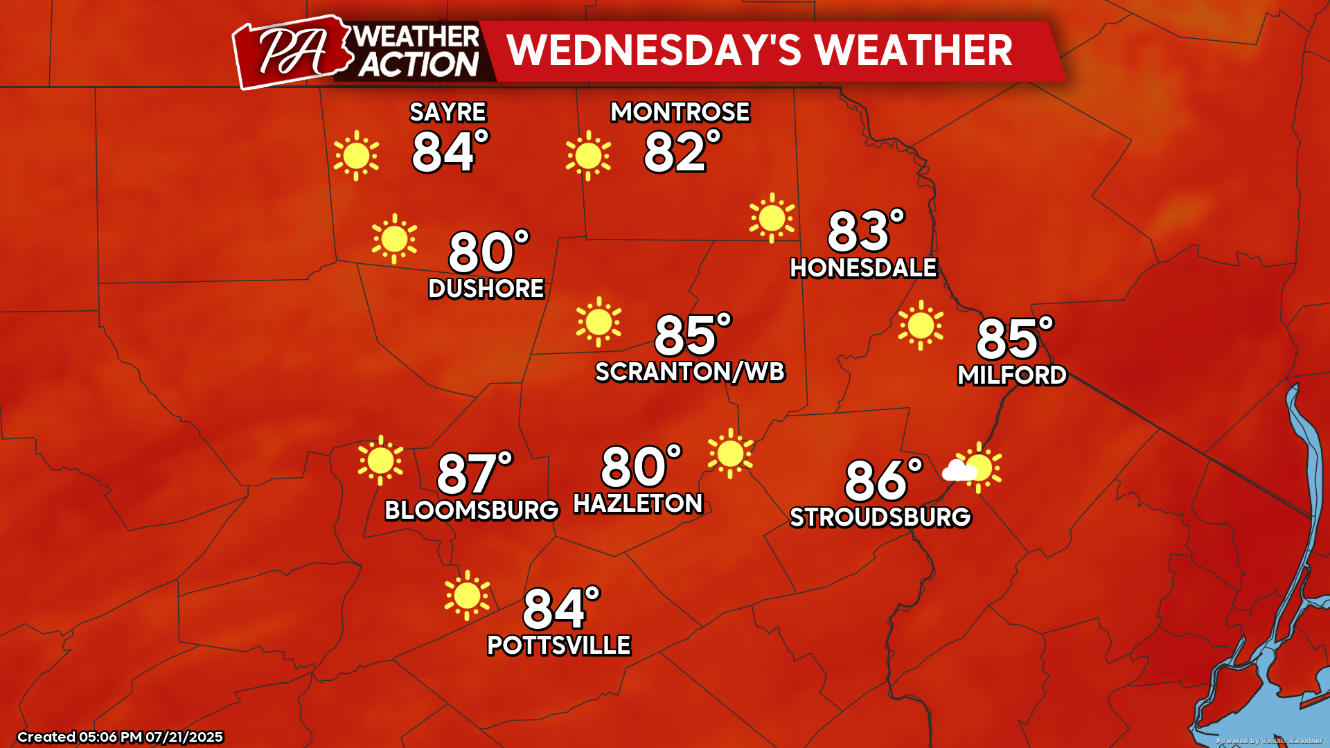
WEDNESDAY
The surface high will slide offshore to our east. Wind will continue to be light along with low humidity to start the day. With the surface high to our east, it will gently move warmer and increasingly-humid air into our area during the day with temperatures climbing into the low-mid 80s. The increase in humidity will result in a return to muggy nighttime Wednesday night with temperatures remaining in the 60s.
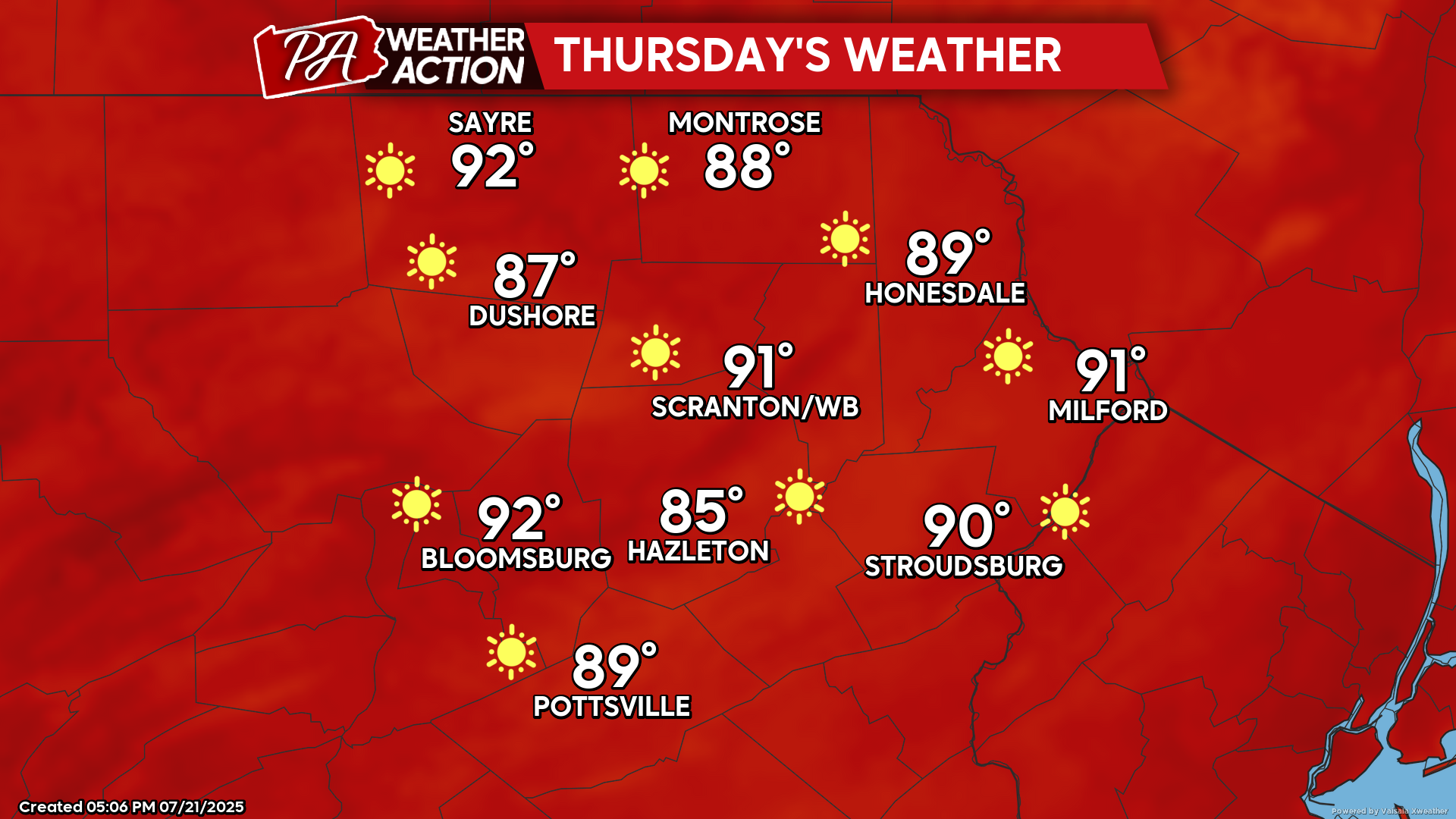
THURSDAY
Heat and humidity will once again be entrenched in our area with temperatures reaching near 90.


You must be logged in to post a comment.