

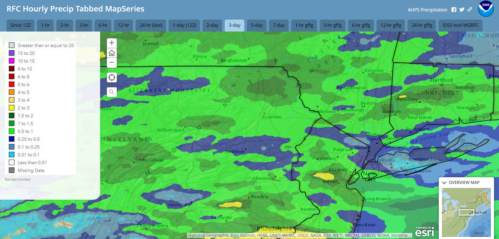
A cold front pushed through our area yesterday, sparking two days of thunderstorms that left scattered tree damage, power outages, and 1-2 inches of rain for most of the area. Not everyone was so lucky, however, with some areas getting barely a quarter of an inch of rain.
That cold front deliver a refreshing Canadian airmass that will provide low humidity, dry weather, and cool overnights through Wednesday. Warm humid air will return for Independence day and last through the weekend, along with multiple opportunities for thunderstorms.
Radar-derived rainfall for Friday-Sunday June 28-30:
This year’s first major hurricane has formed in the Atlantic. As of early afternoon Monday, Beryl is entering the southeastern Caribbean and is moving WNW at 20 mph. Maximum sustained winds are 150mph, making Beryl a Cat 4 hurricane, with tropical-storm force winds extending 125 miles from the center. Beryl is expected to remain very powerful over the next couple of days as it traverses the Caribbean, but gradually weaken into a Cat 1 hurricane before landfall on the Yucatan Peninsula later this week.

TUESDAY
The refreshing Canadian airmass will provide spectacular sunshine and low humidity. Open the windows and enjoy!

WEDNESDAY
Wednesday will also feature spectacular sunshine and low humidity. If you find our refreshing Canadian airmass a bit unexciting, Beryl is expected to have a significant impact to Jamaica on Wednesday.

THURSDAY
Humidity and higher temperatures will return, along with the opportunity for a few scattered thunderstorms. Severe weather is not anticipated.

BEYOND THURSDAY (Friday-Sunday July 5-7)
Very humid and hot weather will cover our area through the weekend. High temperatures will reach near 90 in the valleys, and low-mid 80s in the highest elevations. With the very humid conditions, nighttime low temperatures will struggle to fall below 70. Those of you who aren’t fond of humidity might have to cower in air-conditioning. There will be opportunity for thunderstorms, primarily Saturday into Sunday.


You must be logged in to post a comment.