
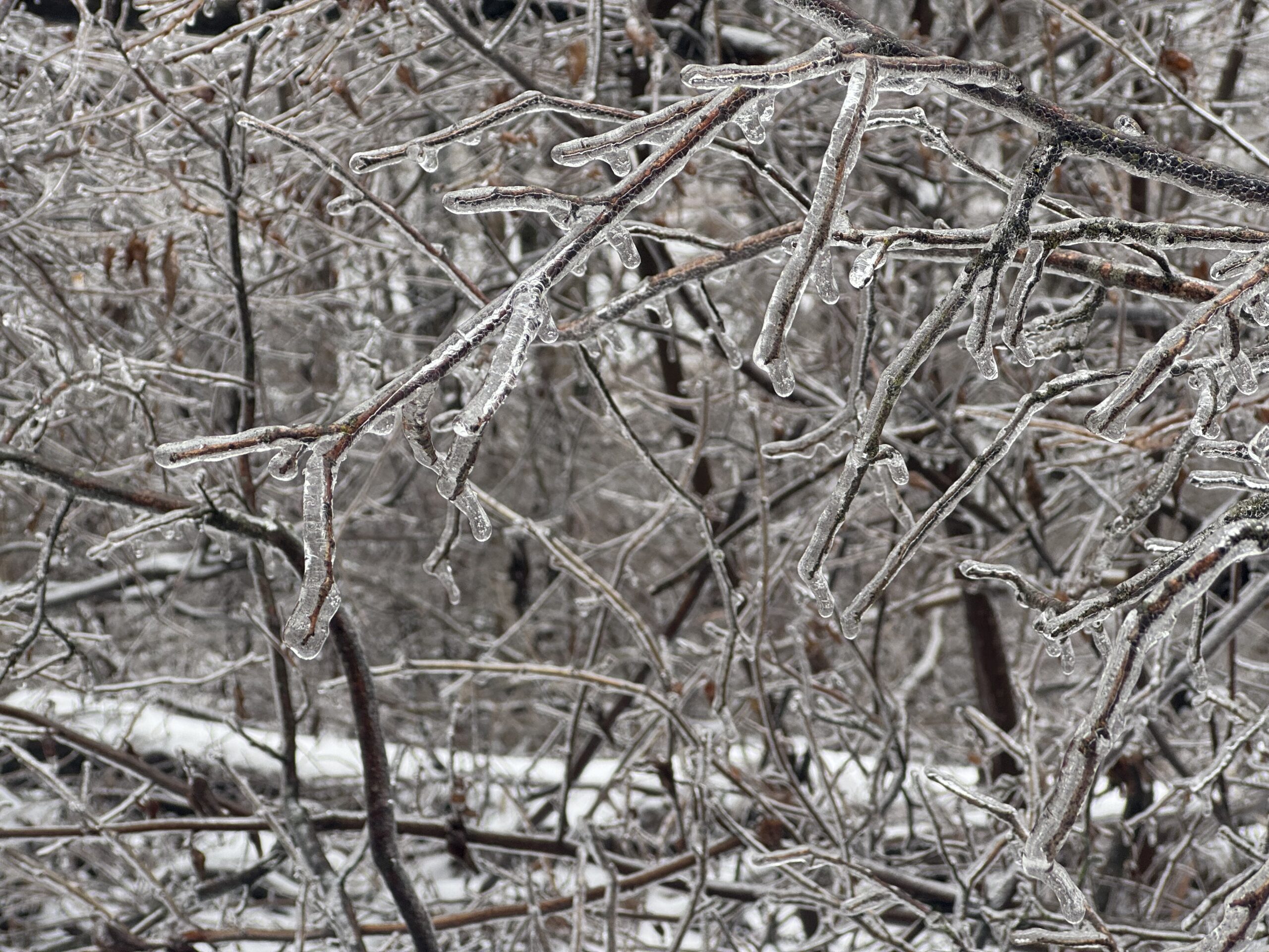
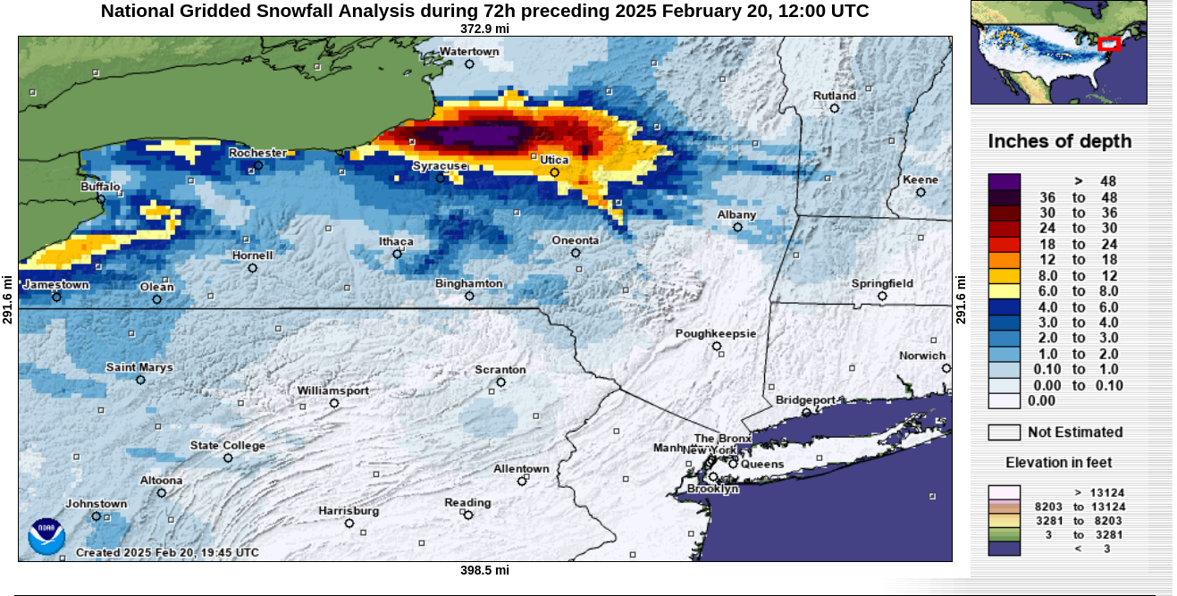
A brutal arctic assault delivered record low temperatures to a large part of the Nation this week. As arctic air blasted across the Great Lakes, the snowbelts east of Lake Ontario received several feet of snow this week. In fact, some of those areas are now over 30 FEET of snow for the winter!
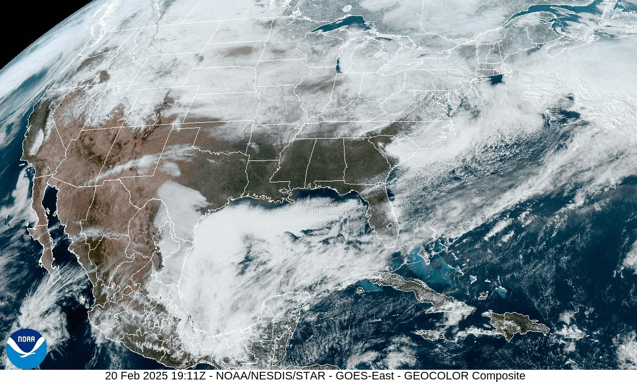
Temperature anomalies as much as 40 degrees below normal cover much of the Plains today. Overnight lows fell below -40 F in parts of Montana! Along with the extreme cold, an impressive snowpack blankets the Nation, which can be seen in this visible satellite loop.
An upper-level disturbance is currently passing near our region, providing a fresh coating of powdery snow this evening. That system will will exit tonight, leaving one more day of arctic air in its wake. This arctic air will relax as we go into this weekend and early next week. But winter is not over yet!
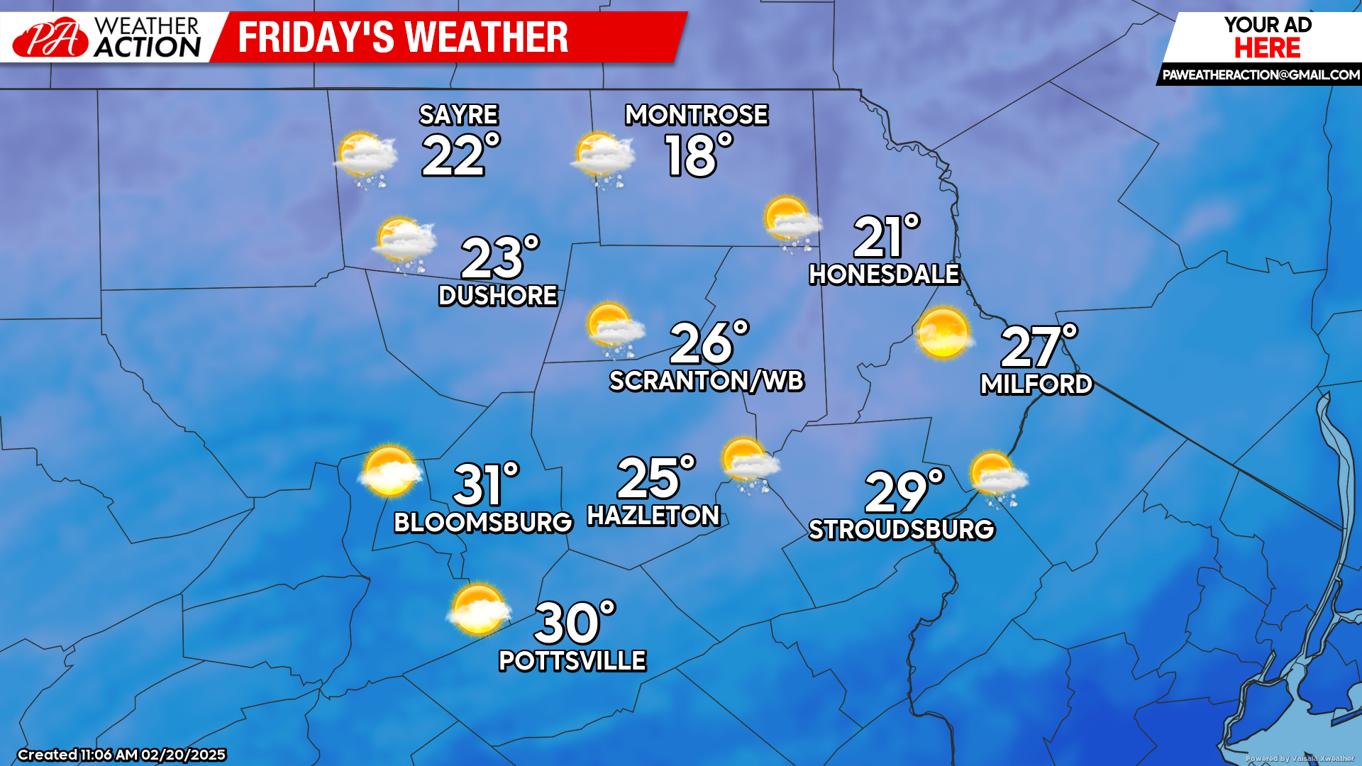
FRIDAY
Arctic wind and cold will persist all day. There could be a few snow showers, mainly in the northern half of our area.
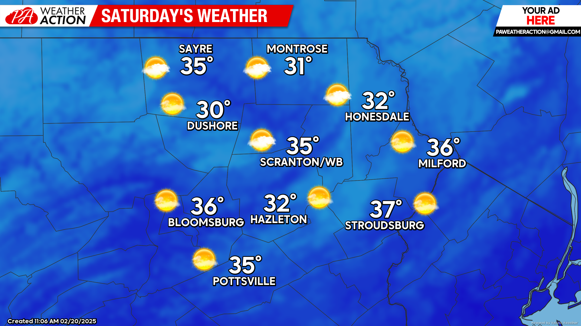
SATURDAY
High pressure will move over our region to provide a sunny, milder day. After morning temperatures in the single digits and teens, temperatures will recover to above freezing levels for all but the highest elevations! Enjoy!
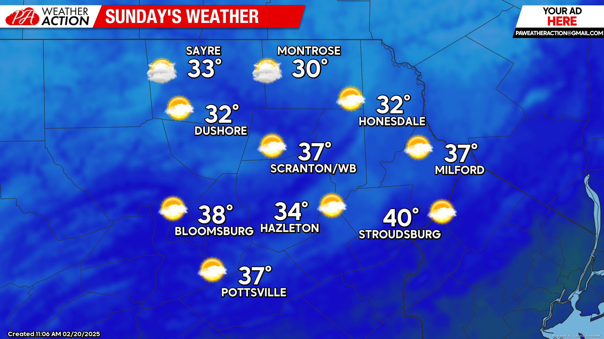
SUNDAY
High pressure will provide another sunny day for our area with near-normal temperatures and a gentle wind from the southwest. Temperatures will continue to warm to above-normal levels for the first half of next week, but cooler weather and potential winter precipitation should return by the end of next week.
You must be logged in to post a comment.