
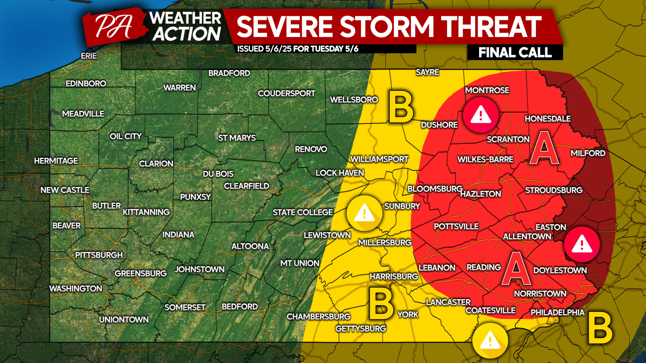
This forecast has been updated for Tuesday! View that forecast below by clicking the image.
Scattered Severe Storms May Produce Large Hail, Gusty Winds in Parts of Pennsylvania Today
Severe Thunderstorms are again possible today as a low pressure system sits and spins to our west, which is keeping a moist and unstable southerly flow over Pennsylvania.
These storms will have unusual storm motion because of this current abnormal setup we have across the US. Storms will actually move from southeast to northwest!
Flash flooding is beginning to be a concern, especially in areas that aren’t under drought conditions like much of Western PA.
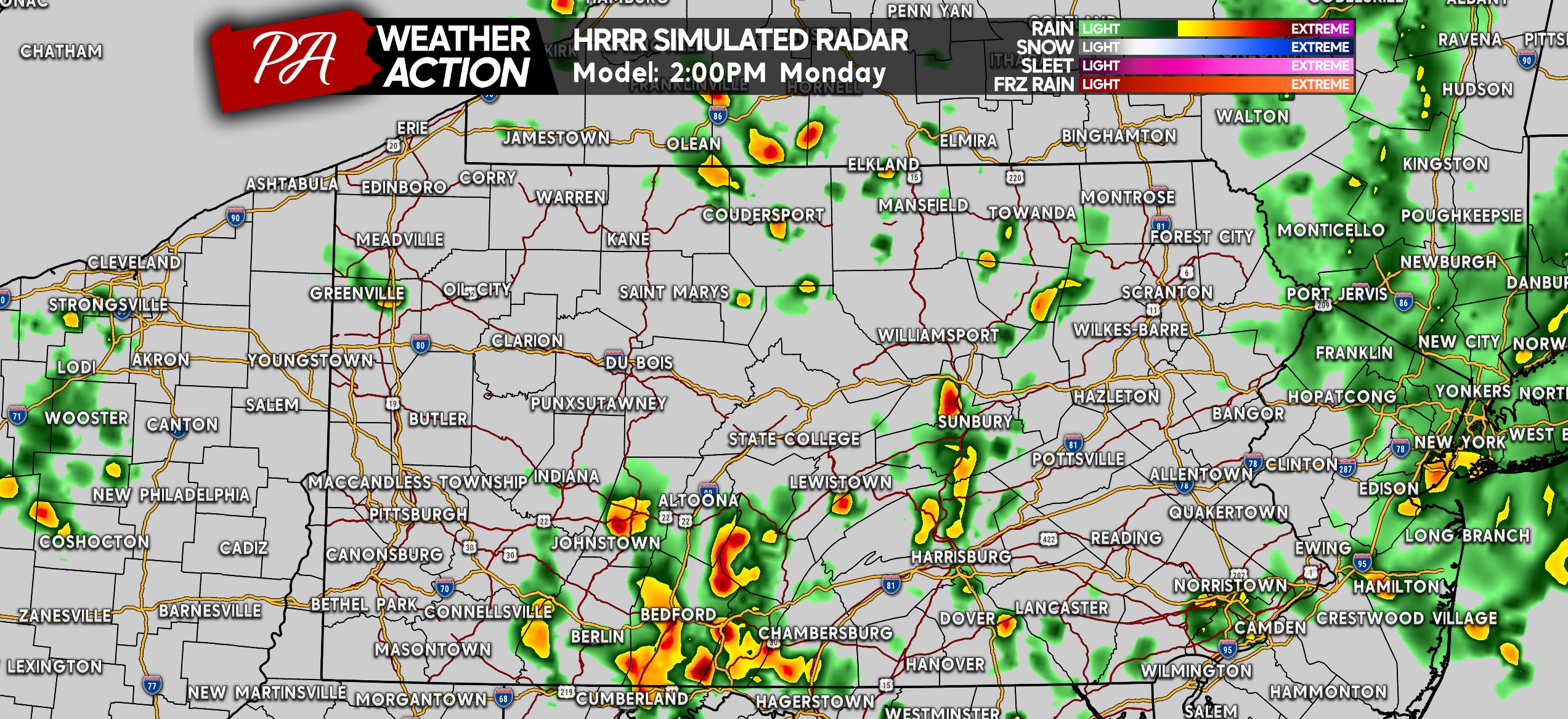
FUTURE RADAR STORM TIMING
Widespread storms will begin to develop especially in South Central PA early this afternoon. Some of these storms will contain lightning, hail, and gusty winds. Here’s a look at 2:00 PM on the HRRR Model.
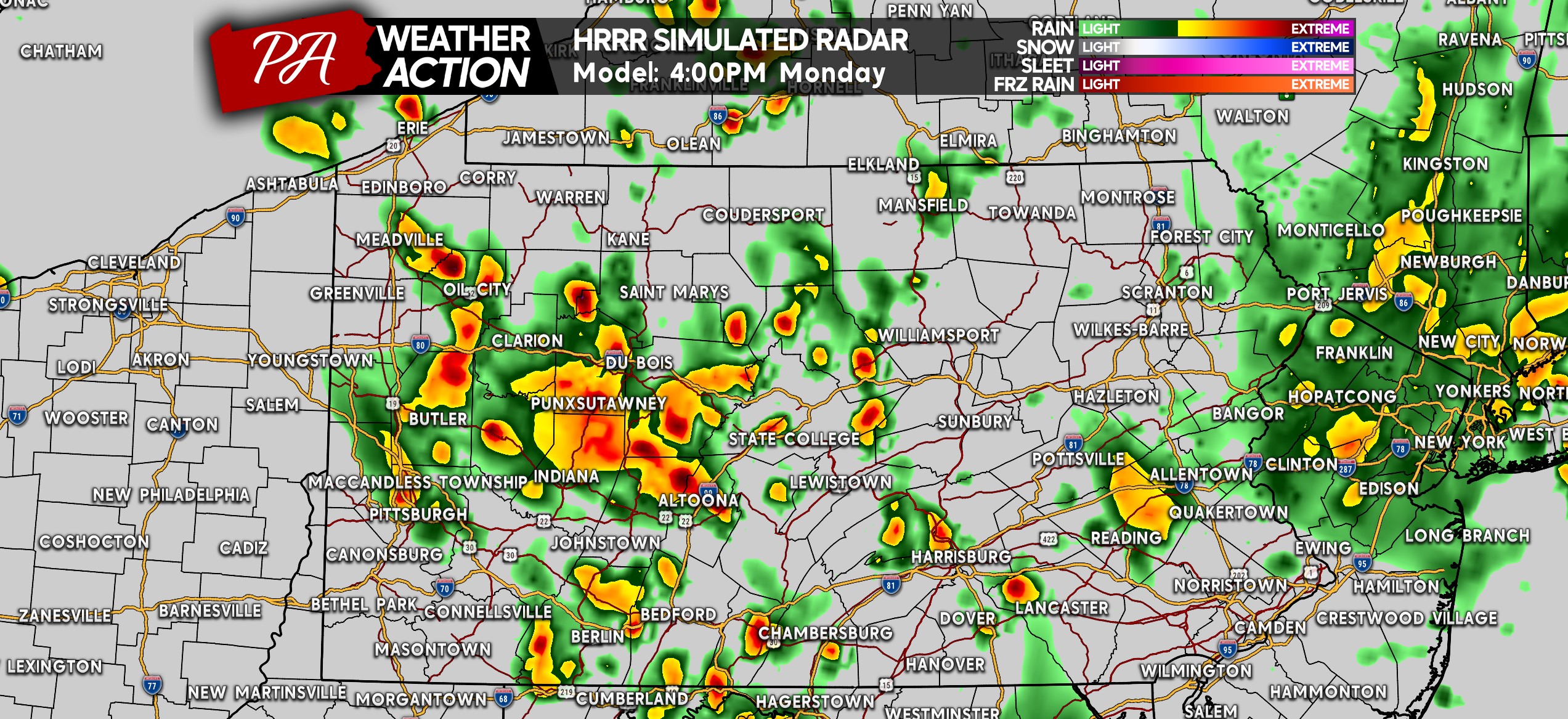
As we head later into the afternoon, the storm coverage will greatly increase across much of Western and Central PA, west of Route 15. Below is future radar for 4:00 PM.
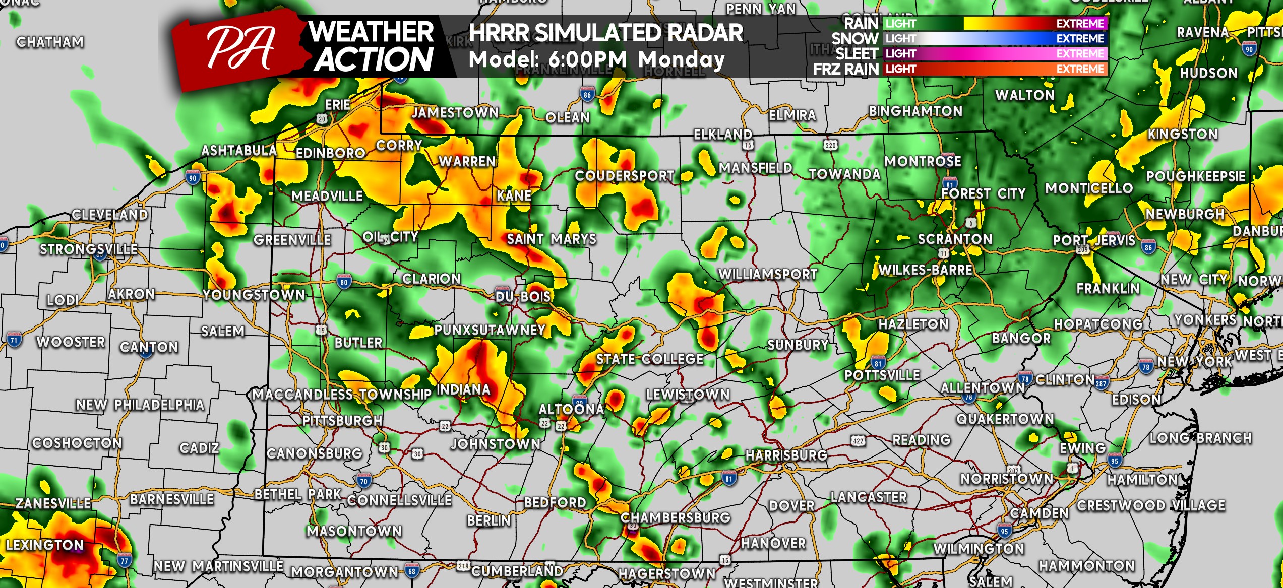
Much of the same continues around dinnertime, with lots of heavy rain across Northwest PA down through Central PA. Don’t be surprised to see some hail! Here is the HRRR for 6:00 PM.
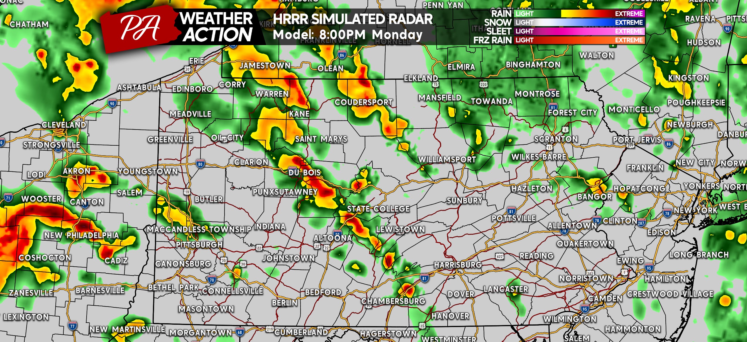
As we head into the evening, storms will become more scattered with perhaps almost a few training lines of strong storms as you see from Shippensburg all the way to Du Bois on the future radar for 8:00 PM below.
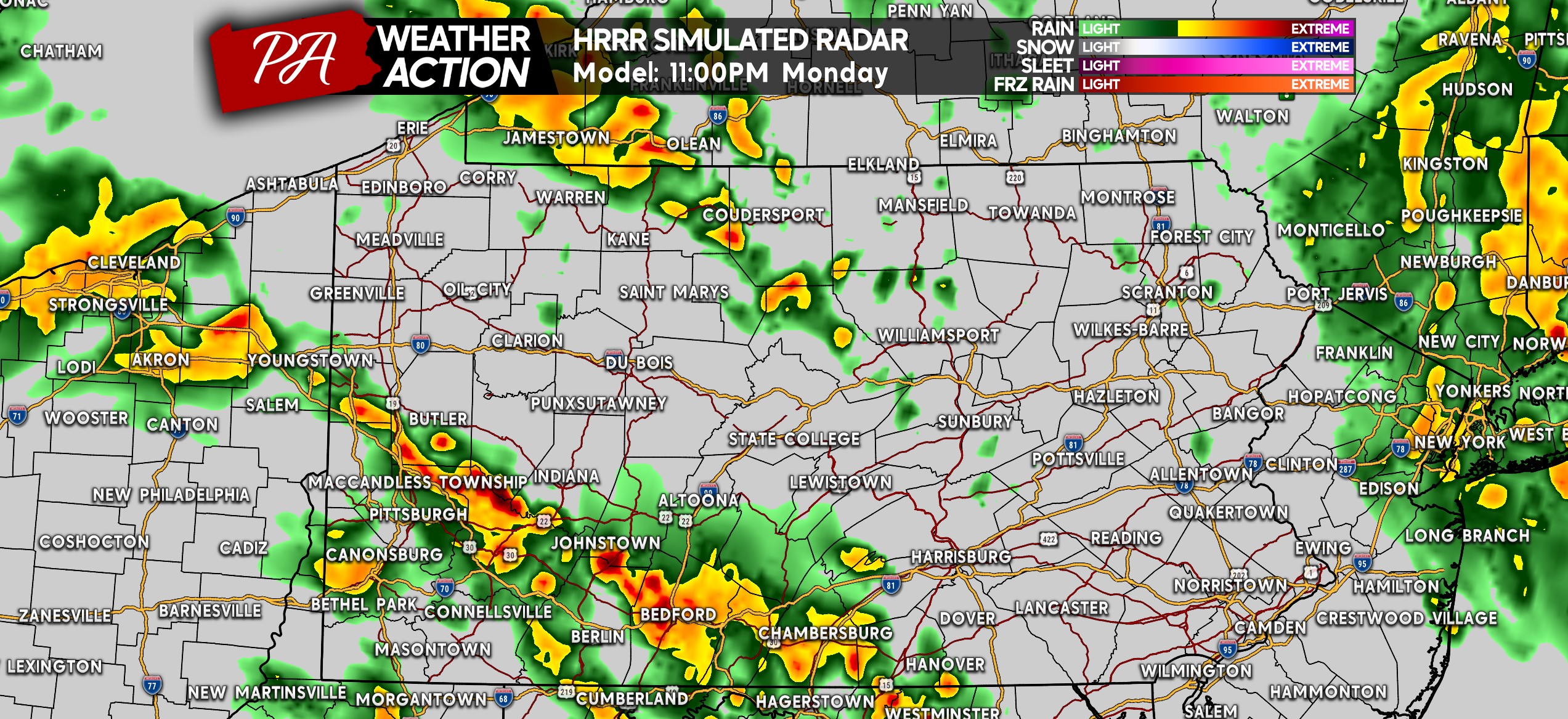
But wait, there’s more! By 11:00 PM, more heavy rain and thunderstorms may be working their way into the the southwest quarter of the state. The hail threat will be lower a few hours after sunset.
MONDAY’S SEVERE THUNDERSTOM THREAT FORECAST
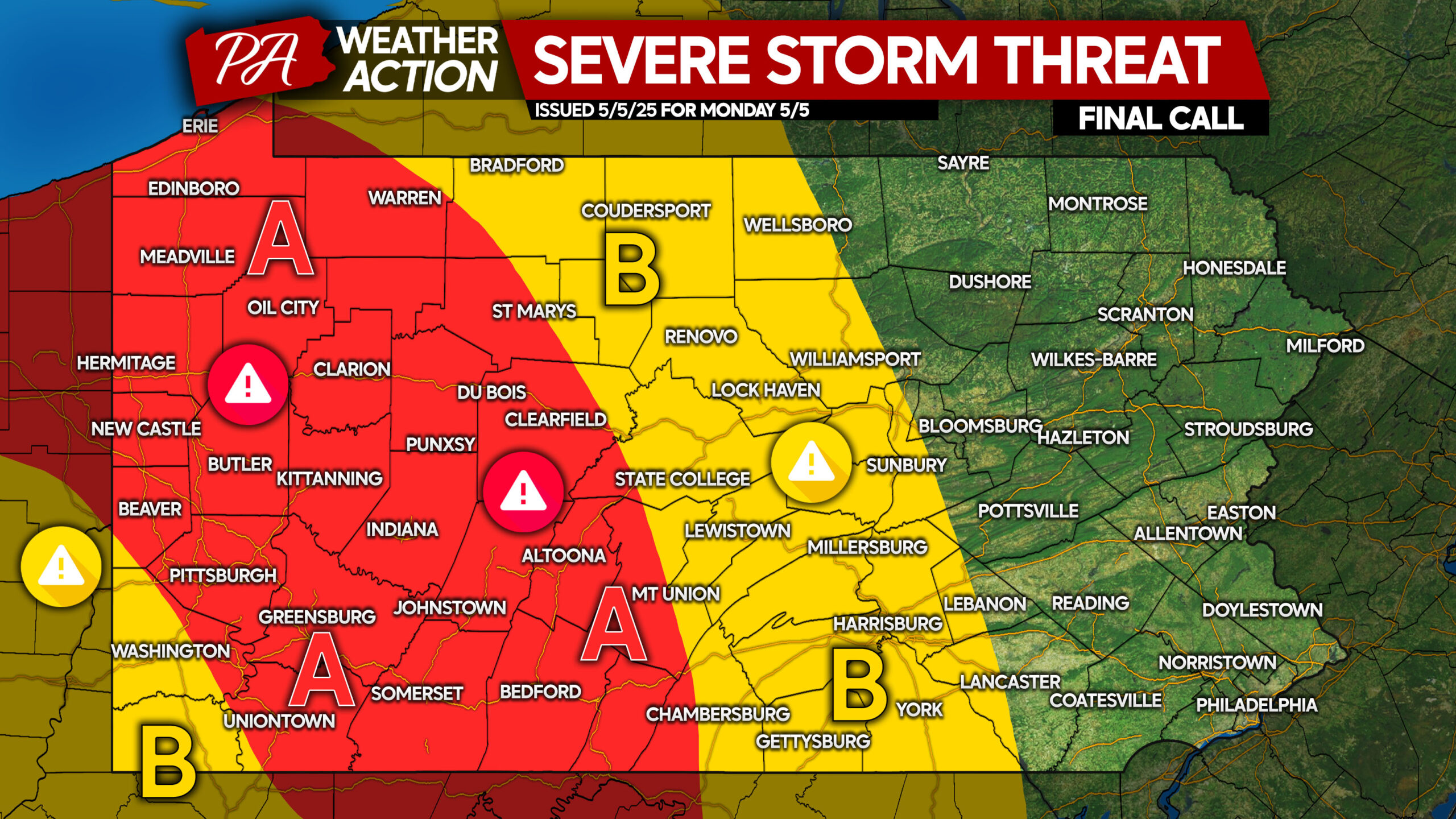
Area A: Scattered strong to severe thunderstorms capable of producing large hail and gusty winds of 40-60mph are expected. Heavy rain training over the same areas may also create a flash flooding risk.
Area B: Isolated strong to severe thunderstorms are expected. Small hail and gusty winds up to 50mph are possible, along with an isolated flash flood threat mainly in urban areas with poor drainage.
Share this forecast with family and friends in highlighted areas!

You must be logged in to post a comment.