We have been spoiled lately by tranquil late Spring weather, as a large part of the country has either been dealing with heat or heavy rain. And while our pattern looks to remain mostly dry, safe to say it’s about to get HOT. But that heat will be delayed until after this weekend (Sat & Sun) thanks to a cold front that will sweep through Friday in the form of showers and thunderstorms.
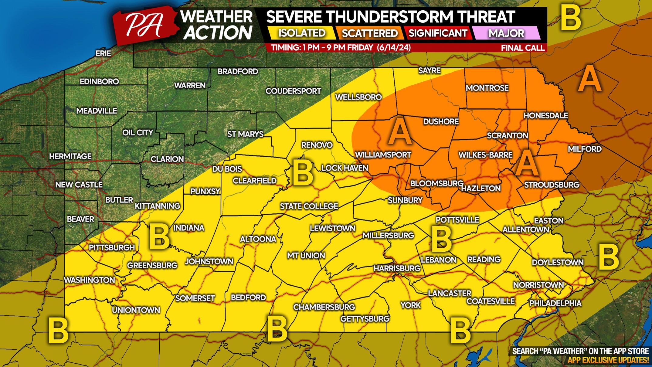
We aren’t overly impressed by the severe parameters for Friday, which is why we have much of the state placed in an isolated severe thunderstorm risk. Northeast PA has a higher chance of thunderstorms overall, some of which may be severe.
FUTURE RADAR TIMING
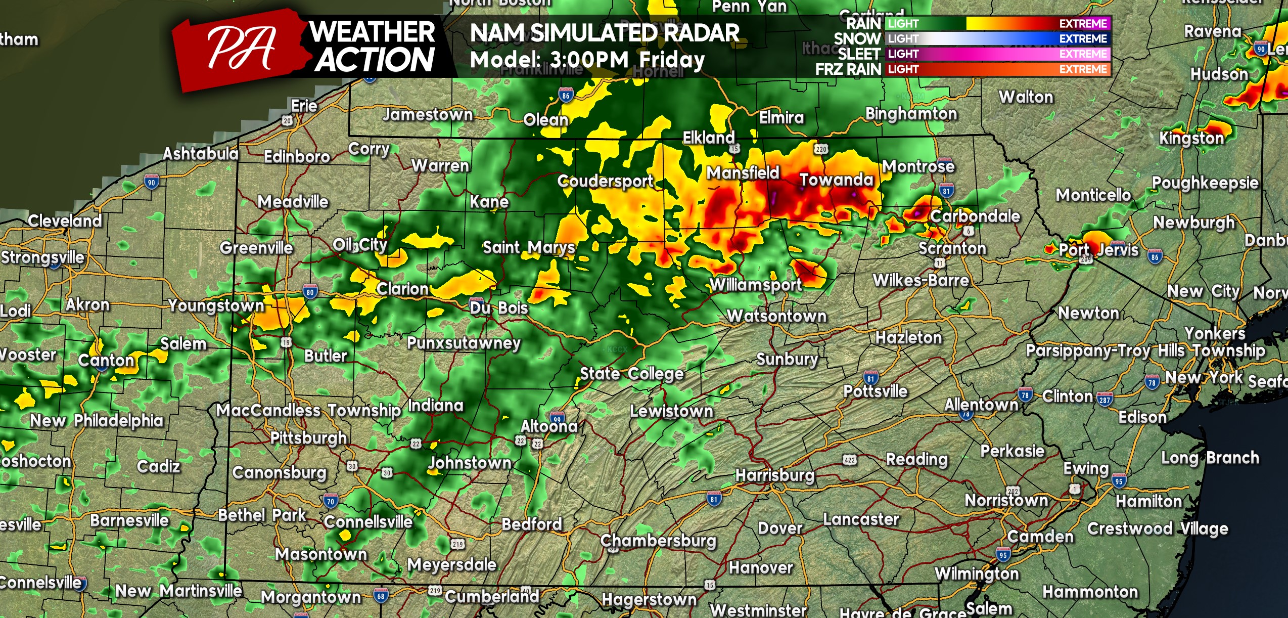
A cluster of thunderstorms is expected to be over North Central & Northeast PA mid-Friday afternoon as shown below. It’s the storms on the eastern extent, mainly east of Route 15, that may be strong to severe. Showers back in Western PA along I-80 should be harmless. Below is Hi-Res NAM future radar for 3:00 PM Friday.
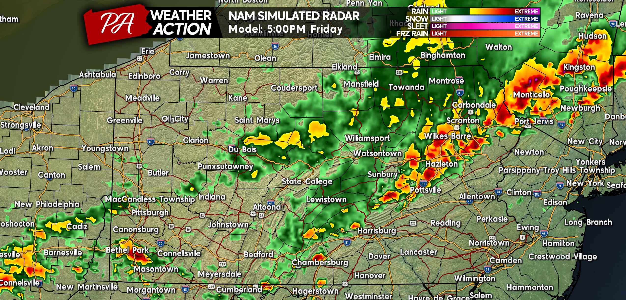
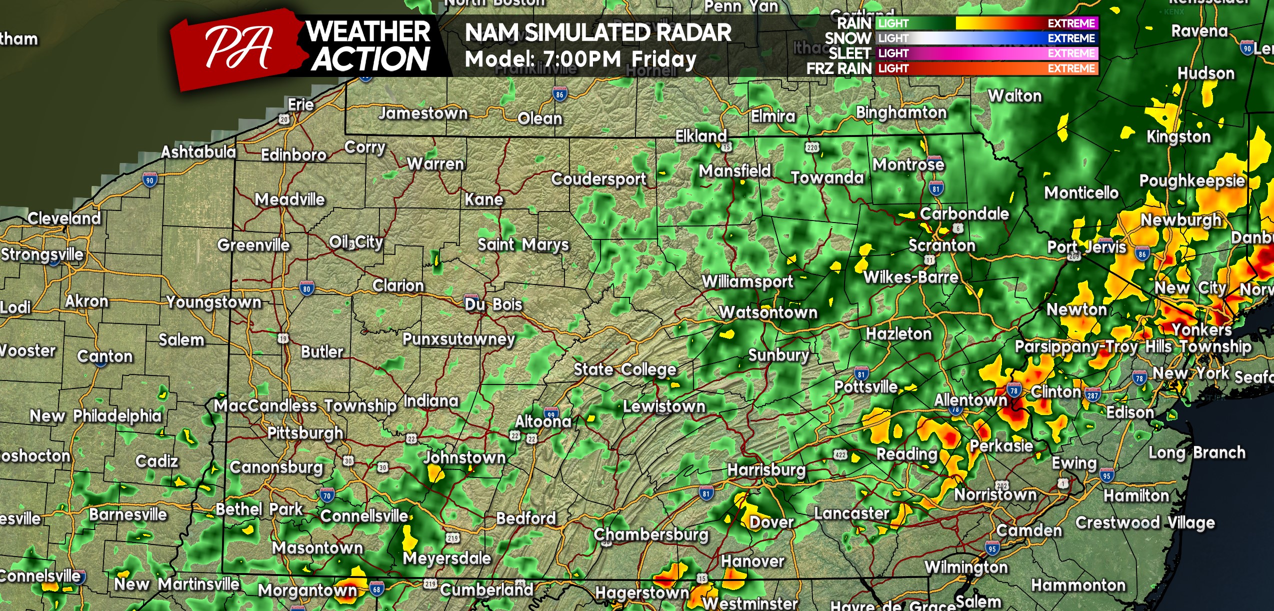
These storms will move fast, and by 5:00 PM, they’re modeled to be across the Poconos and Coal Region. A more isolated threat of storms exists across Southwest & South Central PA.
Some areas in the Alleghenies may not see any rainfall as the cold front pushes through, as modeled below by the gap in precipitation over Altoona and Bedford. Here is future radar for 5:00 PM Friday.
Friday evening festivities in many areas may be dampened or even cancelled as showers and thunderstorms work their way through Eastern PA. Storms are modeled to be north of the Philadelphia suburbs through dinnertime, but models tend to be 1-2 hours behind in many situations so what you see below is not a guarantee.
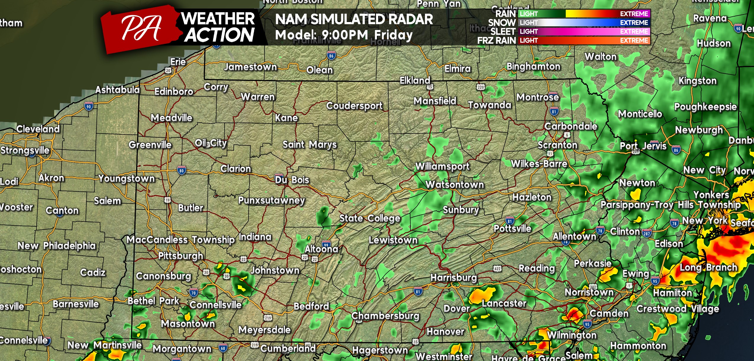
Isolated thunderstorms are projected to move through the Philadelphia Metro around 8-9 PM Friday. Everywhere else in the state should be dry or left with just light showers that are dissipating. Below is future radar for 9:00 PM Friday.
FRIDAY 6/14 SEVERE THUNDERSTORM RISK MAP
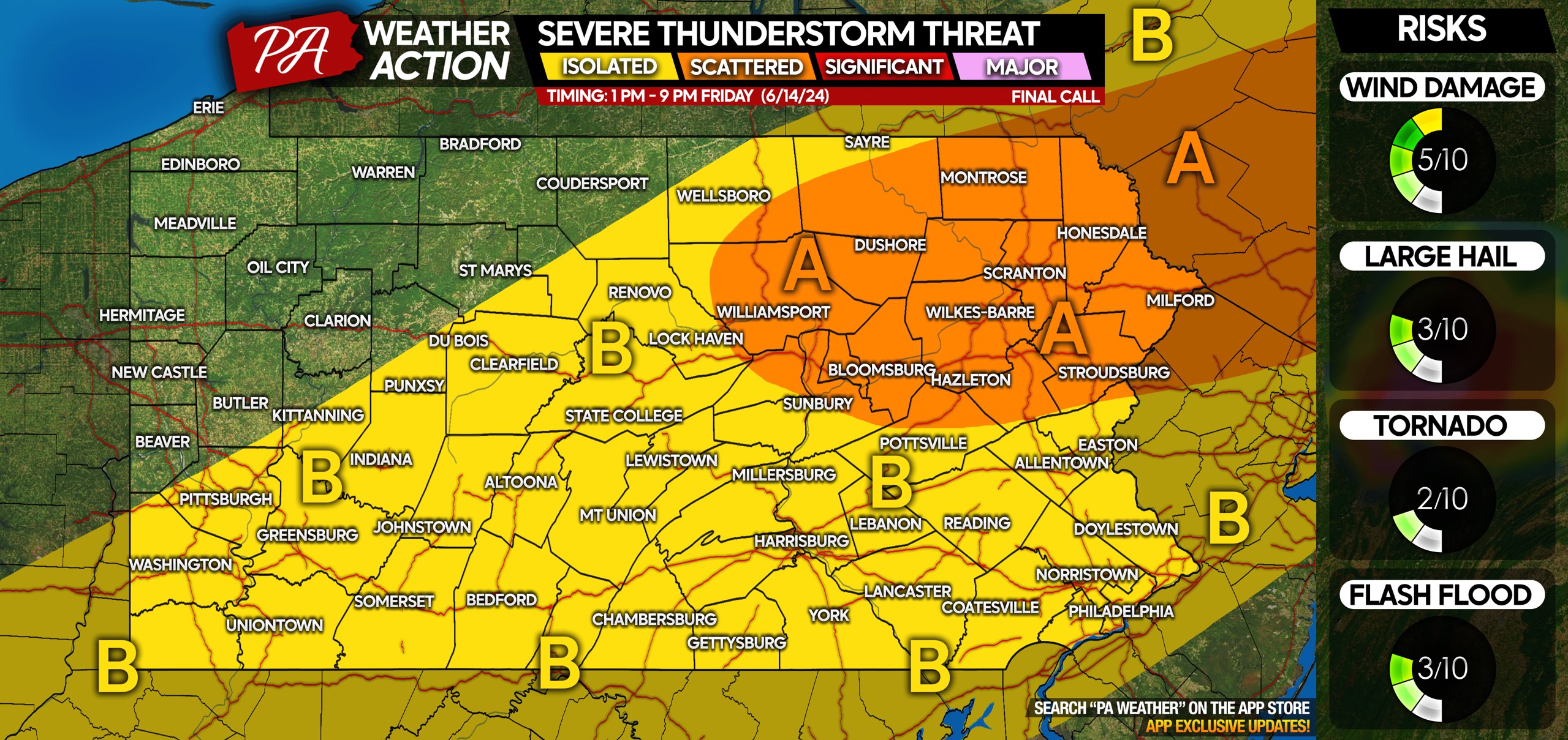
Area A: Scattered severe thunderstorms possible mid Friday afternoon to early Friday evening. Scattered damaging winds and isolated hail are the main concerns, with a very minimal tornado threat.
Area B: Isolated severe thunderstorms possible, view timing for storms near your locality above. Isolated damaging winds and hail possible.
Don’t forget to share this article with family and friends who have outdoor plans Friday evening!
Get the best free radar with a dozen map layers in the PA Weather Action app! Tap the image below to download it on your phone’s app store ~>



You must be logged in to post a comment.