
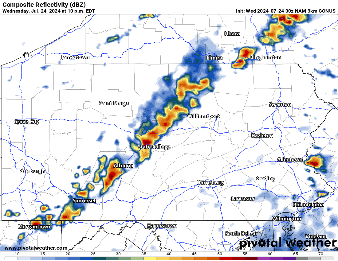
Overnight showers and thunderstorms have lingered around across the state. Below is a look at the latest radar imagery:
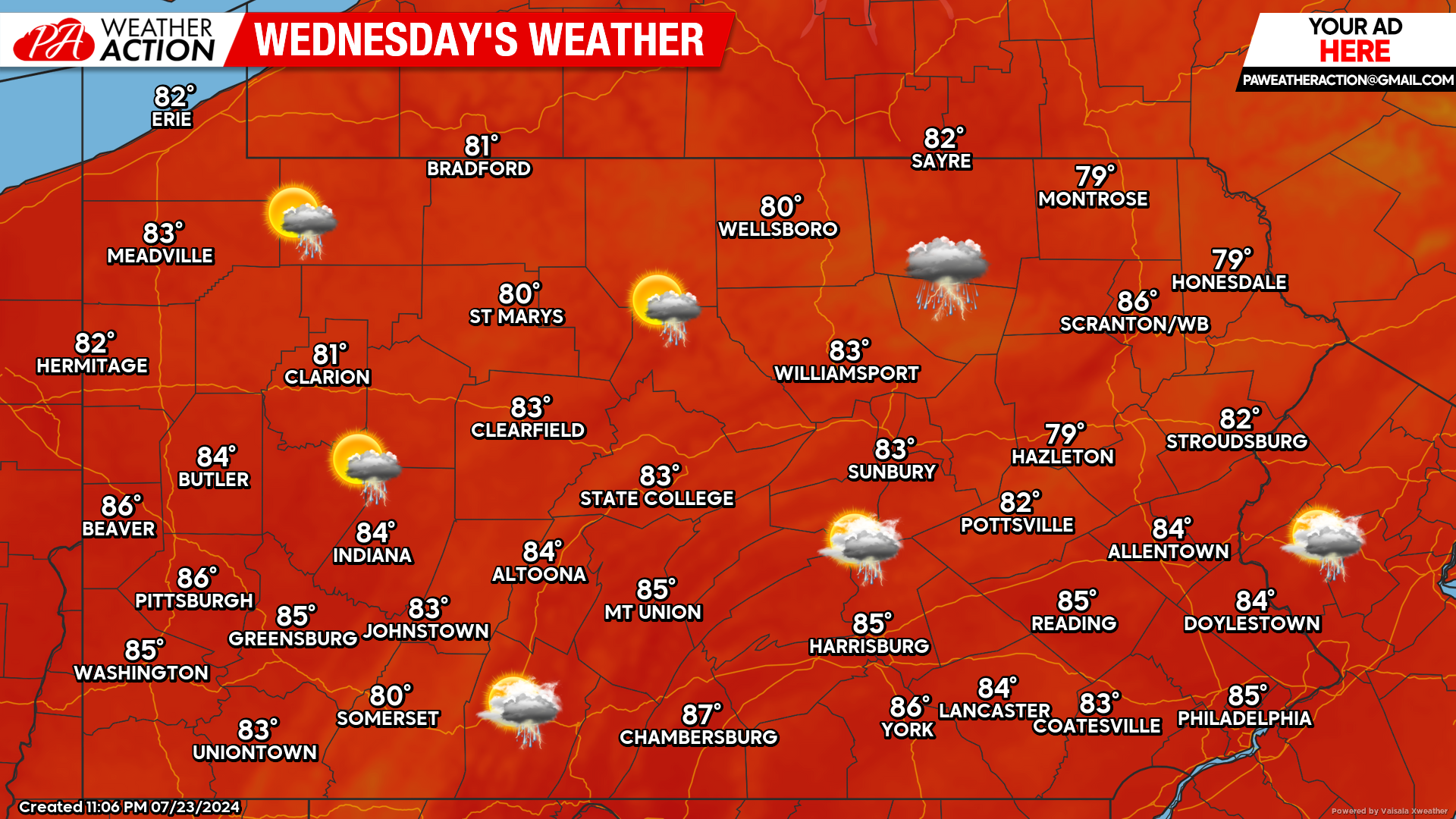
Today’s Weather Forecast: 7/10
This morning’s shower activity will taper off. As we move into the afternoon hours, a line of scattered thunderstorms will likely develop. While the severe weather threat will be limited, these storms will still be capable of producing heavy downpours at times.
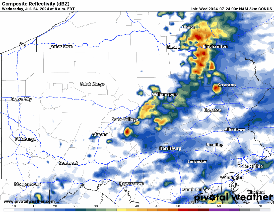
Hi-Res NAM Future Radar Through Early Thursday Morning:
The latest Hi-Res NAM future radar suggests the best chance for thunderstorms today will be across northwest Pennsylvania, especially in the later afternoon and evening hours. For time reference, use the top left of the graphic below:
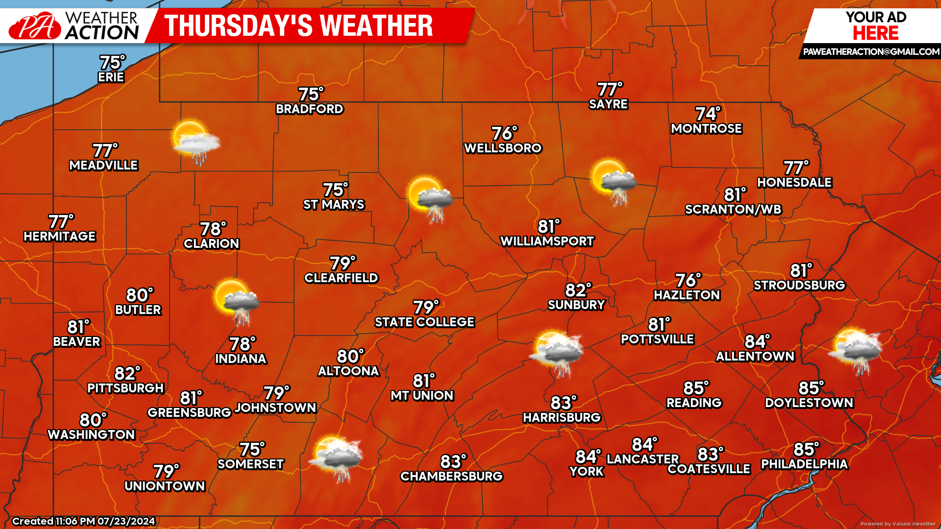
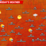
Thursday’s Weather Forecast: 8/10
Thursday’s thunderstorm activity won’t be as widespread. Temperatures will generally be in the upper 70s and lower 80s across the state.
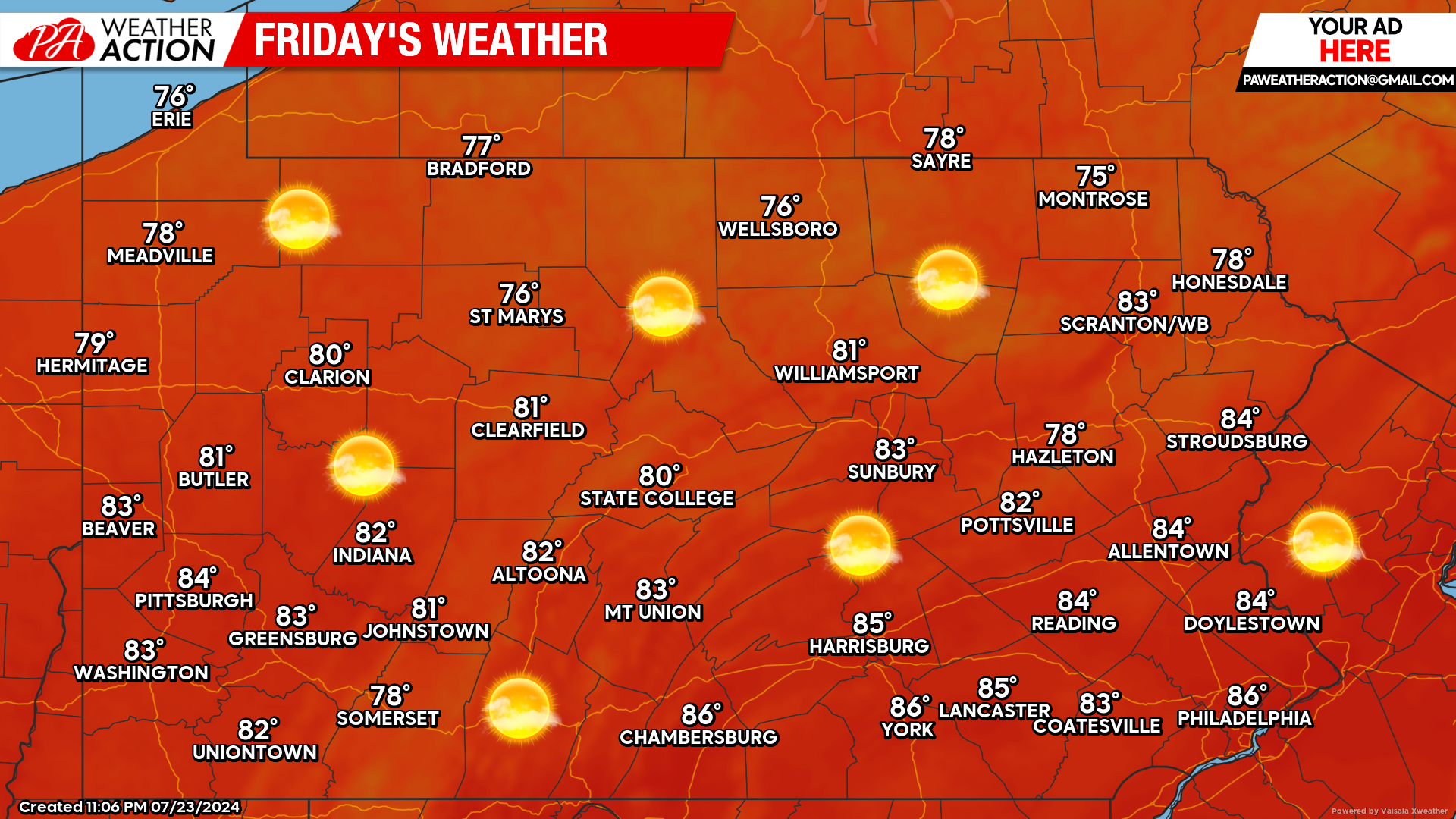
Friday’s Weather Forecast: 10/10
This week will be capped off with a spectacular Friday. Plenty of sunshine with high temperatures in the upper 70s and 80s across the state.
You must be logged in to post a comment.