
After a wet and warm Sunday and a cool and snowy morning (for some) on Monday, we will be turning the pattern to be quite boring as we traverse throughout the week. Tracking seasonable temperatures and more sun than clouds. Let’s jump into the forecast!
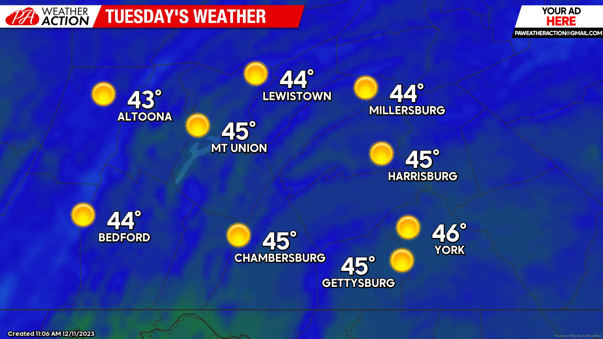
TUESDAY:
Tuesday will allow for generally mostly sunny skies with temperatures rising into the mid-40s for all of the region. We will also see a southerly wind develop in the afternoon of 5 -10 mph with gusts occasionally up to 15 – 20 mph. Temperatures will be a few degrees above average for this time in the month!
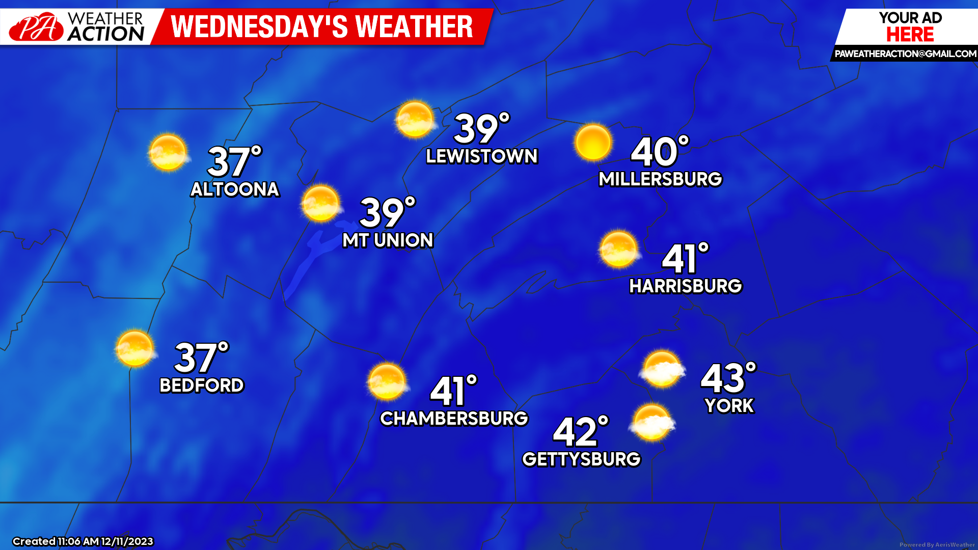
WEDNESDAY:
Wednesday will be slightly cooler as a weak cold front will push through Tuesday afternoon. Expect high temperatures to climb into the upper-30s to low-40s with mostly sunny skies with a few clouds at time-to-time. A westerly wind of 5 – 10 mph is expected with gusts occasionally up to 20 mph.
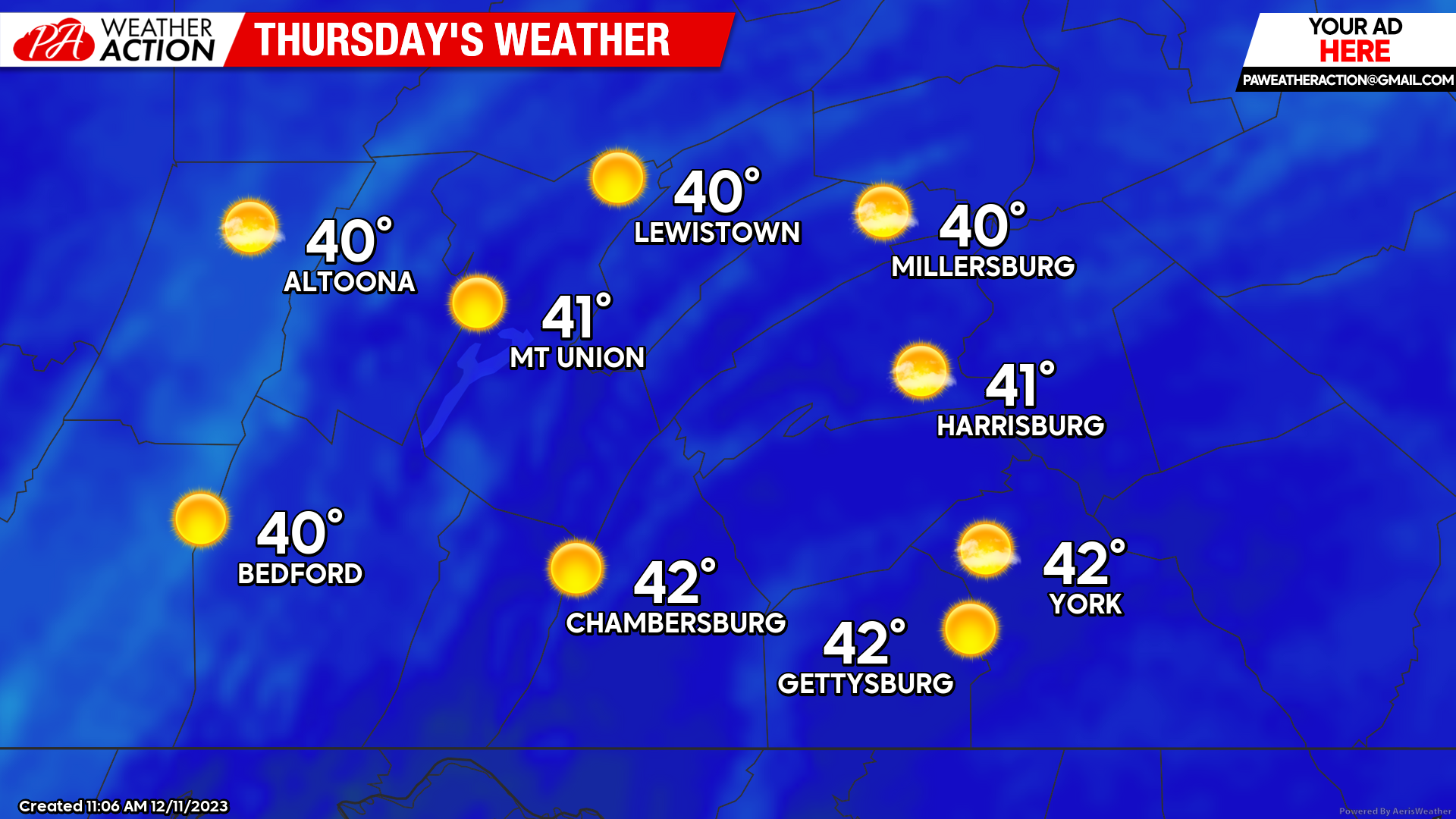
 THURSDAY:
Thursday will be much of the same as Wednesday with high temperatures climbing into the low-40s with generally mostly sunny skies. With high pressure building overhead, we will also see a break from the winds. It will be a bright- yet chilly afternoon!
 Overall, it will be quite “boring” in the weather department this week. The next widespread system may not arrive until late next weekend or early next week. With the lack of any true cold air, if this system occurs, it will most likely come in the form as rain. For more updates, follow PA Weather Action on Facebook and/or download the app on your phones!
Denys

You must be logged in to post a comment.