
FINAL CALL POSTED, SEE ARTICLE LINKED:
The finer details about this weekend’s major winter storm are coming into focus, as short range guidance comes into play and we begin to observe the storm coming together. The north trend that started since the inception of this storm’s potential has continued over the last day.
As a result, all of Southeast PA and most of South Central PA will likely change from snow to sleet or even freezing rain on Sunday afternoon. Areas elsewhere, such as Southwest PA and all of Northern PA look safe. This aligns well with our past experiences with major storms in the last decade.
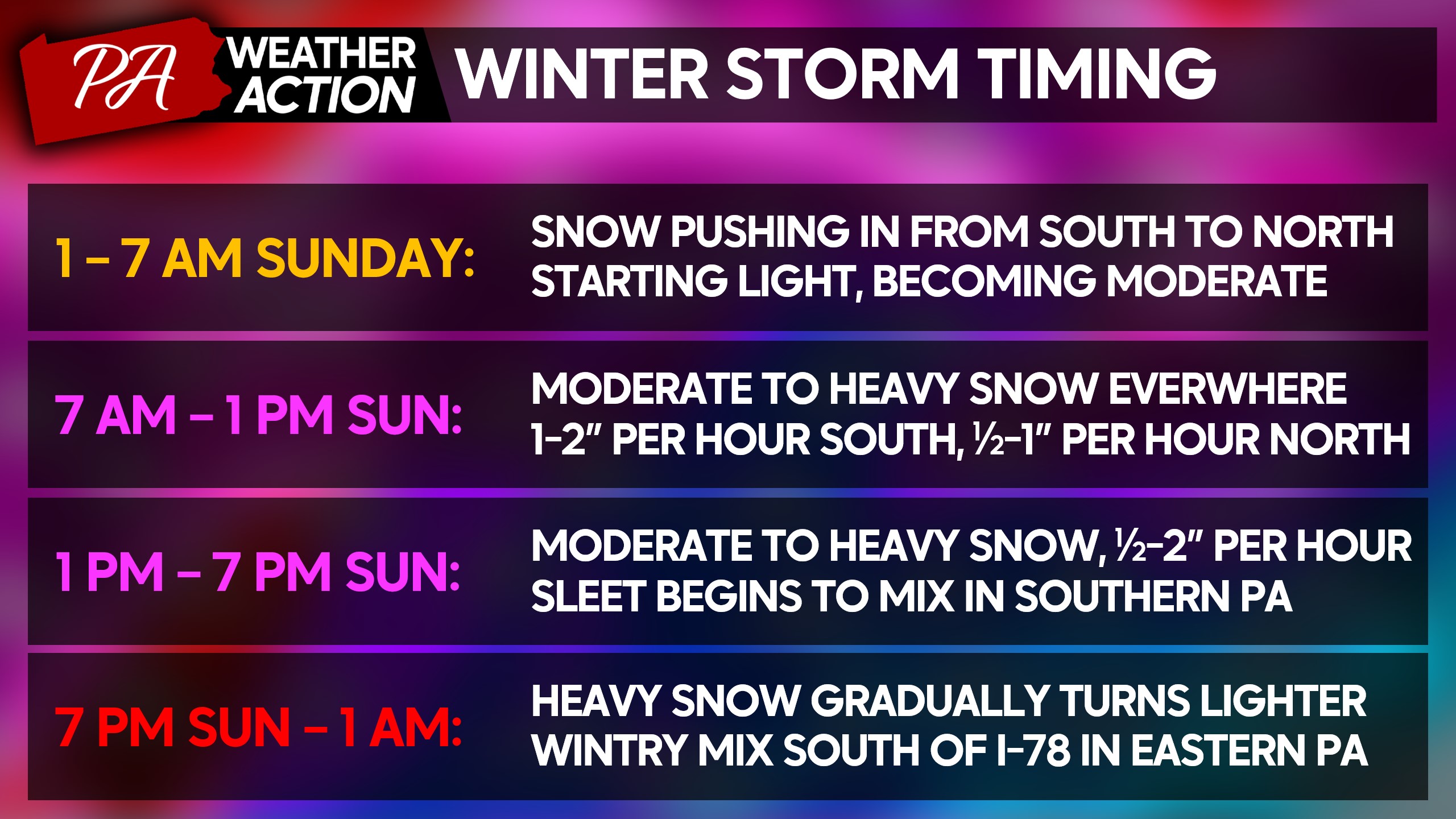
When Will the Storm Start and End?
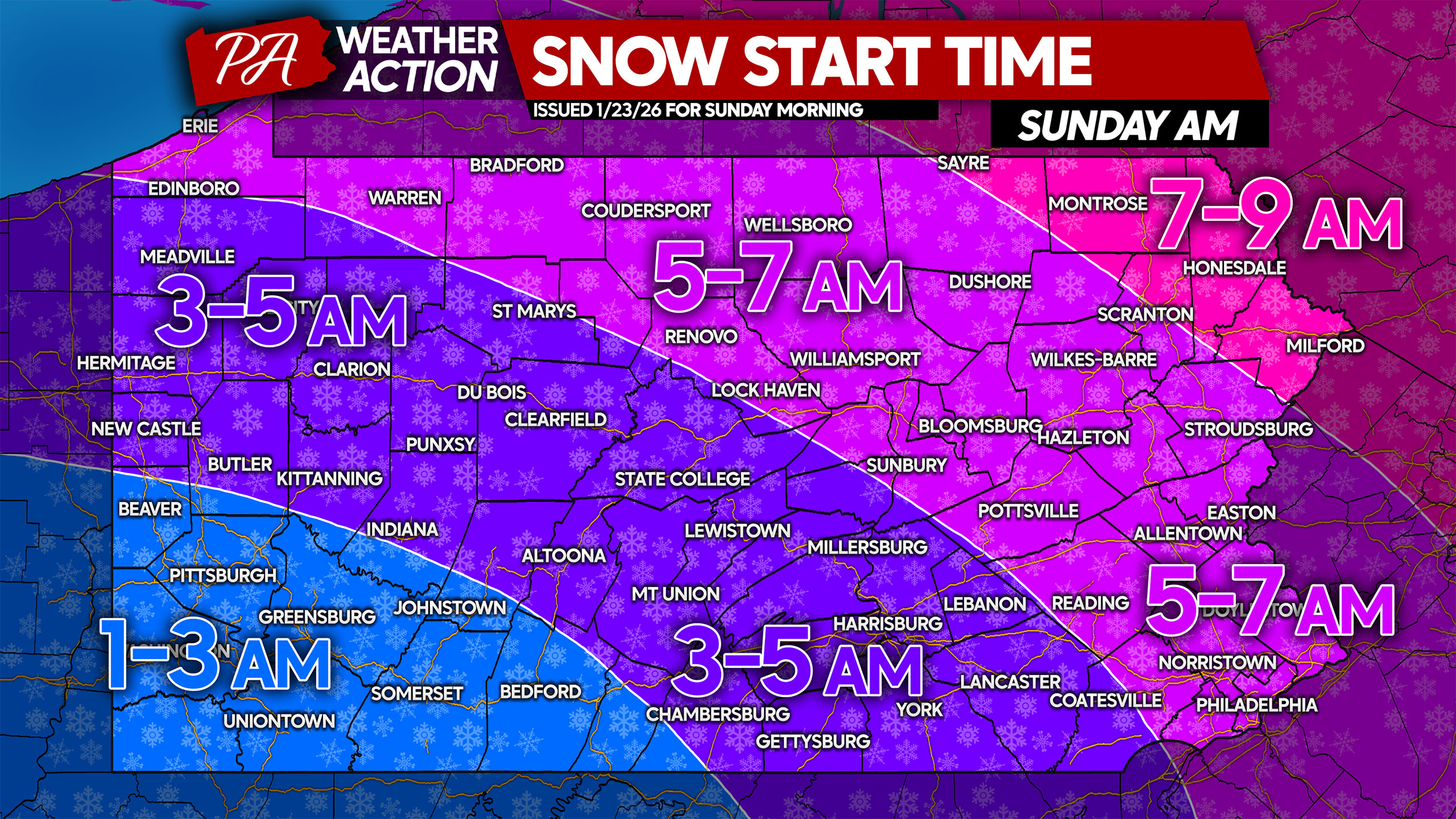
Light snow will push in from southwest to northeast Sunday morning, before sunrise for almost all of us. Snow will turn moderate to heavy within about 2-3 hours of starting in any given location. Below is when you can expect snow to begin in your area.
As mentioned, sleet and freezing rain has crept into the picture across parts of Southern PA. But that change to a wintry mix is not expected until after many hours of accumulating snow.
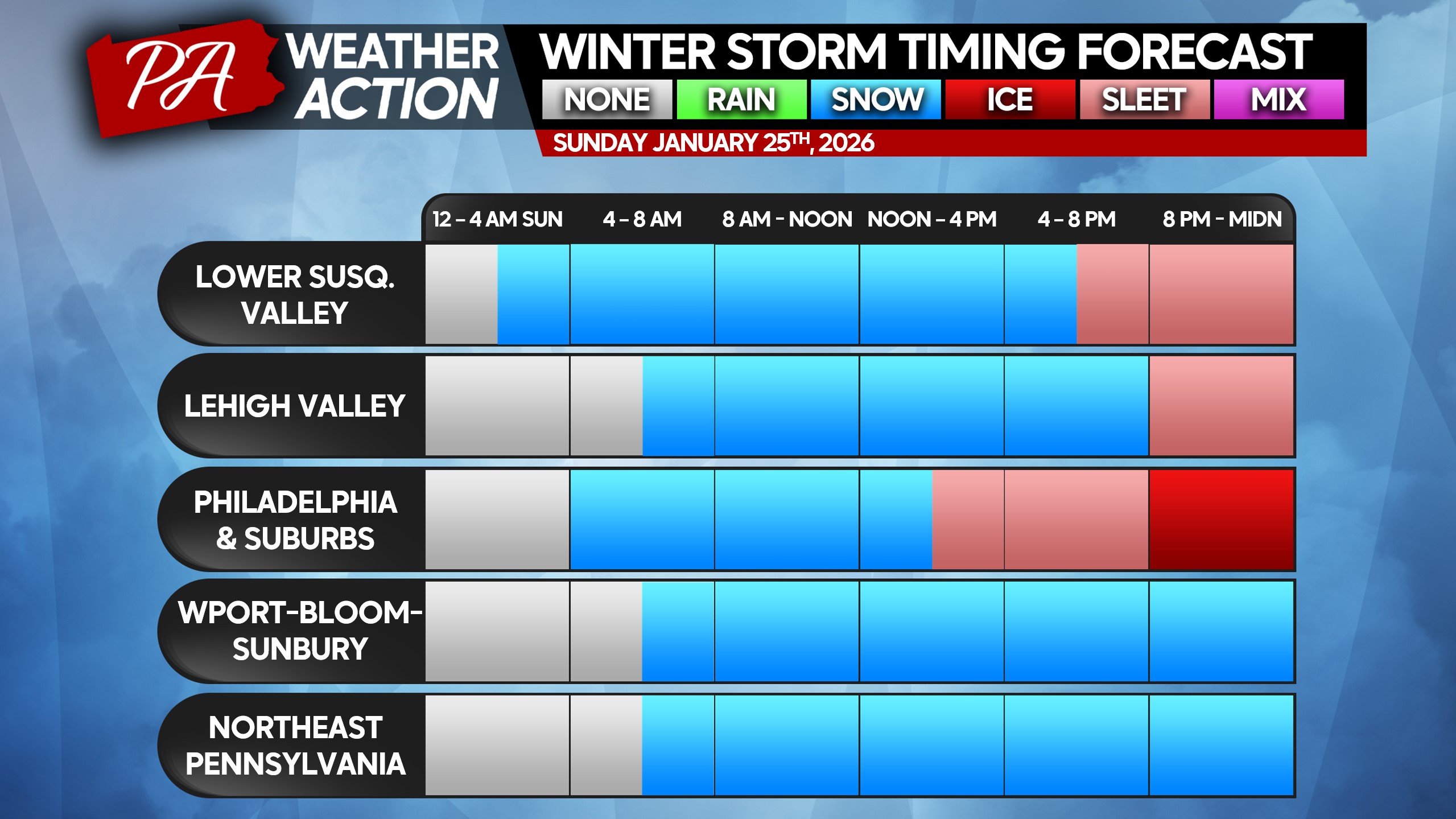
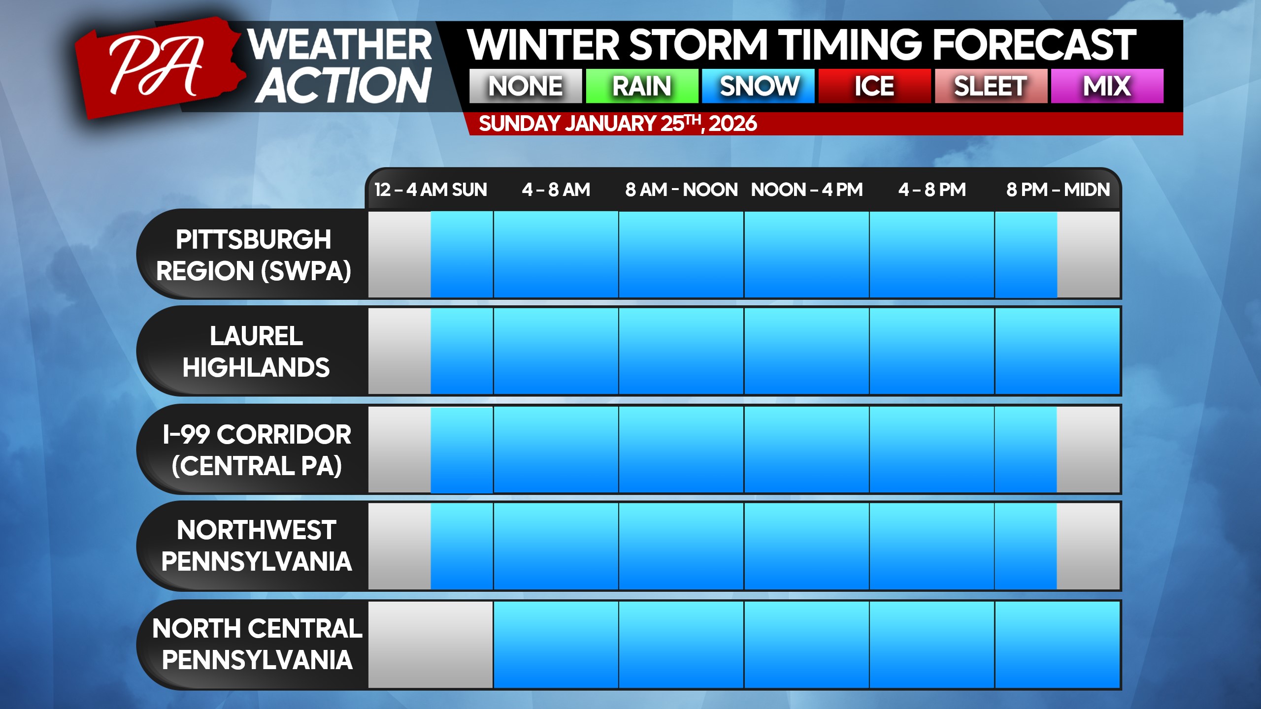
And for most of the state, this is a pure snow event. Heaviest snowfall rates will be from 7 AM Sunday through 10 PM. In addition, some lingering light to perhaps moderate snow will persist in Western and Northern PA into the predawn hours of Monday.
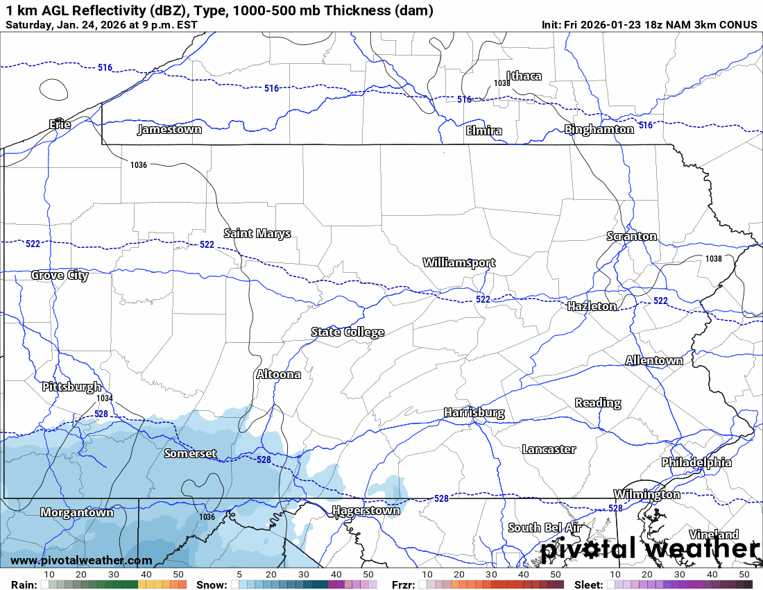
Below is a look at the latest High Resolution NAM model, showing moderate to heavy snow in the picture for many hours. It also illustrates that sleet coming onto the scene in the southeast quarter of Pennsylvania.
The timestamp is in the top left corner, just above the edge of the map.
Here is a breakdown of the storm on a clean and concise graphic.
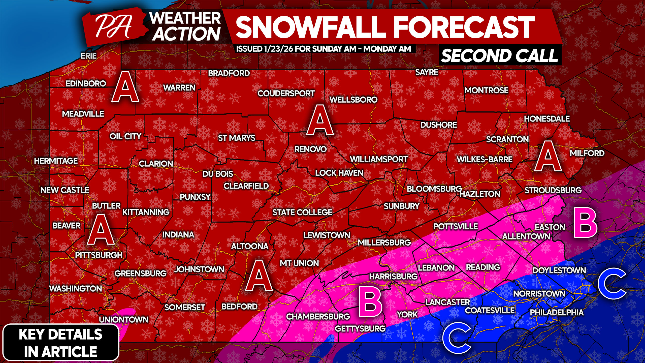
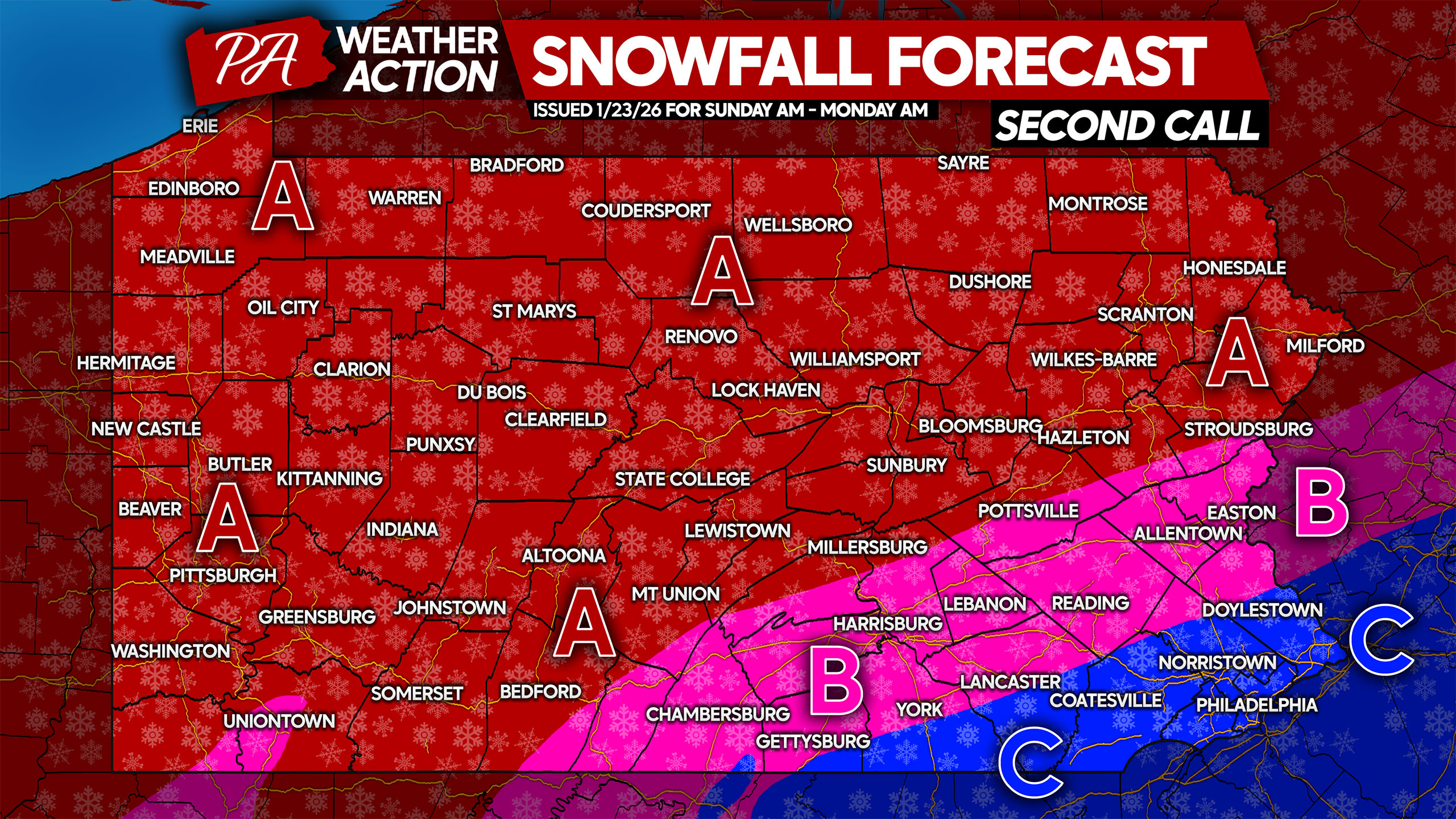
SECOND CALL SNOWFALL FORECAST FOR SUNDAY – EARLY MONDAY IN PA
This will be a fluffy snow, meaning it will be easier to shovel if you take your time. Do not try to shovel too much at once, as exhaustion and/or injury could occur. Stay hydrated when shoveling, and take breaks.
Isolated power outages may occur especially in more prone areas, but are unlikely for most of us. Blowing and drifting is likely Monday with west winds, meaning some roads will become snow-covered once again.
Area A: Snowfall accumulation of 12 – 16″ expected, with all snow anticipated. Do not travel Sunday unless absolutely in an emergency, as you may be stranded. Schools and some businesses will likely be closed Monday and Tuesday.
Area B: Snowfall accumulation of 8 – 12″ expected, with a changeover to sleet later on Sunday. Do not travel Sunday unless absolutely necessary, as you may be stranded. Schools and some businesses will likely be closed Monday, possibly Tuesday.
Area C: Snowfall accumulation of 6 – 8″ expected, with a changeover to sleet and eventually freezing rain likely. A glaze to a tenth-inch of ice is anticipated. Avoid traveling Sunday unless it’s 100% necessary. Schools will likely be closed Monday.
Our Final Call Snowfall Forecast will be posted at 5:00 PM Saturday, stay tuned!
Don’t forget to share this important info with friends and family below!
You must be logged in to post a comment.