
The Final Call Forecast has been posted as of Wednesday evening, please view the article linked below.
Final Call Ice & Snow Forecast for Tonight into Thursday’s Winter Storm in Pennsylvania
We have been able to escape a widespread significant ice storm the last few winters, but not this one! Very fitting with how cold January was relative to seasons prior. And the cherry on top is this is only the first of two ice storms we are watching, with the second coming Saturday afternoon into Sunday morning.
A Tier 4 travel ban has been issued by PennDOT on many state highways, starting 7 PM Wednesday. A Tier 4 ban prohibits travel for all vehicle types except cars, pickup trucks, and EMS vehicles. For more details, view the PennDOT website here.
Pennsylvania is a big state with loads of mountain ridges and valleys. This makes forecasting wintry precipitation type much less clear cut. Thursday will be a good example of that, with model guidance fighting over how long sleet hangs on before changing to freezing rain, and then how long the surface stays below freezing.
It all comes down to temperatures here on the ground to a few thousand feet up, and a difference of a degree is all it takes. This weekend’s system looks to have a slightly higher chance of having at least some snow on the front end in Central and Eastern PA, but it will not stay snow.
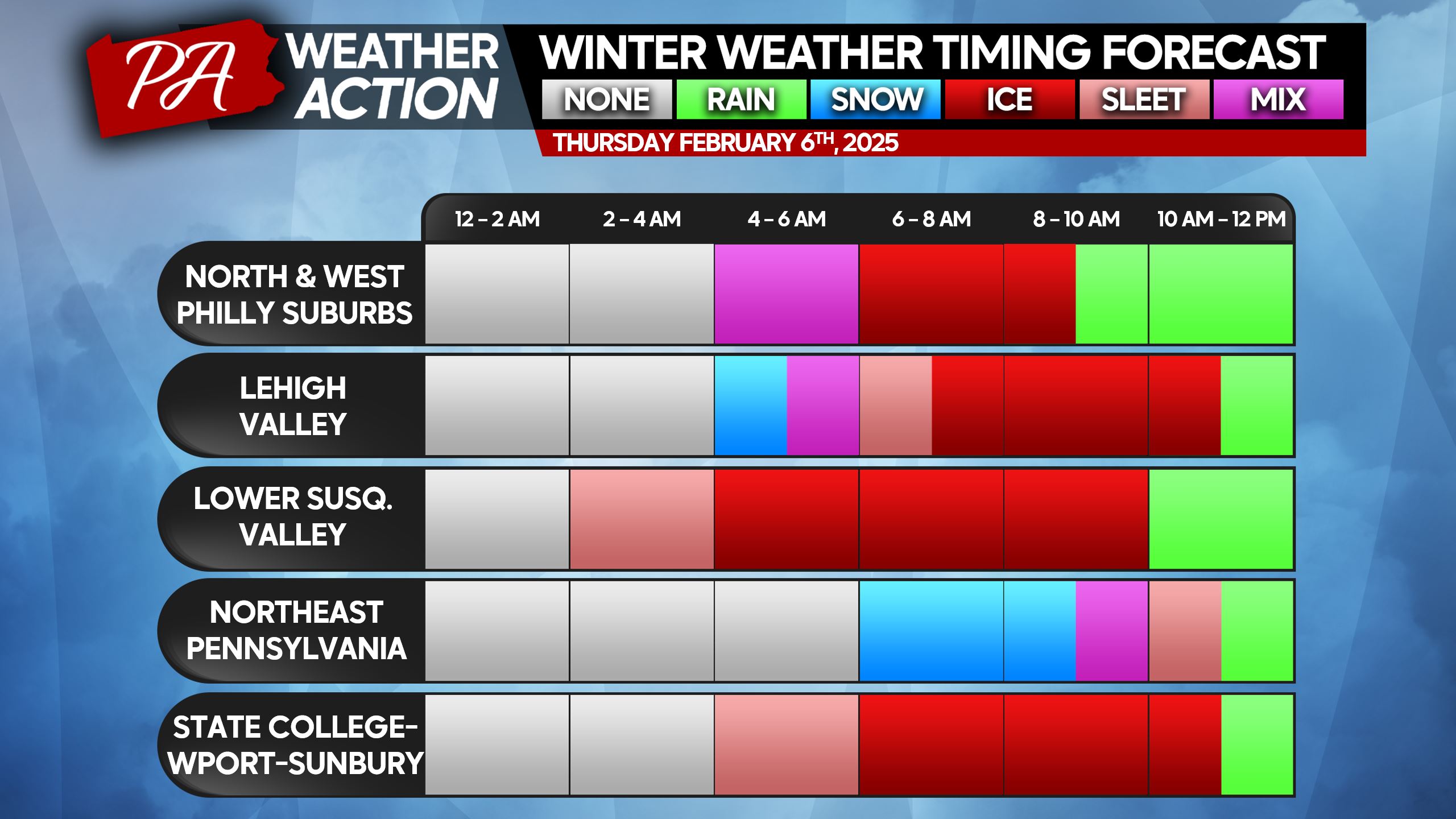
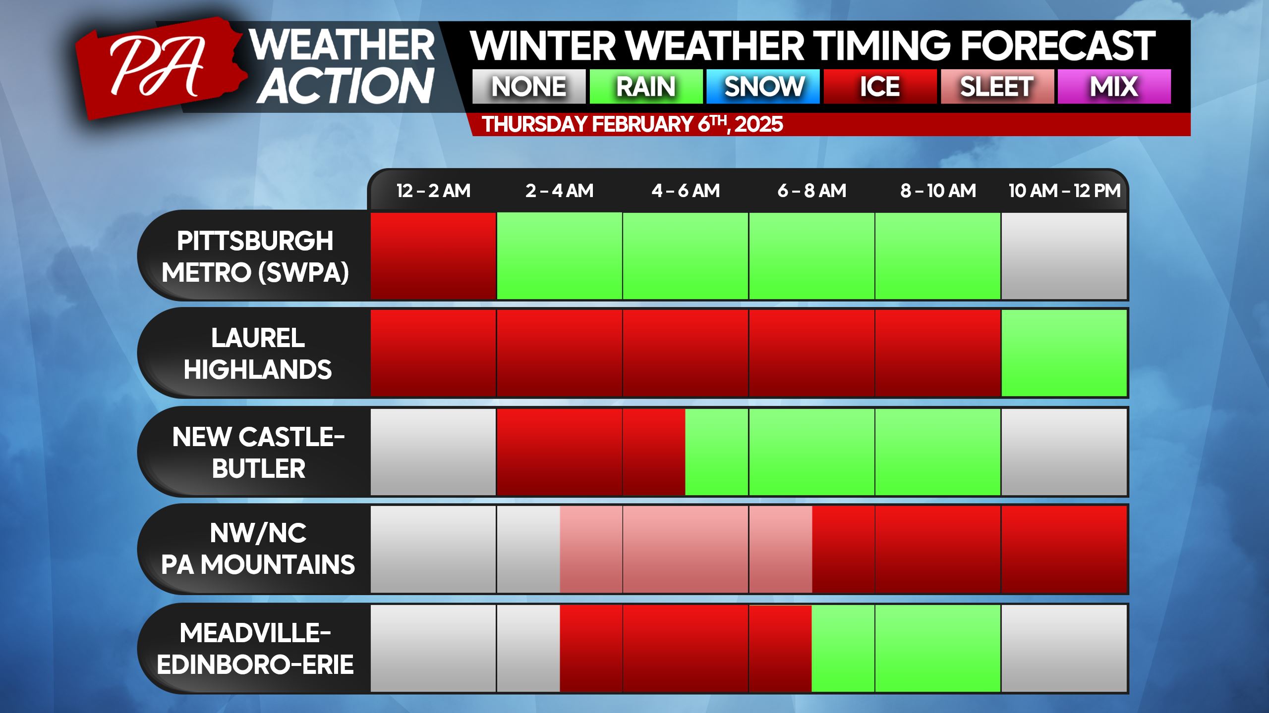
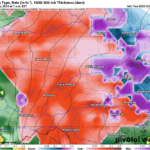
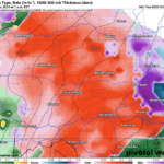
WINTRY PRECIPITATION TIMING CHARTS
When looking at these charts below, understand the most dangerous precipitation type is freezing rain. Especially because it’s deceiving, and you may think since there’s no snow, it’s not slippery. When in fact, it’s very slick and you can hardly walk down the driveway without falling.
Cold air damming will play a role in this, but the battle will be between sleet and freezing rain. The longer a given area hangs onto sleet, the lesser the impacts will be. Please find your nearest city or region below.
SECOND CALL SNOW & SLEET FORECAST FOR THURSDAY
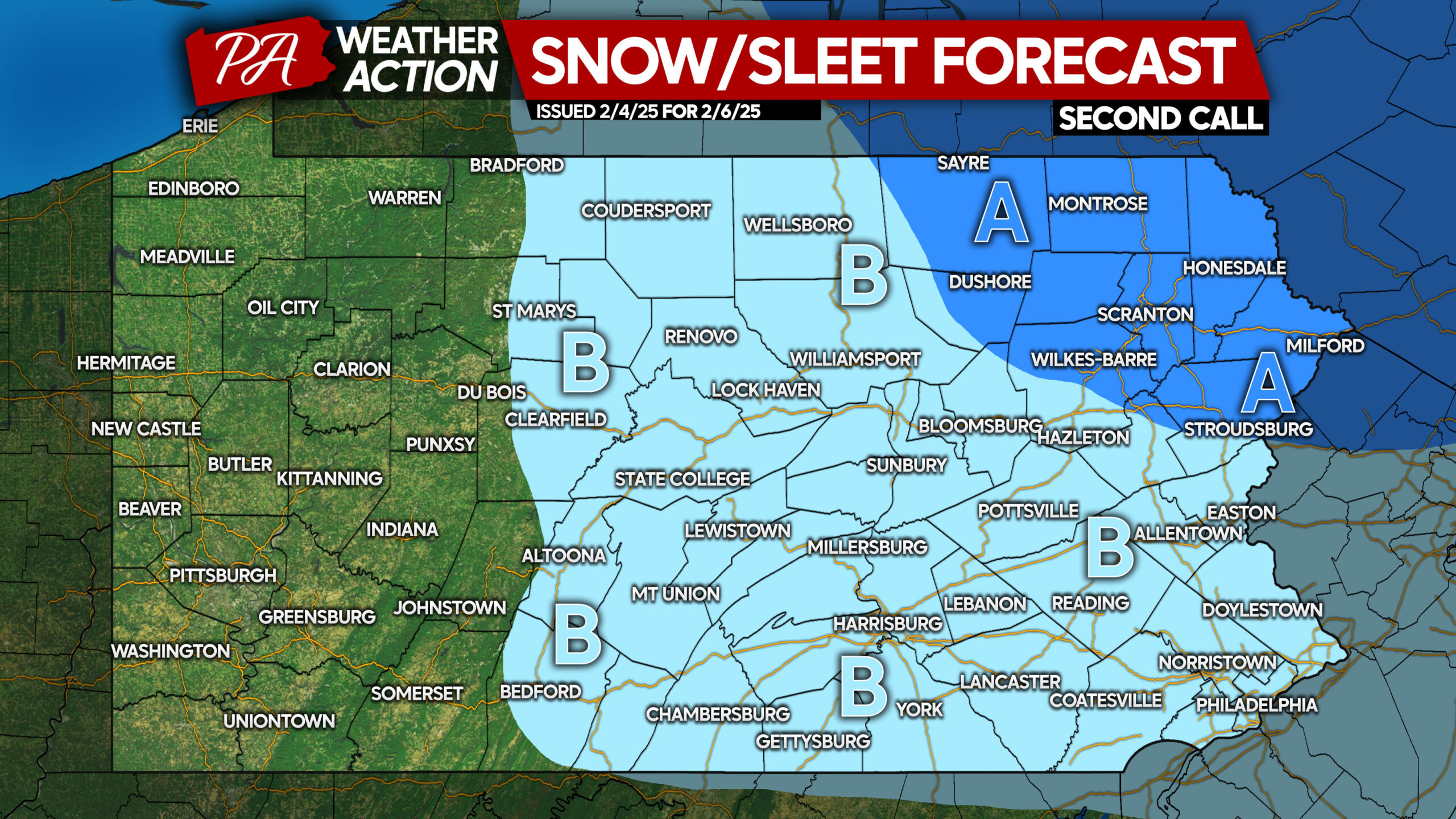
Area A: Snow and sleet accumulation of 1 – 3″ expected. Travel is discouraged until lunchtime Thursday.
Area B: Snow and sleet accumulation of less than 1″ expected. Travel is discouraged until lunchtime Thursday, or until temperatures rise to 33 degrees.
SECOND CALL ICE FORECAST FOR THURSDAY
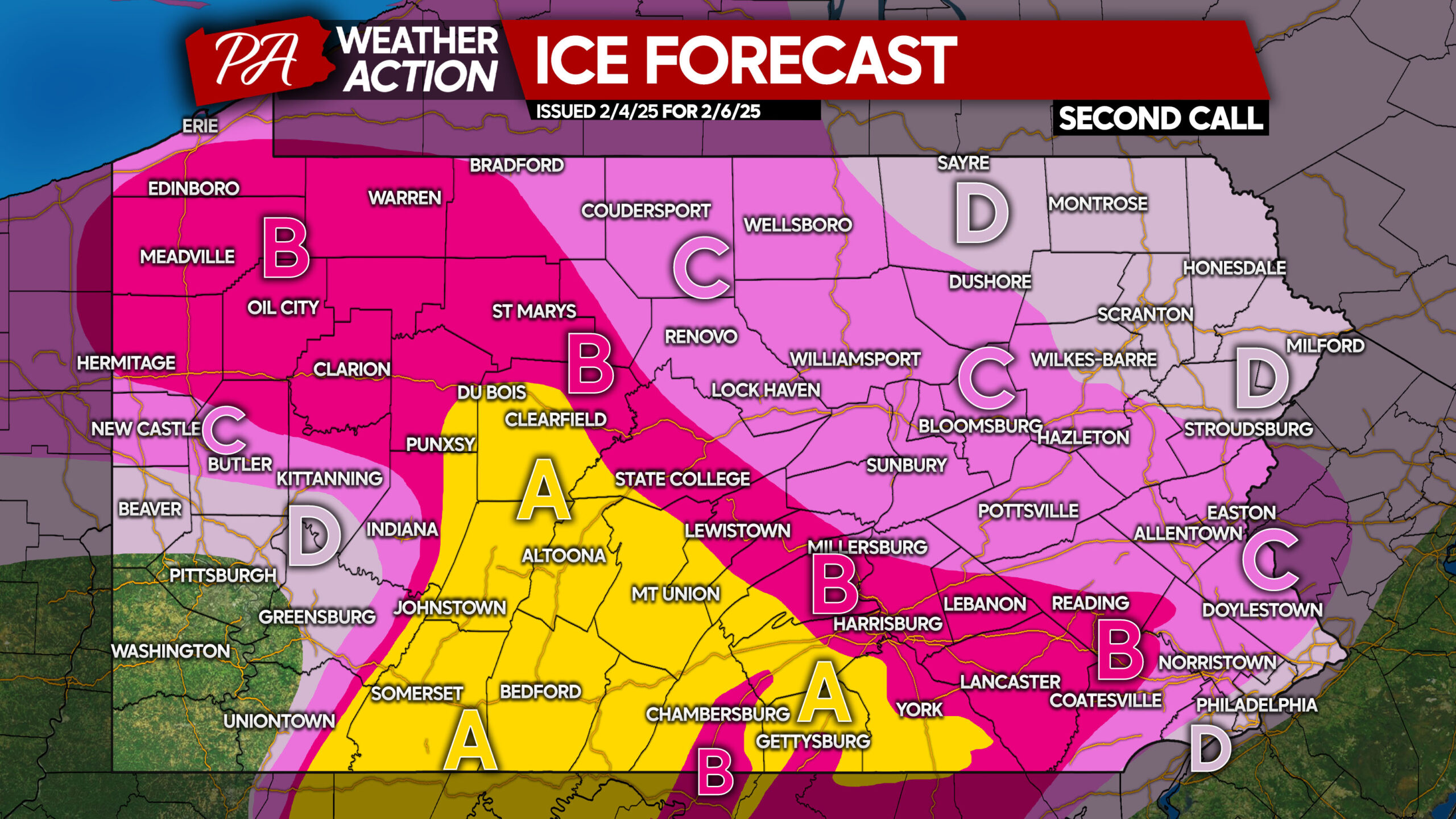
Any outdoor activities should be avoided until temperatures rise above freezing Thursday. School delays/closings are likely in Areas A, B, and C.
Area A: Ice accumulation between a quarter and a third of an inch expected. Roads will be extremely slippery, and travel is highly discouraged.
Area B: Ice accumulation between a tenth to a quarter of an inch anticipated. Roads will be very slippery, and travel is discouraged.
Area C: Ice accumulation between a twentieth and a tenth of an inch expected. Slick road conditions will cause unsafe travel.
Area D: Ice accumulation of a hundredth to a twentieth of an inch anticipated. Untreated surfaces will likely be slippery.
Be sure to share this forecast with friends and family if you haven’t yet. Let’s avoid accidents and falls as much as possible!
You must be logged in to post a comment.