
An active weather pattern is shaping up over the region for at least the next 10 days. Today, however, will be calm and quiet. Below is a look at the latest satellite imagery:

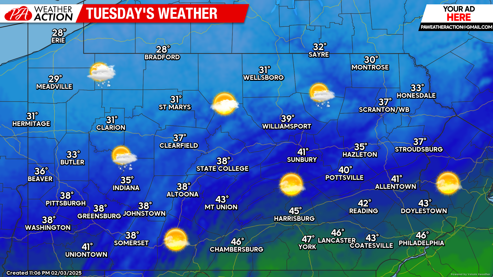
Today’s Weather Forecast: 9/10
A beautiful day is expected today across the state with most areas reaching the 30s and 40s. A passing snow shower cannot be ruled out, especially across northwestern Pennsylvania.
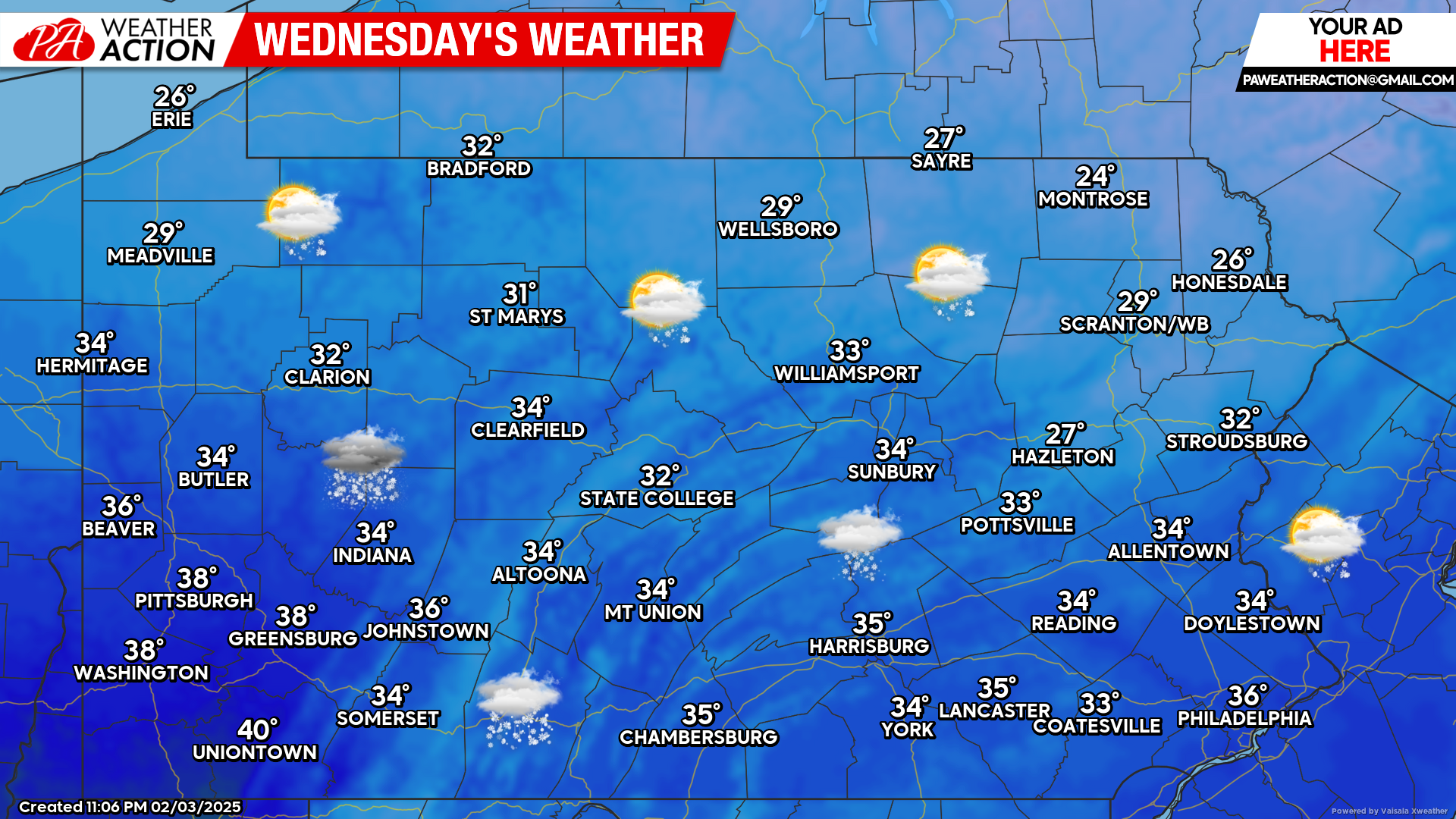
Wednesday’s Weather Forecast: 3/10
The first half of Wednesday will be dry. Heading into the evening hours, the next winter storm will be impacting the state mainly in the form of sleet and freezing rain. This will continue into Thursday morning.
European Model Future Radar Valid for 7:00 AM Thursday morning:
While this upcoming winter storm will not provide significant snow to the area, widespread significant ice is likely across the state. This will ultimately lead to dangerous driving conditions Wednesday night into Thursday morning.
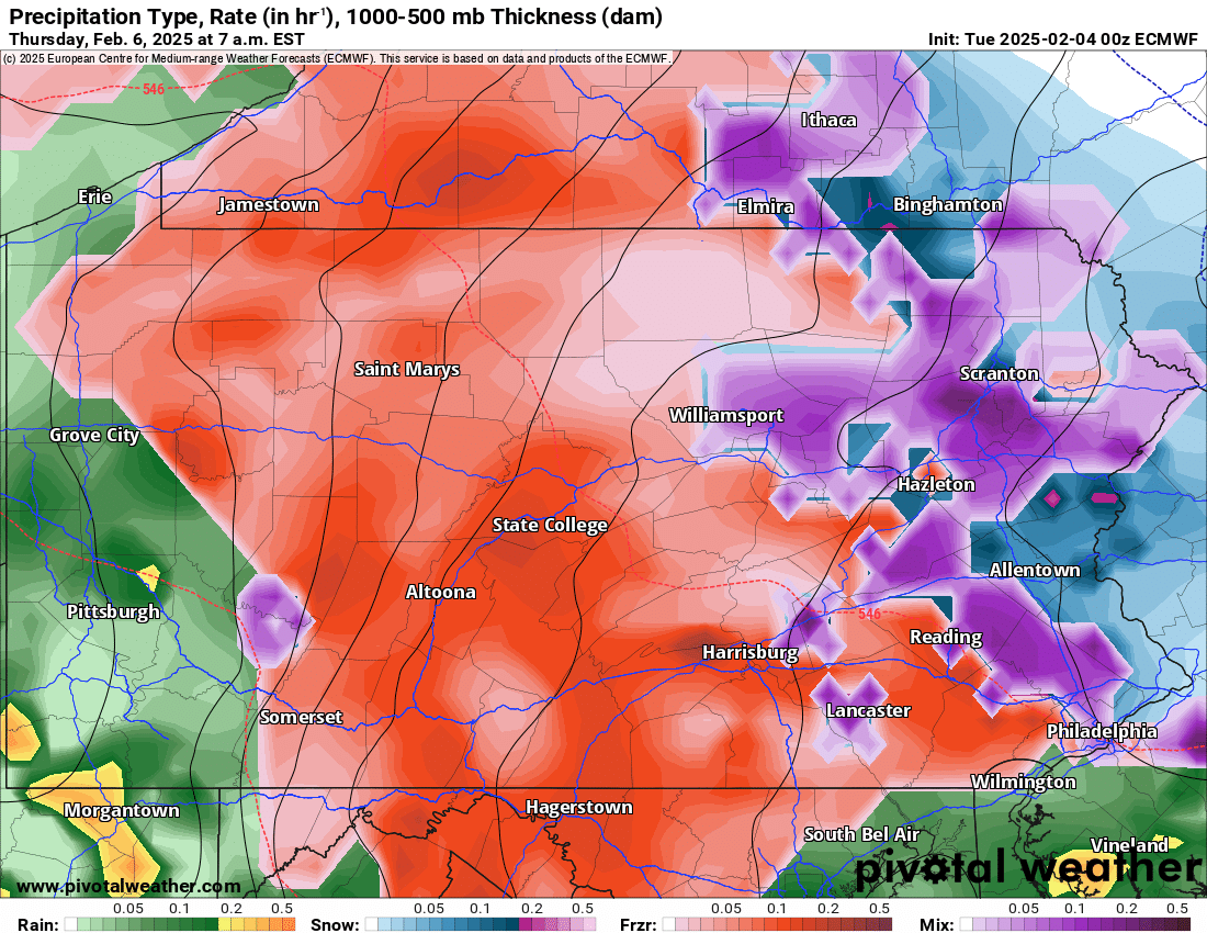
The European Model above illustrates what we can expected early Thursday morning. The majority of the precipitation type will be in the form of sleet and freezing rain. It is possible that some areas start as a period of snow before quickly changing over.
Everyone will likely end as plain rain by the later morning hours Thursday. We want to emphasize if you have travel plans anytime between Wednesday evening and Thursday morning, please plan accordingly. Freezing rain is arguably the most dangerous precipitation to drive in.
We will have an updated snow and ice forecast later this afternoon. If you missed our first call snow, sleet and ice forecast for the upcoming winter storm, please click on the link below:

You must be logged in to post a comment.