
If there’s one thing we can all agree on, its that nobody likes ice and sleet. Yet we find ourselves again in the middle of a wintry mess, as Upstate New York and New England see significant snow. This pattern is very latitude-based, as we projected in our February outlook. And currently, storm centers are moving right over our head, which is not ideal for all snow.
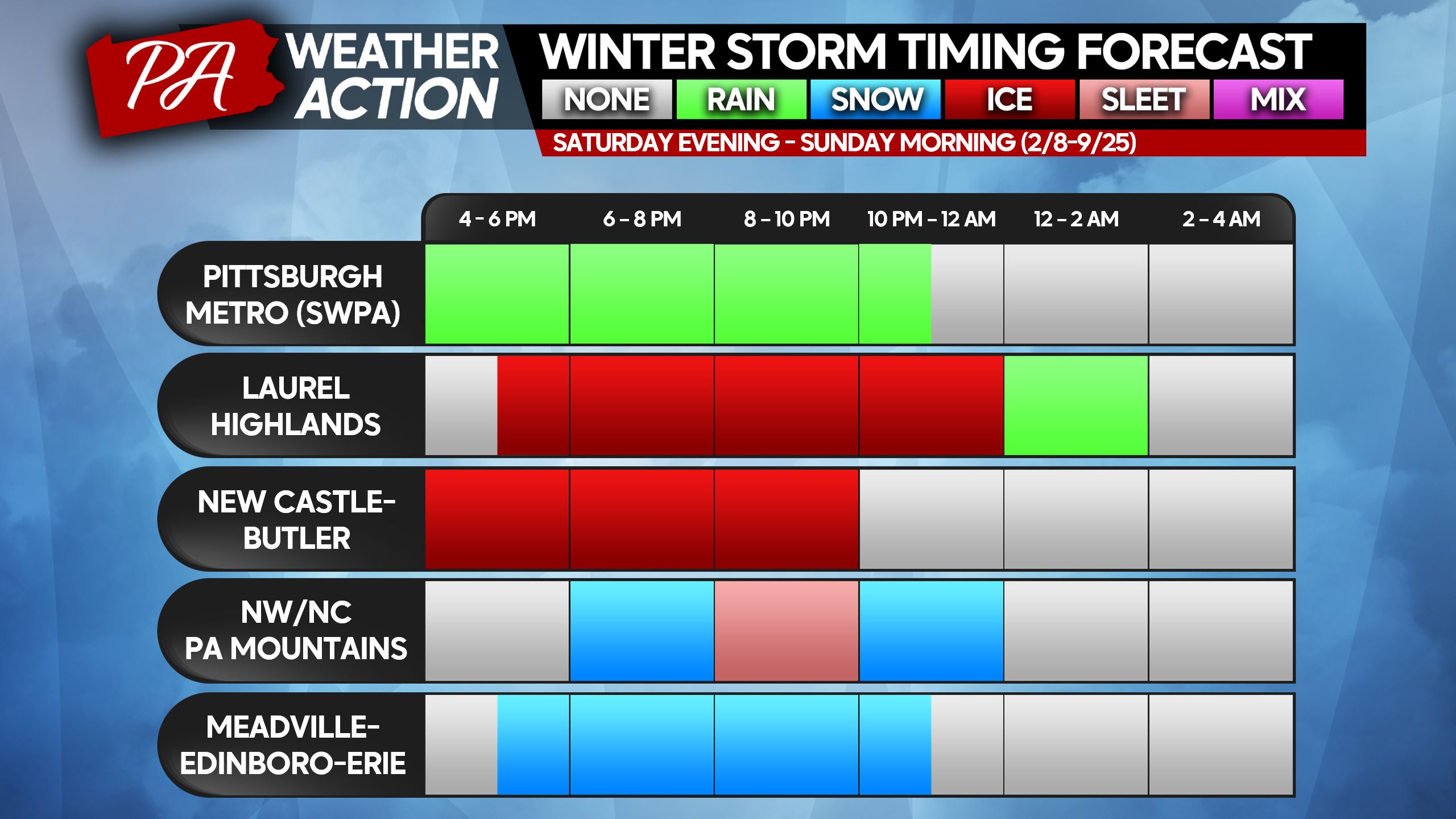
The good news is Super Bowl plans will be unaffected. The bad news is the entirety of Saturday evening now looks treacherous in most of the state. In this type of pattern, Southwest PA will always be the 35 degree and rainy exception. But trust the rest of us, you’re not missing anything special.
As we look towards next week, Tuesday into Wednesday’s storm is looking weaker and south. That doesn’t mean no snow for us, but light to moderate accumulations possible instead of a big storm. That storm looks to be followed by a warmer and wetter storm for most, of course.
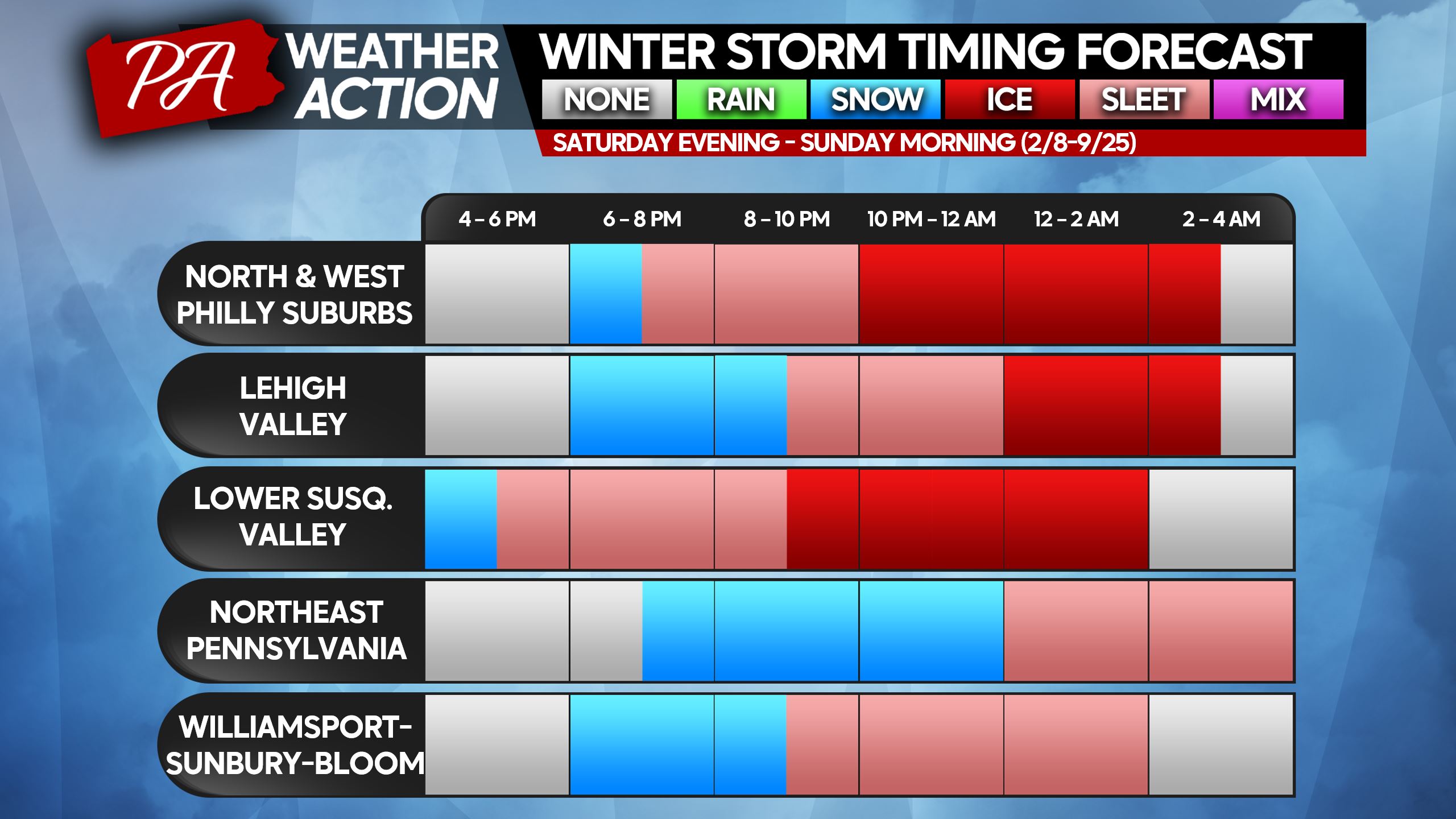
WINTER STORM TIMING CHARTS
A mixture of wintry precipitation will enter the area late Saturday afternoon to early Saturday evening from southwest to northeast. Most of us will see some flakes flying at the onset, but they won’t last long south of the northern mountains. A changeover to sleet and freezing rain will swiftly occur just after dinnertime Saturday.
Worst travel conditions will be dinnertime Saturday through early Sunday morning. But temperatures won’t go above freezing until after sunrise Sunday, so roads will still be in poor shape until probably 7 – 9 AM Sunday.
Please find your nearest city/area on the graphics below.
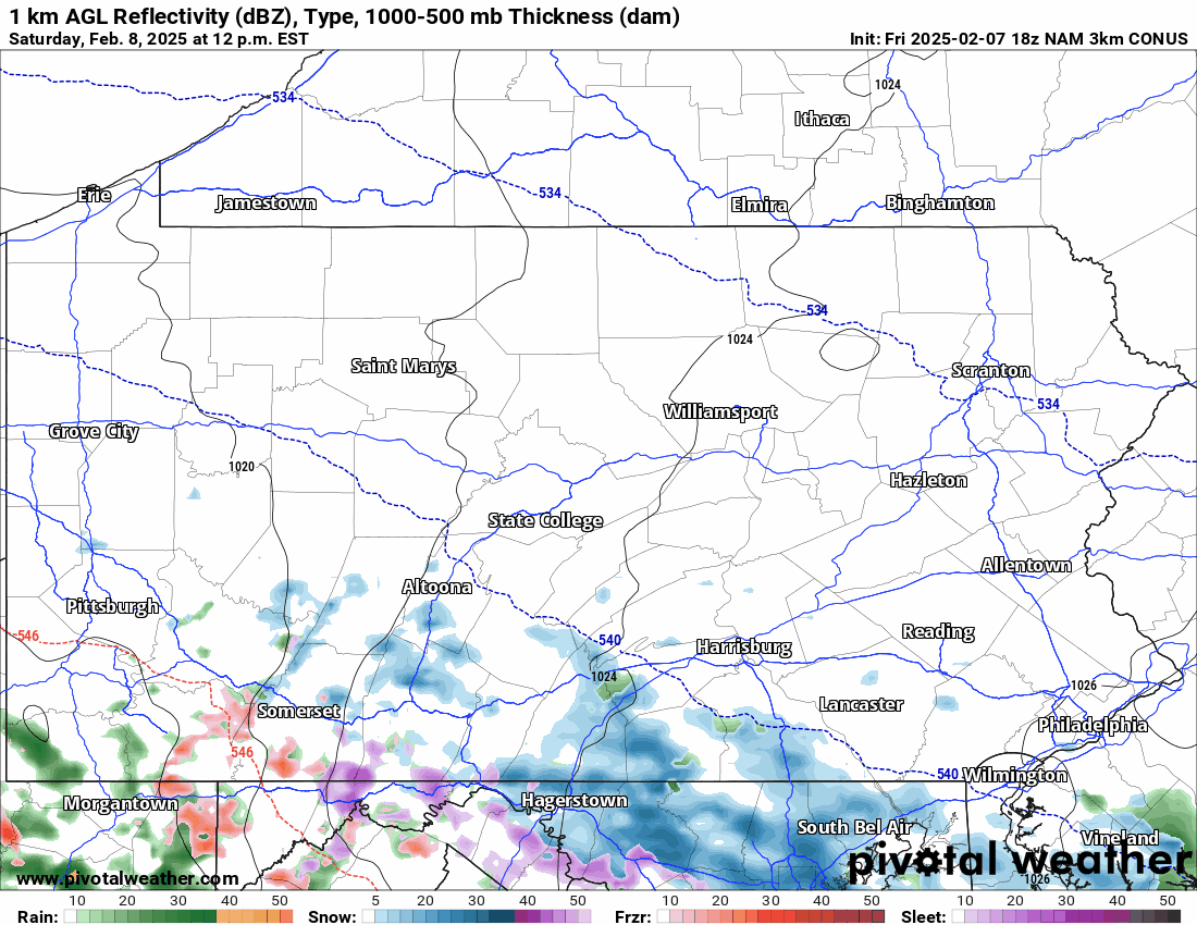
Future radar from the Hi-Res NAM Model for the duration of the event is below as a recurring loop.
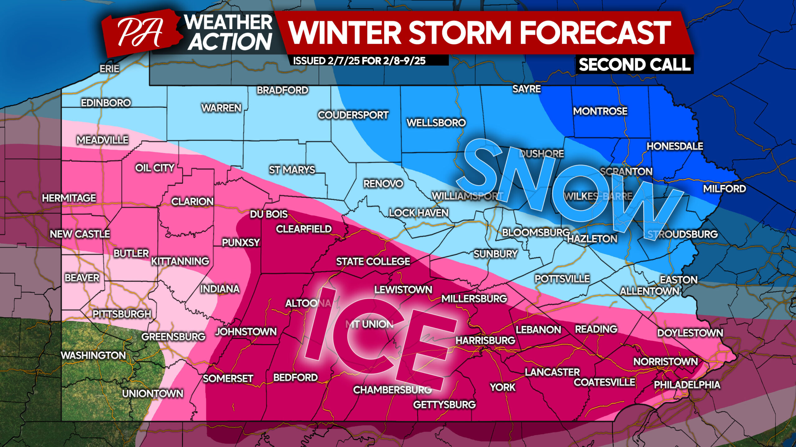
SECOND CALL ICE FORECAST FOR SATURDAY EVENING – SUNDAY MORNING
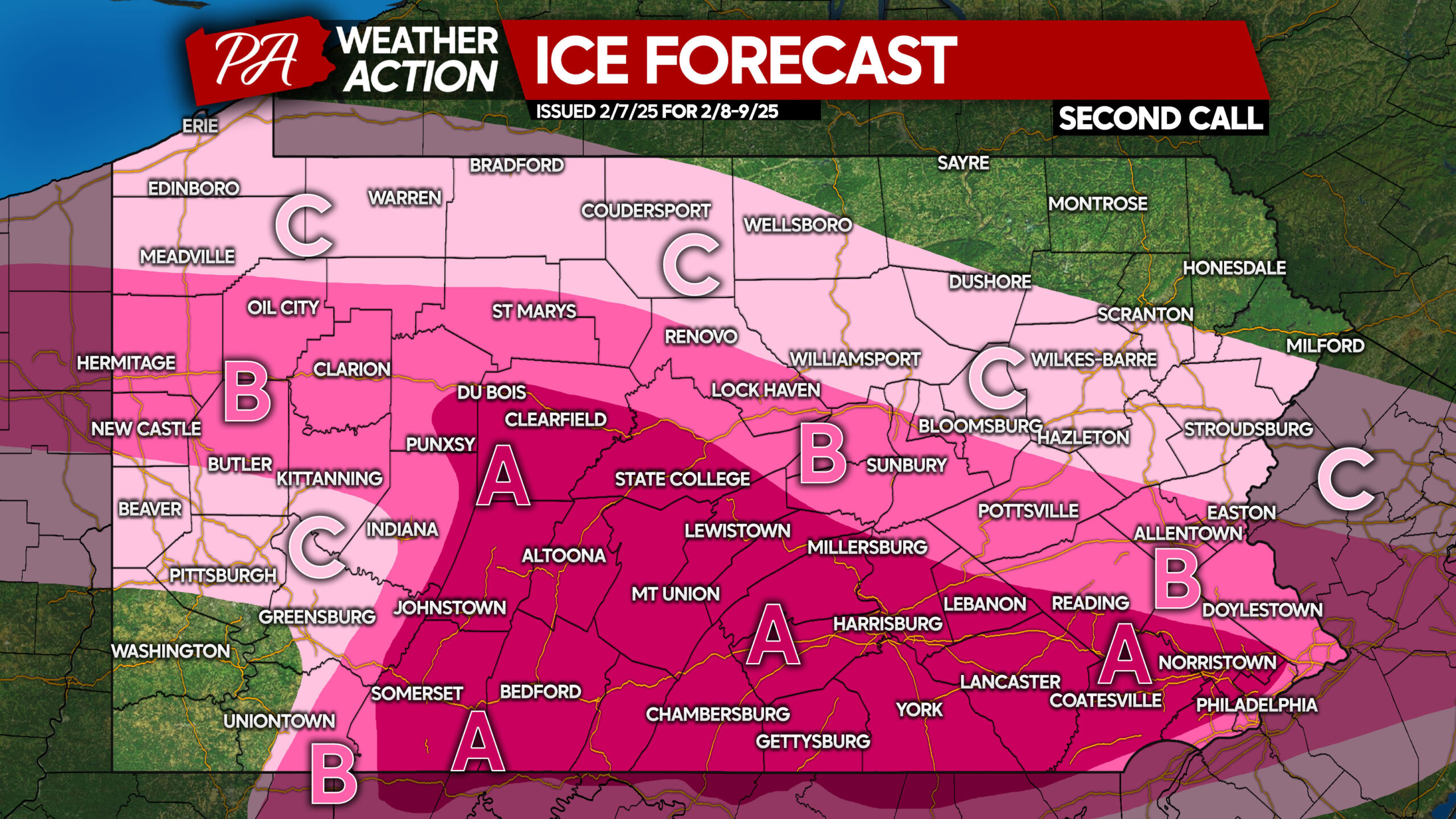
Area A: Ice accumulation between a tenth to a quarter of an inch (0.10 – 0.25″) anticipated. Roads will be icy, and travel is not advised.
Area B: Ice accumulation between a twentieth and a tenth of an inch (0.05 – 0.10″) expected. Slippery roads will cause unsafe travel conditions.
Area C: Ice accumulation of a hundredth to a twentieth of an inch (0.01 – 0.05″) anticipated. Untreated surfaces will be slippery.
SECOND CALL SNOW/SLEET FORECAST FOR SATURDAY EVENING – SUNDAY MORNING
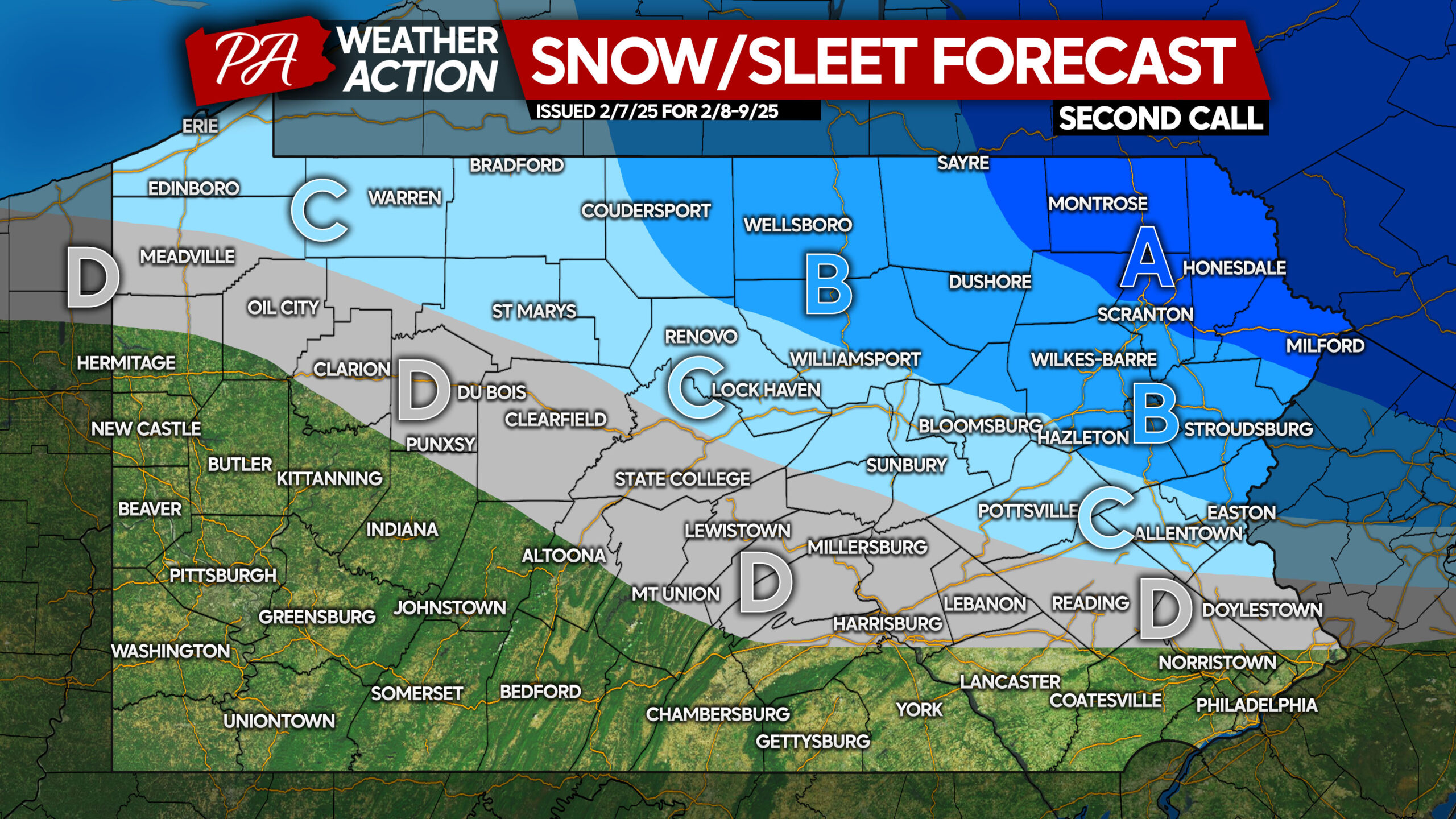
Area A: Snow and sleet accumulation of 4 – 6″ expected. Snow-covered roads will cause hazardous travel conditions.
Area B: Snow and sleet accumulation of 2 – 4″ anticipated. Snow-covered roads will lead to harsh travel conditions.
Area C: Snow and sleet accumulation of 1 – 2″ expected. Slushy roads will create poor travel conditions.
Area D: Sleet accumulation of less than 1″ anticipated. Slippery road conditions are likely.
Don’t forget to share this forecast with friends and family who have Saturday evening plans!
You must be logged in to post a comment.