The final call snowfall forecast has been posted as of Sunday evening. Please follow the article below to view it.
Final Call Snowfall Forecast for Monday’s Snowstorm in Parts of Pennsylvania
The first winter storm of the season is on the way to areas of South Central PA, but models continue to battle over this storm. However, we have seen clear southward trends on most guidance which means less snow in PA.
A storm moving in from the Midwest will push directly east, with snow moving into Southwest PA by early Monday morning and rapidly expanding eastward. This will be very high-ratio snow, meaning a fluffy snow with temperatures in the 20s. The question is if moderate snow will be north or south of the Mason-Dixon line.
The American models (GFS, NAM, HRRR) remain well north, but they’ve found themselves on an island as all other guidance has trended heaviest snow into Northern Virginia. This has gone against typical trends, which is why many forecasts favor a more northern outcome.
We thought a consensus would be reached by this point, but that hasn’t yet occurred. Our forecast is now based largely based on the southern-leaning guidance. We don’t expect additional southern trends, but forecast confidence remains medium.
Winter Storm Timing
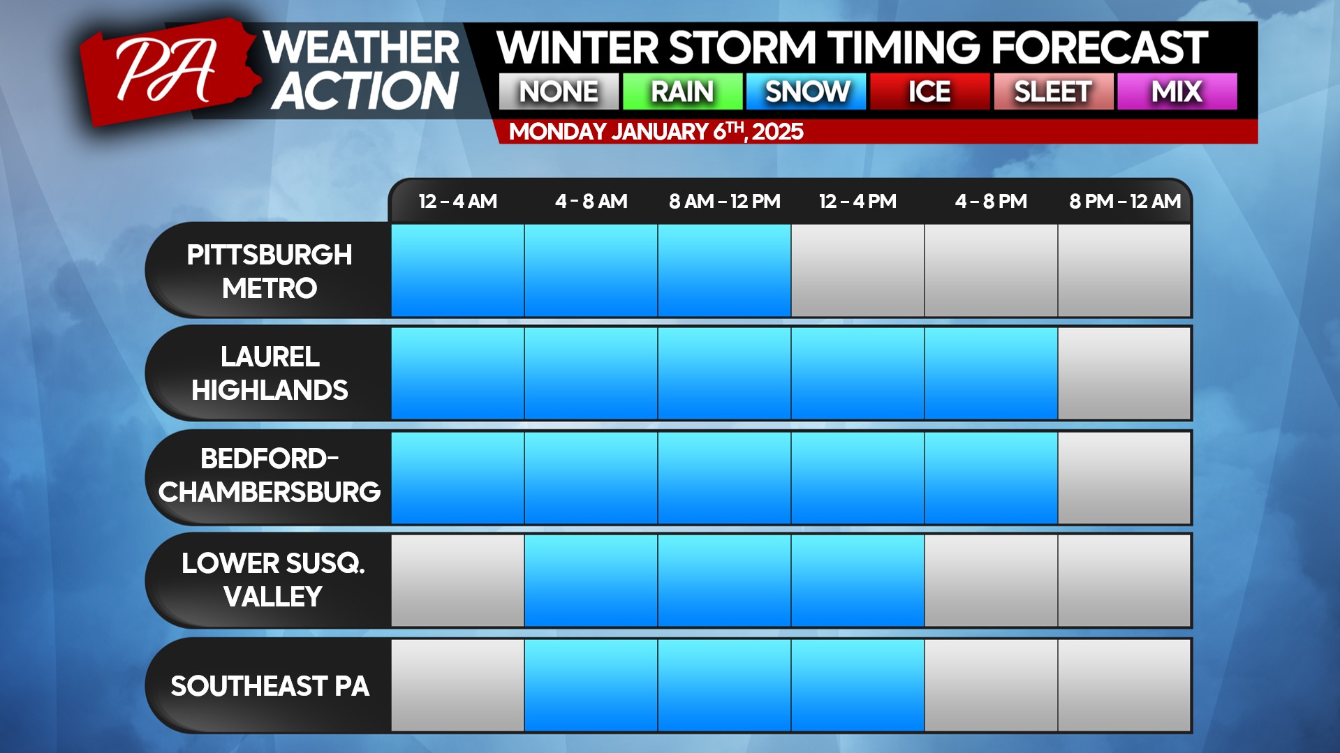
Snow will push in early Monday morning, continuing through the morning hours. Schools are unlikely to delay, as most of the snow will fall during the morning commute through lunchtime or shortly after, depending on location.
North of the southern tier counties of PA, snow is currently expected to remain light. South of there is where more moderate snow is expected. Below is a look at timing for Monday.
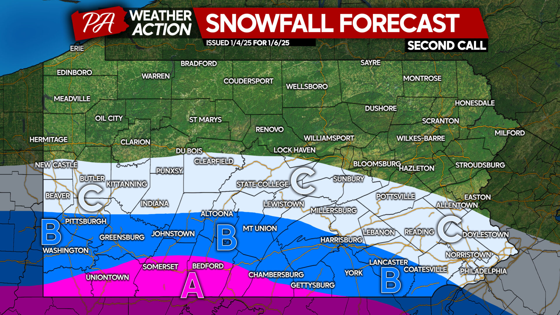
SECOND CALL SNOWFALL FORECAST FOR MONDAY
Area A: Snowfall accumulation of 5 – 8″ expected. School closings are expected, as roads will become snow-covered.
Area B: Snowfall accumulation of 3 – 5″ anticipated. School closings are possible, especially in areas in South Central PA that average less yearly snowfall. Road conditions are likely to be poor during snowfall.
Area C: Snowfall accumulation of 1 – 3″ expected. Road conditions may be impacted, but shouldn’t be too bad.
Our final call snowfall forecast will be posted Sunday at 5 PM. We don’t anticipate significant shifts, as it would be incredible if the American model suite wins out. Either way, we will update you Sunday evening!
Be sure to share this forecast with friends and family in Southern PA!


You must be logged in to post a comment.