
MAJOR CHANGES TO FORECAST, CLICK ARTICLE PREVIEW TO VIEW FINAL CALL:
To begin this article, it’s best to start off by saying that the verdict is still out as far as the model guidance is concerned regarding this storm. Climatology doesn’t give us too much of an indicator as anything can happen in the middle of February. We also factor in how this type of system has behaved in the past. We can hear the thoughts about how weather forecasting is the only profession you can be paid to be wrong in. Fortunately for those thinking that, nobody is cutting us a check every two weeks!
All this to say, do not be taken too off guard if there are changes to this forecast in our final call on Monday. Very recent model trends have shifted everything south, but it’s too early to alter our entire forecast over one run. As always, we will make our absolute best, most accurate possible call at the time of issuance.
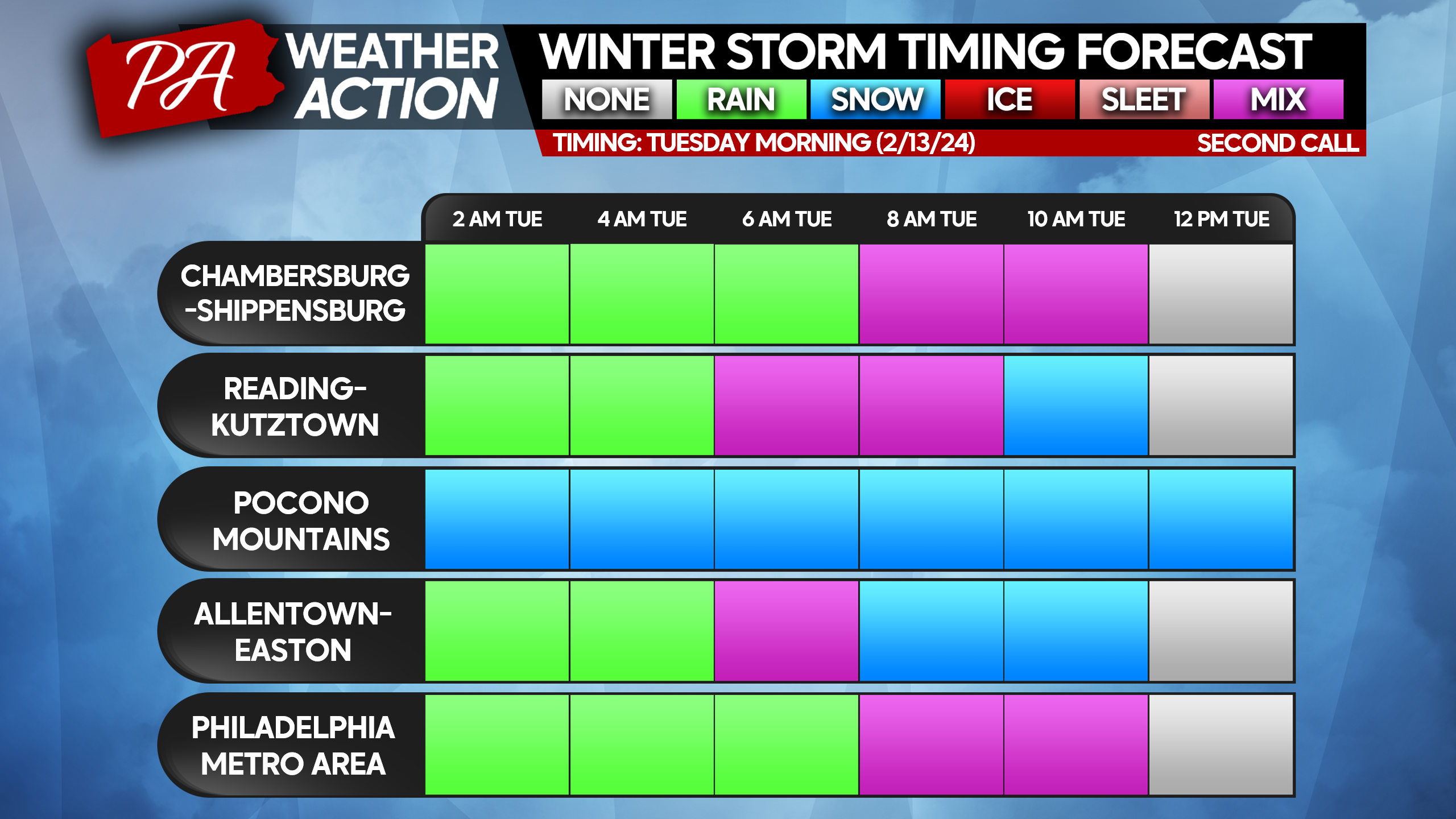
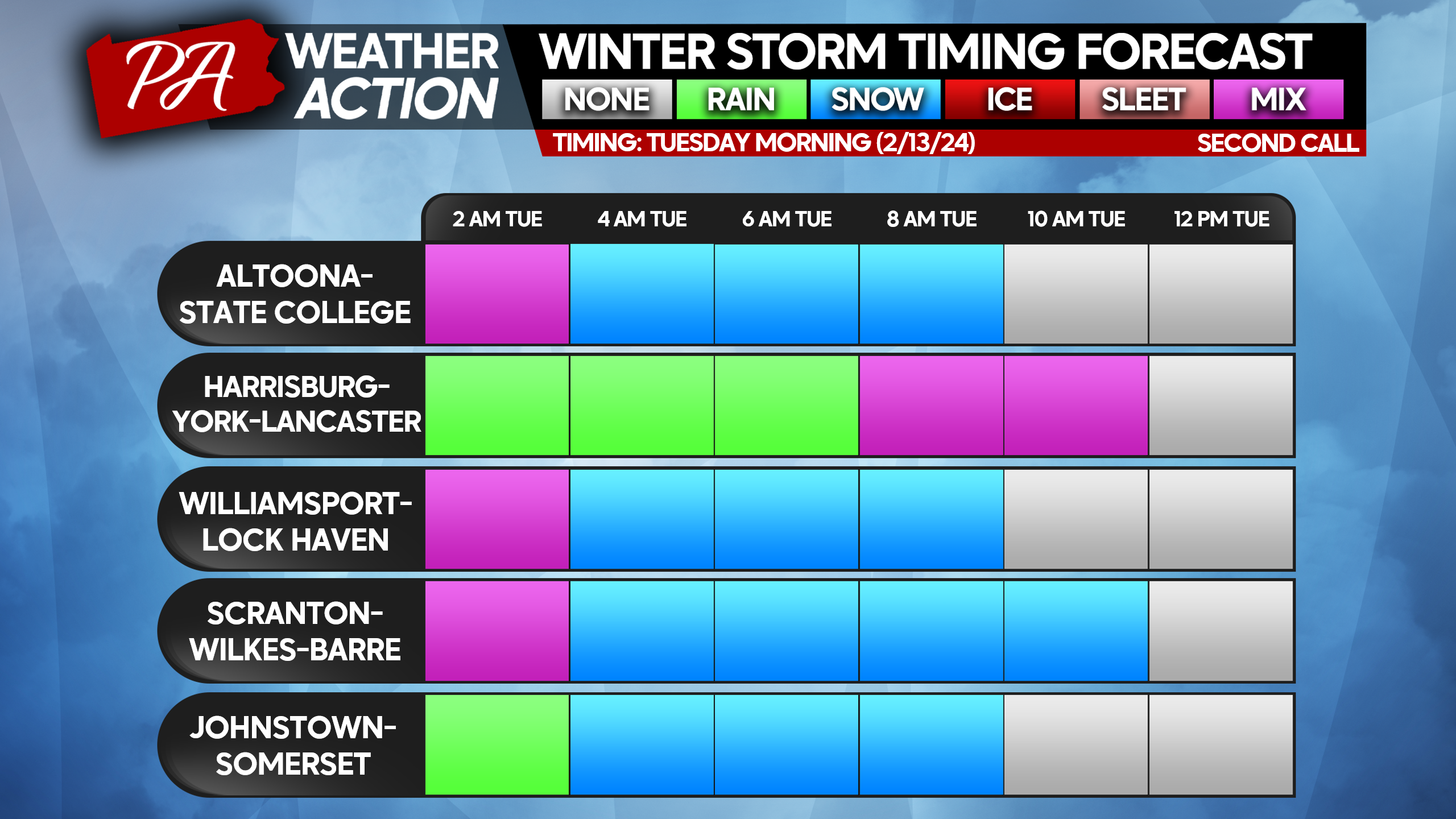
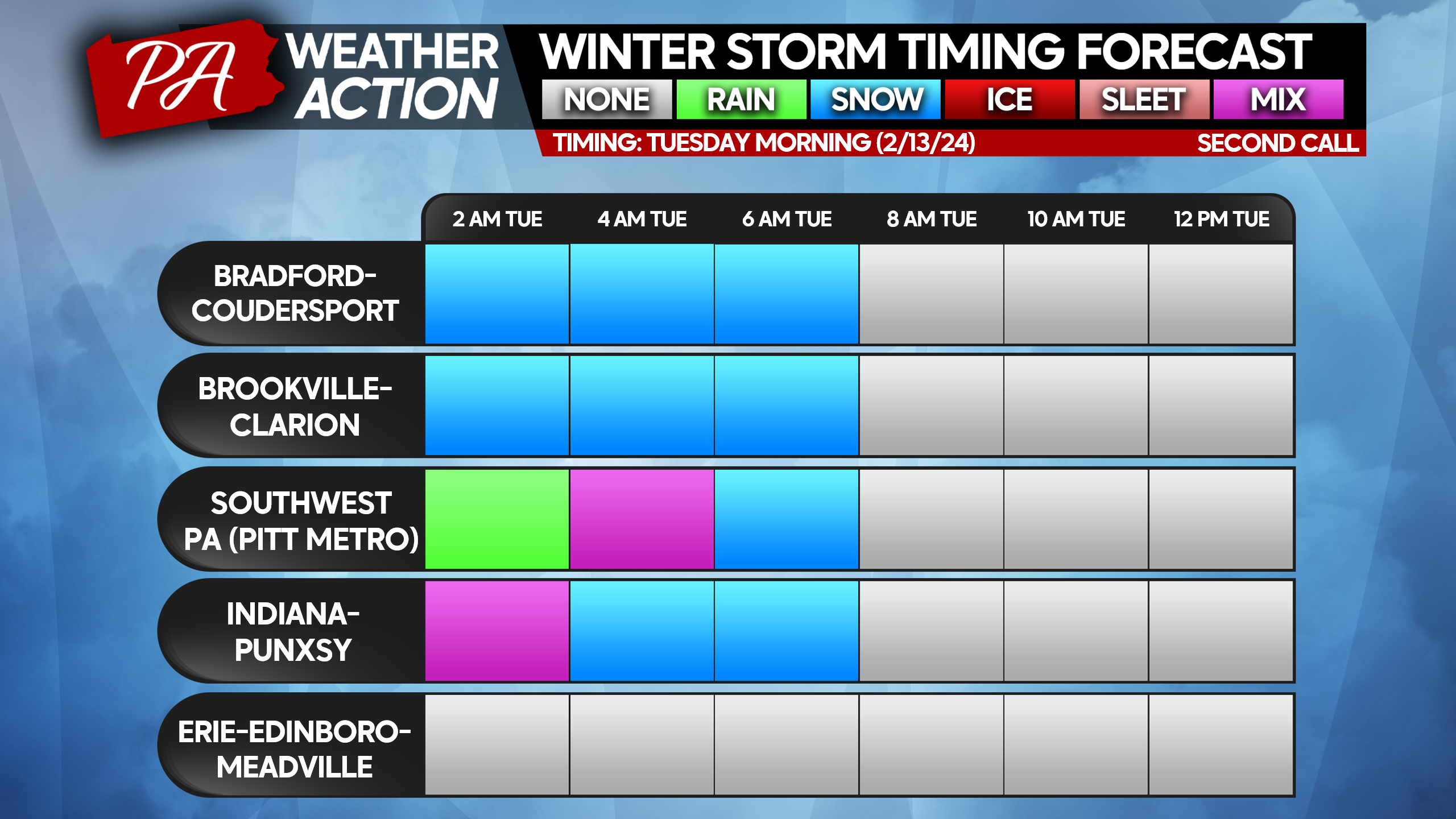
A storm currently dropping snow in parts of Texas will push northeast into the Ohio Valley late Monday before reaching a point near Charleston, WV, before transferring to a coastal low pressure system. The time and placement of the low pressure during that transfer phase will make all the difference in terms of snowfall accumulations. What we often see is that the primary low remains stronger farther north than modeled, which causes Southern PA to see a longer period of rain before changing to snow, if at all. However latest model guidance suggests the low will transfer farther south.
Note that when snow is falling in Central and Eastern PA, it will be falling heavily. So while the storm isn’t going to last a long duration, as you will see below, when the snow is falling, it will be falling at 1″/hour rates. Sometimes snowfall rates may approach 2″ per hour. Safe to say, we do NOT advise you be out and about when snow is falling.
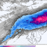
WINTER STORM TIMING CHARTS
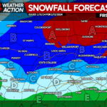
SECOND CALL SNOWFALL FORECAST FOR TUESDAY
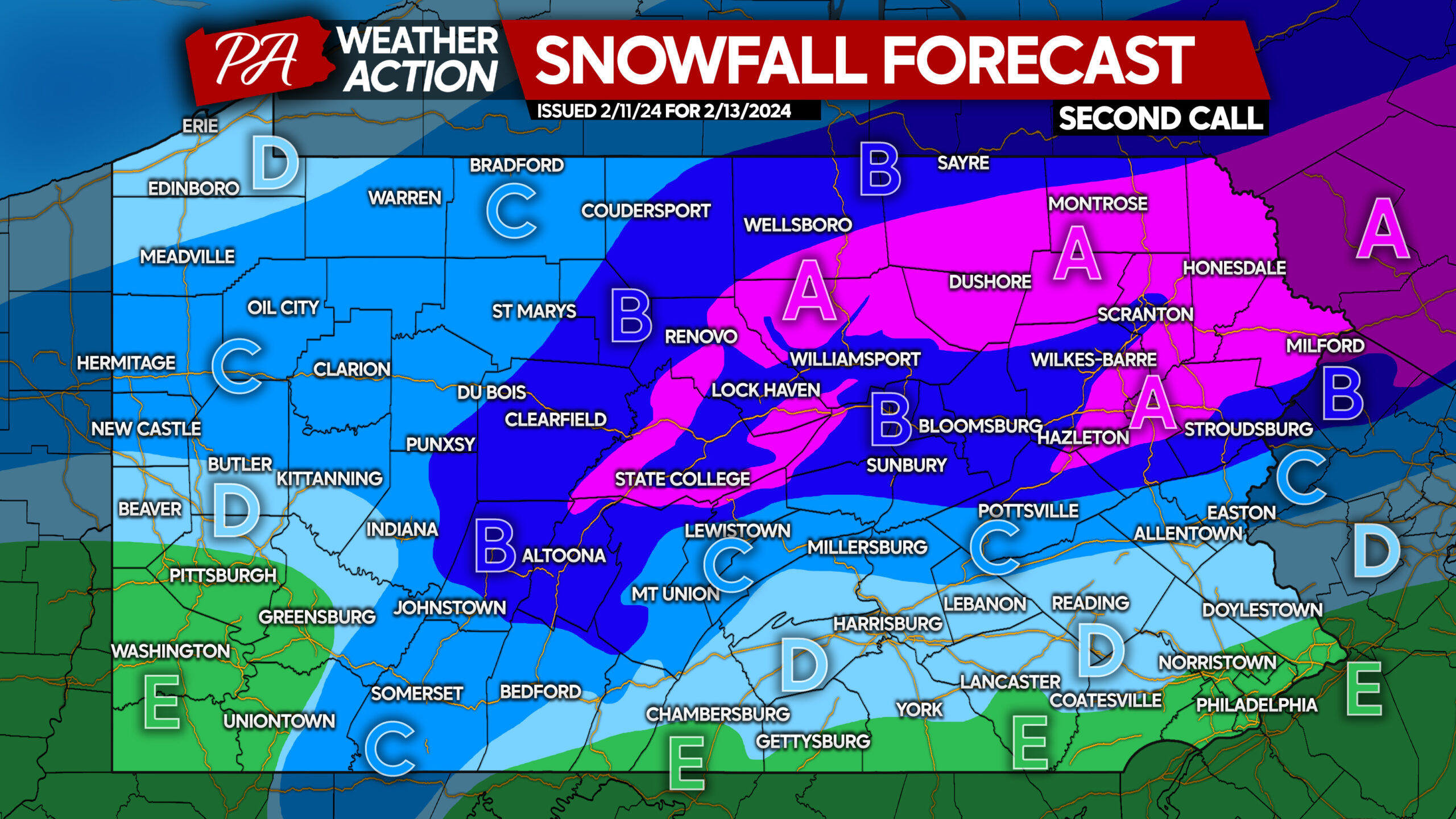
Please note that this will be heavy, wet snow. It’s important to not overwork yourself when clearing it! Be sure to take breaks and stay hydrated!
Area A: Snowfall accumulation of 8 – 12” expected. The Tuesday Morning commute will be very difficult to impossible.
Area B: Snowfall accumulation of 4 – 8” expected. The Tuesday Morning commute will be treacherous with snow-covered roads.
Area C: Snowfall accumulation of 2 – 4” expected. The Tuesday Morning commute may include slushy roadways.
Area D: Snowfall accumulation of 1 – 2” expected. Snow may struggle to accumulate on roadways, but slushy spots are certainly possible Tuesday morning.
Area E: Snowfall accumulation of less than 1” expected after a mostly rain event. No roadway impacts expected besides wet roads.
Definitely be sure to return back on Monday for our final call.
Don’t forget to share this forecast and information with family and friends on Facebook below!
Many of you reading this don’t actually follow us! We post worthwhile updates, and it’s certainly worth it!
You must be logged in to post a comment.