
Winter makes its comeback tomorrow morning as a quick-moving rapidly-intensifying storm delivers a burst of heavy snow to the southern half of our area.
Precipitation will spread northward into the southern part of the area around midnight, likely in the form of rain in the southern Poconos, although it will be all-snow north of I-80. As the storm detonates off the southern NJ coast Tuesday morning, colder air will be drawn southward and heavy snow with rates of 1-2″ per hour will fall over the Poconos, where a foot of snow could accumulate. The snow will end across the area by 1pm Tuesday. Being that this event will be hitting hard during the morning Rush hour, the morning commute will be extremely challenging.
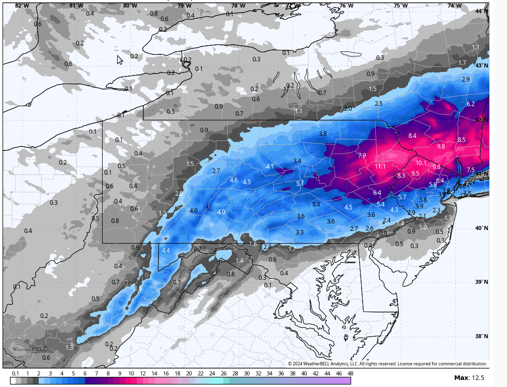
There will be a sharp cutoff in amounts near the NY border, so the northern counties could get very little out of this event. Those near that sharp cut-toff should be aware of any deviations in the track of the storm which would greatly alter their totals. It is entirely possible that locations near the NY border get completely shut out of this event.


You must be logged in to post a comment.