

FINAL CALL POSTED:
Meteorological winter starts December 1st, and this winter will as well. A cold front will push in overnight, setting the stage for our first widespread snowfall of the season. Beyond this storm, below average temperatures and an active storm track will continue. While we may not be looking at big storms, these nickel and dime events will be common.
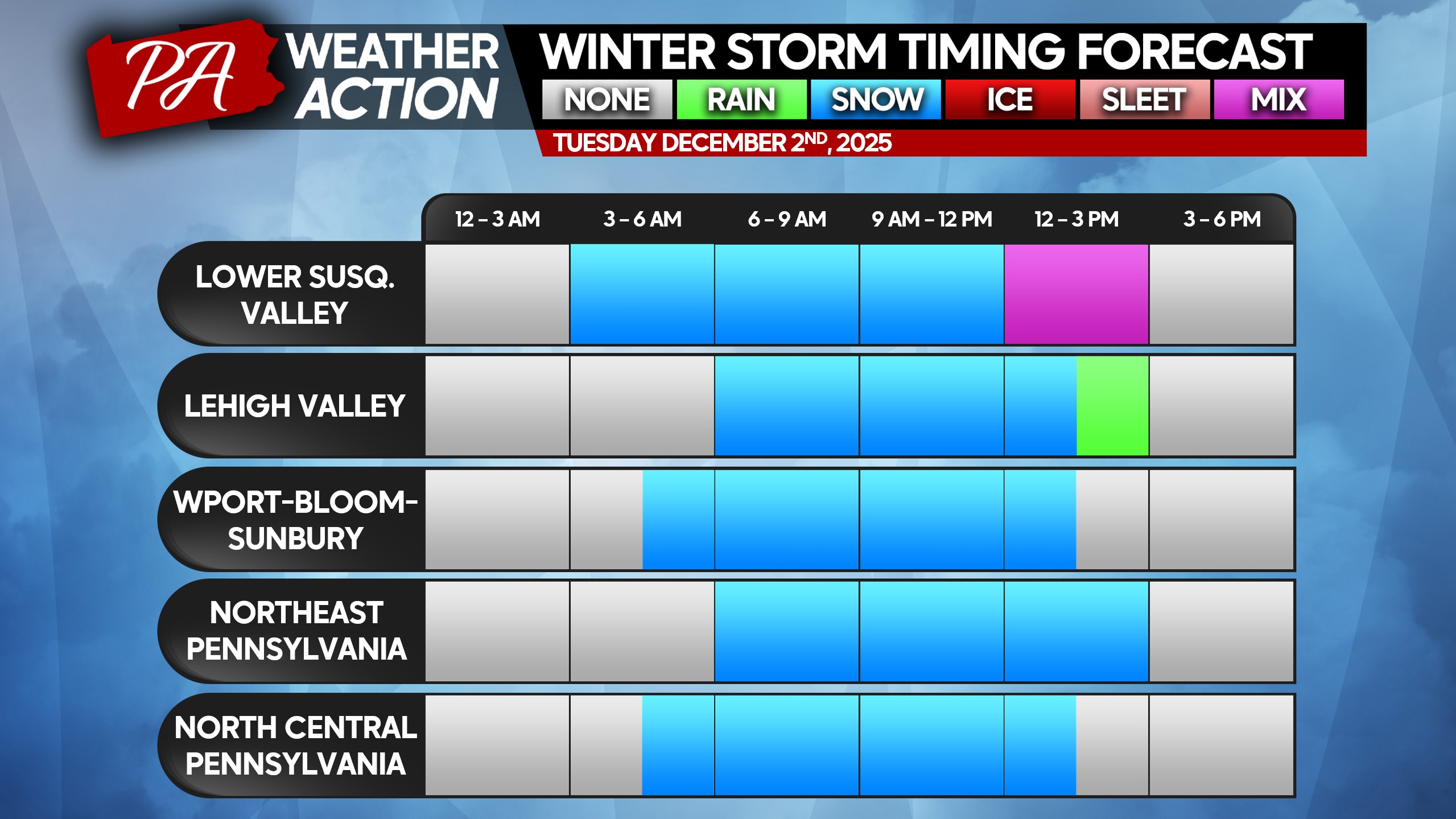
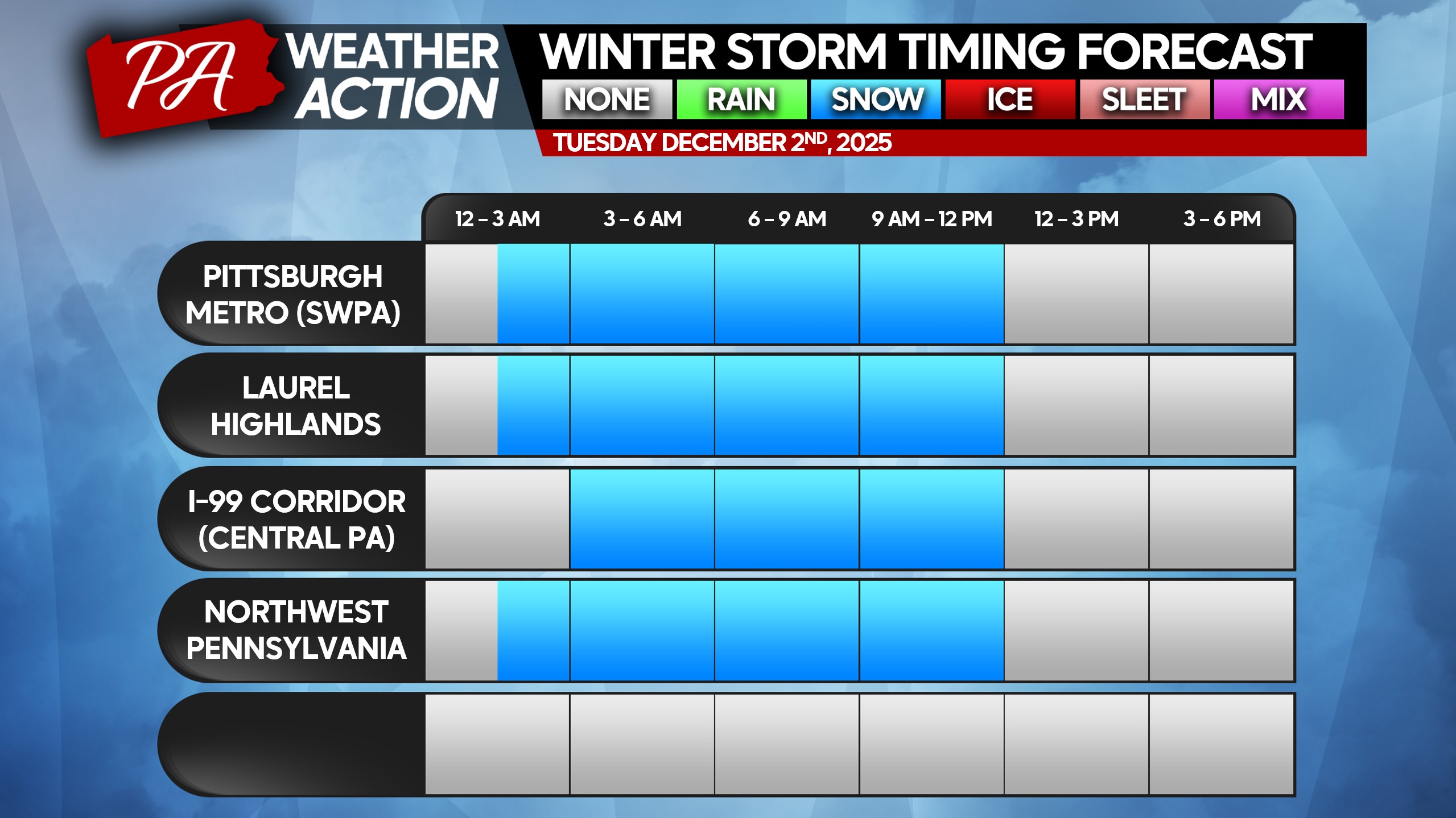
Snowfall totals produced by this relatively quick storm will be moderate, but the timing of the snow will cause many school cancellations and business disruptions. We are bringing back the time tables for this season, which were a useful tool last winter!
WINTER STORM TIMING
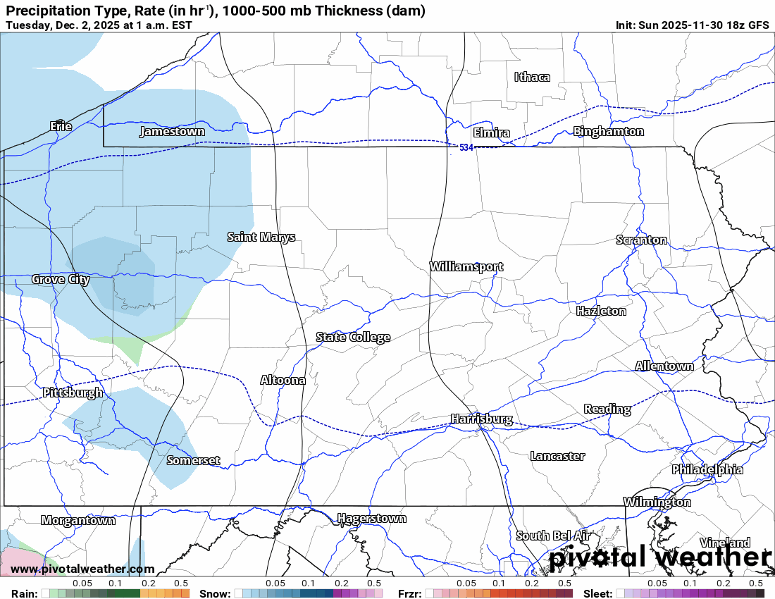
Snow will move into Western PA 1:00 – 3:00 AM Tuesday morning, Central PA by 3:00 – 5:00 AM, and between 5:00 – 7:00 AM in Eastern Pennsylvania. North and west suburbs of Philadelphia may see a brief period of snow before mixing with sleet and rain. Below is future radar from the American (GFS model). As you can see, this is a quick storm.
Below are the timing tables for this event, please find your region. Roads will become slushy and hazardous soon after snow starts falling. Moderate to locally heavy snow is expected during the heart of the event, which will be in the middle to late morning hours of Tuesday in most places.
SECOND CALL SNOWFALL FORECAST FOR TUESDAY
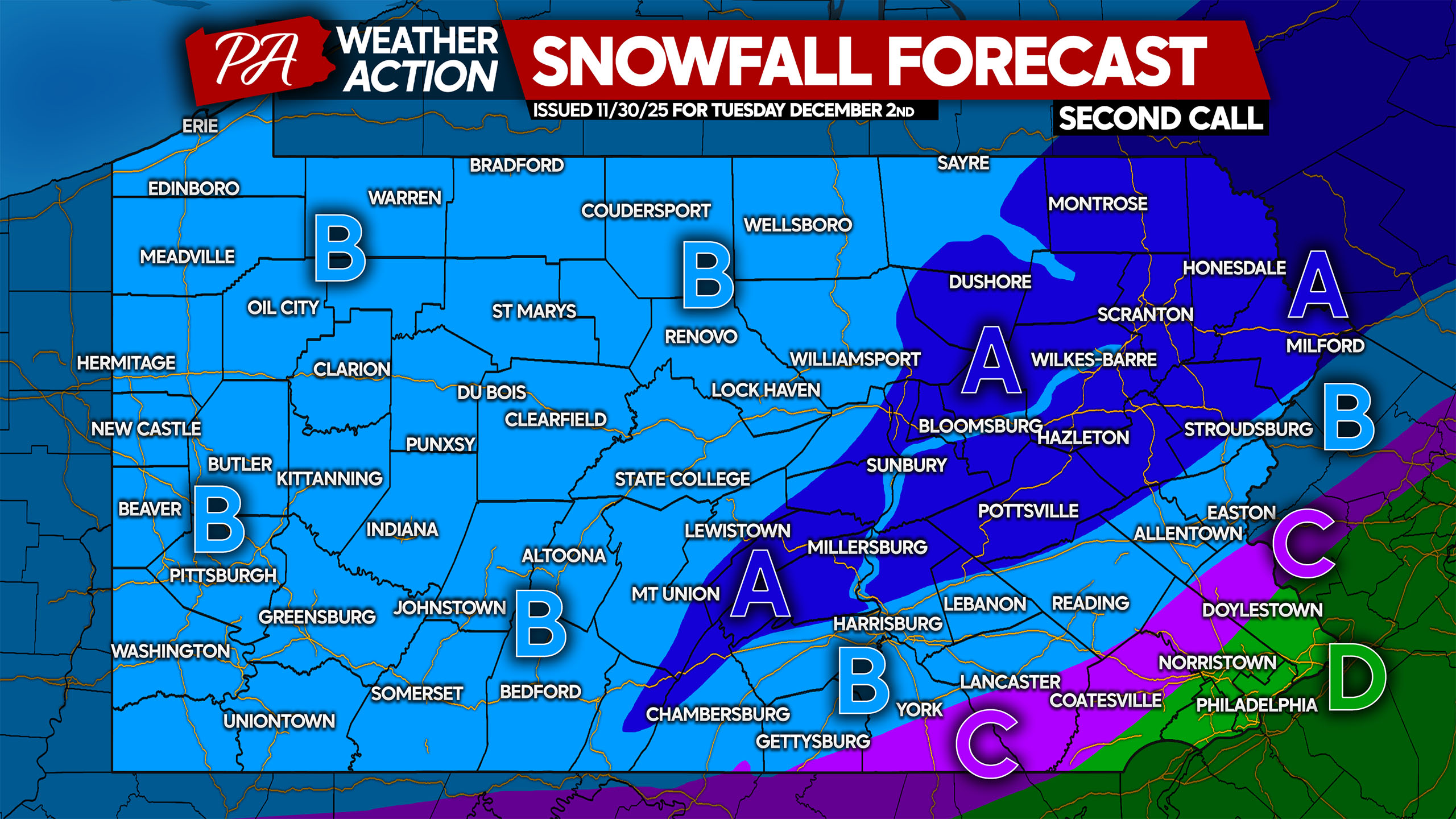
Area A: Snowfall accumulation of 4 – 7″ expected. Snow-covered roads will cause hazardous travel, leading to school cancellations and business disruptions. Avoid traveling during the storm if possible.
Area B: Snowfall accumulation of 2 – 4″ anticipated. Snow-covered, slushy roads will make travel unsafe, causing school cancellations and disruptions to businesses. Avoid travel if possible.
Area C: Snowfall accumulation of 1 – 2″ expected. This area will start as snow before mixing with sleet briefly, likely ending as rain. Slushy roads Tuesday morning may still cause travel headaches.
Area D: A brief wintry mix is possible at the onset, but this will be mainly rain with no snow accumulation.
Our final update to the forecast will come 5:00 PM Monday. Stay tuned!
Be sure to share this forecast with friends and family in affected areas!
You must be logged in to post a comment.