
Rough times for snow lovers in Pennsylvania this week, as a snowstorm will hit south of the area across Virginia to many of our favorite beaches. Southern PA will still get some snow, but the classic north trend many rely on just hasn’t been on our side this winter.
Then immediately following the conclusion of that storm on Wednesday, another stronger system will be pushing through the Midwest. We will likely see a wintry mix at the onset before changing to plain rain. And finally, another storm this weekend looks to be rainy in PA and snowy in Upstate NY. Some snow is possible in the Northern PA Mountains.
As we head into the final third of winter, many are getting antsy for a big storm after what has been a colder winter than most recent. The pattern looks decent going forward, but it’s no guarantee that most of the state will reach average snowfall for the season.
WINTER WEATHER TIMING
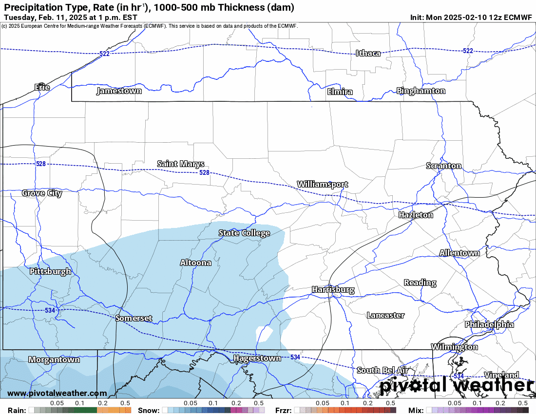
Light snow will push into counties that border the Southern PA line late Tuesday afternoon to early evening. Light snow, possibly moderate near the MD/DE/NJ line in Southern PA, will continue through the evening and past midnight.
Then snow will begin to exit the region from west to east in the early morning hours of Wednesday. Crews may be able to get out in time to avoid school delays on Wednesday. Below is the European model for this event, plus the wintry mix on Wednesday evening into Thursday morning that we will cover shortly.
SECOND CALL SNOWFALL FORECAST FOR TUESDAY PM – WEDNESDAY AM
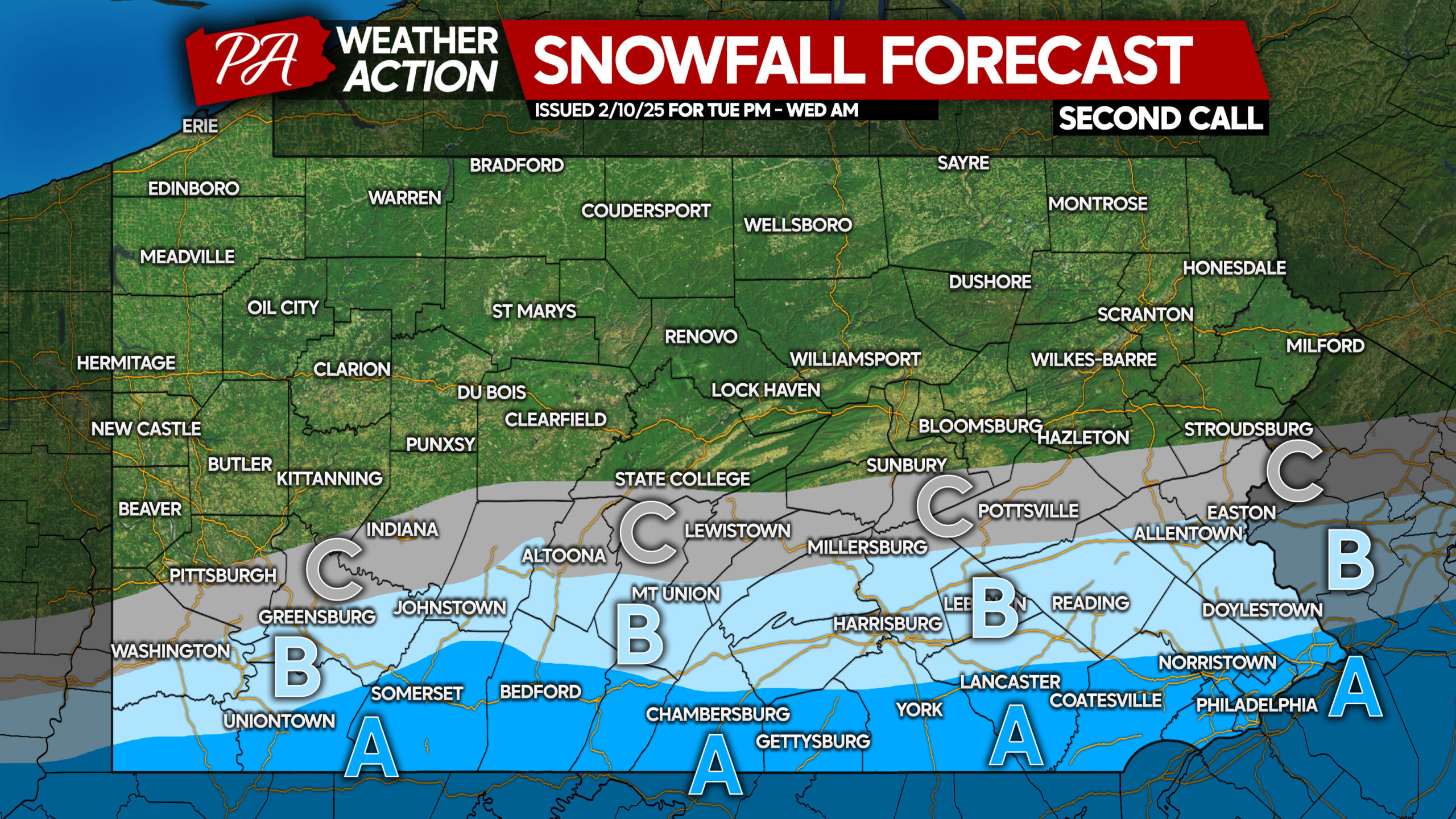
This does not include impacts for the second system we discussed above, only the first one.
Area A: Snowfall accumulation of 2 – 4″ expected. Roads will become snow-covered Tuesday evening into Wednesday morning, possibly leading to delays Wednesday especially in SEPA.
Area B: Snowfall accumulation of 1 – 2″ anticipated. Untreated roads will become snow-covered, possibly causing delays Wednesday AM.
Area C: Snowfall accumulation of less than 1″ expected.
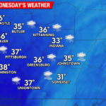
FIRST CALL FORECAST FOR WEDNESDAY EVENING – THURSDAY MORNING
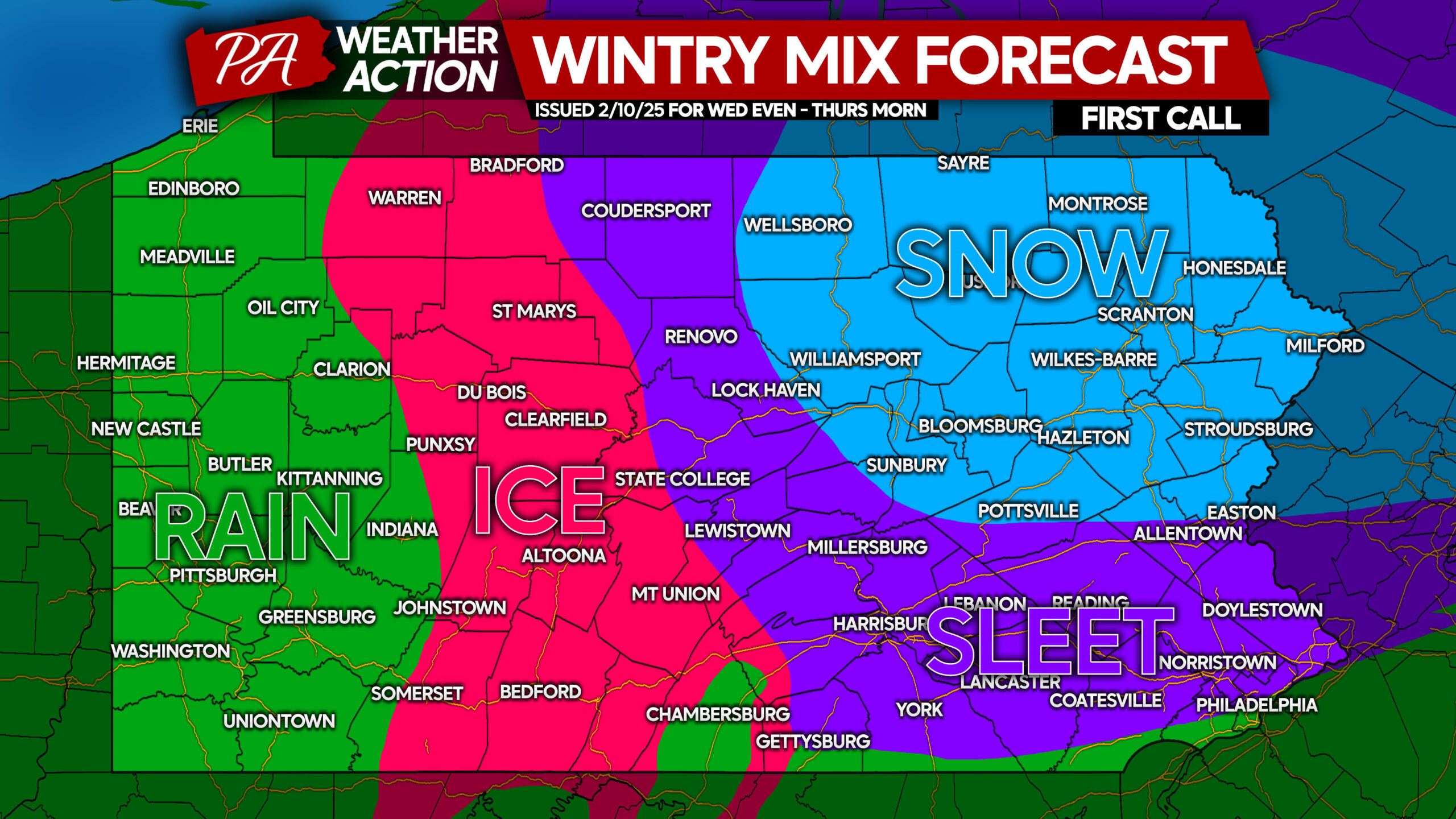
Accumulations from this event will not be significant, but we are watching for this potential travel impacts. The Wednesday evening commute may be affected, especially after 5-6 PM.
Light snow accumulation is possible in the snow shaded area, with light to moderate icing possible in the ice area. We have a large area of sleet, which will likely be more refined in Tuesday’s update. Rain will be common again in Western PA.
Accumulations will be posted for this event in Tuesday’s update.
Stay tuned, and be sure to share this forecast with friends and family in affected areas!
You must be logged in to post a comment.