
After a soggy September, October is off to a beautiful start! A pattern shift over the weekend has brought an end to the dreary weather of weeks prior as a ridge of high pressure is in control bringing summerlike temps and dry weather. Continue reading to see how long this weather will last and how September shaped up compared to average.
September Recap
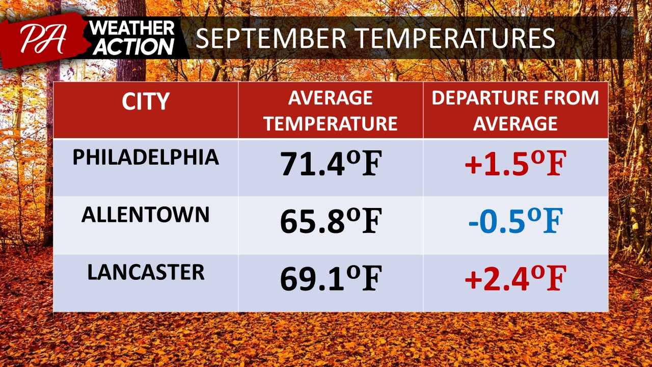
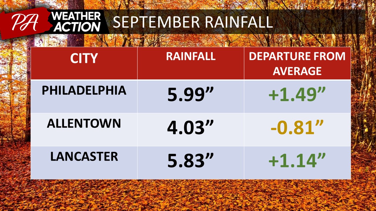
Overall, September was pretty typical compared to long-term averages, albeit slightly warmer and wetter than average for most locations. Locations further Southeast had the greatest anomalies on both the warm and wet sides.
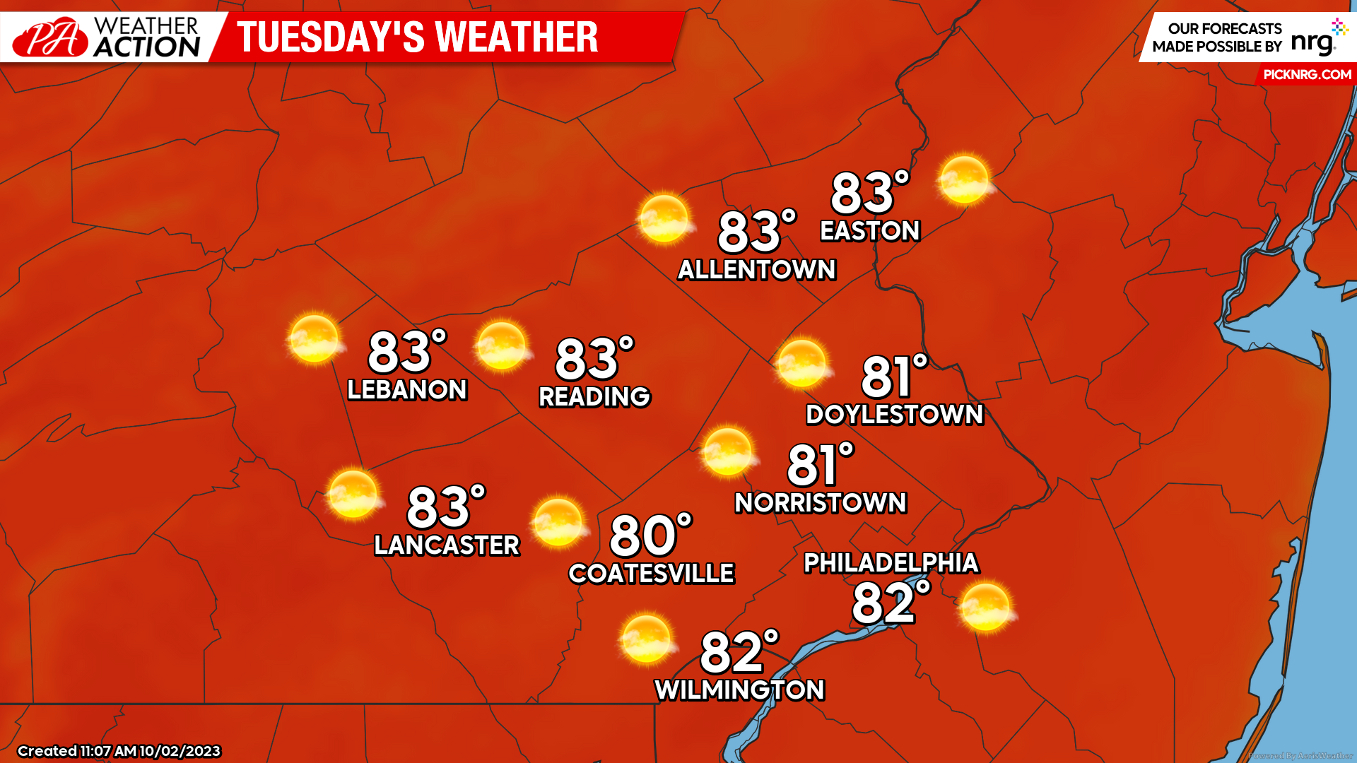
Tuesday
Tuesday’s weather will set the tone for the remainder of the week as a strong ridge of high pressure is in control of our weather pattern. With this, we can expect clear skies and above-average temperatures, making it feel more like August rather than October. Low’s Tuesday morning will start in the mid-upper 50s. Clear skies and a moist atmosphere will allow areas of fog to develop tonight which may bring isolated areas of reduced visibility early Tuesday morning. Temperatures will rise quickly under sunny skies with highs topping into the low 80s by the afternoon. Winds will be light and variable.
Wednesday
Expect a rinse and repeat for the day on Wednesday as high pressure continues to dominate. Morning lows will only drop into the upper 50s-low 60s as areas of locally dense fog develop once again. Skies will remain mostly clear throughout the day with highs reaching the low-mid 80s by afternoon. Winds will remain light out of the SE at 2-7mph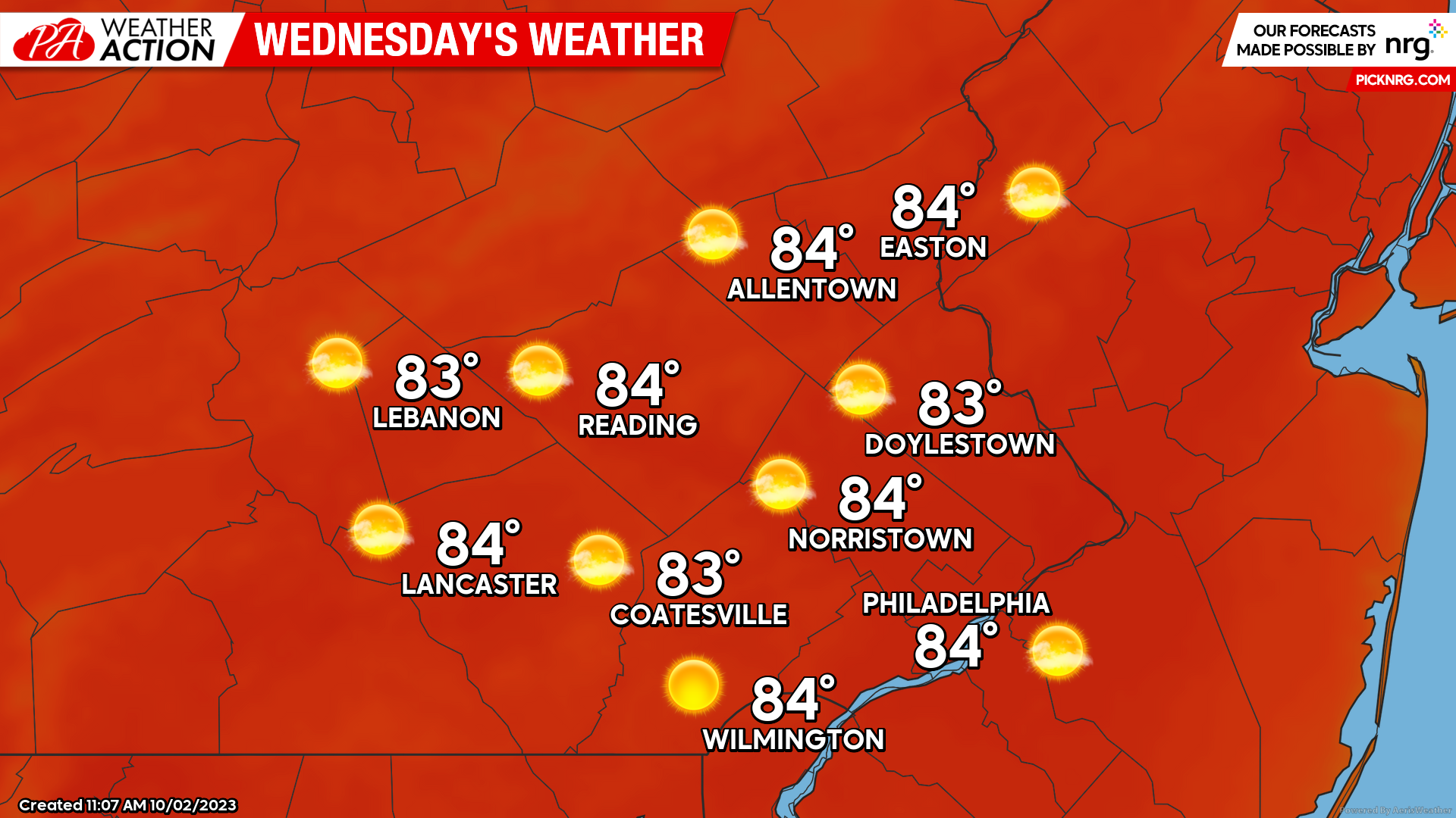
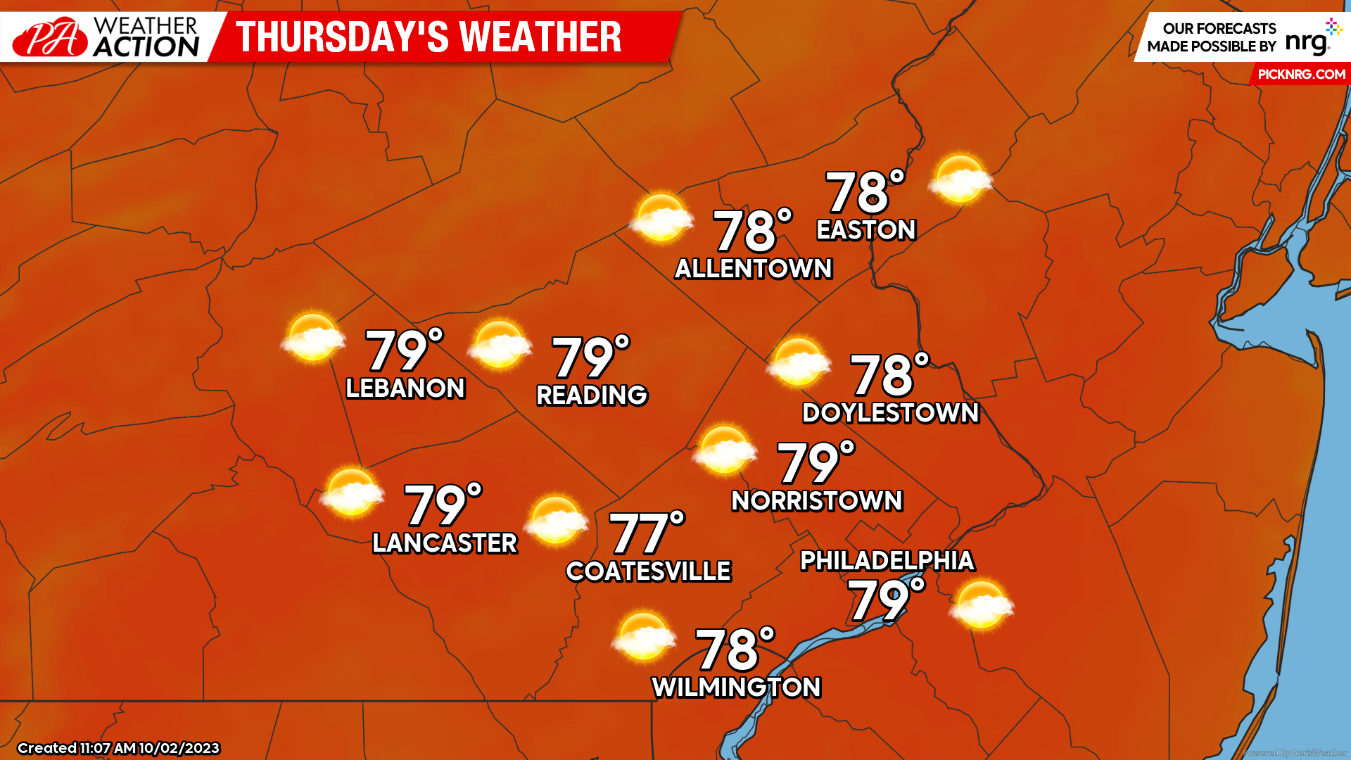
Thursday
Thursday will be another pleasant day however, will mark the beginning to the end of our summerlike weather pattern. Expect clear skies to start the morning with lows dipping into the mid-upper 50s. Patchy fog will once again be possible. Skies should remain mostly clear throughout the morning but cloud cover is expected to increase throughout the afternoon. Expect a transition to mostly cloudy skies by the evening hours as a strong cold front approaches from the west. High temperatures on Thursday should peak into the upper 70s. Winds will be out of the SE at 5-10mph.
As we look ahead to weeks end, major changes to this weather pattern are on the way. A cold front is set to bring back unsettled weather for the weekend while also knocking our temperatures down dramatically. Be sure to stay tuned for more updates! As always make sure to download the PAWeatherAction app for continued weather information and feel free to ask questions about the forecast!
– Michael Woytowiez
You must be logged in to post a comment.