
After a spring plagued with cool, cloudy and windy days, it’s safe to say we have turned the page in the last 10 days. The hot and sticky weather will continue, unless you’re in the mountains of PA, then it’s just comfortably warm!
Along with hot and sticky weather in late June and July comes the inevitable chance of thunderstorms, which is what we’ve met here today for! And unfortunately, because of how rainy May was, flash flooding with be a concern likely all summer.
Monday and Tuesday’s storms will be out ahead of a cold front and then along it, so the main threat will be damaging winds. And of course when you have so much instability available, frequent lightning will be a risk.
MONDAY’S SEVERE THUNDERSTORM RISK
We expect isolated showers and storms to develop late Monday afternoon. A couple may be on the stronger side at this point, especially heading towards dinnertime. Below is the Hi-Res NAM Future Simulated Radar for 4:00 PM Monday.
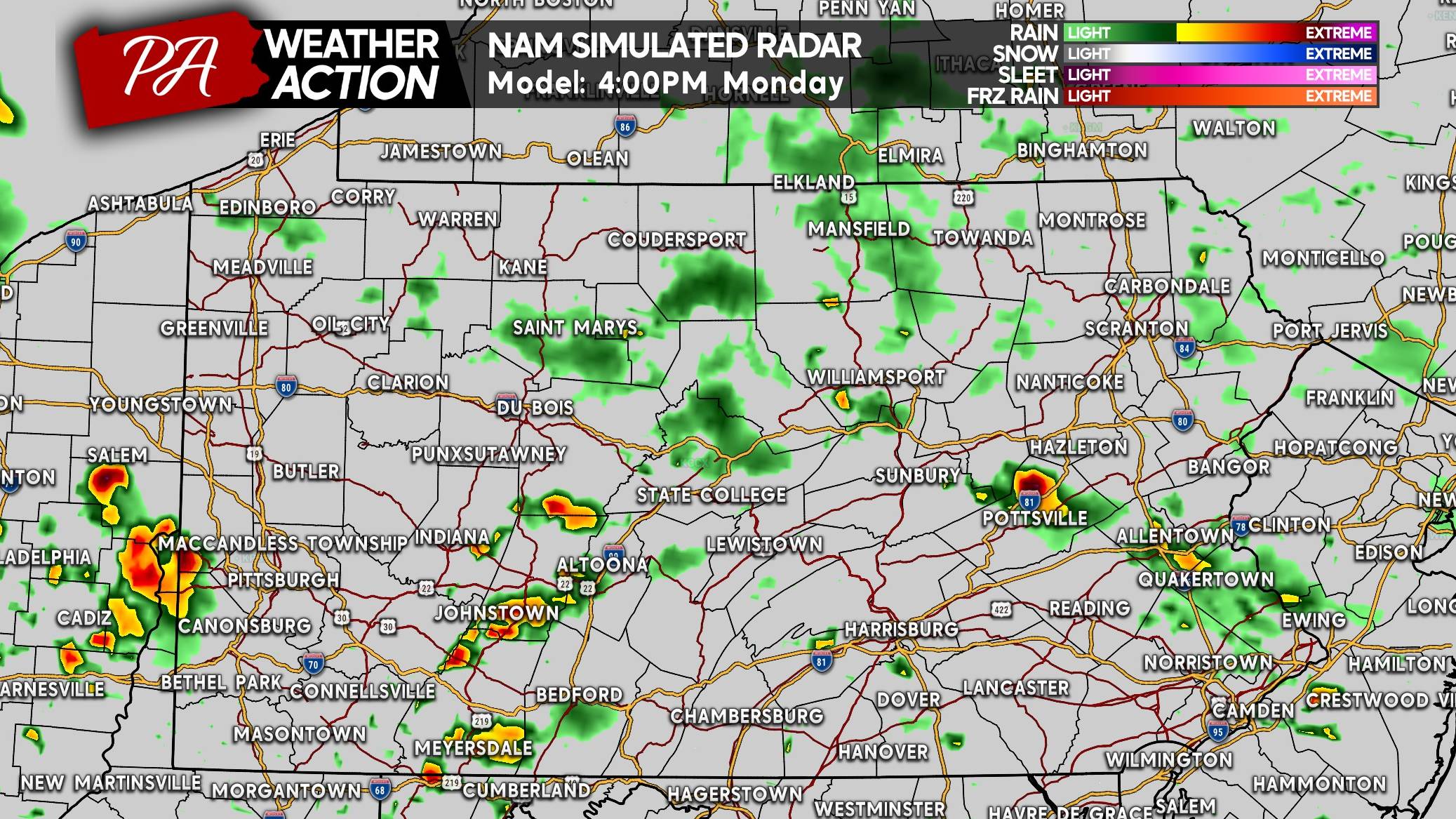
Western PA looks to be most active Monday evening, with scattered to widespread thunderstorms expected. Some of these may be on the stronger side, and there’s a flash flood concern as well.
MONDAY’S SEVERE THUNDERSTORM THREAT FORECAST
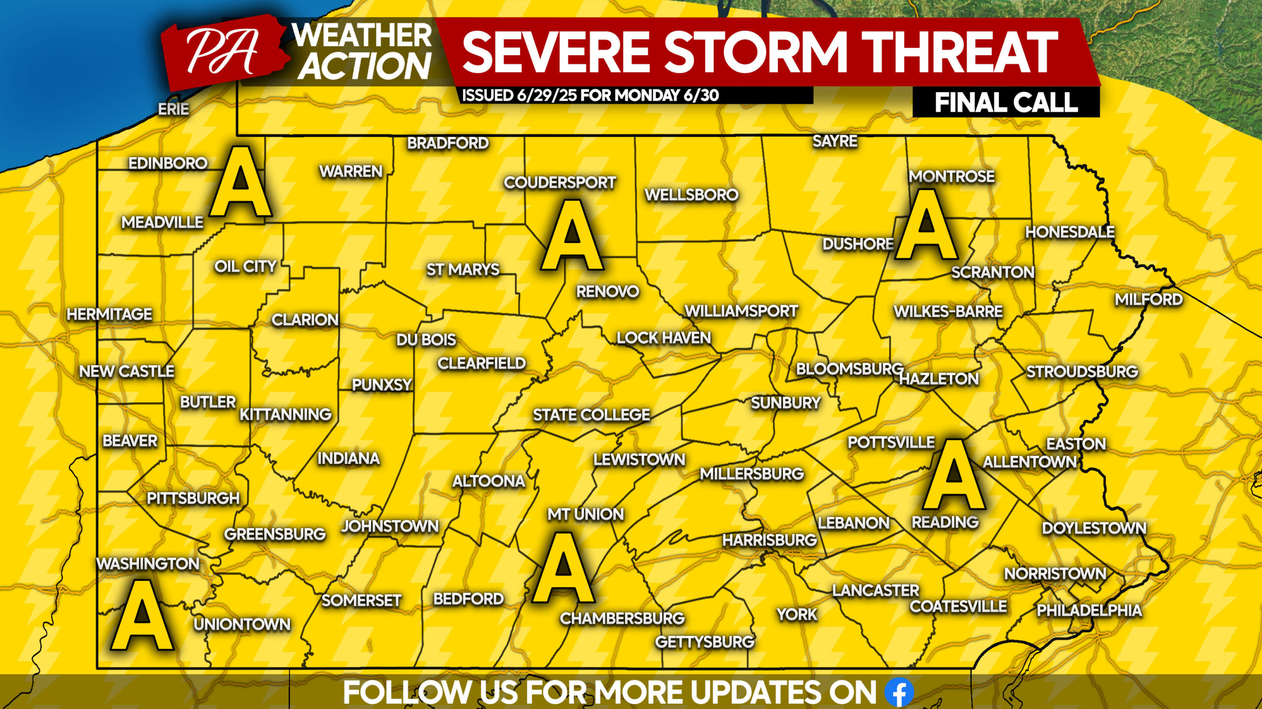
Area A: Isolated severe thunderstorms expected, with damaging winds, flash flooding (especially in Western PA), and frequent lightning the main concerns.
TUESDAY’S SEVERE THUNDERSTORM RISK
The cold front itself will push through Tuesday, with timing still up in the air. If it’s a little delayed, the threat will be farther northwest in much of Northern PA. If not delayed, the severe risk will be focused more on Eastern PA.
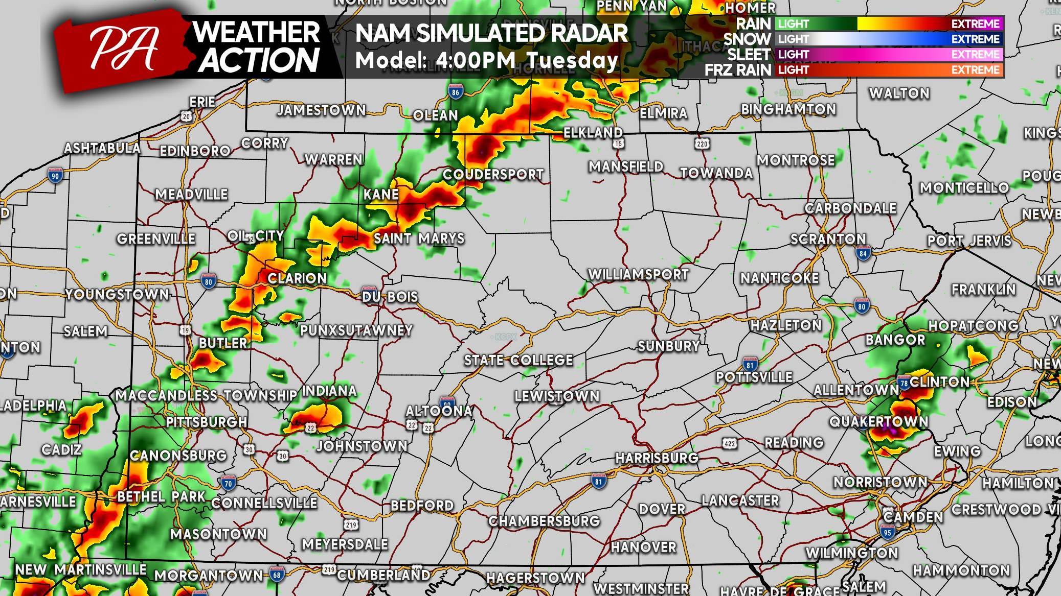
The Hi-Res NAM has the front more delayed than other models, and fires up a nasty line of storms across Western PA Tuesday afternoon. Also note the storms popping up in Eastern PA as well.
If there is any tornado threat, it will be with cells that initiate ahead of the main line in Eastern PA. Below is a look at 4:00 PM Tuesday.
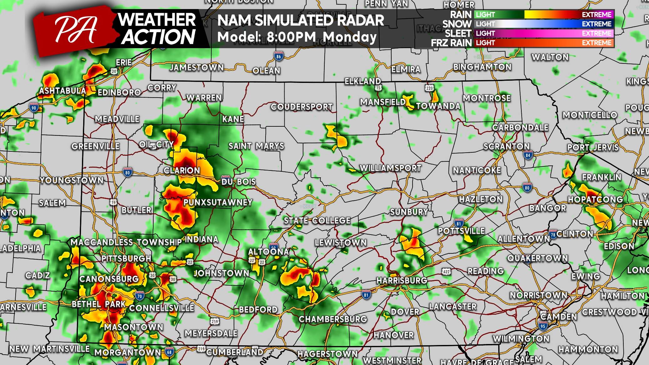
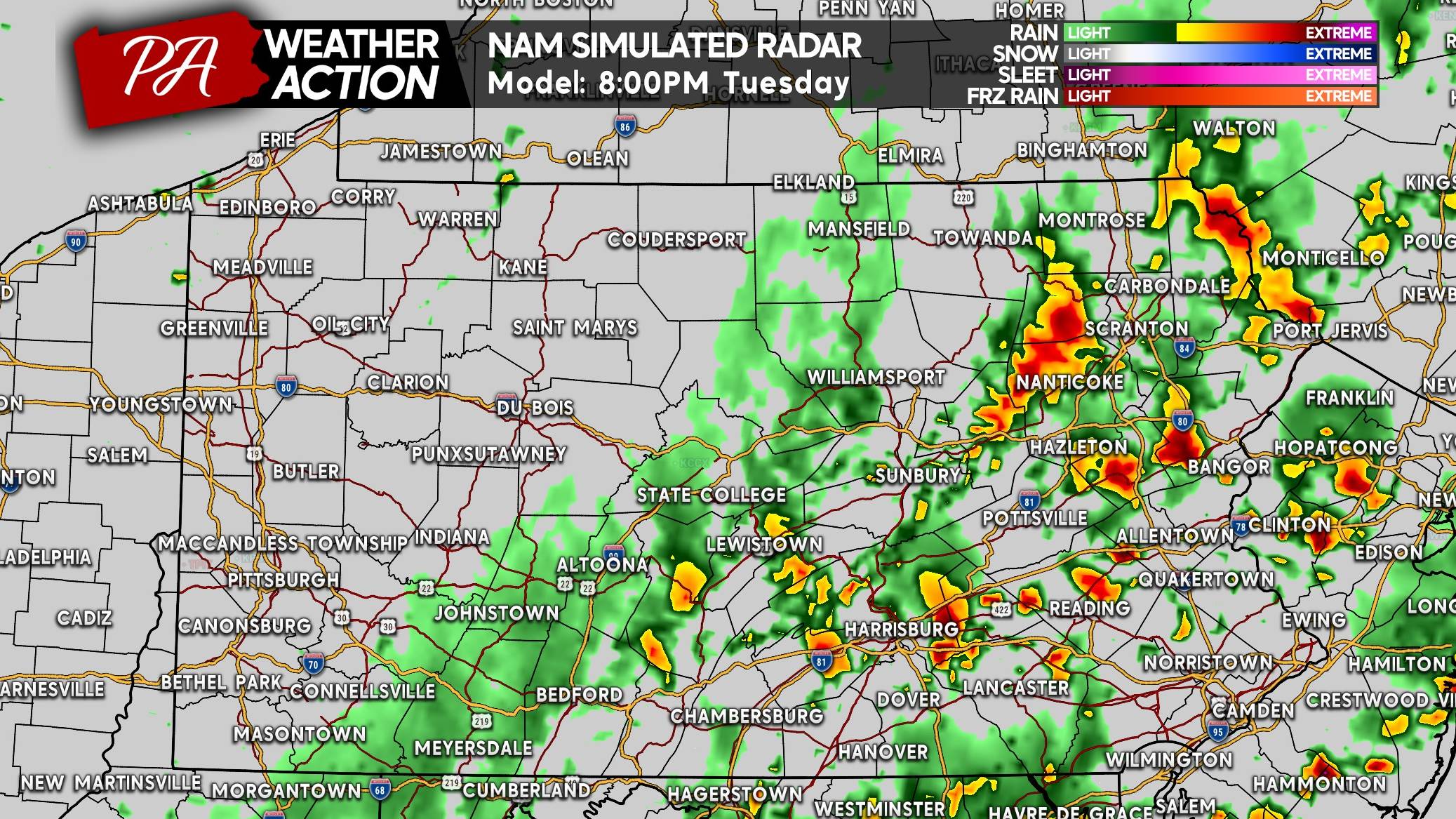
And by 8:00 PM Tuesday, the Hi-Res NAM is showing widespread thunderstorms in the eastern half of the state. Some of these will likely be severe.
TUESDAY’S SEVERE THUNDERSTORM THREAT FORECAST
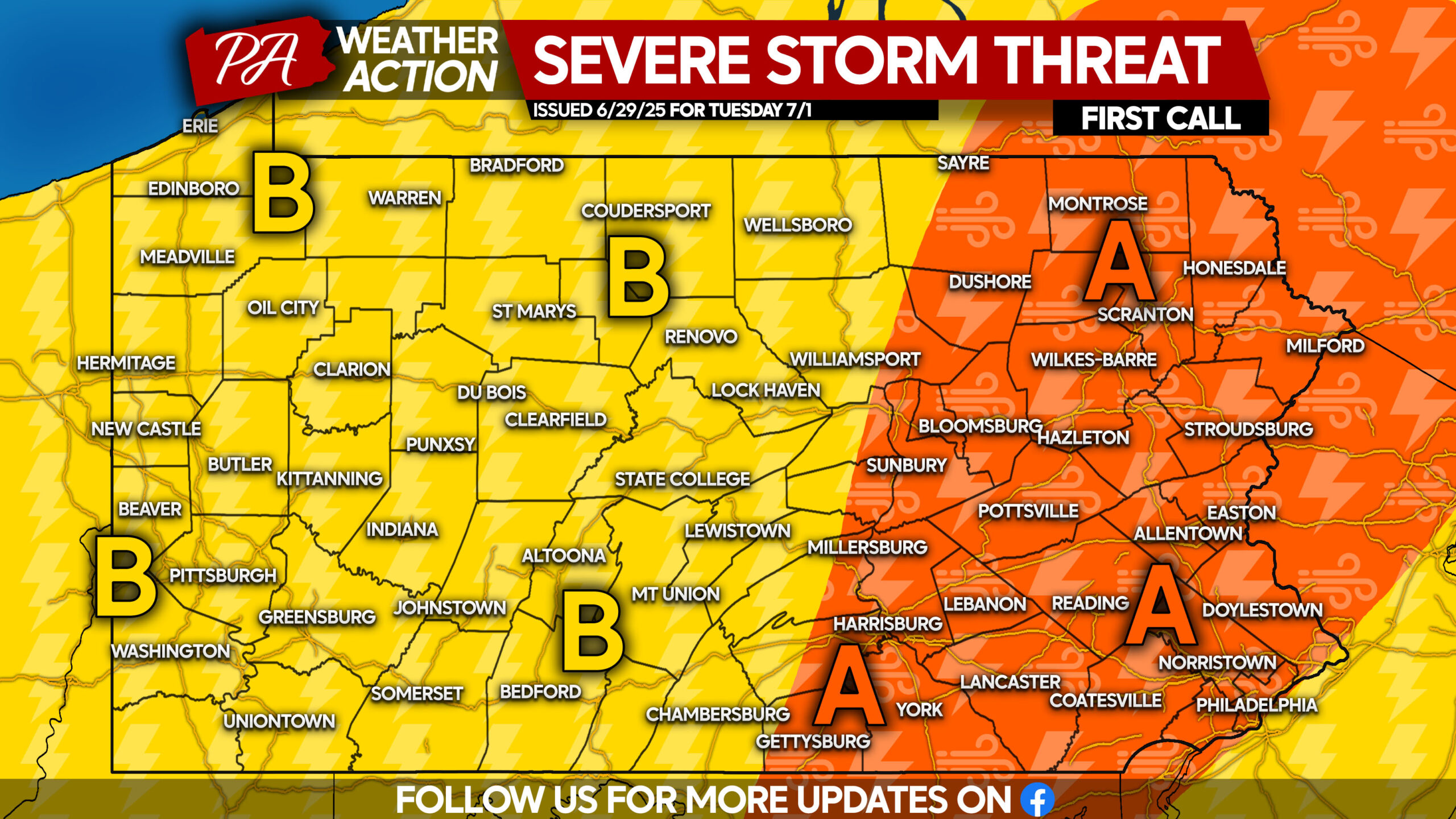
Area A: Scattered strong to severe thunderstorms anticipated. Damaging winds up to 65mph and frequent lightning are the primary concerns. Isolated hail and a very isolated tornado threat may also occur.
Area B: Isolated strong to severe thunderstorms possible. Gusty winds, frequent lightning, and isolated urban flash flooding are the main risks.
We are happy to tell you that Friday (Independence Day) is looking dry, with temperatures right around normal in the 70s and low 80s!
Don’t forget to share this forecast on Facebook with friends and family! Safe travels this week!
You must be logged in to post a comment.