
Just when we thought quiet weather would be on tap around the holiday, a storm threat has trended up for Thursday across Eastern PA. Warm, humid air along with plenty of available CAPE and impressive lapse rates will create an environment conducive for scattered damaging winds and hail.
Friday, Independence Day itself, is still looking clear with mostly sunny skies and a bit lower humidity. The weekend also looks mainly dry.
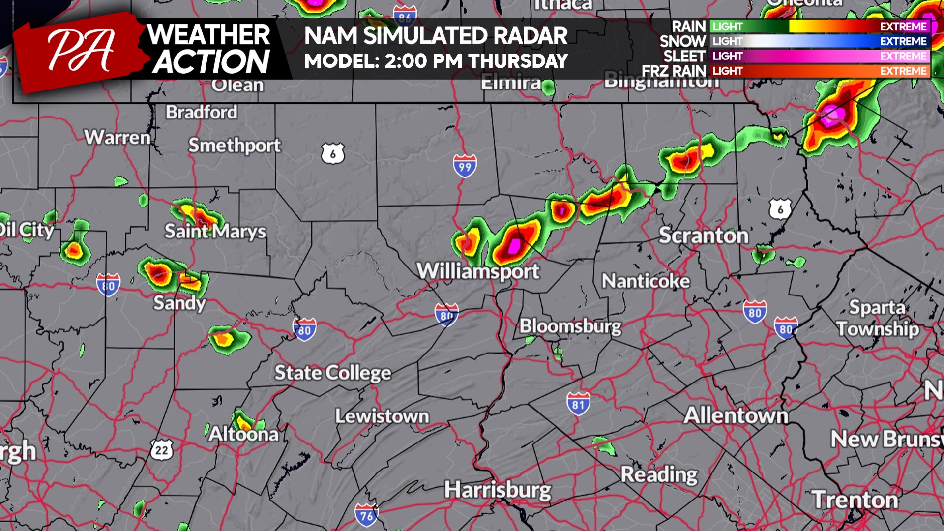
FUTURE RADAR TIMING
Starting around 2:00 PM Thursday, we may begin to see showers and storms pop up across the northern tier of PA. These storms will intensify, particularly in Northeast PA, as they push southeast. Below is the Hi-Res NAM Future Simulated Radar.
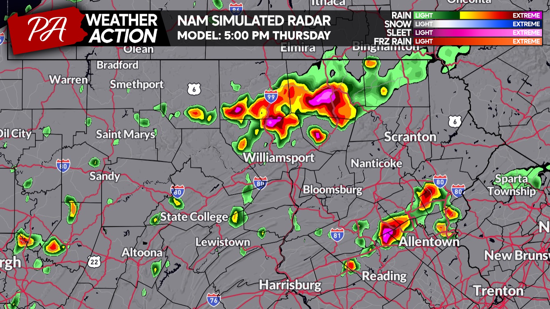
As those initial storms drift southeast towards the Poconos, Lehigh Valley, and Coal Region, a broken line of severe thunderstorms may begin to develop back across far NEPA in the late afternoon. Here’s a look at future radar for 5:00 PM.
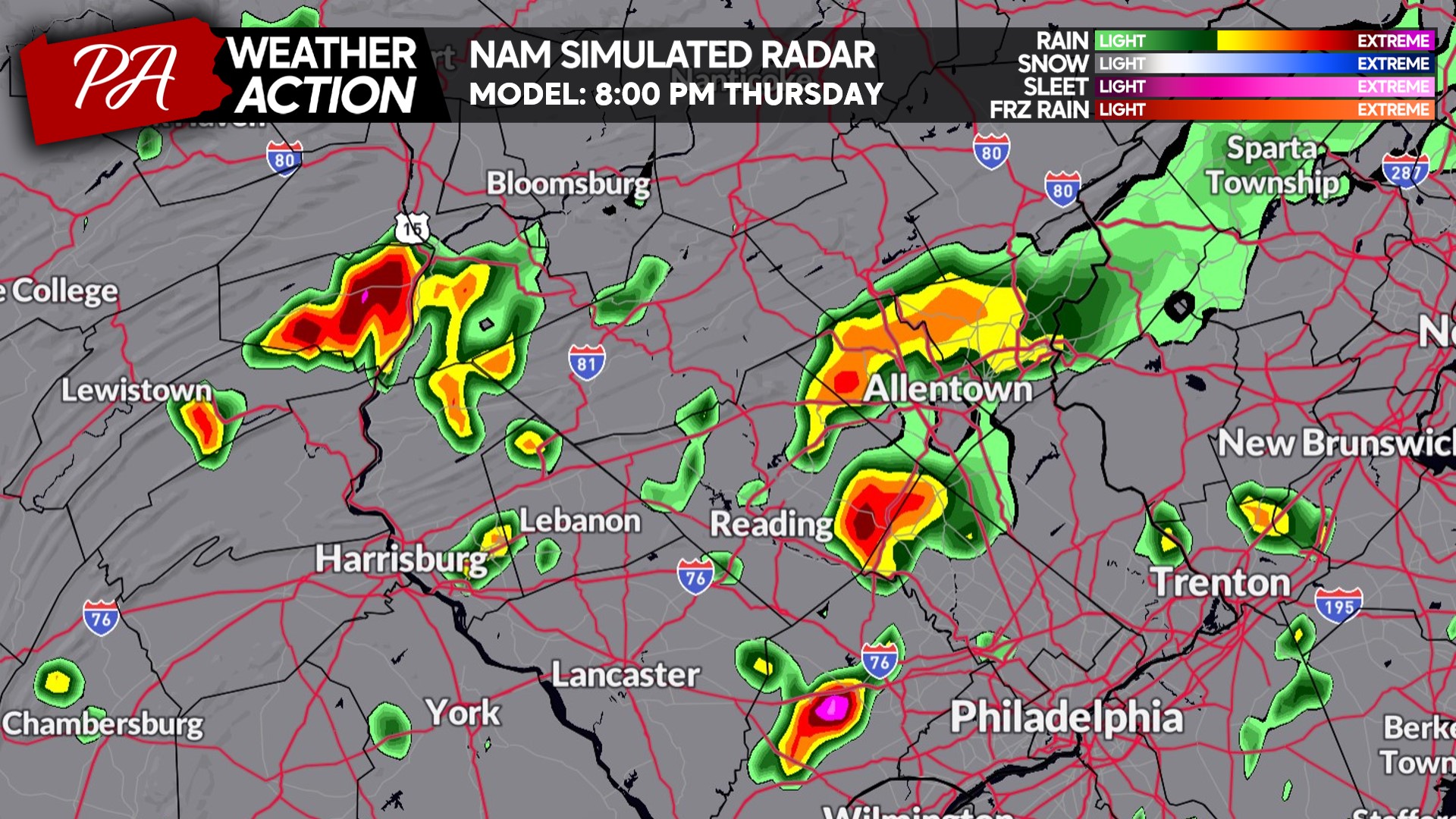
And by 8:00 PM, isolated to scattered storms will be dropping into Southern PA. But we expect the storms to be few and far between by this point, as shown below.
THURSDAY’S SEVERE THUNDERSTORM THREAT FORECAST
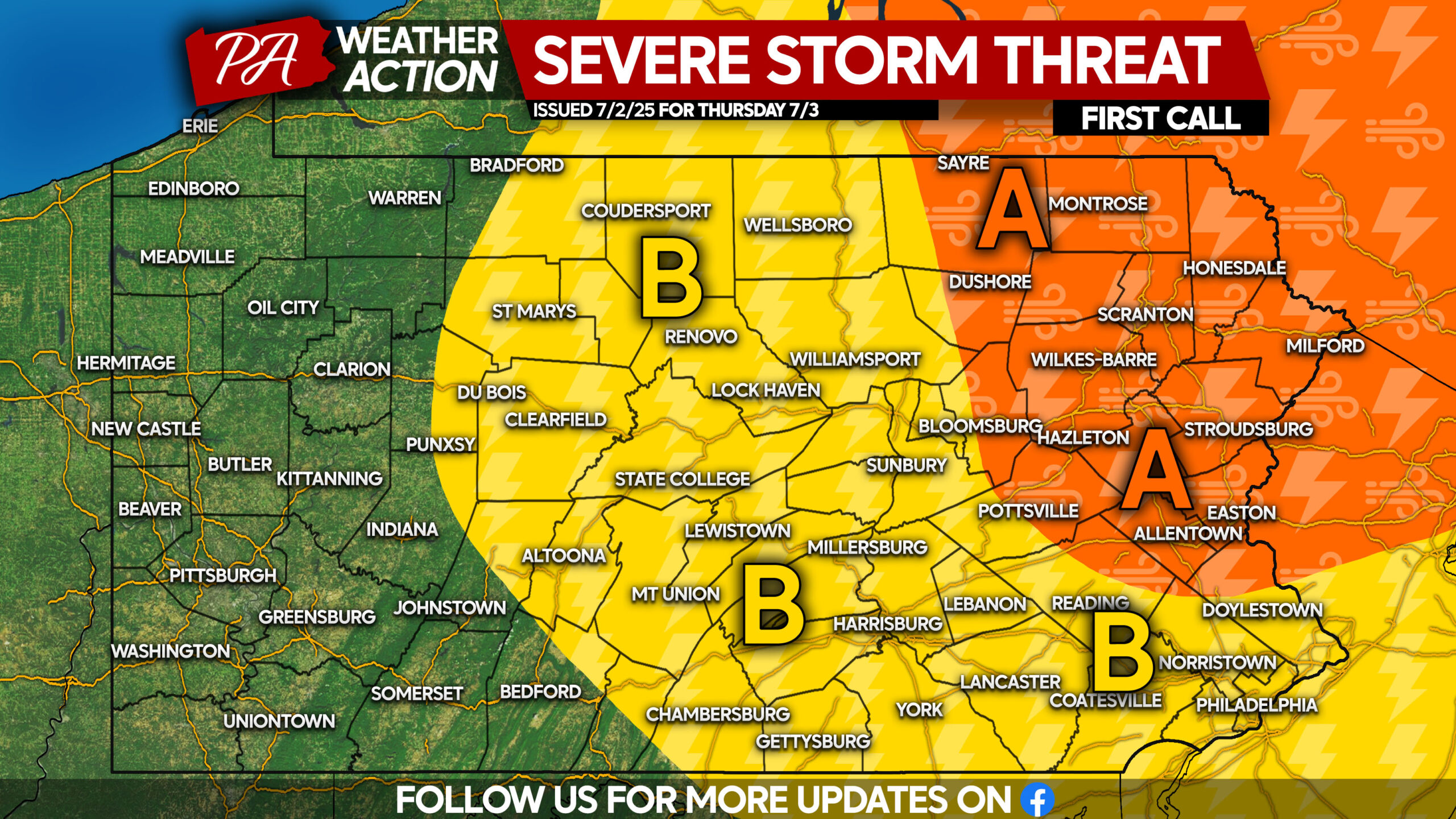
Area A: Scattered thunderstorms are expected Thursday afternoon and evening. Damaging winds and localized flash flooding are possible, with frequent lightning and isolated hail posing a threat as well.
Area B: Isolated showers and thunderstorms are anticipated Thursday afternoon, with gusty winds and small hail as the primary risks. Isolated flash flooding is possible, particularly in places that have seen several inches of rain this week.
Don’t forget to share this forecast with friends and family who have outdoor plans Thursday!
You must be logged in to post a comment.