
It’s MCS season, which stands for Mesoscale Convective System, or in other words, a strong line of storms with mainly straight-line wind damage. It could be disruptive night, especially across the western Carolinas.
REST OF SUNDAY
Hot today as forecasted with highs near 90 and even above for some outside of the higher elevations. Otherwise today will be quiet until the storms move in around dark.
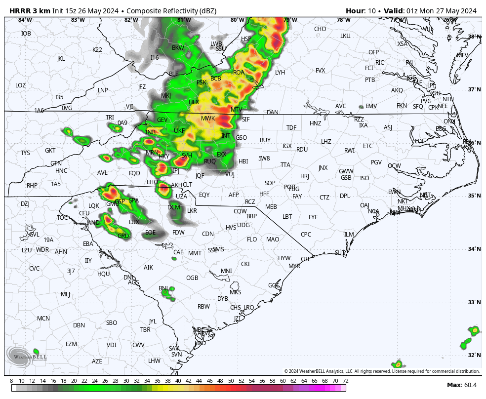
LINE OF STORMS MOVES THROUGH 8-9PM
The line of potentially severe storms will move east out of KY and TN this evening, potentially causing downed trees and power lines, even in the mountains. The mountains will hopefully weaken this system, but if not, the western parts of NC and SC can expect damaging winds and hail.
However, it’s possible the line will weaken before moving east, which would be welcomed news.
TIMING AND IMPACTS
See the image key below for what can be expected in your area.
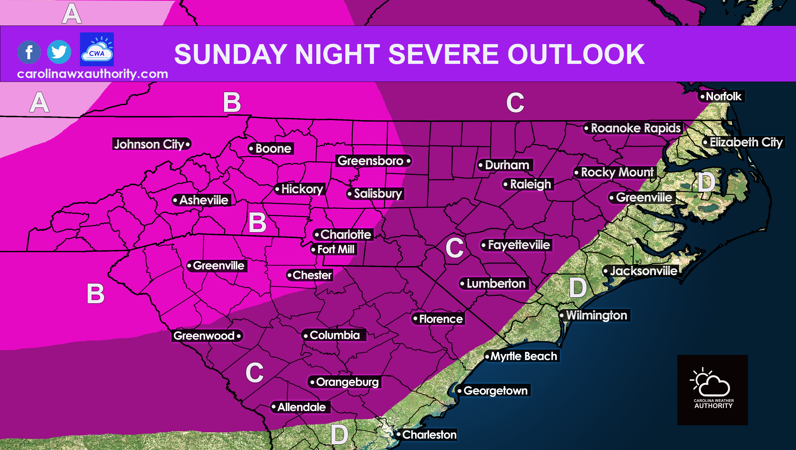
AREA A: This area will see the highest risk later today (4-9pm) for downed trees and power lines.
AREA B: This forecast is tricky since the line of storms could weaken before it pushes into this area. Timing will be from 5-9pm and storms could cause downed trees and power lines, mainly to the west of the I-85 corridor.
AREA C: The storms will likely decay and weaken before heading into this area after 9pm tonight, however wind damage is still very possible.
AREA D: Once the broken line makes it to the beaches, only some thunder and rain is likely in the form of non-severe. This will be well after dark and around or after midnight.
OFFICIAL SPC OUTLOOK
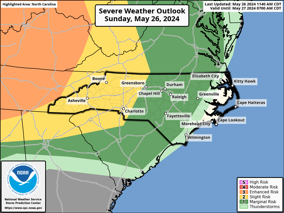
LINE COULD WEAKEN MUCH LATER
Fortunately, the SPC is not expecting the line to maintain its strength as it moves east later tonight. This could be a telltale sign of a weakening system hopefully.
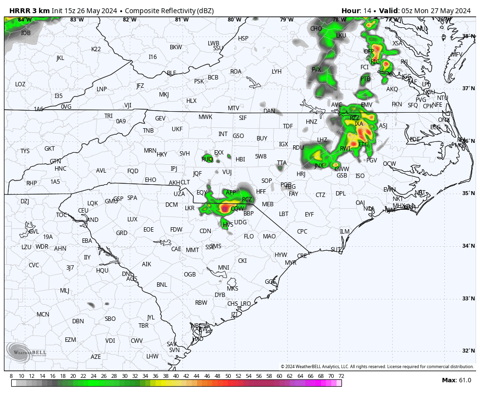
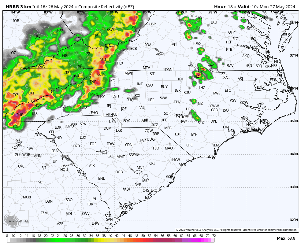
Futurecast radar for overnight into Monday am:
ROUND TWO MONDAY?
Another round of potentially severe storms in the form of an MCS could push out of the mountains and east around 6 am Monday (Memorial Day) morning. Bouts for torrential rains and damaging winds are very possible with this system also.
MEMORIAL DAY
As we remember those who are fallen and take a brief moment of silence, we should enjoy Monday as much as possible before later in the day, which is when scattered storms could go severe. There is no telling which location will get a storm and which will not, so there’s a 40% chance of showers and storms for the rest of Monday. Highs will be in the upper 80s for most, and 90s anticipated along the SE NC coast and SC Lowcountry.
We remember those that did not come home!
Check out our latest articles on paweatheraction.com and carolinawxauthority.com !

You must be logged in to post a comment.