
As the sweltering heat subsides with the ridge breaking down, expect more thunderstorm opportunities in the coming weeks. Especially as we hit peak severe storm season here in Pennsylvania.
Flash flooding remains a concern, with many areas of the state needing only 1.0-1.5″ of rain in an hour to cause flash flooding per latest guidance. With the rainier pattern incoming, expect flooding to continue to be a risk.
Now onto today’s severe thunderstorm threat. Recent model guidance is suggesting an uptick in coverage of storms, albeit still scattered. One area in Central and Northeast PA has been outlined for an increased threat of severe weather.
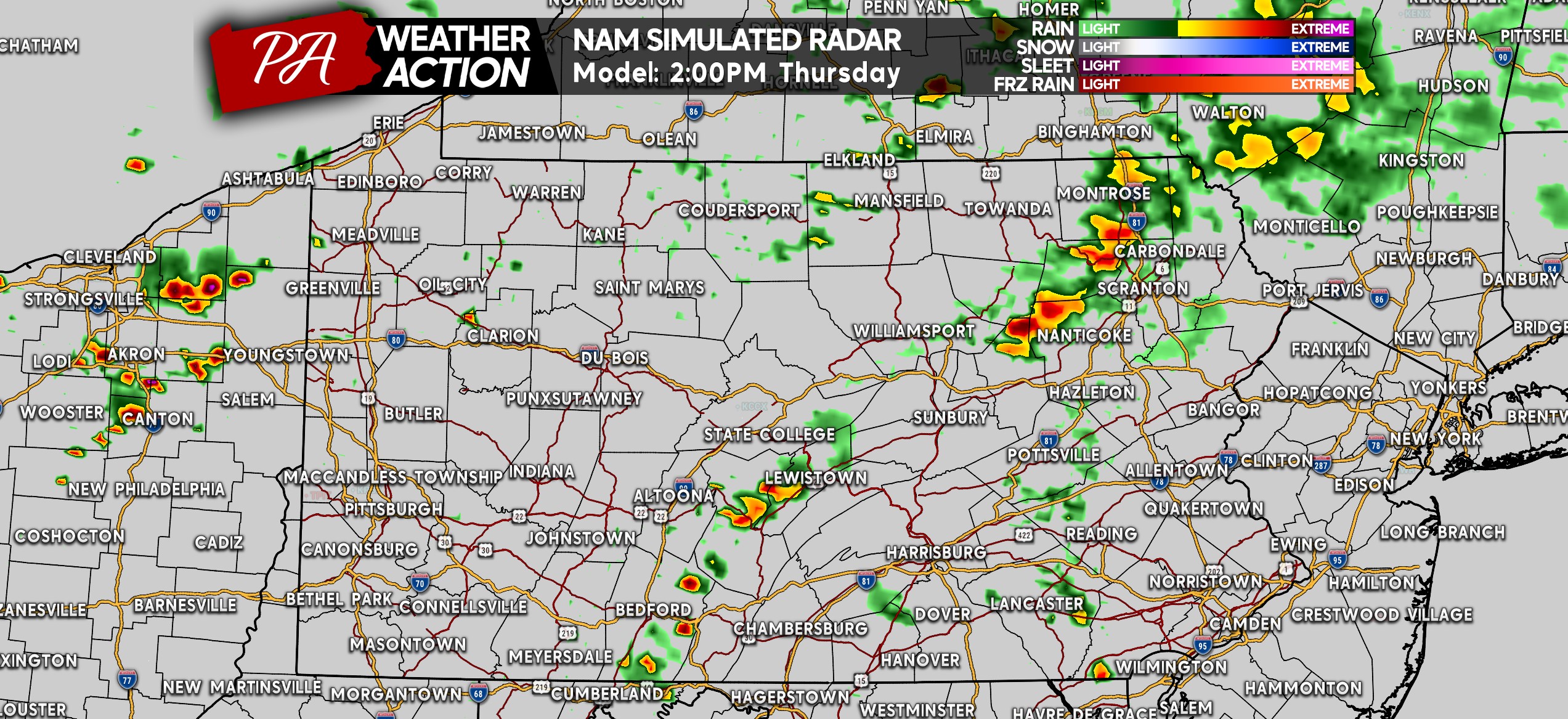
Timing out these storms, we start early this afternoon with the likelihood of isolated showers and storms popping up. Below is Hi-Res NAM Future Radar for 2:00 PM Thursday.
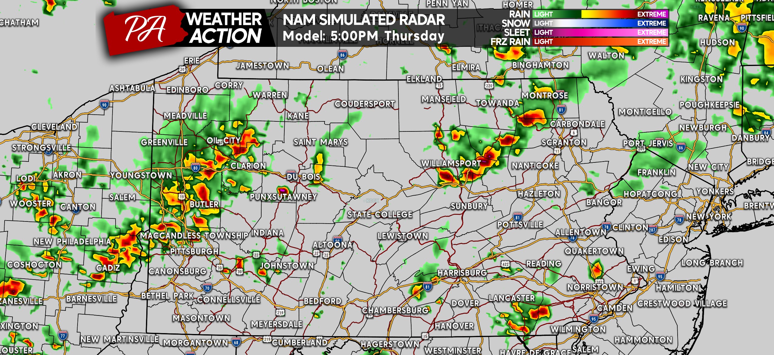
Expect storm coverage to increase later in the afternoon, with the peak of potential strong to severe storm activity around 4-8 PM. Here is a look at 5:00 PM, showing storms more concentrated in Western & Northern PA, with isolated storms will be likely elsewhere.
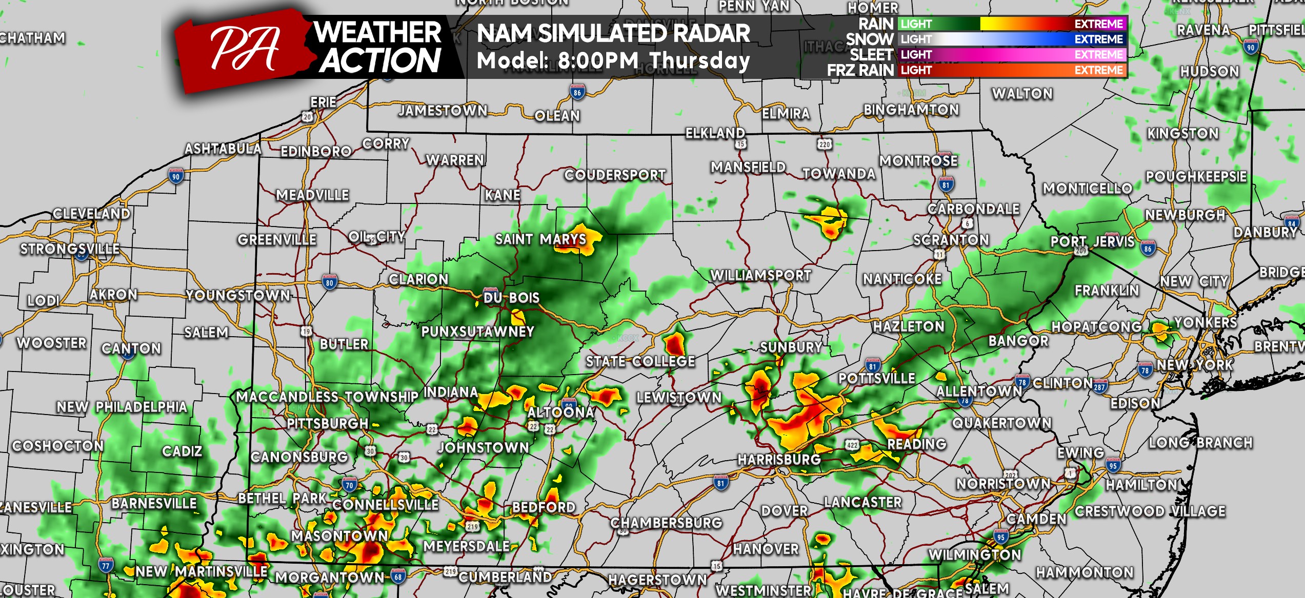
As we approach sunset, those potent storms are expected to push south along the Susquehanna River. In addition, Western PA may see strong storms and localized flash flooding around this time.
After sunset, we expect the severe and flood threat to subside.
THURSDAY’S SEVERE THUNDERSTORM THREAT FORECAST MAP
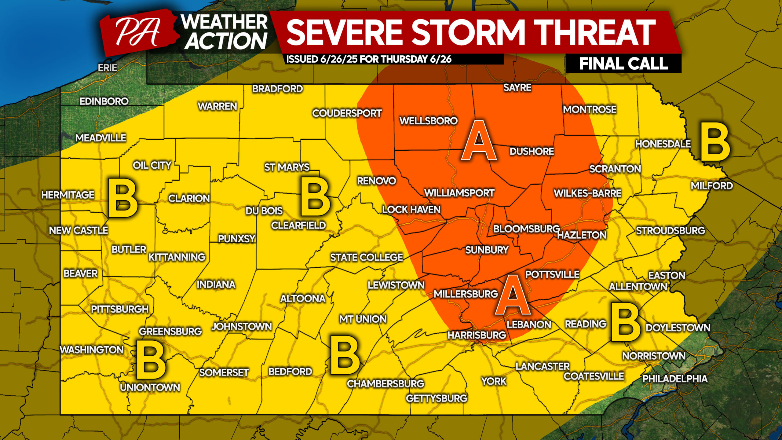
Area A: Scattered strong to severe thunderstorms are probable. Damaging winds, frequent lightning, localized flash flooding, and a very isolated tornado are possible.
Area B: Amidst scattered thunderstorms, a few storms will probably strengthen to severe criteria. Primary threats include damaging winds, frequent lightning, and localized flash flooding.
Don’t forget to share this forecast with friends and family!
You must be logged in to post a comment.