Slow-moving strong to severe thunderstorms will flare up early this afternoon in Eastern PA, and will pose a flash flood risk especially across Northeast PA. These storms will be widespread and produce very heavy rain as they push northeast.
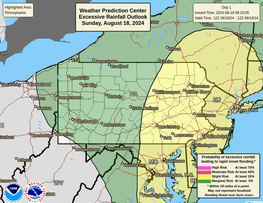
The NWS Weather Prediction Center has placed Eastern PA under a slight risk of flash flooding Sunday, however we expect the threat to be higher than that based on latest modeling. Below is the flash flood risk graphic for today.
As a result, Flash Flood Watches have been hoisted across Eastern and Central PA. Short term flash flood guidance suggests it will only take 1-1.5″ of rain in parts of Northern PA to cause flash flooding due to the recent flooding.
THUNDERSTORM/FLOODING TIMING
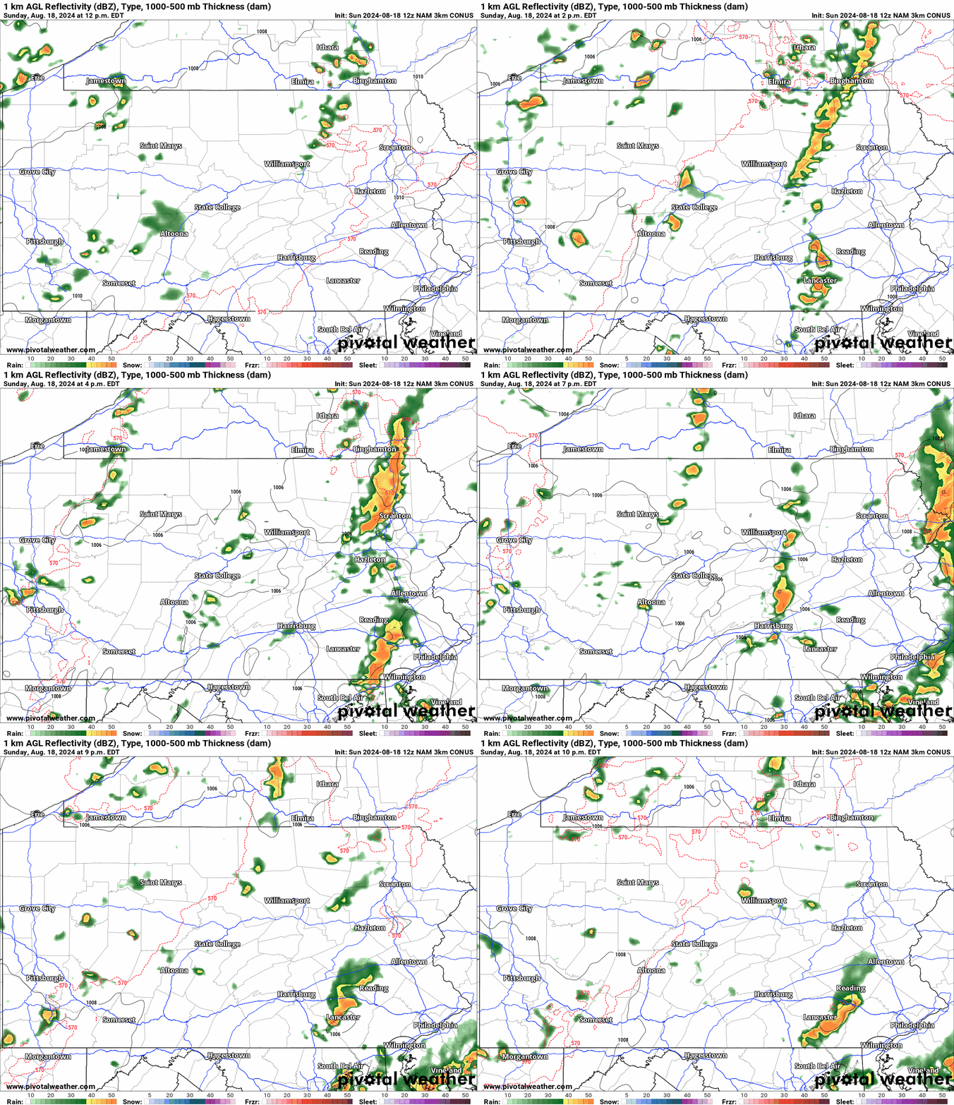
Large clusters of thunderstorms are expected to develop between 1-2 PM this afternoon in eastern parts of the Susquehanna Valley, with additional scattered activity likely to develop in Eastern PA.
As those storms push through Eastern PA by late this afternoon, scattered storms, mostly non-severe, will pop up throughout Central and even Western PA. As these storms push into Central PA near the Susquehanna Valley, some may become strong to severe.
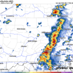
Greatest flash flooding concerns will be in Eastern PA between 2-7 PM, during the period of most widespread and strongest thunderstorm coverage. Below is the Hi-Res NAM Future Radar for this afternoon and evening.
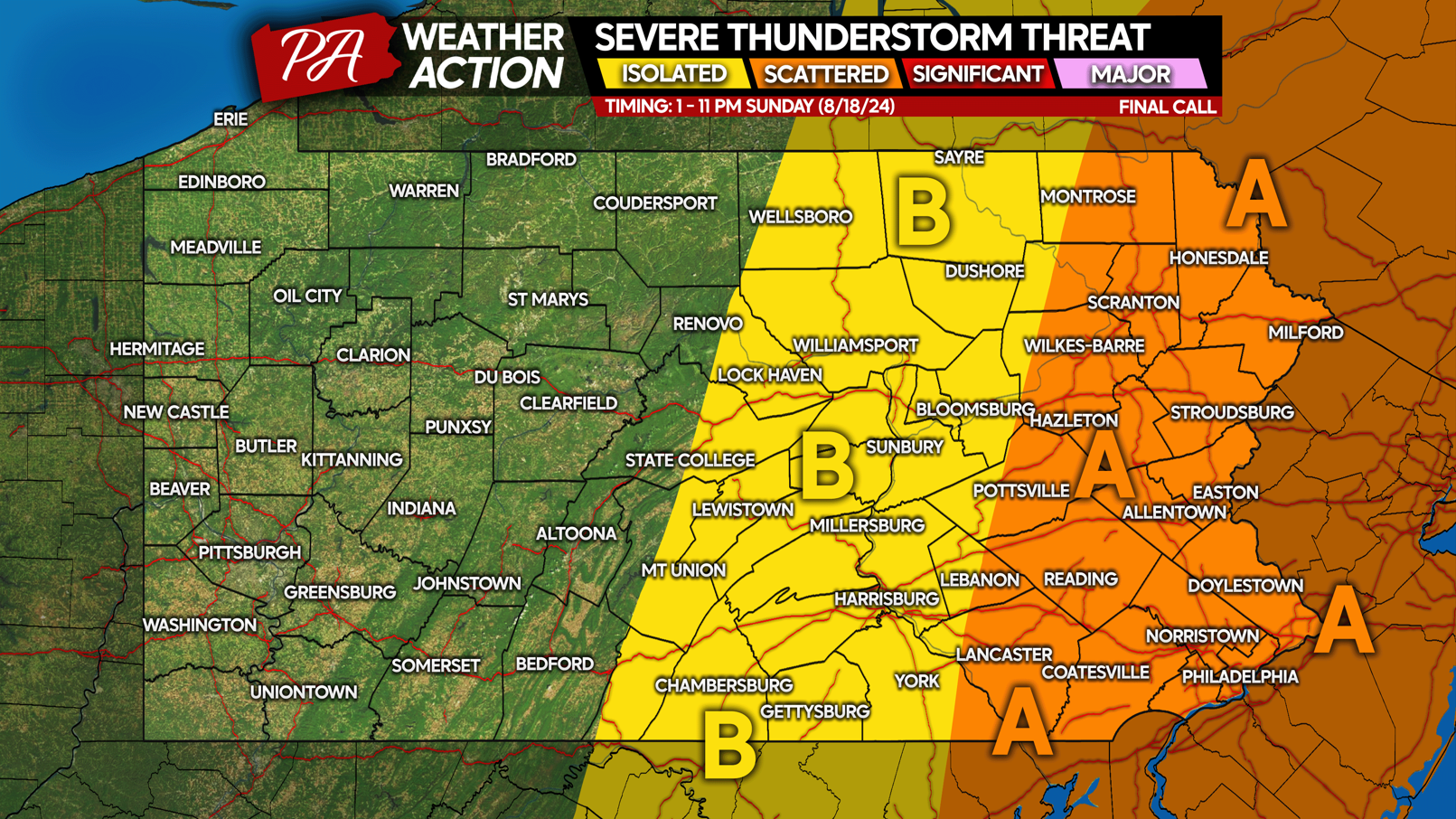
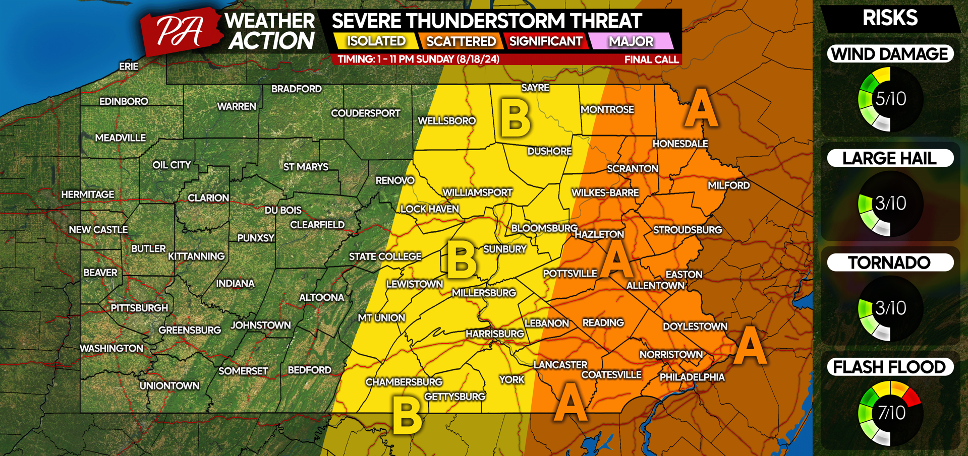
SUNDAY 8/18/24 SEVERE THUNDERSTORM RISK MAP
Area A: Scattered severe thunderstorms expected early Sunday afternoon through mid-evening (7-9 PM), view timing for greater detail. Damaging winds up to 60 MPH, localized flash flooding, and frequent lightning are the main concerns. There are low risks for hail and an isolated tornado.
Area B: Isolated severe thunderstorms possible early Sunday afternoon through mid-evening, however most storms will be under severe criteria. Wind gusts will be more commonly in the 20-40 MPH range. Flash flooding is a concern, mainly in the Northern PA mountains.
Be on the lookout for latest alerts for your area and keep an eye on the radar if holding outdoor activities.
Don’t forget to pass this article along to friends and family!

You must be logged in to post a comment.