
Thursday – Friday Future Radar Timing
Thursday 7/13 Severe Thunderstorm Threat Map
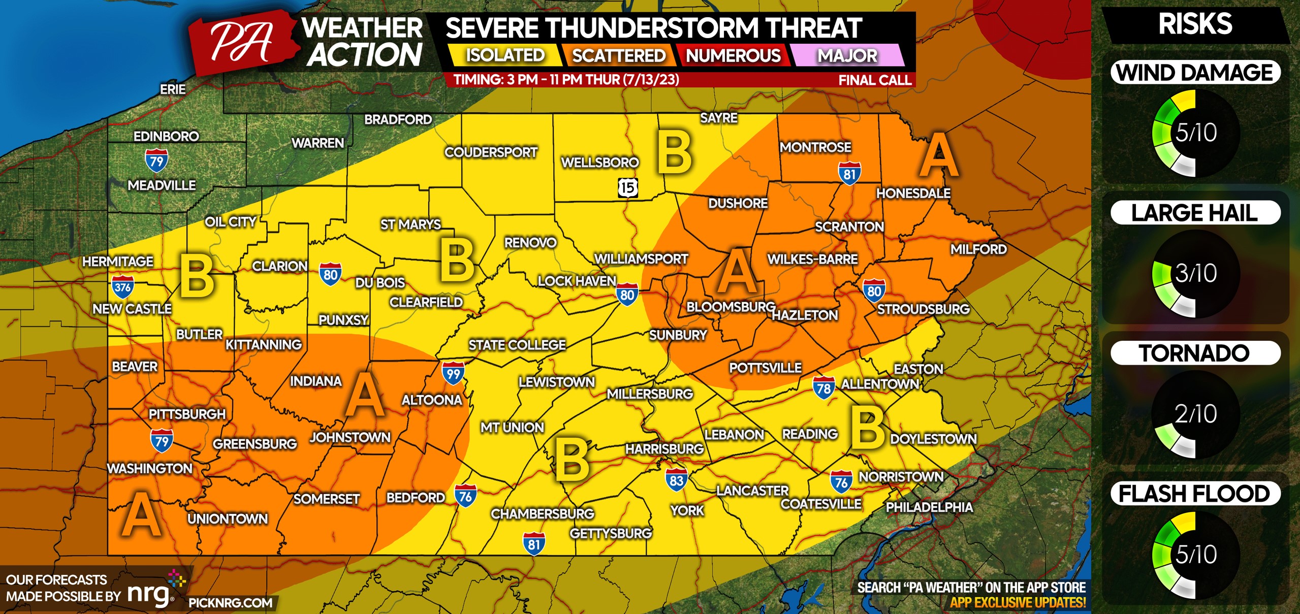
Area A: Scattered strong to severe thunderstorms possible Thursday afternoon and evening. Wind damage is the main risk, with a small risk of large hail and an isolated tornado. Flash flooding is unlikely.
Area B: Isolated strong to severe thunderstorms possible Thursday afternoon and evening. Wind damage is the main risk, with a small risk of large hail and an isolated tornado. Flash flooding is unlikely.
Friday 7/14 Severe Thunderstorm Threat Map
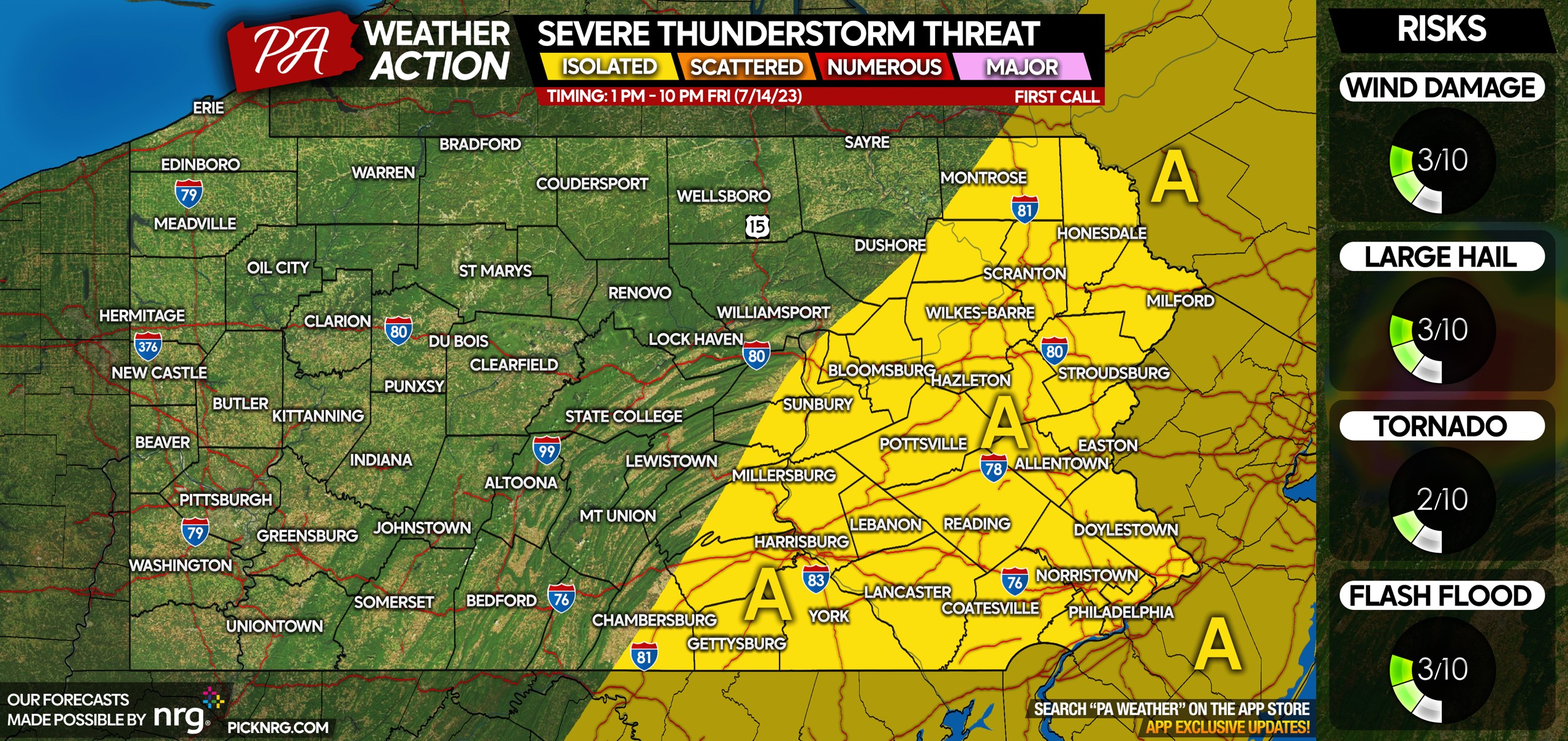
Area A: Isolated strong to severe thunderstorms possible Friday afternoon and evening. There is a relatively low risk of damaging winds, large hail, and flash flooding. The flood risk is more so in urban areas with poor drainage.
Feel free to pass along this forecast with the blue button below!
[social_warfare]
You must be logged in to post a comment.