
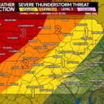
The passage of a low pressure system will bring chances for severe thunderstorms on Tuesday with another chance for severe weather on Thursday.
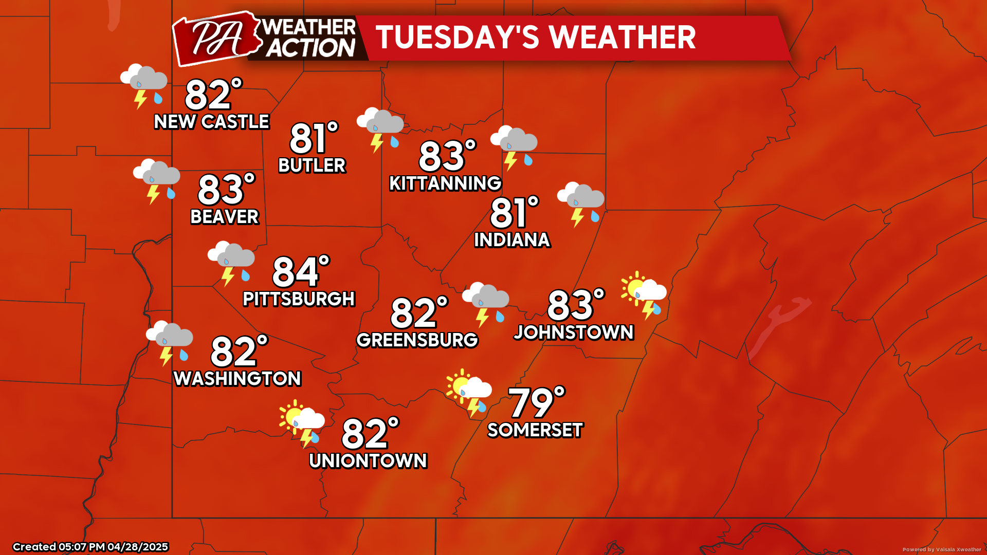
Tuesday
Scattered showers and thunderstorms are possible in the afternoon and evening hours. The National Weather Service has northern and central portions of the region under an Enhanced risk for severe weather with the southern and eastern portions of the region under a Slight risk for severe weather. Primary threats are high winds, large hail, isolated tornadoes cannot be ruled out. Highs will be in the mid to low 80s, lows will be in the mid to low 50s. Winds will be out of the southwest at 10-15 mph, wind gusts approaching 30 mph are possible. Higher wind gusts are possible in thunderstorms.
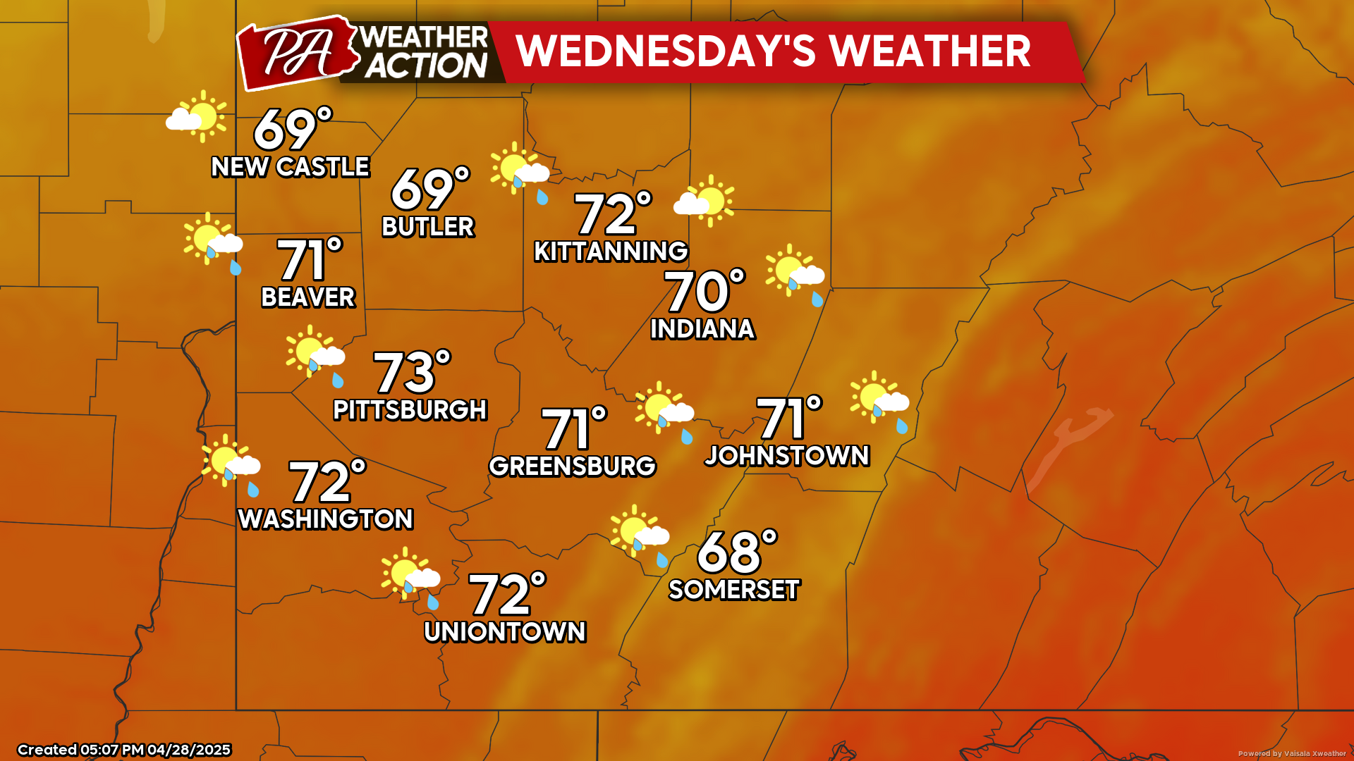
Wednesday
The possibility of the passing cold front stalling will bring an ongoing chance for showers. Highs will be low 70s to upper 60s, lows will be in the mid to low 50s. Winds will be out of the west-northwest at 5 to 10 mph.
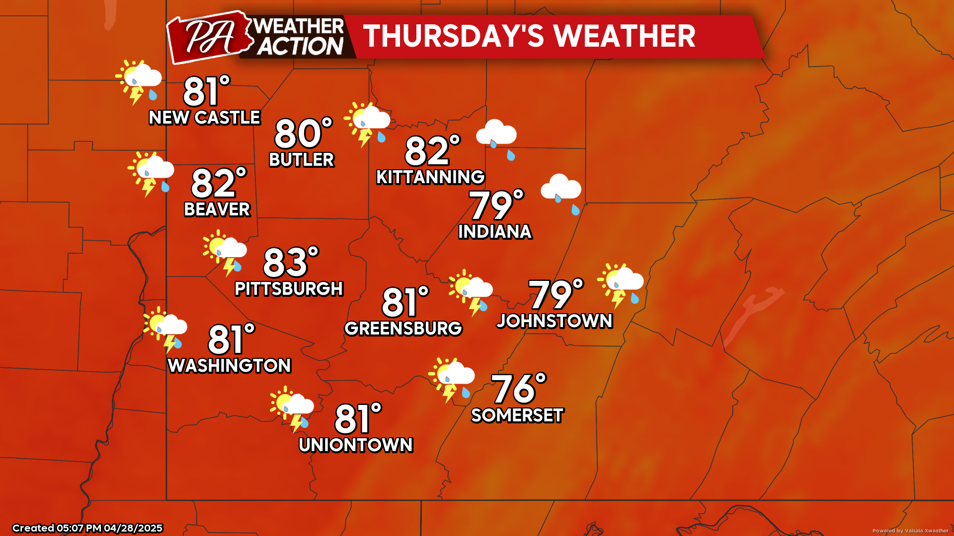
Thursday
The active weather pattern continues with another chance for afternoon severe thunderstorms possible on Thursday. Highs will be in the low 80s to upper 70s, lows will be in the low 60s to upper 50s. Winds will be out of the south-southwest at 5-15 mph, wind gusts approaching 30 mph are possible. Higher winds can be expected in thunderstorms.
The active weather trend will continue to end the week and continue during the weekend. Be sure to follow PA Weather Action for more details and statewide severe storm specific articles.

You must be logged in to post a comment.