
Valleys across Pennsylvania have experienced rapid progression into spring, with many plant species blooming in the last couple weeks. But across the higher mountains of the state, hardly anything has bloomed! Temperatures this week have hit 80 degrees in some spots, and we’ve got much more warmth coming next week before what looks to be a stretch of below average temperatures the following. With the early warmth has come severe weather at our latitude, which is a bit early but not abnormal. Fortunately for us here in PA, most of the damaging severe thunderstorms have been to our west, and that looks to apply Thursday as well.
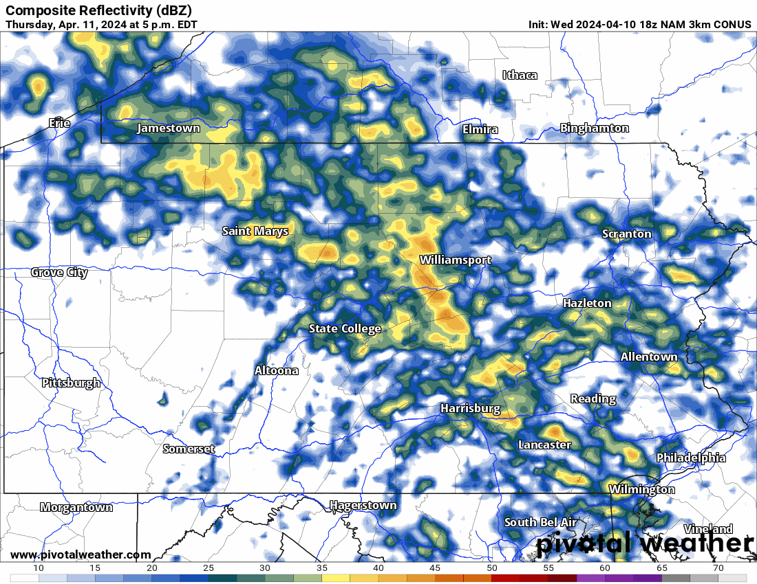
A cold front sweeping through the Upper Midwest will clash with warm, moist Gulf of Mexico air and combined with a bit of convective energy, will pose a low-end severe thunderstorm risk. The concern is mainly damaging winds in an organized bow echo Thursday evening after initial showers move through Thursday afternoon, however models have that staying just across the border in Ohio. Isolated severe thunderstorms will be possible overnight Thursday into Friday as temperatures and dew points remain in the 60s well after sunset. View Hi-Res NAM Future Radar below.
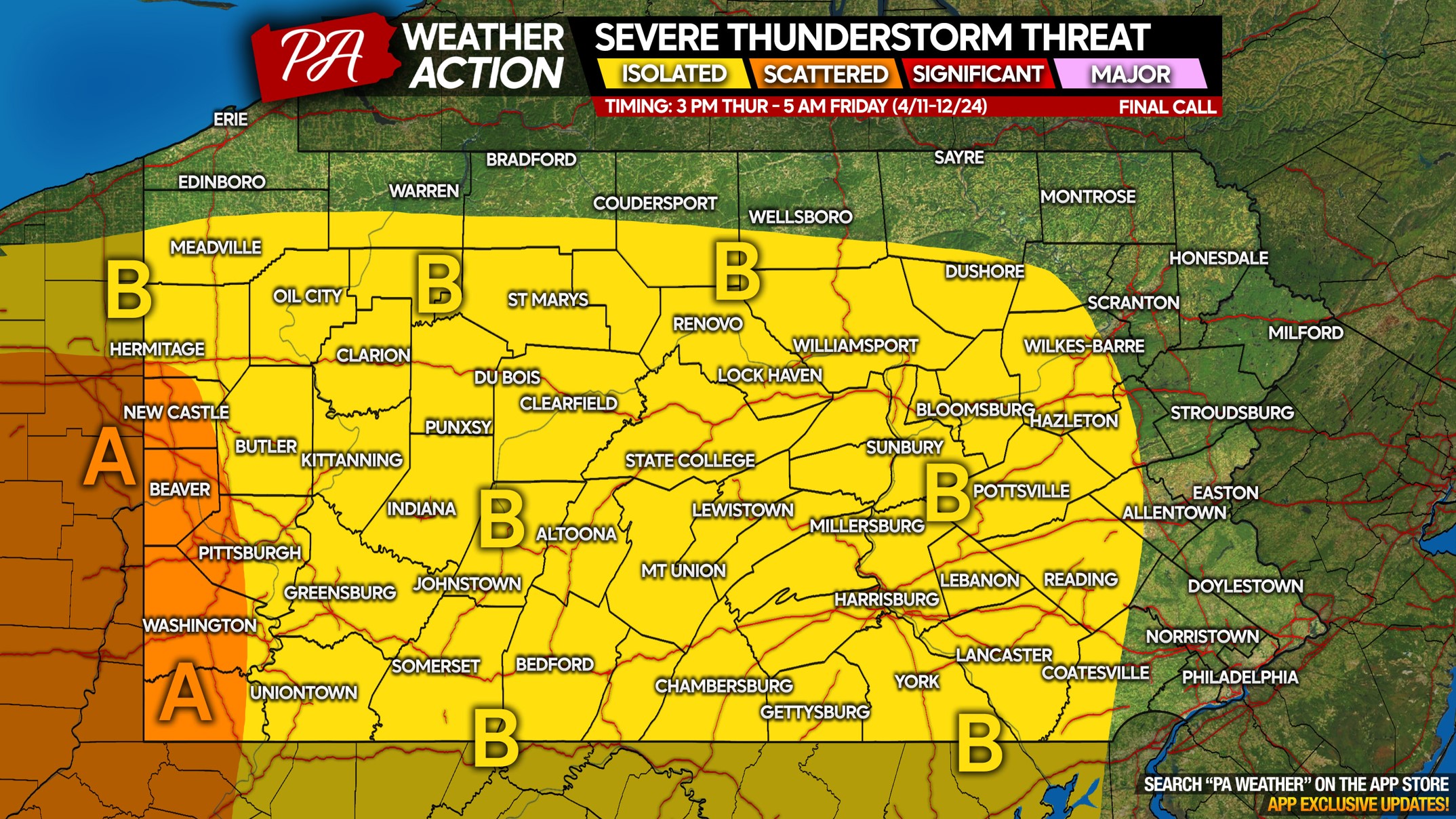
THURSDAY EVENING – FRIDAY EARLY MORNING SEVERE THUNDERSTORM THREAT MAP
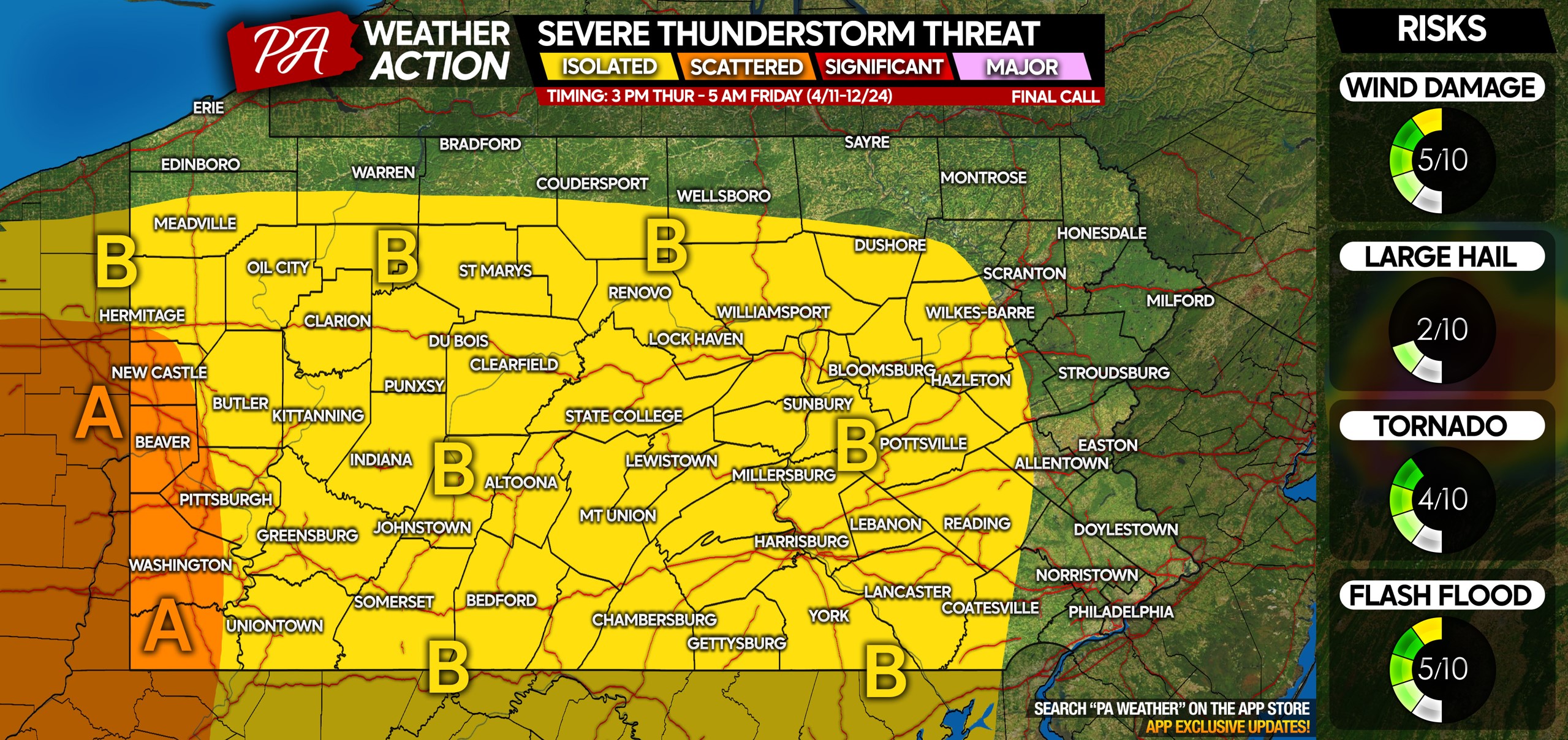
Area A: Scattered severe thunderstorm threat from dinnertime Thursday through just before midnight. Damaging winds are the primary concern, but an isolated tornado is possible.
Area B: Isolated severe thunderstorm threat from late Thursday evening through the pre-dawn hours of Friday. Damaging winds are the main concern, with a very isolated brief tornado possible.
Don’t forget to share this forecast with friends and family in the threat areas!

You must be logged in to post a comment.