
Blazing heat with feels-like temperatures approaching 110° weren’t quite enough for mother nature, so she decided to throw in the chance for severe thunderstorms on Tuesday as well. A cold front will push through both Tuesday and Wednesday, with opportunities for intense thunderstorms each days. Already today (Monday), there have been damaging storms in Northeast PA, and this is only the start as the front gradually works south.
The hottest temperatures in decades were recorded today, with Tuesday likely to be the peak of the heat. The details on Tuesday’s feels-like temperatures throughout the state along with important info are found here.
Damaging winds are main concern this week within severe thunderstorms, but an isolated tornado is certainly not ruled out. Let’s get into timing for Tuesday’s storms.
TUESDAY FUTURE RADAR
Thunderstorms are expected to spark off across parts of West Central and North Central Pennsylvania by early Tuesday afternoon. Given the highly unstable atmosphere, these storms are likely to quickly intensify as they push east. Below is the latest Hi-Resolution NAM Model for 3:00 PM Tuesday.
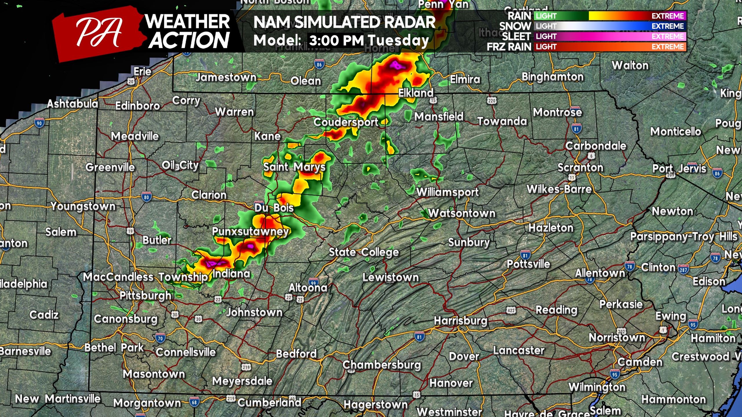
Somewhat of an organized line is modeled to develop as these storms push through the Upper Susquehanna Valley and parts of Central PA by late afternoon. This is when the damaging wind threat will begin to be at its highest, with wind gusts of 50-70 MPH expected in strongest portions of the line. A couple cells may also develop in the Lower Susquehanna Valley by this time.
Below is future radar for 5:00 PM Tuesday, showing a very widespread depiction of these storms. This increases chances that most areas will see some amount of rain and winds, along with lightning.
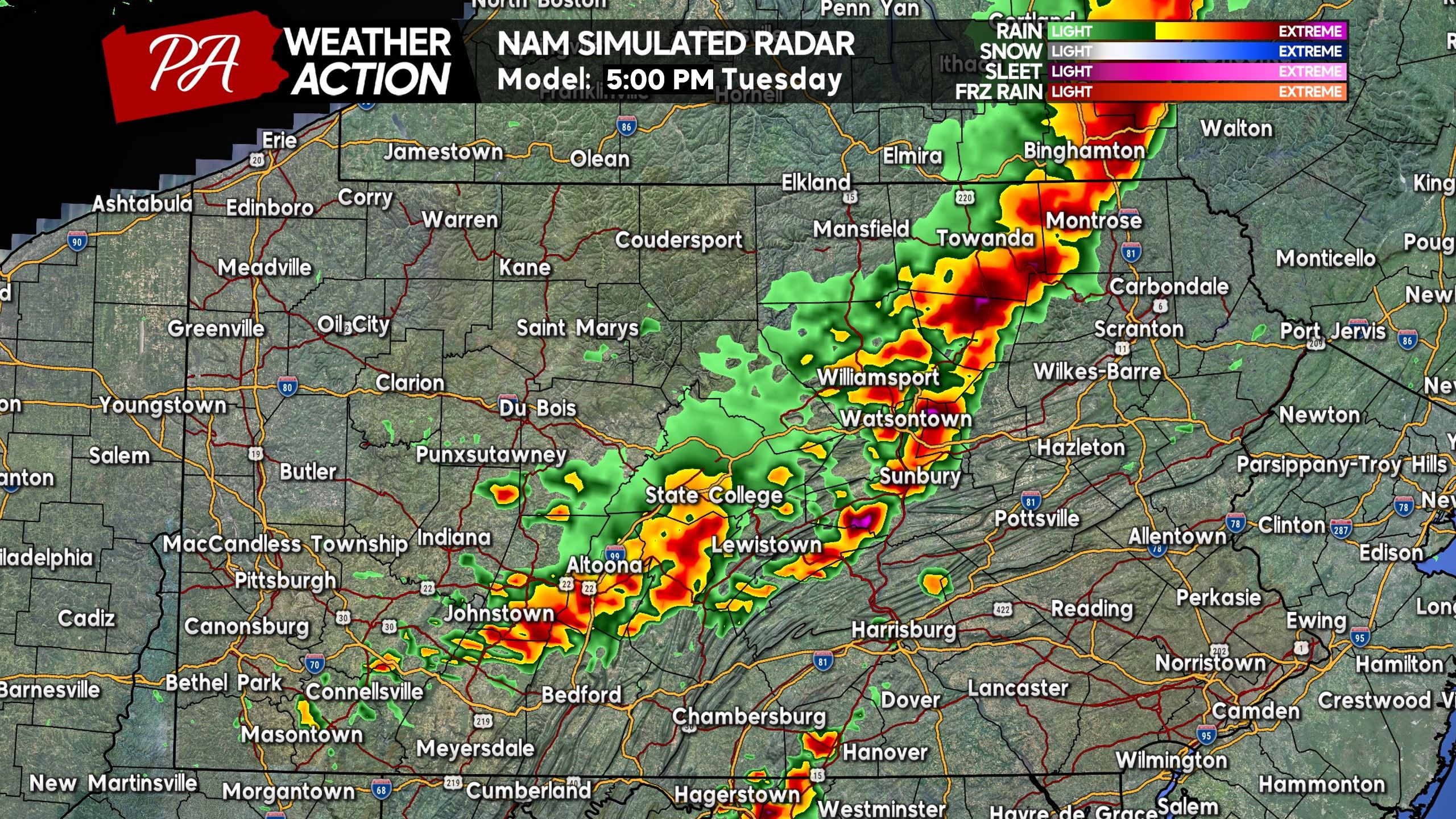
Other model guidance does not show this type of widespread activity, but scattered to even isolated activity instead. This is not set in stone, as no model depiction ever is, but especially this time around there are more inconsistencies.
As you see below, the Hi-Res NAM shows a very dramatic solution for dinnertime in Eastern PA Tuesday evening, with an intense line of storms running from the NY border all the way to the MD border. Here is future radar for 7:00 PM Tuesday.
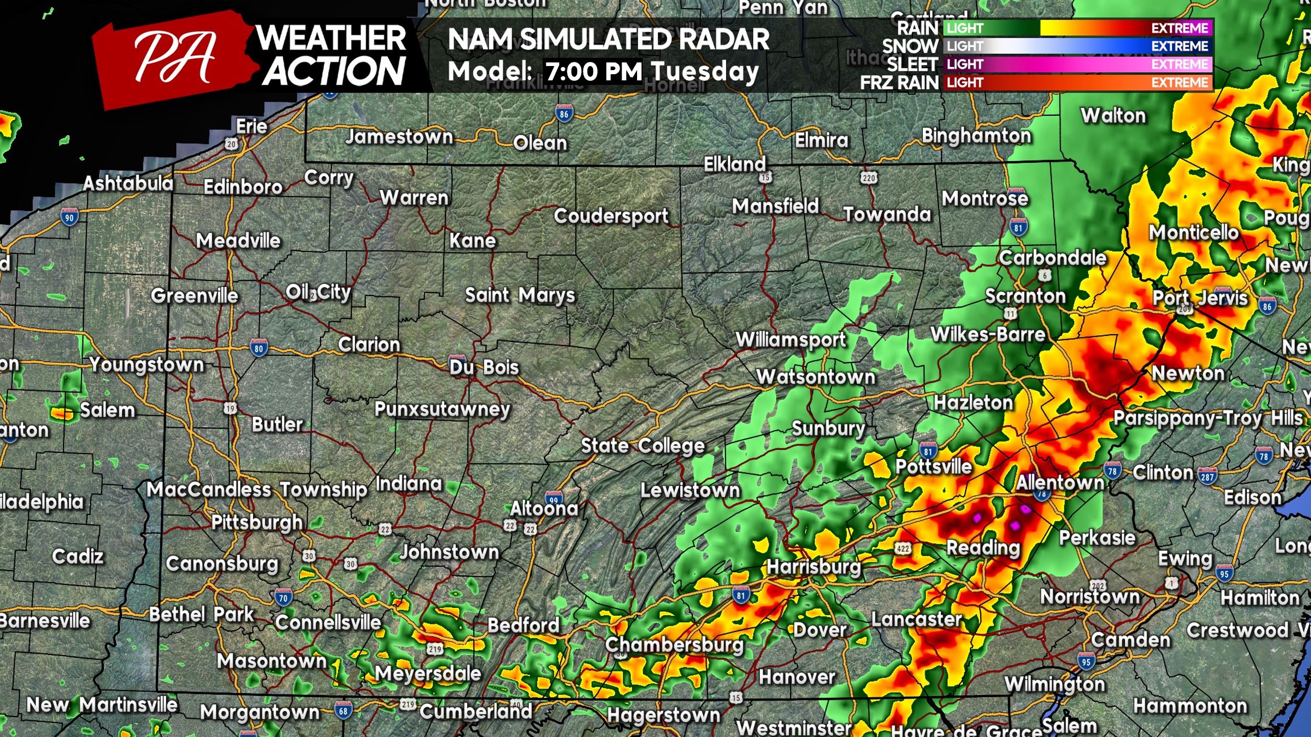
It seems to be the theme this year that storms are developing farther north, likely thanks to the higher heights across much of North America that has shifted everything from heat to thunderstorms farther north. And since that will also be the case Tuesday, thunderstorms will probably weaken as they push into the Philadelphia Metro Area, along with areas like the Lower Susquehanna Valley.
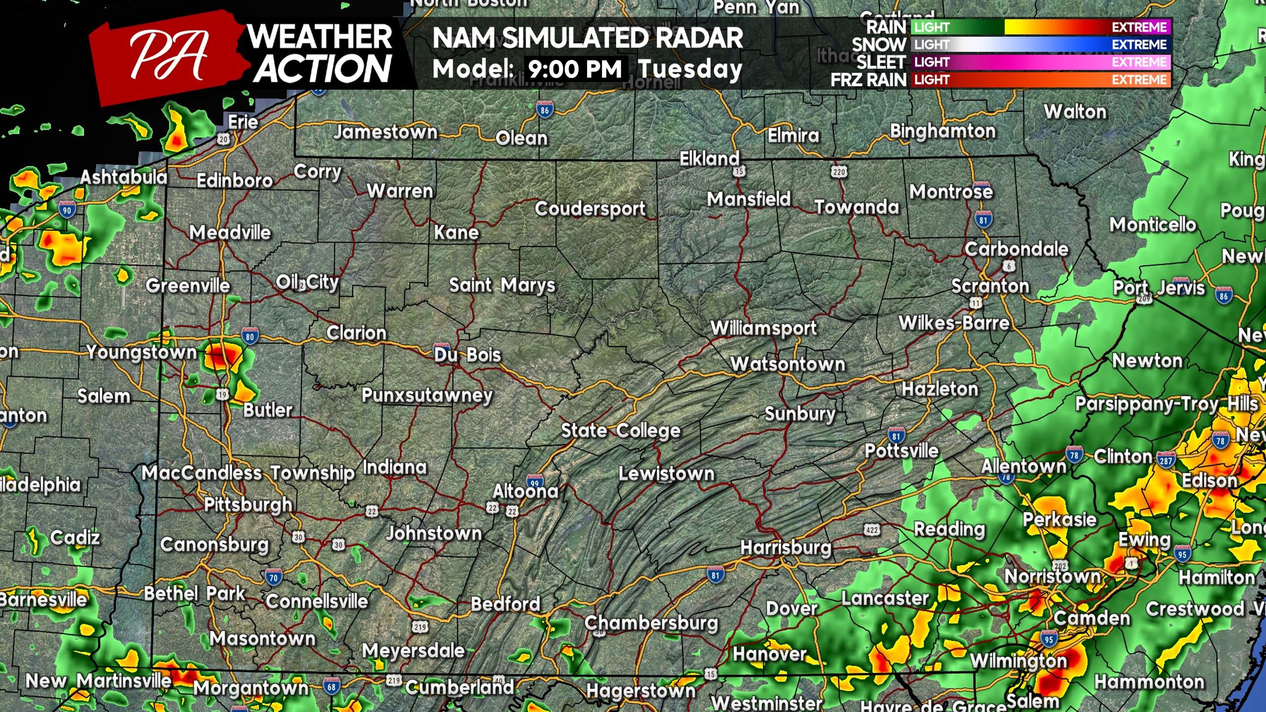
Below is Hi-Res NAM future radar for 9:00 PM Tuesday, showing the significant weakening of storms as they near the Delaware River in Southeast PA.
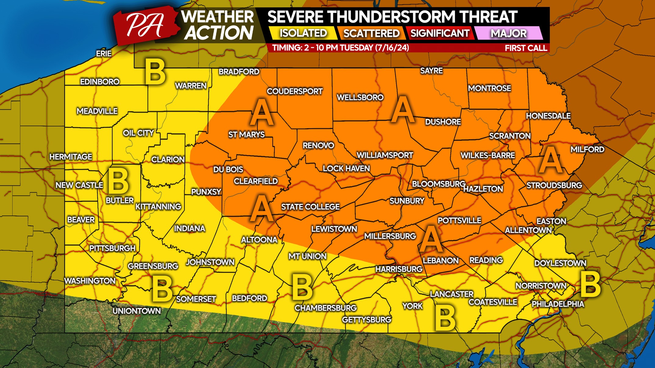
TUESDAY 7/16 SEVERE THUNDERSTORM RISK MAP
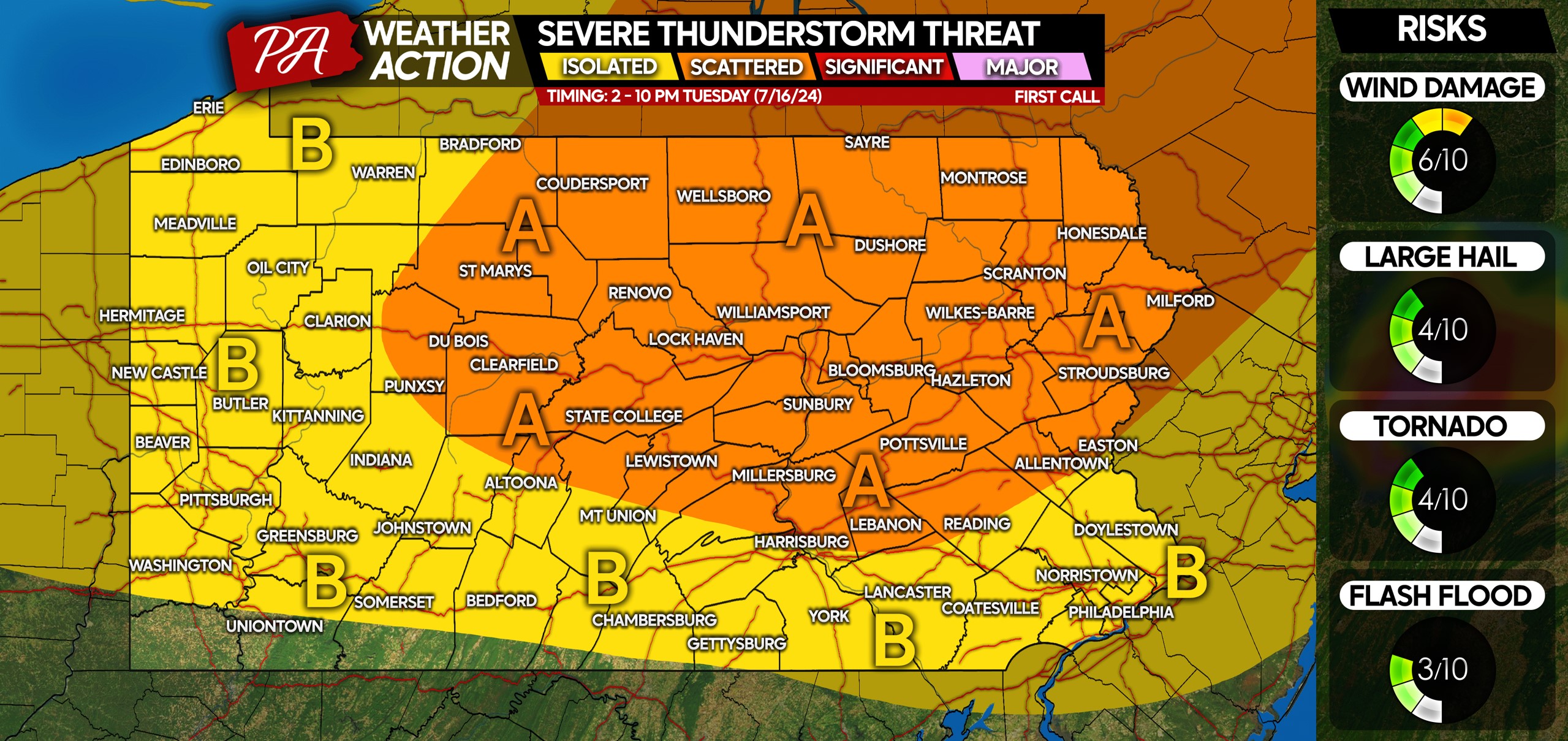
Area A: Scattered severe thunderstorms are possible Tuesday, view timing above! Damaging winds of 50-70 MPH are the primary threat, with isolated hail and a very isolated tornado possible.
Area B: Isolated severe thunderstorms are possible Tuesday, view timing above! Damaging winds of 50-60 MPH are the main concern.
Secure any plant pots, outdoor furniture, etc. that may be blown around and damaged by strong winds!
Don’t forget to help friends and family out by sharing this article and info with them.
You must be logged in to post a comment.