

The region’s first thunderstorms will be experienced throughout the region over the next few days. Some could be severe with the possibility of hail in the stronger cells. Cooler temperatures are expected to follow the next few days of rain.
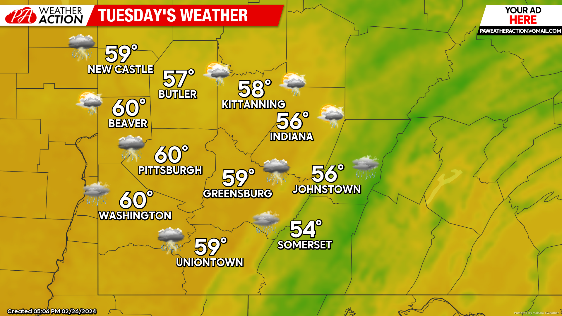
Tuesday
Showers and thunderstorms are expected throughout the day on Tuesday. Highs will be in the low 60s to mid 50s. Winds will be out of the south at 7 to 14 mph, wind gusts may approach 25 mph and could be higher in the stronger cells. Lows will be in the mid to low 50s.
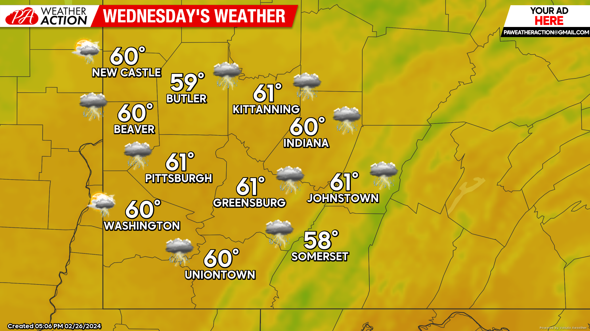
Wednesday
Showers and Thunderstorms are expected to continue with much stronger wind conditions expected throughout the region. Rain will transition to snow showers in the overnight hours. Highs will be in the low 60s. Winds will be out of the south at 20 to 25 mph, wind gusts above 40 mph are possible. Lows will be in the low mid to low 20s.
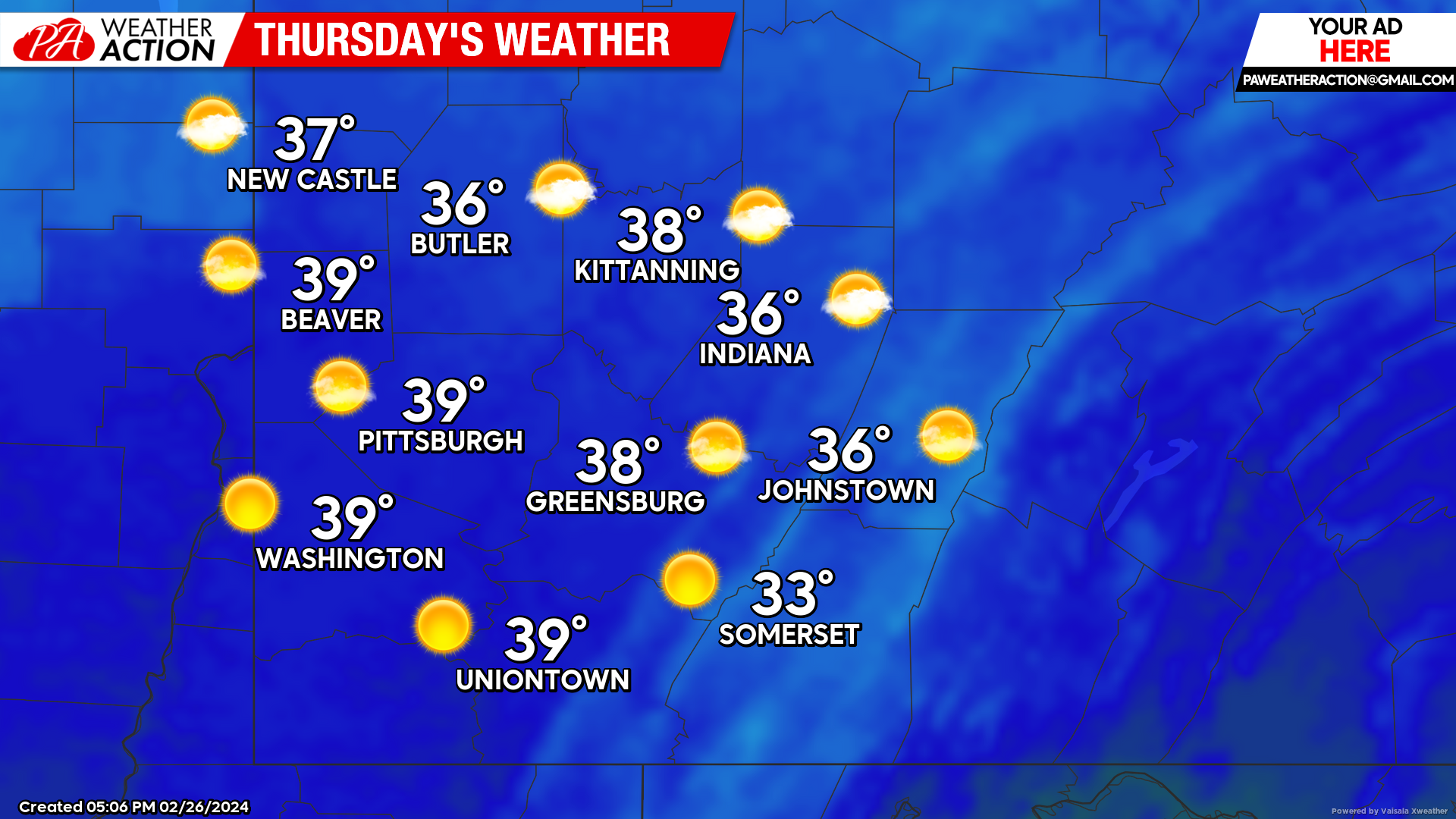
Thursday
Sunny skies, but much cooler temperatures are expected throughout the region. Highs will be in the upper to mid 30s. Winds will be out of the west at 10 to 15 mph. Lows will be in the mid 20s.
Be weather aware the next few days as there is a potential for severe weather. Follow PA Weather Action for any updates as storms move through the area.


You must be logged in to post a comment.