
The passage of an eventual stalled cold front will bring multiple waves of low pressure over the region, bringing multiple chances for showers and thunderstorms this weekend. Primary threats will be heavy rainfall with the chance for flash flooding, and strong wind gusts in thunderstorms.
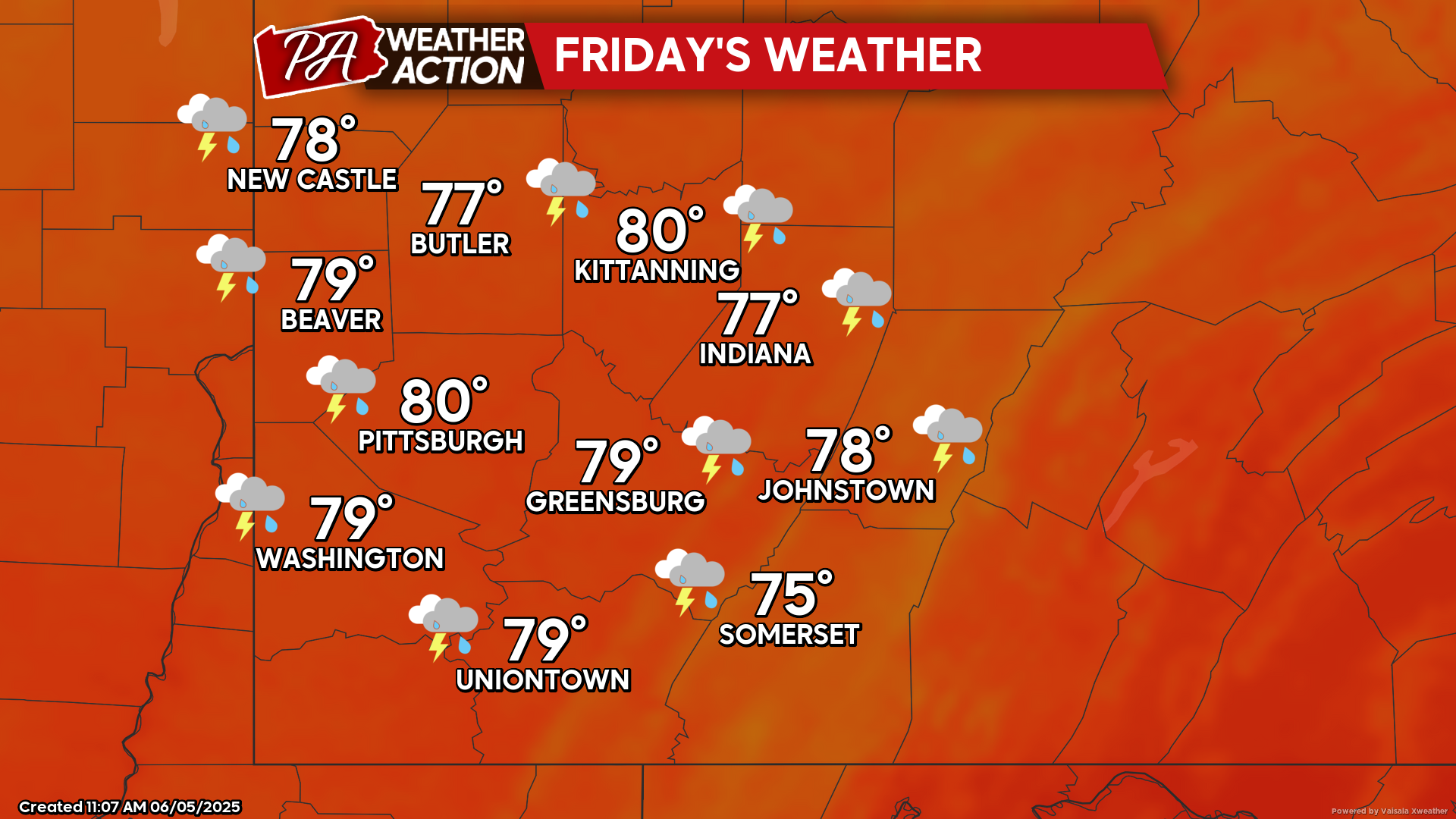
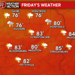
Friday
Showers and thunderstorms are possible throughout the day, with the greatest chance for thunderstorms being in the late afternoon and evening hours. Highs will be in the low 80s to mid 70s, lows will be in the low 60s. Winds will be out of the southwest at 5-7 mph. Rainfall totals will vary between a tenth of an inch to as much as a half an inch in some areas, higher rainfall totals will be possible in thunderstorms.
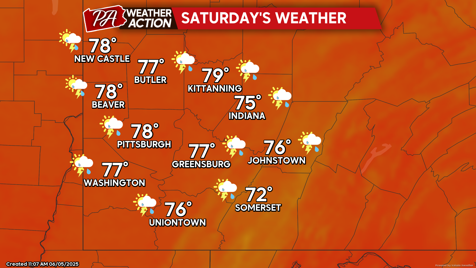
Saturday
Partly sunny skies with scattered showers and a chance for afternoon thunderstorms. Highs will range in the 70s, lows will be in the low 60s to upper 50s. Winds will be out of the northwest at 5-7 mph.
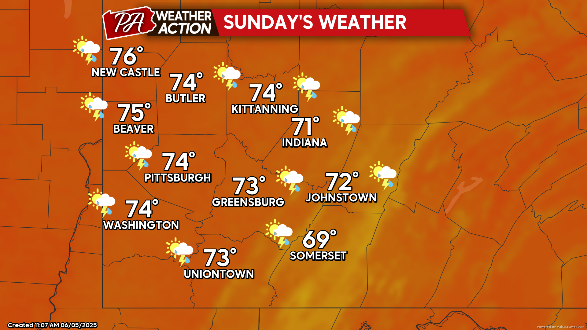
Sunday
Mostly cloudy with chances for afternoon showers. Highs will be in the mid 70s to upper 60s, lows will be in the low 60s to upper 50s. Afternoon winds will be out of the south at 5-15 mph, with wind gusts approaching 30 mph in some areas.
Chances for showers continue into early next week. Be sure to follow PA Weather Action for more details and daily statewide forecasts.
You must be logged in to post a comment.