
Showers and thunderstorms will remain a possibility through mid-week, with chances for severe storms and flash flooding in flood-prone areas. Above-average temperatures return mid-week and continue into the weekend.
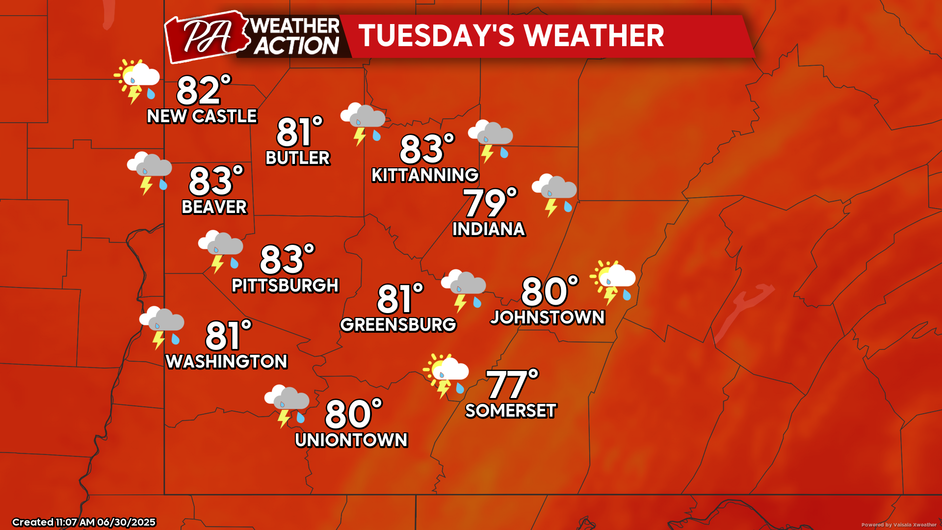
Tuesday
Mostly cloudy with chances for afternoon showers and thunderstorms. Highs will be in the low 80s to upper 70s, lows will be in the mid to low 60s. Winds will be out of the west at 5-10 mph, with wind gusts approaching 20 mph possible.
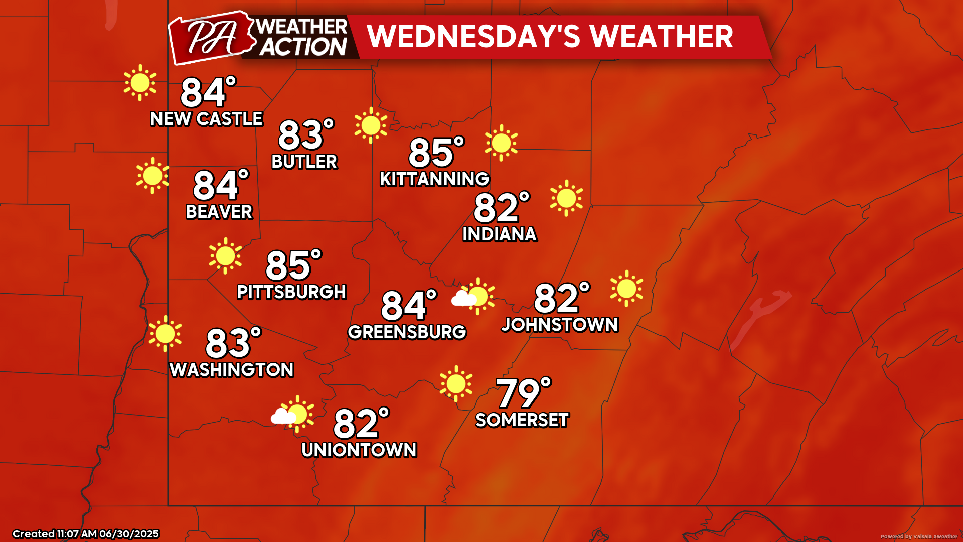
Wednesday
Mostly sunny skies with hot and muggy conditions. Highs will be in the mid 80s to upper 70s, with heat index approaching 90, lows will be in the mid to low 60s. Calm winds will be in the west-northwest.
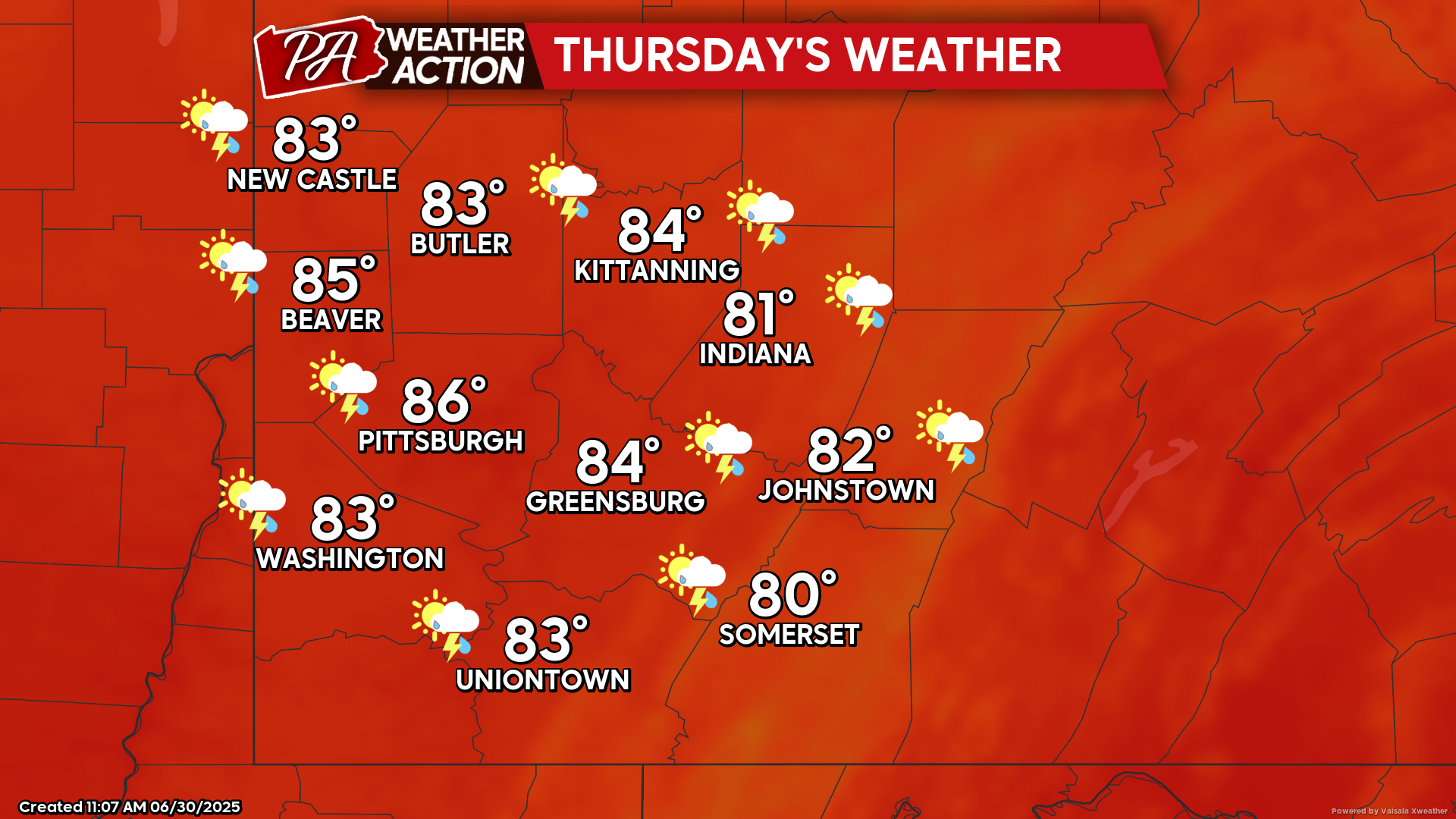
Thursday
Mostly sunny with a slight chance for afternoon showers and thunderstorms. Highs will be in the mid to low 80s, lows will be in the mid to low 60s. Winds will be out of the west-northwest at 5-10 mph, with wind gusts approaching 15 mph.
Temperatures will continue to rise as we approach the weekend, but mostly dry conditions are expected. Be sure to follow PA Weather Action for more details and daily statewide forecasts.


You must be logged in to post a comment.